Damouzy
| Damouzy | ||
|---|---|---|

|
|
|
| region | Grand Est | |
| Department | Ardennes | |
| Arrondissement | Charleville-Mezieres | |
| Canton | Charleville-Mézières-2 | |
| Community association | Ardenne metropolis | |
| Coordinates | 49 ° 48 ' N , 4 ° 41' E | |
| height | 145-356 m | |
| surface | 8.78 km 2 | |
| Residents | 447 (January 1, 2017) | |
| Population density | 51 inhabitants / km 2 | |
| Post Code | 08090 | |
| INSEE code | 08137 | |
| Website | http://damouzy.fr/ | |
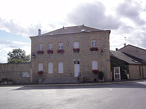
 Town hall and school building in Damouzy |
||
Damouzy is a French commune with 447 inhabitants (as of January 1, 2017) in the Ardennes department in the Grand Est region . It belongs to the arrondissement Charleville-Mézières and is part of the canton Charleville-Mézières-2 (until 2015: canton Charleville-La Houillère ).
geography
Damouzy is located about four kilometers northwest of the city center of Charleville-Mézières and is bordered to the south by the Sormonne River . Damouzy is surrounded by the neighboring municipalities of Sécheval in the north and northwest, Bogny-sur-Meuse in the north and northeast, an exclave of Nouzonville in the northeast, Charleville-Mézières in the east, Warcq in the south, Belval in the southwest, Tournes in the west and Houldizy , Arreux and Montcornet to the west and northwest.
Part of the Charleville-Mézières airport is located in the south-west of the municipality.
Population development
| year | 1962 | 1968 | 1975 | 1982 | 1990 | 1999 | 2006 | 2015 |
|---|---|---|---|---|---|---|---|---|
| Residents | 248 | 292 | 339 | 373 | 428 | 448 | 429 | 427 |
| Source: Cassini and INSEE | ||||||||
Attractions
- Saint-Rémy church

