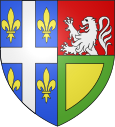
Maubert-Fontaine
| Maubert-Fontaine | ||
|---|---|---|

|
|
|
| region | Grand Est | |
| Department | Ardennes | |
| Arrondissement | Charleville-Mezieres | |
| Canton | Rocroi | |
| Community association | Ardennes Thiérache | |
| Coordinates | 49 ° 52 ' N , 4 ° 26' E | |
| height | 222–338 m | |
| surface | 10.33 km 2 | |
| Residents | 1,031 (January 1, 2017) | |
| Population density | 100 inhabitants / km 2 | |
| Post Code | 08260 | |
| INSEE code | 08282 | |
 Town hall (Mairie) of Maubert-Fontaine |
||
Maubert-Fontaine is a French commune with 1,031 inhabitants (as of January 1, 2017) in the Grand Est region in the Ardennes department . It is located in the arrondissement of Charleville-Mézières and is part of the canton of Rocroi .
geography
Maubert-Fontaine is located about 30 kilometers northwest of Charleville-Mézières in the Ardennes Regional Nature Park . Maubert-Fontaine is surrounded by the neighboring communities of Éteignières in the north and west, Taillette in the north and north-east, Sévigny-la-Forêt in the east, Étalle in the south and south-east, Marby and Flaignes-les-Oliviers in the south and Girondelle in the south-west.
Maubert-Fontaine station was on the Charleville-Mézières – Hirson line .
Population development
| year | 1962 | 1968 | 1975 | 1982 | 1990 | 1999 | 2006 | 2013 |
| Residents | 1.107 | 1,065 | 970 | 1,024 | 916 | 902 | 1,056 | 1,047 |
| Source: Cassini and INSEE | ||||||||
Attractions
- Saint-Nicolas church
Web links
Commons : Maubert-Fontaine - collection of images, videos and audio files

