Aiglemont
| Aiglemont | ||
|---|---|---|

|
|
|
| region | Grand Est | |
| Department | Ardennes | |
| Arrondissement | Charleville-Mezieres | |
| Canton | Villers-Semeuse | |
| Community association | Ardenne metropolis | |
| Coordinates | 49 ° 47 ' N , 4 ° 46' E | |
| height | 132-327 m | |
| surface | 8.85 km 2 | |
| Residents | 1,634 (January 1, 2017) | |
| Population density | 185 inhabitants / km 2 | |
| Post Code | 08090 | |
| INSEE code | 08003 | |
| Website | www.aiglemont.fr | |
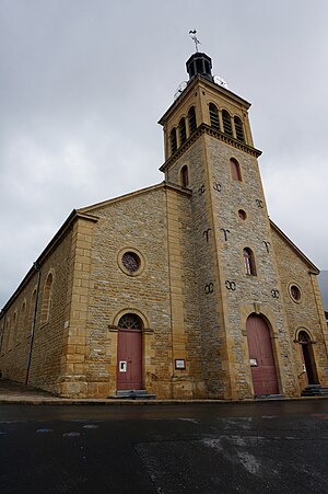
 Saint-Quentin Church |
||
Aiglemont is a French commune with 1,634 inhabitants (as of January 1, 2017) in the Ardennes department in the Grand Est region . It belongs to the arrondissement Charleville-Mézières and is part of the canton Villers-Semeuse (until 2015: canton Charleville-Center ).
geography
Aiglemont is located about four kilometers northeast of the city center of Charleville-Mézières and is bounded to the west by the Meuse (French: Meuse ). Aiglemont is surrounded by the neighboring communities of Nouzonville in the north and north-west, Neufmanil in the north-east, La Grandville in the east, Charleville-Mézières in the south and south-west and Montcy-Notre-Dame in the west.
Population development
| year | 1962 | 1968 | 1975 | 1982 | 1990 | 1999 | 2006 | 2014 |
|---|---|---|---|---|---|---|---|---|
| Residents | 962 | 1,304 | 1,645 | 1,614 | 1,804 | 1,733 | 1,594 | 1,691 |
| Source: Cassini and INSEE | ||||||||
Parish partnership
A partnership with the Beninese community Bohicon has existed since 2010.
Attractions
- Remains of a desert near Manicourt
- Saint-Quentin church, built at the end of the 18th century
- The Champceau area with the redesigned Saint Quentin Chapel
- Gely Castle
- L'Essai anarchist colony (1903–1906)
Personalities
- Jean-Charles Fortuné Henry (1869 – after 1910), anarchist, founder of the libertarian community L'Essai
Web links
Commons : Aiglemont - collection of images, videos and audio files
