Rancennes
| Rancennes | ||
|---|---|---|

|
|
|
| region | Grand Est | |
| Department | Ardennes | |
| Arrondissement | Charleville-Mezieres | |
| Canton | Givet | |
| Community association | Ardenne, Rives de Meuse | |
| Coordinates | 50 ° 7 ' N , 4 ° 49' E | |
| height | 106-207 m | |
| surface | 6.5 km 2 | |
| Residents | 719 (January 1, 2017) | |
| Population density | 111 inhabitants / km 2 | |
| Post Code | 08600 | |
| INSEE code | 08353 | |
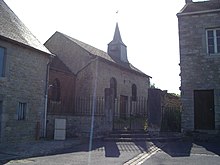
 Town Hall (Mairie) of Rancennes |
||
Rancennes is a French commune with 719 inhabitants (as of January 1, 2017) in the Ardennes department in the Grand Est region (until 2015 Champagne-Ardenne ). It belongs to the arrondissement Charleville-Mézières , the canton Givet and the municipality association Ardenne, Rives de Meuse .
geography
The Maasbogen near Rancennes forms the north-western boundary of the municipality. The place is surrounded by the neighboring communities Fromelennes in the east, Charnois in the south, Chooz in the west and the canton capital Givet in the north.
Population development
| year | 1962 | 1968 | 1975 | 1982 | 1990 | 1999 | 2006 | 2015 |
|---|---|---|---|---|---|---|---|---|
| Residents | 256 | 437 | 445 | 609 | 1,001 | 828 | 725 | 717 |
| Source: Cassini and INSEE | ||||||||
Attractions
- Saint-Léger church
Web links
Commons : Rancennes - collection of images, videos and audio files

