Deville (Ardennes)
| Deville | ||
|---|---|---|
|
|
||
| region | Grand Est | |
| Department | Ardennes | |
| Arrondissement | Charlesville-Mezieres | |
| Canton | Bogny-sur-Meuse | |
| Community association | Vallées and Plateau d'Ardenne | |
| Coordinates | 49 ° 53 ' N , 4 ° 42' E | |
| height | 127-401 m | |
| surface | 7.83 km 2 | |
| Residents | 1,041 (January 1, 2017) | |
| Population density | 133 inhabitants / km 2 | |
| Post Code | 08800 | |
| INSEE code | 08139 | |
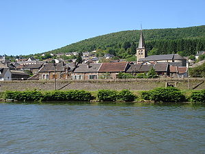
 View of Deville |
||
Deville is a French commune with 1,041 inhabitants (as of January 1, 2017) in the Ardennes department in the Grand Est region ; it belongs to the arrondissement of Charlesville-Mézières and the canton of Bogny-sur-Meuse (until 2015: canton of Monthermé ).
geography
Deville is located near the border with Belgium on the Meuse (French: Meuse ) in the Ardennes . Deville is surrounded by the neighboring communities of Laifour in the north, Monthermé in the east, Sécheval in the south and south-west and Les Mazures in the west and north-west.
history
In May 1033, the Roman-German Emperor Konrad II met here with the French King Henry I and concluded an alliance with him against Odo II of Blois in the dispute over the succession in the Kingdom of Burgundy .
Population development
| year | 1962 | 1968 | 1975 | 1982 | 1990 | 1999 | 2006 | 2013 |
|---|---|---|---|---|---|---|---|---|
| Residents | 1.910 | 1,838 | 1,773 | 1,493 | 1,301 | 1,218 | 1,178 | 1,084 |
| Source: Cassini and INSEE | ||||||||
Attractions
- Saint-Maurice Church
Web links
Commons : Deville - collection of images, videos and audio files
Individual evidence
- ↑ RI III, 1 n.194b, in: Regesta Imperii Online (accessed November 9, 2016).

