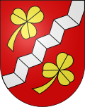
Shells
| Shells | ||
|---|---|---|
| State : |
|
|
| Canton : |
|
|
| Administrative district : | Bern-Mittelland | |
| Residential municipality : | Fraubrunnen | |
| Postal code : | 3314 | |
| former BFS no. : | 0549 | |
| Coordinates : | 606640 / 217 609 | |
| Height : | 500 m above sea level M. | |
| Area : | 1.4 km² | |
| Residents: | 410 (December 31, 2012) | |
| Population density : | 293 inhabitants per km² | |
|
Aerial view of shells |
||
| map | ||
|
|
||
Until December 31, 2013, Schalunen was a political municipality in the Bern-Mittelland administrative district of the canton of Bern in Switzerland . On January 1, 2014, Schalunen merged with the municipalities of Büren zum Hof , Etzelkofen , Grafenried , Limpach , Mülchi and Zauggenried to form the municipality of Fraubrunnen .
geography
Schalunen is at 500 m above sea level. M. , ten kilometers northwest of the city of Burgdorf and 11 km south of Solothurn (as the crow flies). The village extends on a terrace in the extreme northeast of Rapperswil plateau at the edge of the flood plain of the Emme , in the Swiss Plateau .
The area of the 1.4 km² large municipal area covers a section of the central Bernese plateau. The central part of the community is occupied by the hill of Schalunen, a ridge running from south to north on the western edge of the Emme plain. At the height at Bischof is 510 m above sea level. M. reached the highest point of Schalunen. On its west side, this ridge is predominantly wooded ( Hofwald , Hüserwald and Zwingliswald ) and is bordered by the little valley of the Chrümmlisbach (tributary of the Limpach ). To the east, the municipality extends into the broad alluvial plain, through which the Urtenen flows, but does not extend all the way to the Emme. In 1997, 11% of the municipal area was accounted for by settlements, 31% by forests and woodlands and 58% by agriculture.
Schalunen includes a new residential area at Holzhüser as well as some individual courtyards in the Emme plain. Until December 31, 2013 , neighboring communities from Schalunen were Bätterkinden , Fraubrunnen , Büren zum Hof and Limpach .
population
With 410 inhabitants (as of December 31, 2012), Schalunen was one of the small communities in the canton of Bern. 95.1% of the residents are German-speaking, 0.6% French-speaking and 0.6% speak Italian (as of 2000). The population of Schalunen was 135 inhabitants in 1850 and 121 inhabitants in 1900. In the course of the 20th century, the population has always fluctuated between 120 and 190 people. Since 1970 (138 inhabitants) there has been a rapid increase in population combined with almost three times the number of inhabitants within 30 years.
| Population development in the municipality of Schalunen | |||||||||
|---|---|---|---|---|---|---|---|---|---|
| year | 1850 | 1880 | 1900 | 1930 | 1950 | 1980 | 1990 | 2000 | |
| Residents | 135 | 131 | 121 | 163 | 193 | 255 | 344 | 350 | |
politics
The voting shares of the parties on the occasion of the National Council elections in 2011 were: SVP 42.2%, BDP 20.7%, SP 14.3%, GPS 7.0%, FDP 5.7%, glp 4.6%, EPP 2.1 %, CVP 1.6%, EDU 0.2%.
economy
Up until the second half of the 20th century, Schalunen was a village dominated by agriculture . Even today, the have farming , the fruit-growing and cattle breeding an important role in the employment structure of the population. Further jobs are available in local small businesses and in the service sector, including in a mechanical workshop and in a horticultural company. In the last few decades the village has developed into a residential community. Many employed people are therefore commuters who work mainly in the larger towns in the area as well as in the Bern agglomeration and in the Solothurn area .
traffic
Schalunen is very well developed in terms of traffic. The place is on the old main road from Bern to Solothurn . The closest connection to the A1 motorway (Bern-Zurich) is around 8 km from the town center. On April 10, 1916, the Zollikofen-Solothurn section, which is now operated by the local transport company Regionalverkehr Bern-Solothurn , was put into operation with a train station in Schalunen.
history
In the municipality of Schalunen, a gold bracelet from the La Tène period was found in 1864 while plowing a field . The place was first mentioned in a document in 1249 under the name Chaluna . Later, the names Schalune (1321), Schalunen (1361) and Tschalunen (1420) appeared. The etymology of the place name is in the dark.
From 1406, Schalunen was under the rule of Bern. A border then ran straight through today's municipality: the southern part of the village belonged to the Cistercian monastery Fraubrunnen and, after its secularization in 1528, to the Landvogtei Fraubrunnen in the district court of Zollikofen . In contrast, the northern part was subordinate to the Bätterkinden court in the Landshut Landvogtei . After the collapse of the Ancien Régime (1798), both parts of Schalunen belonged to the district of Zollikofen during the Helvetic Republic and from 1803 to the Oberamt Fraubrunnen, which received the status of an official district with the new cantonal constitution of 1831. Schalunen does not have its own church, it belongs to the parish Limpach (Reformed) and the parish Utzenstorf (Catholic).
Attractions
Web links
- Official website of the municipality of Schalunen
- Anne-Marie Dubler : Shells. In: Historical Lexicon of Switzerland .


