Lagardelle-sur-Lèze
|
Lagardelle-sur-Lèze La Gardèla de Lesa |
||
|---|---|---|

|
|
|
| region | Occitania | |
| Department | Haute-Garonne | |
| Arrondissement | Muret | |
| Canton | Portet-sur-Garonne | |
| Community association | Lèze Ariège | |
| Coordinates | 43 ° 25 ' N , 1 ° 23' E | |
| height | 167-500 m | |
| surface | 13.78 km 2 | |
| Residents | 3,045 (January 1, 2017) | |
| Population density | 221 inhabitants / km 2 | |
| Post Code | 31870 | |
| INSEE code | 31263 | |
| Website | www.lagardellesurleze.eu | |
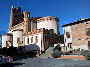
 Ascension Church |
||
Lagardelle-sur-Lèze ( Occitan : La Gardèla de Lesa ) is a French commune with 3,045 inhabitants (as of January 1, 2017) in the Haute-Garonne department in the Occitanie region . Lagardelle-sur-Lèze belongs to the Arrondissement of Muret and the canton of Portet-sur-Garonne . The inhabitants are called Lagardellois (es) .
geography
Lagardelle-sur-Lèze is located about 25 kilometers south of Toulouse on the Lèze River . Lagardelle-sur-Lèze is surrounded by the neighboring communities of Labarthe-sur-Lèze in the north, Vernet in the east and northeast, Miremont in the south and southeast, Beaumont-sur-Lèze in the southwest and Eaunes in the west and northwest.
Population development
| year | 1962 | 1968 | 1975 | 1982 | 1990 | 1999 | 2006 | 2017 |
| Residents | 587 | 610 | 914 | 1139 | 1823 | 2181 | 2433 | 3045 |
Attractions
- 12th century church
- Rectory, built in 1850
- Old Town Hall, built in 1788
- Les Sœurs castle from the 16th century
- Redon Castle from the 18th century
- Le Vignaou Castle, built at the end of the 18th century
- Le Rouquadou bridge over the Lèze
- Water and windmill
literature
- Le Patrimoine des Communes de la Haute-Garonne. Flohic Editions, Volume 2, Paris 2000, ISBN 2-84234-081-7 , pp. 1139-1141.
Web links
Commons : Lagardelle-sur-Lèze - Collection of images, videos and audio files
