List of technical monuments in the Bautzen district (A – K)
The list of technical monuments in the Bautzen district contains the technical monuments in the Bautzen district .
This list is a partial list of the list of cultural monuments in Saxony . Due to the large number of technical monuments, the list is divided into the
- List of technical monuments in the Bautzen district (A – K)
- List of technical monuments in the Bautzen district (L – Z)
Legend
- Image: shows a picture of the cultural monument and, if applicable, a link to further photos of the cultural monument in the Wikimedia Commons media archive
- Designation: Name, designation or the type of cultural monument
-
Location: If available, street name and house number of the cultural monument; The list is basically sorted according to this address. The map link leads to various map displays and gives the coordinates of the cultural monument.
- Map view to set coordinates. In this map view, cultural monuments are shown without coordinates with a red marker and can be placed on the map. Cultural monuments without a picture are marked with a blue marker, cultural monuments with a picture are marked with a green marker.
- Dating: indicates the year of completion or the date of the first mention or the period of construction
- Description: structural and historical details of the cultural monument, preferably the monument properties
-
ID: is awarded by the State Office for the Preservation of Monuments in Saxony. It clearly identifies the cultural monument. The link leads to a PDF document from the State Office for the Preservation of Monuments in Saxony, which summarizes the information on the monument, contains a map sketch and often a detailed description. For former cultural monuments sometimes no ID is given, if one is given, this is the former ID. The corresponding link leads to an empty document at the state office. The following icon can also be found in the ID column
 ; this leads to information on this cultural monument at Wikidata .
Arnsdorf
| image | designation | location | Dating | description | ID |
|---|---|---|---|---|---|
| Subject aggregation Former Royal Saxon Nursing Institution Arnsdorf (today Saxon Hospital for Psychiatry and Neurology Arnsdorf) |
Arnsdorf (map) |
1907–1912 (water siphon) | Individual monument of the above-mentioned aggregate: water lift (see also aggregate document obj 09284584); single-storey, free-standing building on an angled floor plan, historical significance |
09302277
|
|
| Former Royal Saxon Nursing Institution Arnsdorf (today Saxon Hospital for Psychiatry and Neurology Arnsdorf) | Arnsdorf (map) |
1907–1912 (sewage treatment plant) | Individual monument of the above-mentioned entity: sewage treatment plant and enclosure wall with curved gate (see also entity document obj 09284584); Sewage treatment plant consisting of two clarifiers and several small buildings, historical significance |
09302288
|
|
| Subject aggregation Former Royal Saxon Nursing Institution Arnsdorf (today Saxon Hospital for Psychiatry and Neurology Arnsdorf) | Arnsdorf (map) |
1907–1912 (pump house C12) | Individual monument of the above-mentioned aggregate: Condensate pump house C12 (see also aggregate document obj 09284584); single-storey building with hipped roof, historical significance |
09302289
|
|
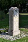 |
Royal Saxon milestones (totality) | Arnsdorf (map) |
19th century (milestone) | Milestone; of importance in terms of traffic history |
09284592
|
| Viaduct and bridge over the Röder |
Kleinwolmsdorf (map) |
Significance in terms of building history and landscape |
09305876
|
||
| Phillipp Mill |
Wallroda (map) |
Core safe 18th century (mill) | Residential mill buildings including mill engineering and angled barn; Mill building upper floor half-timbered, barn half-timbered in the jamb, of importance in terms of architectural and technical history |
09284427 |
Bautzen, city
| image | designation | location | Dating | description | ID |
|---|---|---|---|---|---|
| Waystone |
Bloaschütz (card) |
19th century (road stone) | of importance in terms of traffic history |
09302904
|
|
| Waystone | Bloaschütz (card) |
19th century (road stone) | of importance in terms of traffic history |
09302908
|
|
 More pictures |
Royal Saxon. State penal institution (formerly); Material entirety of Bautzen Prison I (formerly); Yellow misery |
Gesundbrunnen (map) |
1900-1904 (cell wing); 1903 (laundry); 1903 (prison wall); 1903 (institutional church); 1950 (hospital) | Individual features of the aggregate penal institution Bautzen I: Church, House I, House II, House III, House IV (hospital), kitchen, laundry, chimney (technical monument) and enclosure wall (see also aggregate document obj. 09301250); historical and scientific value. (see also Weigangstraße 8a) |
09250715
|
| Copper hammer mill (former) | Gesundbrunnen (map) |
1913-1914 (rolling mill); around 1920 (administration building); 1913-1914 (laboratory); probably 16th century (Mühlgraben); 1795 (bridge); around 1900 (weir) | Industrial complex (former mill location, later copper rolling and hammer mill) with the former administration building including laboratory and pickling house, Mühlgraben weir system with tunneling underneath and footbridge as well as fencing (further former administration building see Kupferhammer 2 (obj. 09254971)); special importance in terms of building history, local history and economic history |
09250451
|
|
| Dyeing works with chimney in the courtyard (former workshop) | Gesundbrunnen (map) |
around 1900 (dyeing) | of importance in terms of building history and local history |
09250459
|
|
 More pictures |
Building complex, consisting of workshops and administration buildings (Buildings I, Ib, Id, II, III, IV, VI, VII, X), with chimney on Building Id (important landmark) and chimney as well as ceramic relief "Eisenflechter" on the outer wall and wall design Two lying rectangular and two square abstract ceramic reliefs on the inner wall of the former dining room | Gesundbrunnen (map) |
around 1920 (formerly kitchen); marked 1922 (building III); Mid 19th century (building Ib); marked 1869 (building I); around 1890 (chimney) | of architectural and technical history as well as of artistic importance |
09251229
|
 More pictures |
Friedensbrücke; Kronprinzenbrücke (formerly); Spreetalbrücke |
Downtown (map) |
marked 1909, built 1908–1909 (road bridge) | Road bridge over the Spree; shaping the landscape as well as shaping the townscape, of technical and local historical significance |
09250980
|
| Garden shed in the rear of the property and historical laundry shortages in the front building | Downtown (map) |
around 1800 (garden house); 4th quarter of the 19th century (lack of laundry) | Garden house evidence of architectural history, of importance in terms of urban planning and history, lack of laundry of importance in terms of technical history |
09251459
|
|
 |
New water art | Downtown (map) |
inscribed 1606 (water art); 1692 (stone bench) | New water art with stone bench and quarry stone retaining wall at the Neutor, including a connecting passage to the keeper's house (see also Fischergasse 20 -Obj. 09251179); Architecturally, historically and technically of importance, shaping the townscape |
09250962
|
 |
Sewage pumping station | Downtown (map) |
1929 (pump house) | Pump house; Single-storey clinker brick building with an extension adapted to the level of the site as access to the roof terrace (with iron railing), with arched window and door openings, retracted entrance, of importance in terms of building history and technology |
09286964
|
 |
Werkhaus der Neue Wasserkunst | Downtown (map) |
1606–1610 (residential building) | Former Werkhaus der Neue Wasserkunst (cf. obj 09250962) with remains of the enclosure; Of outstanding importance in terms of building history and technology history |
09251179
|
 |
Stocking Walke (former) | Downtown (map) |
Residential and production building with two extensions, in open development; of importance in terms of building history and technology history |
09251180
|
|
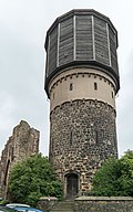 More pictures |
Water tower | Downtown (map) |
1877 (water tower) | Water tower; of importance in terms of building history and technology history |
09251155
|
 More pictures |
Saxon post mile pillars (totality) | Downtown (map) |
1725 (full mile column) | Post mileage column; Remnants of a full-mile column, of significance in terms of traffic and local history |
09250250
|
| Power station | Downtown (map) |
around 1900 (substation); 1900 (administration building) | Old power station, today ESAG customer service, consisting of a former switching house and administration building and enclosure wall (see also Rosenstrasse 30, property); of importance in terms of local history and technology |
09250717
|
|
 |
Power station | Downtown (map) |
around 1900 (substation); 1900 (administration building) | Old power station, today ESAG customer service, consisting of a former switching house and administration building and enclosure wall (see also Rosenstrasse 30, property); of importance in terms of local history and technology |
09250717
|
 |
Gebr. Paulinus-Schmiede | Downtown (map) |
marked 1896 (forge) | Smithy in the backyard with extension building; of significance in terms of technology history |
09250026
|
 |
Lazarus mill | Downtown (map) |
2nd half of the 18th century (mill) | Former mill with a mill ditch running underground; see also obj. 09253223, of importance in terms of building history, local history and technology history |
09251123
|
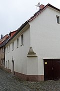 More pictures |
Residential house with a two-story bridge over the Mühlgraben to the rear building, in semi-open development | Downtown (map) |
marked 1785 (residential building) | Significant in terms of building history and the appearance of the street |
09251125
|
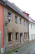 |
Residential house with back building (built over the Mühlgraben) and arched bridge, in closed development | Downtown (map) |
1775 (house bridge, marked keystone) | of importance in terms of building history and technology history |
09251126
|
 |
Big mill; Council mill; Riding house; So-called. "Donkey stable" | Downtown (map) |
in the core of the 16th century (Mühlgraben); Core middle ages; marked on the panel 1897 (side building); around 1920 (turbine house) | Mühlgraben in the area Unterm Schloß in its entire extent (from Unterm Schloß 6 to Unterm Schloß 48, see also obj. 09251123), partly vaulted (quarry stone, very desolate), including an overflow weir with free flood, turbine house with remains of the technology (shaft turbine), rifle system , Arch reinforcements in the area of the former large mill (or Ratsmühle) as well as the enclosure wall along the street, as well as the adjacent building of the former so-called donkey stable; of importance in terms of local history, shaping the townscape and technological history |
09253223
|
 More pictures |
City fortifications and promenades (entity); Old water art | Downtown (map) |
after 1558 (water art) | Individual monument of the city fortifications and promenades: old water art with battlements, weir and ditch as well as preserved technology (see list of objects 09301008); shaping the cityscape, of importance in terms of local history, building history and technology history |
09251001
|
 |
Path pillar |
Kleinseidau (map) |
19th century (road stone) | of importance in terms of local history and traffic history |
09253074
|
 More pictures |
Water tower |
Kleinwelka (map) |
marked 1931 (water tower) | Water tower; A tower that defines the townscape and has a technical and historical significance |
09253057
|
 |
Path pillar |
Löschau (map) |
19th century (road stone) | Of importance in terms of traffic history |
09252290
|
 More pictures |
Bautzen train station |
Nordostring (map) |
1846 (passenger station); around 1900 (station building); around 1935 (taxi stand); 1931 (War Memorial 1st World War); around 1910 (formerly Post Office) | Station with wall and ceiling painting in the foyer and the associated house platform with roofing, the building of the former post office, the building of the taxi stand on the station forecourt and a war memorial in honor of the railway workers who died in the First World War; importance in terms of building history and traffic history |
09251181
|
 More pictures |
Steam locomotive 52 8056-5 | Nordostring (map) |
1943 (steam locomotive) | Steam locomotive with tender, on a base; Significant for railway history and technology history In the course of the redesign of the station, the locomotive was moved to Packhofstrasse on September 18, 2017 and transferred to the Löbauer Verein Ostsächsische Eisenbahnfreunde (OSEF) on March 5, 2018 . |
09250503
|
| Path pillar |
Oberuhna (map) |
1st half of the 19th century (Wegestein) | of importance in terms of traffic history |
09252275
|
|
| Path pillar | Oberuhna (map) |
around 1850 (Wegestein) | of importance in terms of traffic history |
09252273
|
|
| Path pillar | Oberuhna (map) |
1st half of the 19th century (Wegestein) | of importance in terms of traffic history |
09252289
|
|
 More pictures |
Waterworks |
Ostvorstadt (map) |
marked 1893 (waterworks); 1949/50 (drinking water treatment plant) | Waterworks with collecting well as well as drinking water treatment plant behind; of importance in terms of building history and technology history |
09251337
|
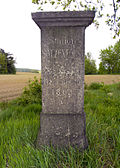
| Path pillar | Ostvorstadt (map) |
2nd half of the 19th century (Wegestein) | of importance in terms of traffic history |
09251338
|
|
 More pictures |
Totality of the Royal Saxon Triangulation ("European degree measurement in the Kingdom of Saxony"); Station 49 salt forest |
Salzenforst (map) |
marked 1865 (triangulation column) | Triangulation stone, 2nd order station; significant testimony to the geodesy of the 19th century, significant in terms of surveying history |
09252283
|
 |
Royal Saxon milestones (totality) |
Stiebitz (card) |
19th century (milestone) | Milestone; Half milestone reworked into a kilometer stone, of significance in terms of traffic history |
09250199
|
 |
Bautzen – Bad Schandau railway line |
Südvorstadt (map) |
1919 (railway bridge) | Concrete arch bridge with concrete parapet and side wing walls; In view of the remote location, a remarkably elaborate bridge structure, originally built as a railway bridge, but never used as such due to the lack of operational approval, of importance in terms of railway history and building history |
09250505
|
 |
Boblitzer Wasser Bridge; Görlitz – Dresden railway line | Südvorstadt (map) |
1845/1846 (railway bridge) | Railway bridge with side retaining walls; Double arched vault bridge made of granite ashlar masonry, of importance in terms of railway and building history |
09250205
|
 |
Frankenstein Mill | Südvorstadt (map) |
2nd half of the 19th century (mill) | Grinding mill, including mill ditch, weir and parts of the technical equipment (diesel engines, water technology system); of importance in terms of building history, economic history and technology history |
09250535
|
 More pictures |
Railway viaduct over the Spree | Südvorstadt (map) |
around 1850 (viaduct) | Erected as a stone bridge with five larger and five smaller round arches, important in terms of railway history, architectural history and technology history |
09250166
|
| Blechschmidt's enamelling factory | Südvorstadt (map) |
around 1890 (factory building) | Factory complex with the factory buildings 4.1 and 4.2 as well as the fence and porter's house; of local importance |
09250534
|
|
| Path pillar |
Teichnitz (map) |
1st half of the 19th century (Wegestein) | of importance in terms of traffic history |
09251378
|
|
| Path pillar |
Temritz (map) |
marked 1863 (Wegestein) | of importance in terms of traffic history |
09252294
|
|
 More pictures |
Holy Spirit Bridge; Spree Bridge |
Westvorstadt (map) |
1595 (road bridge) | Multi-arch bridge over the Spree; of importance in terms of urban history, traffic history, building history and technology history |
09250206
|
| Former forge and octagonal chimney | Westvorstadt (map) |
around 1910 (forge) | Shape of the street and of importance in terms of technology history |
09250195
|
|
| Substation (without technical systems) and residential building (red brick buildings) | Westvorstadt (map) |
around 1930 (substation); around 1930 (residential building) | of importance in terms of building history and technology history |
09250452
|
|
 |
Approaches to a narrow bridge over the Spree (pedestrian bridge) | Westvorstadt (map) |
Early 1980s (pedestrian bridge) | of significance in terms of technology history |
09250506
|
 More pictures |
Jordan Valley Bridge | Westvorstadt (map) |
1907-1909 (road bridge); 1953 (reconstruction) | Two-arched bridge over Salzenforster Strasse; of importance in terms of technology and traffic history |
09250410
|
 More pictures |
Kappler mill | Westvorstadt (map) |
marked 1718 (residential house) | Mill with remnants of the water-technical system and double dwelling in open development (with water level board); of importance in terms of building history and local history |
09251220
|
| Grinding mill | Westvorstadt (map) |
around 1850 (mill) | Former grinding mill (four-storey, hipped roof) with elongated extension, with all technology, including water-technical system (weir, mill ditch through the building) and bridge over the Spree; all buildings have largely been preserved in their original state, of importance in terms of building history, local history and technology history |
09251443
|
|
 More pictures |
Hammer mill; Iron hammer | Westvorstadt (map) |
around 1850 (iron hammer's house); marked 1897 (mill building); marked 1905 (warehouse); marked 1898 (tenement house) | Mill ensemble with tenement house in corner location, miller's house, outbuilding (gatehouse), rear mill wing with an L-shaped floor plan, storage building in the courtyard and courtyard paving, plus mill technical equipment and water system including the associated weir; Three murals in the mill building, depicting views of the city from around 1850–1880 (Eisenhammer until 1888, then mill), mill technology fully available, of importance in terms of building history, local history and technology history |
09250828 |
Bernsdorf, city
| image | designation | location | Dating | description | ID |
|---|---|---|---|---|---|
| Two way stones |
Bernsdorf (map) |
19th century (road stone) | of traffic-historical importance |
09304586
|
|
| Path stone and boundary stone | Bernsdorf (map) |
probably 19th century (road stone) | Of importance in terms of traffic and regional history |
09278789
|
|
 More pictures |
Windmill Great Ditch |
Great Grave (Map) |
Early 19th century (mill) | Tower Dutchman; of importance in terms of local history and the appearance of the town |
09278799
|
 More pictures |
Windmill Strassgräbchen |
Rhinestone (card) |
19th century (mill) | Tower Dutchman; of importance in terms of local history and the appearance of the town |
09228236
|
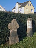 |
Atonement Cross and Way Pillar | Rhinestone (card) |
16./17. Century (Murder and Atonement Cross); 19th century, road column (road stone) | significance in terms of local history and traffic history |
09305315
|
| Wiednitz railway station; Lübbenau – Kamenz railway line |
Wiednitz (map) |
1874, route and station opening (passenger station); 1911 (reception building); around 1910 (railway house) | Reception building with goods handling (No. 22), platform, loading lane with paving and shed as well as a railway house (No. 20); Formerly with several loading tracks and form signals, an authentically preserved reception building, red brick or red brick reminding of the design of Prussian train stations. Plastered building with an elaborate structure typical of the time and a moving roof landscape, a railway house made of red brick also elaborately structured, goods handling and a long loading street are the last testimony to the once heavy cargo handling in connection with agriculture and especially the lignite industry, ensemble of architectural, local, industrial and railway historical importance. |
08985167
|
|
| Waystone | Wiednitz (map) |
19th century (road stone) | of importance in terms of traffic history |
08985159
|
|
| Waystone | Wiednitz (map) |
19th century (road stone) | of importance in terms of traffic history |
08985163
|
|
| Waystone | Wiednitz (map) |
19th century (road stone) | of importance in terms of traffic history |
08985162
|
|
| Waystone | Wiednitz (map) |
19th century (road stone) | of importance in terms of traffic history |
08985160
|
|
| Transformer tower | Wiednitz (map) |
around 1930 (transformer station) | with accentuating formal language typical of the time, of significance in terms of technology history |
08985161
|
|
| Waystone | Wiednitz (map) |
19th century (road stone) | of importance in terms of traffic history |
08985164
|
|
| Waystone |
Zeißholz (map) |
19th century (road stone) | of importance in terms of traffic history |
09278773 |
Bischofswerda, city
| image | designation | location | Dating | description | ID |
|---|---|---|---|---|---|
| Waystone |
Belmsdorf (map) |
19th century (road stone) | of importance in terms of traffic history |
09305601
|
|
| Waystone | Belmsdorf (map) |
19th century (road stone) | of importance in terms of traffic history |
09305600
|
|
 More pictures |
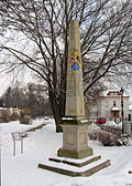
Saxon post mile pillars (totality) |
Bischofswerda (map) |
1724 (post distance column) | Post mileage column; partial copy of a distance column, of importance in terms of traffic history |
09285749
|
| Bischofswerda train station; Görlitz – Dresden railway line | Bischofswerda (map) |
1845 (reception building); 1883–1884, eastern extension (station building) | Station with reception building, house platform roofing and central platform with platform roofing, staircase housing and paving; of importance in terms of railway history and local history |
09285706
|
|
| Bridge over the Wesenitz | Bischofswerda (map) |
Late 19th century (road bridge) | single-arch sandstone / granite bridge, of importance in terms of traffic and technology |
09285704
|
|
| Factory building of the old brewery with enclosure wall | Bischofswerda (map) |
around 1850 (factory building) | in the corner of Hans-Volkmann-Straße, of architectural and local significance |
09288403
|
|
| Mill (formerly) | Bischofswerda (map) |
after 1813 (residential building) | Residential house in open development; of importance in terms of building history and local history |
09285897
|
|
| Pedestrian tunnel | Bischofswerda (map) |
around 1900 (road tunnel) | Granite, important in terms of traffic history |
09285676
|
|
| Görlitz – Dresden railway line | Bischofswerda (map) |
marked 1901 (railway bridge) | Railway bridge; Two-arched granite bridge, important in terms of railway history and technology |
09285675
|
|
| Görlitz – Dresden railway line | Bischofswerda | around 1900 (railway bridge) | Railway bridge; Granite, of importance for the history of traffic and technology |
09285674
|
|
| Brick factory | Bischofswerda (map) |
2nd half of the 19th century (brickworks) | Brick building with zigzag furnace including rear annex with drying shelves; of significance in terms of technology history |
09288470
|
|
| Bridge over the Wesenitz | Bischofswerda (map) |
Late 19th century (road bridge) | single-arch granite bridge, of importance in terms of architectural and technical history |
09285719
|
|
| Road bridge over the railroad | Bischofswerda (map) |
around 1900 (road bridge) | double-arched granite bridge, of architectural and technical significance |
09285678
|
|
| Railway bridge | Bischofswerda (map) |
around 1900 (railway bridge) | of importance in terms of technology and traffic history |
09285683
|
|
| Granite arch bridge and landmark |
Grossdrebnitz (map) |
19th century (road bridge) | Of importance in terms of building history, technology history and local history |
08986184
|
|
| Schönbrunn Bridge; Kamenz – Bischofswerda railway line |
Schönbrunn (map) |
1901 (railway bridge) | Railway bridge; Arched bridge with two openings over Burkauer Straße, characterizing the townscape, of architectural and railway history |
09288940
|
|
| Path pillar | Schönbrunn (map) |
19th century (road stone) | of importance in terms of traffic history |
09289492
|
|
| Path pillar |
Weickersdorf (map) |
around 1905, Wegsäule (Wegestein) | square granite column with a five-sided top, significance in terms of traffic history |
09304676
|
|
| Weickersdorf stop; Görlitz – Dresden railway line | Weickersdorf (map) |
1909, outhouse (passenger station); 1909 (waiting hall) | Waiting hall and toilets at the Weickersdorf stop; Waiting hall with entrance using surrounding technology, of importance in terms of railway history, architectural history and local history |
09276211
|
|
| Two arch bridges at the Hentschelmühle | Weickersdorf (map) |
Inscription stone marked 1828 (second arch bridge); Mid 19th century (first arch bridge); Inscription stone marked 1850 (second arch bridge) | one of the two bridges with two inscription stones, of architectural and local significance |
09276210
|
|
| Görlitz – Dresden railway line | Weickersdorf (map) |
4th quarter of the 19th century (railway bridge) | Railway bridge; single-arched granite bridge with side walled cheeks, of importance in terms of railway history and technology history |
09304142
|
|
| Waystone | Weickersdorf (map) |
19th century (road stone) | of importance in terms of traffic history |
09276207
|
|
| Waystone | Weickersdorf (map) |
19th century (road stone) | Granite obelisk, inscription field with route sign "Stolpen", of importance in terms of traffic history |
09276213
|
|
| Weickersdorfer Mill | Weickersdorf (map) |
marked 1830 (farmhouse) | Mill property with house and barn on a hook floor plan; Formerly cutting and grinding mill, upper floor timber-framed boarded up, massive gable, important in terms of building history and local history |
09276216 |
Bretnig-Hauswalde
| image | designation | location | Dating | description | ID |
|---|---|---|---|---|---|
| Path pillar |
Hauswalde (map) |
19th century (road stone) | of importance in terms of traffic history |
09289144 |
Burkau
| image | designation | location | Dating | description | ID |
|---|---|---|---|---|---|
| Waystone |
Bocka (map) |
19th century (road stone) | of importance in terms of traffic history |
09289394
|
|
| Raschemühle |
Burkau (map) |
around 1870, core possibly older (mill) | House and barn of a mill and a mill pond; Upper floor residential building timber-framed boarded and slated, front door granite walls, exposed location, of architectural and local significance |
09289426
|
|
| Eichardt's mill | Burkau (map) |
marked 1808 (mill) | Mill with attached house and mill pond; Mühle three-storey building with a half-hip roof, attached residential building, two-storey plastered building with a half-hip roof, of architectural and local importance |
09289385
|
|
| Wenceslas mill | Burkau (map) |
Kern 18th century (mill); around 1910 (saw gate) | Mill building with integrated barn and cutting mill extension as well as technology and remains of hydraulic engineering; Upper floor timber-frame clad, cutting mill boarded-up wooden construction, of importance in terms of building history, technical history and local history |
09288630
|
|
| Waystone | Burkau (map) |
19th century (road stone) | of importance in terms of traffic history |
09289435
|
|
| Waystone | Burkau (map) |
19th century (road stone) | of importance in terms of traffic history |
09289430
|
|
| Path pillar | Big boy | 19th century (road stone) | of importance in terms of traffic history |
09289464
|
|
| Waystone | Big boy (card) |
19th century (road stone) | of importance in terms of traffic history |
09289465
|
|
| Mill and house of a mill estate | Big boy (card) |
marked 1698, furnace plate retrospectively in the facade verm (mill); Door frame marked 1793 (Mühle) | both buildings upper storey timber framed boarded |
09289468
|
|
| Waystone |
Uhyst am Taucher (map) |
19th century (road stone) | of importance in terms of traffic history |
09289450 |
Crostwitz
| image | designation | location | Dating | description | ID |
|---|---|---|---|---|---|
| Waystone |
Caseritz (map) |
marked 1854 (Wegestein) | of importance in terms of traffic history |
09228350
|
|
| Waystone |
Crostwitz (map) |
19th century (road stone) | Of importance in terms of traffic history |
09228347
|
|
| Wayside shrine and stone | Crostwitz (map) |
18th century (wayside shrine); 19th century (road stone) | Wayside shrine consisting of a curved granite column with a tabernacle-like top made of sandstone, of regional and traffic history |
09228346
|
|
| Waystone | Crostwitz (map) |
19th century (road stone) | Of importance in terms of traffic history |
09301493
|
|
| Waystone |
Horka (map) |
19th century (road stone) | Granite, important in terms of traffic history |
09228367
|
|
| Waystone |
Kopschin (map) |
19th century (road stone) | Granite, important in terms of traffic history |
09228365
|
|
| Path pillar |
Prautitz (map) |
19th century (road stone) | of importance in terms of traffic history |
09228360
|
|
| Prautitz Mill | Prautitz (map) |
marked 1859 in the granite door stock (grain mill); Affixed in 1920 (medallion) | Mill building with an angled floor plan with technical equipment, two portrait medallions above the doors of each wing of the building, a stone bench and two stone troughs in the courtyard; Technical equipment in function, of importance in terms of building history, local history and technical history |
09302882 |
Cunewalde
| image | designation | location | Dating | description | ID |
|---|---|---|---|---|---|
| Cunewalde oil mill |
Cunewalde (map) |
around 1800 (mill); around 1800 (house); Late 19th century (warehouse); marked 1784 (fountain trough) | Residential mill building with outside wheel room, southern extension and attached residential building with an L-shaped floor plan (Hauptstraße 216), side building (Am Bahndamm 5), well trough, gate pillar and gate, bank reinforcement including rifle weir and water extraction facilities of the mill as well as three stone deck bridges; Mill property in a corner location, in an ensemble with the hydraulic engineering systems and the typical regional stone deck bridges over the Cunewald water, defining the townscape, of importance in terms of building history and technology history |
09225390
|
|
| Höhnes quarry | Cunewalde (map) |
19th century (quarry) | Large quarry, plus old stairs, running wheels and winches as well as embankments; Granite quarry flooded with groundwater, approx. 60 m deep, of technical significance |
09225387
|
|
| Waystone | Cunewalde (map) |
1st half of the 19th century (Wegestein) | of importance in terms of traffic history |
09225256
|
|
| Old school bridge | Cunewalde | 19th century (road bridge) | Bridge over the Cunewalder water; of significance in terms of technology history |
09225231
|
|
| Granite quarry | Cunewalde (map) |
approx. 1800–1950 (quarry) | flooded with groundwater, of technical significance |
09225050
|
|
| Großpostwitz – Löbau railway line | Cunewalde (map) |
around 1890 (passenger station) | Mittelcunewalde stop; small wooden house, significance in railway history |
09301860
|
|
| Großpostwitz – Löbau railway line | Cunewalde | 1928 (waiting hall) | Obercunewalde stop; Wooden house, important in terms of railway history |
09301861
|
|
| Großpostwitz – Löbau railway line | Cunewalde (map) |
around 1900 (passenger station); around 1890 (goods shed) | Obercunewalde station with loading hall (goods shed); Massive with wide roof overhangs and a large wooden bus shelter, significance in terms of railway history |
09225052
|
|
| Cunewalde oil mill | Cunewalde (map) |
around 1800 (mill); around 1800 (house); Late 19th century (warehouse); marked 1784 (fountain trough) | Residential mill building with outside wheel room, southern extension and attached residential building with an L-shaped floor plan (Hauptstraße 216), side building (Am Bahndamm 5), well trough, gate pillar and gate, bank reinforcement including rifle weir and water extraction facilities of the mill as well as three stone deck bridges; Mill property in a corner location, in an ensemble with the hydraulic engineering systems and the typical regional stone deck bridges over the Cunewald water, defining the townscape, of importance in terms of building history and technology history |
09225390
|
|
| Großpostwitz – Löbau railway line | Cunewalde (map) |
around 1900 (passenger station) | Reception building with attached goods shed as well as extension with waiting room and signal box; Reception building, upper floor half-timbered, significance in terms of railway history |
09225051
|
|
| two factory buildings | Cunewalde (map) |
4th quarter of the 19th century (textile factory) | At right angles to each other, two-storey buildings with original cubature, proportions and design features including historical stairwells and production halls with iron columns; Interesting in terms of building history, shaping the townscape and the history of the town |
09225103
|
|
| Waystone | Cunewalde (map) |
1st half of the 19th century (Wegestein) | of importance in terms of traffic history |
09225386
|
|
| Kalauch textile factory (formerly) | Cunewalde (map) |
around 1905 (part of the textile industry) | Production building with hall extension and chimney; of importance in terms of building history and technology history |
09225428
|
|
| August Hempel textile factory (formerly) | Cunewalde (map) |
around 1900 (factory building) | Former production building; today a community center, of importance in terms of building history and technology |
09225433
|
|
| Inheritance court (former) | Cunewalde (map) |
2nd half of the 19th century (production building) | Residential building (surrounding area) barn extension and production building; Upper floor half-timbered house, of architectural and local importance |
09225453
|
|
| Oil mill (formerly) | Cunewalde (map) |
marked 1845 (oil mill) | Mill building; Significance for the local image and for scientific documentary and local history |
09226882
|
|
| Residential mill house as well as iron comb wheel and gully | Cunewalde (map) |
around 1920 (mill) | of importance in terms of local history and technology |
09225156
|
|
| Residential house (surrounding area) and barn, plus a fountain in the courtyard | Cunewalde (map) |
marked 1799 (residential building) | Upper floor half-timbered house, of architectural significance |
09225159
|
|
| Albert Leuner sawmill | Cunewalde (map) |
marked 1823 (factory) | Residential house (surrounding area), production building and chimney of a sawmill; Upper floor residential building timber-framed, of importance in terms of building history and local history |
09225257
|
|
| Residential building (surrounding area) with a set of stairs, rear weaving mill building, further back building as well as courtyard paving (including the granite slabs around the residential building) and a small garage | Cunewalde (map) |
around 1880 (production building); 1st half of the 19th century (residential building); 1868 (rear building); 1920s (garage) | Upper floor half-timbered residential building, of architectural and socio-historical importance |
09225204
|
|
| Textile factory Friedrich Wilhelm Kloss (formerly) | Cunewalde (map) |
4th quarter of the 19th century (factory building) | Production building of a textile factory; of importance in terms of building history and technology history |
09225227
|
|
| Textile factory Friedrich Wilhelm Kloss (formerly) | Cunewalde (map) |
marked 1868 (factor house) | Trading post (surrounding area), plus paving; Upper floor half-timbered, office in the block room, of importance in terms of building and industrial history |
09225226
|
|
| Steel sand factory | Cunewalde (map) |
1920s (factory) | Production and storage building of a former factory; with continuous roof pike, attached skylight with chimney, of importance in terms of building history and technology history |
09225234
|
|
| Small weaving mill in a former barn with three historic looms | Cunewalde (map) |
2nd half of the 19th century (weaving) | of importance in terms of building history and social history |
09225242
|
|
| Großpostwitz – Löbau railway line |
Halbau (map) |
1928 (information) | Station building of the Halbau am Hochstein stop; wooden building with hipped roof, of importance in terms of railway history |
09225272
|
|
| Gedan's quarry |
Schoenberg (map) |
19th century (quarry) | Quarry with quarry stone wall; Granite quarry on the street, of local historical importance |
09225515 |
Demitz-Thumitz
| image | designation | location | Dating | description | ID |
|---|---|---|---|---|---|
| Path pillar |
Cannewitz (map) |
19th century (road stone) | of importance in terms of traffic history |
09289298
|
|
| Wölkau Mill | Cannewitz (map) |
1602 (mill); Late 19th century (barn); Late 19th century (side building) | Barn with extension and side building of a former mill with an angled floor plan and mill ditch; Former mill and bar, plastered buildings with a gable roof, the side building with twin windows in the gable, the mill ditch runs as a watercourse under the barn, of architectural and local significance |
09289297
|
|
| Demitz Viaduct; Görlitz – Dresden railway line |
Demitz-Thumitz (map) |
1845–1846 (viaduct) | Railway bridge; The viaduct that defines the townscape with 11 arches is important in terms of building history, technology history and traffic history |
09289235
|
|
| Bridge over the Hoyerswerdaer Schwarzwasser | Demitz-Thumitz (map) |
marked 1924 (road bridge) | historically important |
09289228
|
|
| Old stone saw mill | Demitz-Thumitz (map) |
inscribed in the granite door frame 1838 (Müllerwohnhaus) | Residential and mill building, barn with technical equipment (historical stone saw), wheel chamber and historical stone loading crane; Residential mill house, upper floor half-timbered, of local and technological significance |
09303342
|
|
| Sawmill with grinding system | Demitz-Thumitz (map) |
19th century (sawmill) | Plastered building with a half-hip roof, of importance in terms of building history and technology |
09289262
|
|
| Old stone saw mill | Demitz-Thumitz (map) |
inscribed in the granite door frame 1838 (Müllerwohnhaus) | Residential and mill building, barn with technical equipment (historical stone saw), wheel chamber and historical stone loading crane; Residential mill house, upper floor half-timbered, of local and technological significance |
09303342
|
|
| Path pillar |
Medewitz (map) |
19th century (road stone) | of importance in terms of traffic history |
09304078
|
|
| Waystone | Medewitz (map) |
19th century (road stone) | of importance in terms of traffic history |
09304109
|
|
| Waystone |
Pottschapplitz (map) |
19th century (road stone) | of importance in terms of traffic history |
09289304
|
|
| Waystone | Pottschapplitz (map) |
19th century (road stone) | of importance in terms of traffic history |
09289303
|
|
| Fold mill (former) |
Rothnaußlitz (map) |
1864 (mill); 1900 (residential building) | Residential house, attached mill building, side building and bridge over the Silberbach; Plastered quarry stone buildings, windows and doors granite walls, of architectural and local significance |
09289294
|
|
| Malthouse with adjoining building opposite | Rothnaußlitz (map) |
around 1900 (malt house) | Technology still available, malt house plastered quarry stone building with clinker clinker arches on the windows, of architectural and local significance |
09289290
|
|
| Waystone | Rothnaußlitz (map) |
19th century (road stone) | of importance in terms of traffic history |
09289289
|
|
| Waystone |
Stacha (map) |
19th century (road stone) | of importance in terms of traffic history |
09289278
|
|
| Former mill and stable building |
Wölkau (map) |
1st half of the 19th century (mill) | Mill upper floor half-timbered boarded up, side building plastered quarry stone building with jamb, of architectural and local significance |
09289264
|
|
| Path pillar | Wölkau (map) |
19th century (road stone) | of importance in terms of traffic history |
09304079 |
Doberschau-Gaussig
| image | designation | location | Dating | description | ID |
|---|---|---|---|---|---|
| Waystone |
Arnsdorf (map) |
marked 1927 (Wegestein) | of importance in terms of traffic history |
09252742
|
|
| Pond stand | Arnsdorf (map) |
marked 1824 (water element) | Granite, connects two village ponds, of technical significance |
09252748
|
|
| Well room | Arnsdorf (map) |
19th century (fountain house) | of cultural and historical importance |
09252747
|
|
| Pond stand | Arnsdorf (map) |
marked 1853 (on the southern pond) | Granite, important in terms of technology history |
09252766
|
|
| Well room | Arnsdorf (map) |
19th century (fountain house) | of cultural and historical importance |
09252764
|
|
| Old Mill |
Doberschau (map) |
2nd half of the 19th century (mill) | Mill building; Consisting of two parts of the building, without a north-western commercial extension at the rear, largely authentically preserved appearance, original front door, of architectural significance |
09252951
|
|
| Waystone |
Pushing (map) |
19th century (road stone) | of importance in terms of traffic history |
09303447
|
|
| Pottery fisherman |
Gaussian (map) |
1826 (founding of the pottery); around 1900 (round furnace) | Round furnace; Round ceramic kiln with four fire openings, as a testimony to the centuries-old tradition of firing by means of coal kilns, which has been largely superseded by the introduction of electric kilns, also in small pottery, is now a rarity and has a scientific and documentary value, and is also of importance in terms of technology history |
09252320
|
|
| Factory building |
Gnaschwitz (map) |
around 1910 (factory building) | Plastered building with thermal bath window and stylized colossal order, of importance in terms of building history and local history |
09252964
|
|
| Waystone |
Golenz (map) |
19th century (road stone) | of importance in terms of traffic history |
09250801
|
|
| Two-arched bridge over the Spree |
Grubschütz (card) |
19th century (road bridge) | Natural stone, shaping the landscape, significant in terms of building history and traffic history |
09252947
|
|
| Preibischmühle | Grubschütz (card) |
19th century (weir) | High water mark and water system of the former mill; Significant in terms of production history and landscape |
09252948
|
|
| Waystone | Grubschütz (card) |
19th century (road stone) | Granite, important in terms of traffic history |
09252946
|
|
| Katschwitzer mill |
Katschwitz (map) |
rew. First mentioned in 1766 (mill) | Watermill with overshot water wheel, mill pond, ditch and all the technology of the 20th century; of importance in terms of technology, cultural and social history |
09251997
|
|
| Waystone |
Preuschwitz (map) |
marked 1926 (Wegestein) | with spherical crowning, important in terms of traffic history |
09251469
|
|
| Waystone |
Schlungwitz (map) |
19th century (road stone) | of importance in terms of traffic history |
09252966
|
|
| Path pillar |
Zockau (map) |
19th century (road stone) | of importance in terms of local history and traffic history |
09303452 |
Elsterheide
| image | designation | location | Dating | description | ID |
|---|---|---|---|---|---|
| Path stone with three corner stones |
Klein Partwitz (map) |
19th century (road stone) | of importance in terms of local history and traffic history |
08990017
|
|
| Waystone |
Nardt (map) |
19th century (road stone) | of importance in terms of local history and traffic history |
08990064
|
|
| Waystone | Nardt (map) |
19th century (road stone) | of importance in terms of local history and traffic history |
08990062
|
|
| Bridge over the Black Elster |
Neuwiese-Bergen (map) |
around 1930 (road bridge) | Significant in terms of traffic history, building history and technology history |
08990054
|
|
| Mill wheel | Neuwiese-Bergen (map) |
of significance in terms of technology history |
08990058
|
||
| Waystone |
Sabrodt (map) |
19th century (road stone) | of importance in terms of local history and traffic history |
08990082
|
|
| Waystone | Sabrodt (map) |
19th century (road stone) | of importance in terms of local history and traffic history |
08990076 |
Elstra, city
| image | designation | location | Dating | description | ID |
|---|---|---|---|---|---|
| Waystone |
Dobrig (map) |
19th century (road stone) | of importance in terms of local history and traffic history |
09228390
|
|
| Steel girder bridge on natural stone pillars (granite) over the Black Elster |
Elstra (map) |
around 1890 (railway bridge) | Part of the Kamenz – Bischofswerda railway line, of significance in terms of technology history |
09228405
|
|
| Waystone | Elstra (map) |
1st half of the 19th century (Wegestein) | Of importance in terms of traffic history |
09228404
|
|
| Railway bridge | Elstra | around 1890 (railway bridge); before 2012 (railway bridge) | of significance in terms of technology history |
09228400
|
|
| Saxon post mile pillars (totality) | Elstra (map) |
marked 1725, copy (post distance column) | Post mileage column; Copy of a distance column, important in terms of traffic history |
09227462
|
|
| Waystone | Elstra (map) |
around 1850 (Wegestein) | of importance in terms of traffic history |
09221901
|
|
| Barchmann pottery | Elstra (map) |
around 1890 (kiln) | Rectangular kiln based on the functional principle of the circular kiln; With a capacity of approx. 36 m³, fireclay brick masonry, the only still existing kiln of this size in the area, of significance in terms of technology history |
09228388
|
|
| Hainmühle; Hommelmühle | Elstra (map) |
inscribed 1602 in the coat of arms (oil mill) | Mill property, consisting of residential mill building with the coat of arms of the abbess Anna Margareta Dornin and insignia of the miller's trade above the entrance door, the former oil mill and stable building, including the existing grinding technology and remains of the water-technical system (wheel chamber in rubble brickwork between the grinding and oil mill); Formerly part of the Marienstern monastery, residential mill building, quarry stone masonry, oil mill, upper floor clay peg half-timbered, gable roof with beaver tails, upper floor half-timbered stable building, partly plastered over, of architectural, social and local significance |
09228408
|
|
| Saxon post mile pillars (totality) | Elstra (map) |
1725 (post distance column) | Post mileage column; Remnants of a distance column, of importance in terms of traffic and local history |
09227490
|
|
| Waystone | Elstra (map) |
19th century (road stone) | of importance in terms of local history and traffic history |
09227464
|
|
| Two road stones and a landmark | Elstra (map) |
19th century (road stone); 19th century (boundary stone) | of importance in terms of local history and traffic history |
09225557
|
|
| Waystone |
Gödlau (map) |
19th century (road stone) | of importance in terms of traffic history |
09226289
|
|
| Path pillar |
Kriepitz (map) |
19th century (road stone) | of importance in terms of traffic history |
09228389
|
|
| Waystone | Kriepitz (map) |
19th century (road stone) | of importance in terms of local history and traffic history |
09304231
|
|
| Marking stone | Ossel | 19th century (road stone) | of local importance |
09305880
|
|
| Waystone |
Prietitz (map) |
marked 1852 (Wegestein) | of importance in terms of local history and traffic history |
09304232
|
|
| Huge mill |
Rauschwitz (map) |
1912 (residential building); 1st half of the 19th century (side building) | Residential house and side building of the former mill; Current house built after the fire in 1912 in place of the previous residential mill building (without mill function), side building, upper floor half-timbered, of architectural and local significance |
09225930
|
|
| Waystone |
Rehnsdorf (map) |
19th century (road stone) | of importance in terms of traffic history |
09228398
|
|
| Waystone |
Wohla (map) |
19th century (road stone) | of importance in terms of traffic history |
09228393 |
Frankenthal
| image | designation | location | Dating | description | ID |
|---|---|---|---|---|---|
| Technical system (including water wheel) of a mill | (Map) | 19th century (mill technology) | of significance in terms of technology history |
09289560 |
Goeda
| image | designation | location | Dating | description | ID |
|---|---|---|---|---|---|
| Waystone |
Birkau (map) |
19th century (road stone) | of importance in terms of traffic history |
09251392
|
|
| Waystone | Birkau (map) |
around 1850 (Wegestein) | of importance in terms of traffic history |
09250265
|
|
| Corridor landmark | Birkau (map) |
2nd half of the 19th century (boundary stone) | of local importance |
09251430
|
|
| Fehrmann mill |
Coblenz (map) |
inscribed 1832 (in the core probably older in parts); 1947–1948 (addition of a silo); 2nd half of the 19th century (outbuilding); 2nd half of the 19th century (miller's house); marked 1787 (Mühlgraben branch) | Northwestern miller's house, mill building with silo annex and technical equipment, outbuildings east of the mill, Mühlgraben, three weirs (branch Hoyerswerdaer Schwarzwasser, branch Mühlgraben and inlet weir) and three millstones; small mill with complete old technical equipment, preserved right up to the roof, of importance in terms of building history, local history and technological history |
09251427
|
|
| Waystone | Coblenz (map) |
19th century (road stone) | of importance in terms of local history and traffic history |
09303824
|
|
 |
Arch bridge over the Lange Wasser |
Dahren (map) |
19th century (road bridge) | historically important |
09250255
|
| Waystone |
Dobranitz (map) |
19th century (road stone) | of importance in terms of traffic history |
09252220
|
|
| Waystone | Dobranitz (map) |
19th century (road stone) | of importance in terms of traffic history |
09252219
|
|
| Waystone |
Dreikretscham (card) |
19th century (road stone) | of importance in terms of traffic history |
09303835
|
|
| Mill property of a former watermill |
Göda (map) |
denotes 1821 (No. 5); around 1850 (No. 7); 1st half of the 19th century (outbuilding); around 1870 (barn) | No. 5 (three buildings: western residential mill house and eastern building consisting of two outbuildings one behind the other, residential mill building and southeastern outbuilding, upper floor half-timbered, partly boarded up) with two millstones in front of the street-side gable of the eastern outbuilding and with existing technical equipment as well as a former wheel chamber and No. 7 (two buildings: miller's house and north-western barn), of importance in terms of building history, local history, technology history and shaping the townscape |
09251289
|
|
| Waystone |
Lesser Whip (card) |
19th century (road stone) | of importance in terms of traffic history |
09303838
|
|
 |
Görlitz – Dresden railway line | Lesser Whip (card) |
possibly 1845–1864 (railway bridge) | Railway bridge; Two-arched bridge made of natural stone with masonry cheeks on the sides, important in terms of railway history, architectural history and landscape design |
09303571
|
| Waystone |
Leutwitz (map) |
19th century (road stone) | of importance in terms of traffic history |
09251156
|
|
| Waystone |
Muschelwitz (map) |
19th century (road stone) | of importance in terms of traffic history |
09303822
|
|
| Waystone | Muschelwitz (map) |
19th century (road stone) | of importance in terms of traffic history |
09303823
|
|
| Waystone |
Passditz (map) |
19th century (road stone) | of importance in terms of traffic history |
09303834
|
|
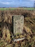 |
Saxon post mile pillars (totality) |
Prischwitz (map) |
marked 1725 (quarter milestone) | Post mileage column; Quarter milestone, important in terms of traffic history |
09304935
|
 |
Path stone and boundary stone | Prischwitz (map) |
19th century (road stone); 19th century (boundary stone) | of importance in terms of traffic history |
09252365
|
 |
Two arch bridge over the Schwarzwasser | Prischwitz (map) |
19th century (road bridge) | historically important |
09251309
|
| Mill building with residential house and barn built around the corner | Prischwitz (map) |
1915 to Brand (Mühle) | Little technology available, mill building with simple facade structure, mansard roof with long roof pike, of importance in terms of building history, technical history and local history |
09252363
|
|
 |
Arch bridge over the Lange Wasser | Seitschen (map) |
marked 1880 (road bridge) | historically important |
09250701
|
| Waystone | Seitschen (map) |
around 1850 (Wegestein) | of importance in terms of traffic history |
09250278
|
|
 |
Road bridge over the Görlitz – Dresden railway line | Seitschen (map) |
around 1845 (road bridge); 1954 true to original reconstruction (road bridge) | Segmented arch vaults, ashlar masonry with bricked cheeks on the sides, an impressive monument to the early railway history, of significance in terms of building history and technology |
09254341
|
| Waystone | Seitschen (map) |
1st half of the 19th century (Wegestein) | of importance in terms of traffic history |
09303442
|
|
| Waystone | Seitschen (map) |
around 1850 (Wegestein) | of importance in terms of traffic history |
09250275
|
|
 |
Road bridge over the Görlitz – Dresden railway line |
Siebitz (map) |
1845/1846 (road bridge) | original condition, important testimony to the early railway history in Saxony and Germany, of importance in terms of building history and technology |
09251435
|
| Waystone |
Sollschwitz (card) |
19th century (road stone) | of importance in terms of traffic history |
09252242
|
|
| Waystone | Sollschwitz (card) |
19th century (road stone) | Of importance in terms of traffic history |
09252301
|
|
 |
Bridge over the Hoyerswerdaer Schwarzwasser | Sollschwitz (card) |
19th century (road bridge) | four-arched granite bridge, of architectural significance |
09250269
|
| Bridge over the Hoyerswerdaer Schwarzwasser |
Spittwitz (map) |
marked 1714 (road bridge) | single arched natural stone vault bridge, of architectural significance |
09251409
|
|
| Hand ric mill | Spittwitz (map) |
possibly from the 17th century (mill); marked 1841 (house); marked 1865 (barn) | Mill property with residential house with attached outbuilding, angular barns in the south and two outbuildings as well as enclosure with gate pillars and gate; of importance in terms of building history and local history |
09251407
|
|
| Kohlermühle; Skal mill | Spittwitz (map) |
around 1820 (mill) | Mill with residential mill house, mill technology and outbuildings; old location Skala, of importance in terms of building history and technology history |
09251410
|
|
| Hermannmühle | Spittwitz (map) |
inscribed 1844 (mill) | Mill building with attached chimney and weir; Plastered quarry stone building with simple plaster structure, of importance in terms of building history and local history |
09251408
|
|
| Steam mill E. Rätze; Rätze mill | Spittwitz (map) |
designated 1772 (Mühle); around 1800 (side building); around 1920 (chimney) | Mill building with annex, chimney and side building of a mill property; of importance in terms of building history and technology history |
09251406
|
|
| Waystone |
Storcha (map) |
marked 1856 (Wegestein) | of importance in terms of traffic history |
09252231
|
|
| Waystone | Storcha (map) |
19th century (road stone) | of importance in terms of traffic history |
09252256
|
|
| Prayer cross | Storcha (map) |
1858 (prayer cross) | Granite pedestal with crucifixion, of regional historical importance |
09252258
|
|
| Waystone |
Zscharnitz (map) |
19th century (road stone) | of importance in terms of traffic history |
09303833
|
|
| Waystone | Zscharnitz (map) |
19th century (road stone) | of importance in terms of traffic history |
09252225 |
Grand Dubrau
| image | designation | location | Dating | description | ID |
|---|---|---|---|---|---|
| Waystone |
Crosta (map) |
19th century (road stone) | of importance in terms of traffic history |
09252981
|
|
| Waystone |
Dahlowitz (map) |
19th century (road stone) | of importance in terms of traffic history |
09253004
|
|
| Waystone |
Großdubrau (map) |
19th century (road stone) | of importance in terms of traffic history |
09252997
|
|
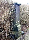 |
Totality of the Royal Saxon Triangulation ("European degree measurement in the Kingdom of Saxony"); Station 48 Großdubrau | Großdubrau (map) |
1865 (triangulation column) | Triangulation column; Second order station, of significance in terms of technology history |
09305033
|
| Margarethenhütte | Großdubrau (map) |
after 1900 (sanitary facilities); 1850 (Huthaus); from 1873, production building (factory building) | Huthaus (social building) and production building for the production of high-voltage porcelain (today a museum) with equipment as part of the so-called Margarethenhütte; Significant in terms of mining history, technology history and local history |
09253013
|
|
 |
Water tower | Großdubrau (map) |
marked 1926 on the weather vane (water tower) | Water tower; Natural stone visible base storey, divided into three and a half storeys by cornices, of importance in terms of building history and technology |
09253007
|
| Two way stones |
Jetscheba (map) |
19th century (road stone) | of importance in terms of traffic history |
09252973
|
|
| Stone arch bridge |
Kauppa (map) |
around 1800 (road bridge) | historically important |
09252980
|
|
| Waystone | Kauppa (map) |
19th century (road stone) | of importance in terms of traffic history |
09252976
|
|
| Rittergut and Gutspark Kauppa (material entity) | Kauppa (map) |
in the core around 1730 (manor house); marked 1840 (on the stable-barn building); marked 1874 (stable building); marked 1892 (Wohn-Wirtschaftsgeb.); around 1910 (other buildings) | Individual features of the totality of the Kauppa manor: Ruin of the manor house over the remains of the former castle (vault) and piles of the former. Wasserburg (No. 5), administrator's house (No. 7), mill building (No. 2, 4, 8) with mill ditch and two overshot water wheels, residential and farm building (No. 10) with gate passage and coat of arms (marked 1892, i. Plan coat of arms 1), stable-barn building (no.10) with coat of arms plate above the gate entrance (marked 1840, probably those of Standfest, i.Plan coat of arms 3), coat of arms plate of those of Gersdorf and von Schönberg (marked 1697, i.Plan Coat of arms 2), stable building (southwest of no.7) with coat of arms (marked 1874 and initials JAF = Johann August Fischer, i.Plan Wappen 4), and a right-angled calf barn and house (no.3) with fish coat of arms (see also Objective document obj. 09252977); Significant in terms of building history, local history and the appearance of the town |
09252978
|
|
| Residential mill house as well as ditch, weir and pond of a mill complex (technical equipment no longer available) |
Klix (map) |
18th century (residential house) | Residential mill house massive, single-storey, compact structure with a crooked hip roof, of importance in terms of architectural, local and technical history |
09252080
|
|
| Waystone |
Kronförstchen (map) |
19th century (road stone) | of importance in terms of traffic history |
09252969
|
|
| Waystone |
Särchen (card) |
19th century (road stone) | of importance in terms of traffic history |
09252081
|
|
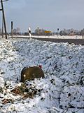 |
Royal Saxon milestones (totality) |
Sdier (map) |
19th century (milestone) | Milestone; of importance in terms of traffic history |
09252994
|
| Sdier waterworks | Sdier (map) |
1960–1964 (waterworks) | Four buildings of the Sdier waterworks; authentically preserved evidence of post-war modernism, of significance in terms of building history and technology history |
09250257
|
|
| Waystone |
Spreewiese (map) |
19th century (road stone) | of importance in terms of traffic history |
09252975
|
|
| Waystone | Spreewiese (map) |
19th century (road stone) | of importance in terms of traffic history |
09252974 |
Großharthau
| image | designation | location | Dating | description | ID |
|---|---|---|---|---|---|
| Residential mill house with attached technical building of a former water mill |
Bühlau (map) |
marked 1904 (residential mill building) | Of importance in terms of building history, local history and technology history |
09276103
|
|
| Hexenburg | Bühlau (map) |
marked 1855 (brickyard) | Brickworks with driveway and chimney; Four-wing system around a square inner courtyard, of importance in terms of building history, local history and technology history |
09276090
|
|
| Görlitz – Dresden railway line |
Großharthau (map) |
1875/1880 (railway bridge) | Railway bridge over the Wesenitz; In terms of building history, technology history and landscape design of importance |
09288568
|
|
| Reception building and goods handling at Großharthau station | Großharthau (map) |
1875/1880 (reception building) | Entrance building from the Gründerzeit plastered construction with a flat gable roof, of architectural and local importance |
09288563
|
|
| Waystone | Großharthau (map) |
19th century (road stone) | of importance in terms of traffic history |
09288636
|
|
| Waystone | Großharthau (map) |
traffic history significance |
09305104
|
||
| Industrial mill | Großharthau (map) |
around 1873 (side building) | Mill (no. 8) and side building (no. 8a) as well as mill ditch with weir; of importance in terms of building history and local history |
09288571
|
|
| Post Bridge |
Seeligstadt (map) |
19th century (road bridge) | Quarry stone bridge; of importance in terms of building history and local history |
09289736
|
|
| Wegstein | Seeligstadt (map) |
19th century (road stone) | of importance in terms of traffic history |
09289495 |
Großpostwitz / OL
| image | designation | location | Dating | description | ID |
|---|---|---|---|---|---|
| Waystone |
Binnewitz (map) |
marked 1829 (Wegestein) | of importance in terms of traffic history |
09252754
|
|
| Waystone |
Cosul (map) |
19th century (road stone) | of importance in terms of traffic history |
09303889
|
|
| Memorial stone for Martin Luther |
Denkwitz (map) |
marked 1888 (memorial stone) | Obelisk-like granite stone on a profiled base, with an inscription: Nov. 10, 1488 In memory of the 400 year old. Birthday Dr. Martin Luther the Elder Nov 10, 1888, historically significant |
09252752
|
|
| Waystone |
Ebendörfel (map) |
19th century (road stone) | of importance in terms of traffic history |
09303892
|
|
| Waystone |
Eulowitz (map) |
19th century (road stone) | of importance in terms of traffic history |
09252820
|
|
| Großpostwitz – Löbau railway line; Bautzen – Neukirch railway line; Großpostwitz station |
Großpostwitz / OL (map) |
September 1, 1877 (commissioning of the station) | Reception building, ice house, goods ramp made of natural stone, switch posts as well as two signals north and two signals south of the station; Reception building of late historical plastered structure with rich plaster structure, ice house plastered structure with pilaster structure, of architectural and railway historical importance |
09252781
|
|
| Beak mill; Art mill (totality) | Großpostwitz / OL (map) |
marked 1823 (supply building) | Artistic mill with the following individual monuments: Residential mill building including technical equipment, part of the building of the former sack sewing and turbine room, storage building, barn, weir and mill ditch (see list of individual monuments - obj. 09303600, same address) and the rest of the enclosure as a whole; largely authentically preserved, significance in terms of building history, local history, social history and technology history |
09252787
|
|
| Mill building with weir | Großpostwitz / OL (map) |
2nd half of the 19th century (mill) | Preserved to a high degree in its original appearance, of importance in terms of building history and technology |
09253372
|
|
| Two factory buildings | Großpostwitz / OL (map) |
2nd half of the 19th century (factory building) | Plastered buildings with segmented arched windows, of architectural and local significance |
09253371
|
|
| Waystone | Großpostwitz / OL (map) |
19th century (road stone) | of importance in terms of traffic history |
09252783
|
|
| Old Spree Bridge | Großpostwitz / OL (map) |
around 1900 (road bridge) | Road bridge over the Spree; of importance in terms of building history and technology history |
09275283
|
|
| Waystone |
Rasha (card) |
19th century (road stone) | of importance in terms of traffic history |
09252774 |
Großröhrsdorf, city
| image | designation | location | Dating | description | ID |
|---|---|---|---|---|---|
| Ribbon weaving FA Schurig |
Großröhrsdorf (map) |
after 1914 (factory building) | Factory building of a former ribbon weaving mill; only the part on the main street, owned by Schurig, a very early example of the skeleton construction, of importance in terms of building history, local history and the street scene |
09289676
|
|
| Ribbon and belt weaving EG Liebig | Großröhrsdorf (map) |
1866, later redesigned (administration building); 1893 (factory buildings); 1903 (factory buildings) | Administration building with enclosure and factory building behind; Administration building stately plastered building with a flat central projection, attic with two figures, flat hipped roof, of architectural and socio-historical importance |
09289737
|
|
| Belt and ribbon weaving mill JG Schöne (formerly) | Großröhrsdorf (map) |
around 1920 (factory building); around 1936 (factory building); 1837 (administration building); after 1873 (social building); around 1940 (technical equipment) | Two production buildings, administration building and social building of the former ribbon and belt weaving mill; Production building including original weaving rooms, one with complete technical equipment with historical looms, administration building with a collection of original order books, diaries, wage books, sample books, photographs of the company, typing and calculating machines and various samples from the company's product range, social building with a dining room that was built during the period including a complete historical space and historical factory kitchen, location and production history to a high degree |
09289587
|
|
| Factory building of a former ribbon weaving mill and steam engine | Großröhrsdorf (map) |
around 1900 (factory building); 2nd half of the 19th century (steam engine) | Factory building with an elaborate facade, high lattice windows and decorative ribbons made of clinker bricks, today the city library and the technical museum of ribbon weaving, of importance in terms of building history, local history and the appearance of the street |
09289657
|
|
| Waystone |
Kleinröhrsdorf (map) |
19th century (road stone) | of importance in terms of traffic history |
09289699
|
|
| Residential mill house | Kleinröhrsdorf (map) |
marked 1793 (mill) | Upper floor visible framework, stand very irregular, sandstone door walls, crooked hip roof, above the front door a plaque with a miller's coat of arms: two lions move a wheel, important in terms of building history, the history of the town and the street scene |
09289688 |
Haselbachtal
| image | designation | location | Dating | description | ID |
|---|---|---|---|---|---|
| Road bridge over the Haselbach |
Bischheim (map) |
19th century (road bridge) | Significant in terms of building history and the appearance of the town |
09227352
|
|
| Three road bridges over the Haselbach | Bischheim (map) |
2nd half of the 19th century (road bridge) | Significant in terms of building history and the appearance of the town |
09227336
|
|
| Waystone | Bischheim (map) |
19th century (road stone) | of importance in terms of traffic history |
09227339
|
|
 |
Windmill Bischheim | Bischheim (map) |
1865 (mill) | Tower Dutchman; Quarry stone masonry, conical roof, structural history, characterizing the local image, local history and technological history of importance |
09227357
|
| Railway viaduct |
Gersdorf (map) |
1869–1871 (viaduct) | of importance in terms of railway history, building history and technology history |
09223916
|
|
| Residential house with forge and outbuildings | Gersdorf (map) |
Weather vane marked 1933 (Schmiede) | The structure of the building remained largely unchanged, of importance in terms of building history and local history |
09223918
|
|
 |
Hustemühle Gersdorf | Gersdorf (map) |
after 1846 (mill) | Tower Dutchman; Quarry stone construction, of importance in terms of building history, technology history and the townscape |
09223919
|
| Open-air museum of the granite industry |
Ugly (card) |
The aggregate of the former granite quarry with the following structures and facilities as aggregate parts: so-called social building with kitchen and dining room, forge and office, compressor room, locomotive shed, track systems with turntables, cable crane system, gang saw, explosion protection tower and explosives storage container, loading ramp and road network; of importance in terms of local history and production history, as well as a value that defines the local image |
09227009
|
||
| Shrub mill |
Möhrsdorf (map) |
Early 19th century (miller's house); around 1915 (saw gate) | Miller's house and cutting mill with mill technology of a mill property; Müllerwohnhaus upper floor timber frame boarded up, of importance in terms of building history, local history and technology history |
09226991
|
|
| Windmill Möhrsdorf | Möhrsdorf (map) |
2nd half of the 19th century (mill) | Tower Dutchman; Significant in terms of building history, shaping the townscape and technological history |
09220722
|
|
| Gruhl's mill |
Reichenau (map) |
1805 and later (mill); A. 19th century (water trough) | Mill building with attached inn and two side buildings as well as granite trough in the courtyard; Significant in terms of building history, local history and the appearance of the streets |
09227300
|
|
| Mill Bridge | Reichenau (map) |
marked 1864 (road bridge) | Round arch bridge over the Pulsnitz; made of granite rubble stones, the front sides of the arches are made of granite ashlars, marked downstream in the keystone, the parapet is bricked up and covered with granite slabs, important for the history of the building and the townscape |
09227299
|
|
| Waystone |
Reichenbach (map) |
19th century (road stone) | of importance in terms of traffic history |
09304257 |
Hochkirch
| image | designation | location | Dating | description | ID |
|---|---|---|---|---|---|
| Waystone |
Hochkirch (map) |
19th century (road stone) | of importance in terms of traffic history |
09251708
|
|
| Waystone | Hochkirch (map) |
19th century (road stone) | of importance in terms of traffic history |
09251707
|
|
| Obermühle; Klarmühle; Klarsche Mühle |
Kohlwesa (map) |
around 1850 (moving house); 1850 (barn) | Southern pull-out house with attached side building and two northern barns of a mill property at an angle to each other; Pull-out house upper floor half-timbered, natural stone walls, saddle roof with bat dome, massive side buildings, barns plastered quarry stone buildings, of architectural, local and technological historical importance |
09251665
|
|
| Niedermühle | Kohlwesa (map) |
around 1850 (mill); 1st half century (barn) | Northern residential mill house with mill technology and southwestern barn of a mill property; Residential mill house three-storey quarry stone building with a gable roof, barn plastered quarry stone building with a crooked hip roof, of importance in terms of building history, local history and technology history |
09304344
|
|
| Waystone |
Kuppritz (map) |
19th century (road stone) | of importance in terms of traffic history |
09251719
|
|
| Waystone | Kuppritz (map) |
19th century (road stone) | of importance in terms of traffic history |
09251673
|
|
| Kuppritz oil mill | Kuppritz (map) |
marked 1802 (residential building) | Residential mill house, barn and side building of a mill property; Oil mill, plastered quarry stone buildings, residential mill house with jamb and crooked hip roof, of importance in terms of building history, local history and technology history |
09251646
|
|
| Waystone |
Meschwitz (map) |
19th century (road stone) | of importance in terms of traffic history |
09251624
|
|
| Waystone | Meschwitz (map) |
19th century (road stone) | of importance in terms of traffic history |
09251623
|
|
| Waystone | Meschwitz (map) |
19th century (road stone) | of importance in terms of traffic history |
09251621
|
|
| Residential house, side building and mill moat of a mill property | Meschwitz (map) |
designated 1831 (Mühle); 18th century (Mühlgraben) | Residential house plastered construction with half-hip roof, side building upper floor half-timbered, gable roof, of architectural and local significance |
09251596
|
|
| Arch bridge | Meschwitz | 19th century (road bridge) | historically important |
09251620
|
|
| Village fountain | Meschwitz (map) |
17th century (fountain) | of importance in terms of local history and social history |
09251615
|
|
| Waystone |
Neukuppritz (map) |
around 1800 (Wegestein) | of importance in terms of traffic history |
09251709
|
|
| Liebig mill |
Plot (card) |
marked 1787 (mill) | Eastern mill house, north side building and western barn of a mill property as well as archway, mill pond and remains of the masonry mill ditch (at the house); Residential mill house, upper floor half-timbered, of architectural and local significance |
09251674
|
|
 More pictures |
Seven-arched railway bridge |
Pommritz (map) |
after 1850 (railway bridge) | Of importance in terms of building history, railway history and technology history |
09251675
|
 More pictures |
Görlitz – Dresden railway line; Powder house | Pommritz (map) |
Mid 19th century (powder house) | Pulverhaus on the Dresden – Görlitz railway line; built to store the powder for possible war-related demolition of the viaduct, small quarry stone building with vault, rare testimony to German railway military history in the area of tension between the newly founded German Empire under Prussian rule and the K. u. K. Austro-Hungarian Monarchy |
09251416
|
| Old Forge | Pommritz (map) |
1726 (residential building) | Smithy (surrounding area) with upper arbor; Upper floor half-timbered, rear train, of importance in terms of building history and house history |
09251683
|
|
| Pommritz station | Pommritz (map) |
around 1870 (passenger station) | Railway station with reception building, former post office building, in between flat connecting structure and goods shed with ramp; Typical plastered buildings with flat gable roofs, of architectural and railway history of importance |
09251677
|
|
 |
Pommritzer windmill | Pommritz (map) |
1858 (mill) | Tower Dutchman; defining the appearance of the town and significant in terms of local history |
09251689
|
| Road bridge over a body of water (passage) |
Rodewitz (map) |
from 1250, medieval origin (road bridge) | Single arch, quarry stone, part of a ravine probably laid out in the Middle Ages, lined with oaks on both sides, scientific, historical and landscape significance |
09279088
|
|
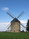 |
Rodewitz windmill | Rodewitz (map) |
1856 (mill) | Tower Dutchman; defining the appearance of the town and significant in terms of local history |
09251577
|
| Krujatz mill | Rodewitz (map) |
marked 1876 (mill) | Residential mill house of a mill estate; Typical plastered building with jamb and gable roof, of importance in terms of building history and local history |
09251687
|
|
| Waystone |
Angry (card) |
19th century (road stone) | of importance in terms of traffic history |
09304353
|
|
| Waystone |
Steindörfel (map) |
around 1800 (Wegestein) | Of importance in terms of traffic history |
09251704
|
|
 |
Royal Saxon milestones (totality) | Steindörfel (map) |
19th century (milestone) | Milestone; Of importance in terms of traffic history |
09251705
|
| Low mill |
Wuischke (map) |
around 1790 (mill) | Residential mill house, millstone and two moats of a mill property; Upper floor half-timbered, of architectural and local significance |
09251717
|
|
| Well house with pump |
Zschorna (map) |
around 1900 (fountain house) | socially important |
09251721 |
Hoyerswerda, city
| image | designation | location | Dating | description | ID |
|---|---|---|---|---|---|
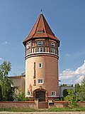 |
Water tower on the eagle |
Bröthen / Michalken (map) |
1914–1915 (water tower) | Water tower with parts of the original technical equipment; high-quality designed tower structure that characterizes the landscape, of technical and local significance |
08975768
|
| Mill technology of a water mill | Bröthen / Michalken (map) |
19./20. Century (mill technology); 1874 (mill) | old location Bröthen, the complete historical technical equipment of the mill received, including the grinder, of technical historical importance |
08975757
|
|
| Transformer tower station | Bröthen / Michalken (map) |
around 1915 (transformer station) | of importance in terms of local history and technology |
08975766
|
|
| Hoyerswerda station | Bröthen / Michalken (map) |
1873–1875 (passenger station); marked 1909 (platform roofing); 1873 (signal box W1) | Station with reception building, people tunnel with staircase and handrail, two platform roofs and platform building, signal boxes W1, W2, B5 and W6 with technical equipment, barrier system including bell at the Schäferweg level crossing and switchman building; Entrance building simply structured plastered building with floating gables, platform house with service room in the manner of a half-timbered house, ensemble of significance in terms of railway history, technical history and architectural history |
08975499
|
|
| Waystone |
Dörgenhausen (map) |
19th century (road stone) | Granite signposts, important in terms of traffic history |
08975733
|
|
| Waystone | Dörgenhausen (map) |
19th century (road stone) | Granite signposts, important in terms of traffic history |
08975743
|
|
| Post mill Dörgenhausen | Dörgenhausen (map) |
1707 (mill) | Post mill with technical equipment; typical wooden windmill, important in terms of technology and local history |
08975735
|
|
| Waystone | Dörgenhausen (map) |
19th century (road stone) | Granite signposts, important in terms of traffic history |
08975744
|
|
| South footpath with pavement |
Hoyerswerda (map) |
around 1900 (street) | Basalt-greywacke flooring with decorative patterns, significance in terms of traffic history and craftsmanship |
08975498
|
|
| Hoyerswerda station | Hoyerswerda (map) |
1873–1875 (passenger station); marked 1909 (platform roofing); 1873 (signal box W1) | Station with reception building, people tunnel with staircase and handrail, two platform roofs and platform building, signal boxes W1, W2, B5 and W6 with technical equipment, barrier system including bell at the Schäferweg level crossing and switchman building; Entrance building simply structured plastered building with floating gables, platform house with service room in the manner of a half-timbered house, ensemble of significance in terms of railway history, technical history and architectural history |
08975499
|
|
| Commercial facility building | Hoyerswerda (map) |
around 1890 (factory building) | old location Klein Neida / Dresdener Vorstadt, yellow brick building with red and green glazed structure, in a typical local design, historically important |
08975461
|
|
| Sewage pumping station | Hoyerswerda (map) |
1960 (pump house) | Evidence of the infrastructural development, of significance in terms of technology history |
08975375
|
|
| Railway depot and rail vehicle depot Hoyerswerda | Hoyerswerda (map) |
1874 (Hall B, rationalization equipment workshop); between 1912 and 1920 (Hall D); between 1912 and 1920 (Hall C); between 1912 and 1920 (administration building); around 1985 (rheostat testing system); around 1985 (passenger car wash); around 1985 (high voltage test system) | Railroad depot with railroad car factory: Railway maintenance office, administration building, Hall B with external sliding platform as well as parallel workshop and connecting buildings, Hall C, Hall D, loading crane, two water cranes, two purification systems with inclined elevator, a coaling system with coal bunkers and the associated locomotive treatment track and a siding, also a rheostat System, a high-voltage test system and a passenger train washing system; Extensively preserved ensemble for the maintenance and repair of locomotives and passenger coaches, due to the legibility of the functional relationships of great importance in terms of railway history, technical history and architectural history. |
08975373
|
|
 More pictures |
Light rail car VT 4.12.01 (until 1970) or 173 001 (from 1970) | Hoyerswerda, Heinrich-Heine-Straße 43 (near) (map) |
1964 (railcar) | Combustion railcar (VT) of the Deutsche Reichsbahn; Conversion model of the former VT 2.09 railcar series, the first of two prototypes that did not go into series production and that were presented by VEB Waggonbau Bautzen at the Leipzig spring fair in 1964, of great importance in terms of technology and traffic history |
08975371
|
| Sewage pumping station | Hoyerswerda (map) |
1960 (pump house) | Evidence of the infrastructural development, of significance in terms of technology history |
08975379
|
|
| Saxon post mile pillars (totality) | Hoyerswerda (map) |
1730 (post distance column) | Post mileage column; Copy of a distance column, important in terms of traffic history |
08975611
|
|
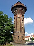 |
Water tower | Hoyerswerda (map) |
1907 (water tower) | Water tower; Railway water tower with ball tank of the Klönne type, of great importance in terms of railway history and technology history, as a water tower with Klönne ball of rarity, with a solid shaft also unique in Saxony |
08975500
|
| Hoyerswerda station | Hoyerswerda (map) |
1873–1875 (passenger station); marked 1909 (platform roofing); 1873 (signal box W1) | Station with reception building, people tunnel with staircase and handrail, two platform roofs and platform building, signal boxes W1, W2, B5 and W6 with technical equipment, barrier system including bell at the Schäferweg level crossing and switchman building; Entrance building simply structured plastered building with floating gables, platform house with service room in the manner of a half-timbered house, ensemble of significance in terms of railway history, technical history and architectural history |
08975499
|
|
| Knappenrode station |
Knappenrode (map) |
1913 (service building); around 1870 (railway keeper's house) | Railway station with service building (No. 1), goods floor and station keeper's house (No. 2) with toilets; Service building plastered building in the reform style of the time around 1910, railway keeper's house historicizing clinker brick building, freight shed half-timbered building, of importance to the history of the railway, ancillary building (local style with surrounding framework and ornamental framework) converted to Lohsa, OT Riegel, Am Wald 19 |
08975369
|
|
| Werminghoff briquette factory; Coal connecting railway Werminghoff / Knappenrode – Zeißholz; Today Knappenrode Energy Factory -Lausitz Mining Museum | Knappenrode (map) |
1914–1921 (factory); 1950s (factory); around 1950 (bucket wheel excavator) | Briquette factory, today a mining museum, with all the buildings that are still standing (the former internal numbers in brackets): coal loading (50), cooling tower (19), electrical storage (87), chop (80), cold store IV (61), lamellar cold store (78), Factory I, II, III and wet duty (77), power station (83), 30 kV station (84), main electrical workshop, storage and switchboard (81), administration (82), training workshop (135), shed (85) , North chimney with fox (79), administration (88), embankment wall (86), old scales (25), stacking wall (73), coal connection line Knappenrode – Zeißholz 900 mm with gauge ramp (137), remaining section of the briquette factory section to the Knappenrode – Koblenz district road, in addition the implemented structures: Headframe from Nochten for underground mining, shafts 1 and 4 and shaft 3 from Welzow (headframe shaft 3 was moved to the district of Bautzen, city of Wittichenau, OT Maukendorf, on the B96, northwest of the village, Gem. Maukendorf , Corridor 1, parcel 109/1 implemented), further implemented Buildings and movable technical monuments (cf. Collection / equipment); Important industrial plant, the reinforced concrete buildings with brick facades, of importance in terms of building history, local history and technology history. |
08975370
|
|
| Transformer station | Knappenrode (map) |
around 1920 (transformer station) | cautiously historicizing clinker tower construction, of significance in terms of technology history |
09299861
|
|
| Waystone |
Schwarzkollm (map) |
19th century (road stone) | three-sided stone stele, important in terms of traffic history |
08975424
|
|
| Waystone | Schwarzkollm (map) |
19th century (road stone) | four-sided stone stele, significant in terms of traffic history |
08975420
|
|
| Schwarzkollm train station | Schwarzkollm (map) |
around 1900 (platform hall) | Bus shelter at the train station; south of the tracks, small waiting hall in the style of a half-timbered house, Heimatstil, of architectural and railway history of importance |
08975427
|
|
| Mill | Schwarzkollm (map) |
1920s (mill) | Brick building, typical industrial mill from the period after 1900, of importance in terms of building history and technology |
08975446
|
|
| bus depot |
Zeißig (card) |
1961–1962 (bus station) | Distinctive hall construction consisting of four adjoining halls made of reinforced concrete, unique value, as this hall construction was only carried out in Rostock, Schwarze Pump and Lauchhammer, of significance in terms of building history, traffic history and technology history |
08975740 |
Kamenz, city
| image | designation | location | Dating | description | ID |
|---|---|---|---|---|---|
 |
Waystone |
Deutschbaselitz (map) |
19th century (road stone) | of importance in terms of traffic history |
09227071
|
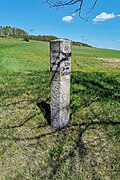 |
Waystone |
Hennersdorf (map) |
19th century (road stone) | of importance in terms of traffic history |
09304087
|
 More pictures |
Kamenz – Pirna railway line |
Kamenz (map) |
2nd half of the 19th century (retaining wall) | Embankment walls on both sides of the railway tracks including the bridge (at Zwingerstraße) and the bridge at the tunnel entrance (in front of Bönischplatz); Bridges with elaborate decorative friezes, embankment walls in granite, importance in terms of traffic history |
09303316
|
 |
Totality of the Royal Saxon Triangulation ("European degree measurement in the Kingdom of Saxony"); Station 66 Lessingturm | Kamenz (map) |
1870 (triangulation column) | Triangulation column; Second order station, significant in terms of surveying history and technology history |
09305038
|
 |
Vineyard container | Kamenz (map) |
1894 (water supply and sewage system) | Water tank and valve chamber including almost completely preserved fittings; Clinker exterior facade with access door and two ventilation openings, essential testimony to the Kamenz drinking water supply until 1928, of local and technological importance |
09300934
|
| Bridge with granite posts | Kamenz | of significance in terms of technology history |
09227834
|
||
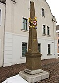 More pictures |
Saxon post mile pillars (totality) | Kamenz (map) |
marked 1725 (post distance column) | Post mileage column; Distance column, important in terms of traffic history |
09227747
|
 |
Spittelmühle | Kamenz (map) |
Mill building, Contor and outbuildings; of local importance |
09227681
|
|
 More pictures |
Hydraulic ram of a water pumping station | Kamenz (map) |
around 1915 (hydraulic ram) | opposite the Rote Mühle, water management system of technical and historical interest |
09227005
|
 |
Single-arched granite bridge over the Lange Wasser | Kamenz (map) |
forms with the castle mill (large mill) an ensemble of historical, production-historical and local significance |
09227829
|
|
 |
Water trough (granite) | Kamenz (map) |
around 1900 (water trough) | socially important |
09227180
|
 |
Former Pumping station |
Lückersdorf (map) |
1979/1980 (pump house) | Building of the former pumping station with original equipment from the time of construction and water reservoir; Technical history of the drinking water supply in the Kamenz district area, there of singular importance |
09300939
|
 |
Waystone | Lückersdorf (map) |
19th century (road stone) | of importance in terms of traffic history |
09223215
|
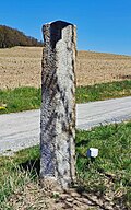 |
Waystone | Lückersdorf (map) |
19th century (road stone) | of importance in terms of traffic history |
09223214
|
 |
Schiedeler mill |
Schiedel (map) |
around 1820 (mill) | Mill building with side extension and barn; Mühle plastered building with a classical front door, of architectural and local significance |
09284043
|
 More pictures |
Railway bridge (industrial line) over Bischofswerdaer Straße and barrage of the Black Elster with rifle weir |
Wiesa (map) |
1890 (railway bridge) | the part of the bridge that crosses the street was demolished, which is of importance in terms of traffic and technology |
09223020
|
 More pictures |
Castle mill | Wiesa (map) |
marked 1823 (grain mill) | Grain mill with bakery, cutting mill and miller's house of a mill complex as well as mill technology, water wheel and the remains of a mill ditch; Grinding mill with cutting mill located in parallel, mill ditch still recognizable, bakery with old German oven, characteristic and largely completely preserved mill complex, of local and technical significance |
09227782
|
 More pictures |
locomotive | Wiesa Bischofswerdaer Straße 42 (opposite) |
1954 (different information: 1958) |
Small diesel locomotive LKM 251215 of the type LKM N4 , delivered to VEB Kombinat "Otto Grotewohl" Böhlen in 1958, stationed in the Espenhain section from 1969 , handed over to VEB Papierfabrik Hainsberg in 1975 , in 1991 erected as a memorial at the model railway shop in Sora , moved from Sora to Wiesa in 2015 , of significance in terms of technology history |
09268630
|
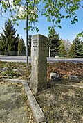 |
Waystone |
Zschornau (map) |
19th century (road stone) | of importance in terms of traffic history |
09304086 |
Königsbrück, city
| image | designation | location | Dating | description | ID |
|---|---|---|---|---|---|
| Waystone |
Graefenhain (map) |
19th century (road column) | of importance in terms of traffic history |
09300633
|
|
| bridge | Graefenhain (map) |
1st half of the 19th century (road bridge) | Single arched vault bridge made of quarry stone over the Pulsnitz, important for the landscape and townscape |
09223066
|
|
 More pictures |
Railway steel bridge |
Koenigsbrück (map) |
Late 19th century (railway bridge) | Significance in terms of traffic history and landscape design, construction of rarity |
09229998
|
| Old weir | Koenigsbrück (map) |
early 1920s (weir) | Hold-up weir with medium protection system with weir bodies and firing floor; Weir body and front wall of the firing floor clad with large natural stone blocks, historical, here above all local and technical historical importance as well as landscape-defining value, since the location of the weir system including its predecessor buildings with a similar purpose has been proven to have existed since the 17th century and the current structure as the last relic regulating the Documented water supply for the green butcher mill through its own mill ditch |
09229965
|
|
| Bader Bridge | Koenigsbrück (map) |
marked 1558 (road bridge) | Round arch bridge over the Pulsnitz; Of importance in terms of building history, local history and technology history |
09227187
|
|
| Round arch bridge made of quarry stone masonry | Koenigsbrück (map) |
19th century (road bridge) | landscape design and technological history of importance |
09227638
|
|
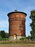 |
Water tower | Koenigsbrück (map) |
1894 (water tower) | Water tower; Of importance in terms of technology history and landscape |
09227166
|
| Stone frame saw (1906), two paving machines (1920) and a stone grinding machine in the Horst Füssel granite works | Koenigsbrück (map) |
1906, stone frame saw (machine); 1920, two paving machines (machine) | high rarity value, of technical significance |
09228024
|
|
| Saxon post mile pillars (totality) | Koenigsbrück (map) |
marked 1722 (quarter milestone) | Post mileage column; Copy of a quarter milestone, of importance in terms of traffic history |
09301587
|
|
 More pictures |
City mill Alfred Kretzschmar | Koenigsbrück (map) |
1937 (mill building); 1931 (silo) | Mill ditch with turbine chamber and free flood, hold-up weir, protective system and regulatory protection as well as mill building (No. 21) with north-western facade of the former extension, stable building (No. 12) and silo (No. 14) with extension as part of a mill property; Significant in terms of local history, building history and technology history |
09229994
|
| Waystone | Koenigsbrück (map) |
1st half of the 19th century (road stone) | of importance in terms of traffic history |
09301590 |
Königswartha
| image | designation | location | Dating | description | ID |
|---|---|---|---|---|---|
 More pictures |
Watermill, without rear attachment |
Wartha (map) |
around 1820 (mill) | Upper floor half-timbered structure, largely intact wooden construction, of architectural and local significance |
08990741 |
Kubschütz
| image | designation | location | Dating | description | ID |
|---|---|---|---|---|---|
| Waystone |
Baschütz (map) |
19th century (road stone) | of importance in terms of traffic history |
09251348
|
|
| Waystone |
Blösa (map) |
marked 1845 (Wegestein) | of importance in terms of traffic history |
09251906
|
|
| Middle mill | Blösa (map) |
marked 1748 (bone mill) | Mill stone of the former Bone Stamp with 5 grinding holes; refers to AR D Z4D MK 1748, of significance in terms of technology history |
09301162
|
|
| Niedermühle (formerly); Gasthof Blösa (formerly) | Blösa (map) |
marked 1840 (mill) | Mill building, two millstones, stone deck bridge, two portals of the former inn as well as a side building facing the valley and quarry stone wall opposite the mill building; Architectural and local historical significance as well as important for the townscape, high side building standing downhill with half-timbered upper floor |
09251904
|
|
| Waystone |
Canitz-Christina (map) |
19th century (road stone) | of importance in terms of traffic history |
09251915
|
|
| Waystone | Canitz-Christina (map) |
marked 1836 (Wegestein) | of importance in terms of traffic history |
09252180
|
|
| Waystone |
Jenkwitz (map) |
19th century (road stone) | of importance in terms of traffic history |
09301171
|
|
| Waystone |
Kreckwitz (map) |
19th century (road stone) | of importance in terms of traffic history |
09304091
|
|
| Waystone |
Kumschütz (card) |
19th century (road stone) | of importance in terms of traffic history |
09251893
|
|
| Waystone | Kumschütz (card) |
19th century (road stone) | of importance in terms of traffic history |
09251894
|
|
| Waystone |
Neupurschwitz (map) |
1st half of the 19th century (road stone) | of importance in terms of traffic history |
09302446
|
|
| Waystone | Neupurschwitz | 19th century (road stone) | of importance in terms of traffic history |
09251914
|
|
| Path pillar | Rachlau | 1st half of the 19th century (road stone) | of importance in terms of traffic history |
09251936
|
|
| Residential mill house (surrounding area) with mill pond, barn, enclosure and courtyard paving | Rachlau (map) |
denotes 1825 (Mühle); marked 1828 (Mühlteich) | Residential mill house, upper floor timber frame boarded up, basket arch portal, of importance in terms of building history, technology history and local history |
09251960
|
|
| Waystone |
Scheckwitz (map) |
19th century (road stone) | of importance in terms of traffic history |
09301182
|
|
| Waystone |
Soritz (map) |
19th century (road stone) | of importance in terms of traffic history |
09251902
|
|
| Residential mill house and barn of the former mill | Soritz (map) |
i. Lintel marked 1802.GK (mill) | Residential mill house on the upper floor half-timbered plastered, two basket arch portals with keystones, massive quarry stone barn with jamb and crooked hip roof, of architectural, local and technological history |
09253684
|
|
| Waystone |
Waditz (map) |
1st half of the 19th century (road stone) | of importance in terms of traffic history |
09302447
|
|
| Road bridge with boundaries over a railway line | Waditz (map) |
around 1890 (road bridge) | of importance in terms of technology history and landscape design |
09251892
|
|
| Waystone |
Weißig (card) |
19th century (road stone) | of importance in terms of traffic history |
09301188 |
Remarks
- ↑ The list may not correspond to the current status of the official list of monuments. This can be viewed by the responsible authorities. Therefore, the presence or absence of a structure or ensemble on this list does not guarantee that it is or is not a registered monument at the present time. The State Office for the Preservation of Monuments in Saxony provides binding information .
swell
Commons : Cultural monuments in the district of Bautzen - collection of images, videos and audio files
- List of monuments of the state of Saxony
- Answer to the big question of the AfD parliamentary group of 23 August 2016; Appendix to the Big Question Drs. 6/5471
- ↑ a b LKM 251215. In: Rangierdiesel.de . Retrieved June 1, 2017 .