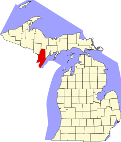
Menominee County, Michigan
![The Menominee County Courthouse in Menominee, listed on NRHP No. 75000958 [1]](https://upload.wikimedia.org/wikipedia/commons/thumb/0/04/2009-0619-Menominee-CtyCt.jpg/298px-2009-0619-Menominee-CtyCt.jpg) The Menominee County Courthouse in Menominee, listed on NRHP No. 75000958 |
|
| administration | |
|---|---|
| US state : | Michigan |
| Administrative headquarters : | Menominee |
| Address of the administrative headquarters: |
County Administrator, 839 10th Avenue Menominee, MI 49858 |
| Foundation : | |
| Demographics | |
| Residents : | 24,029 (2010) |
| Population density : | 8.9 inhabitants / km 2 |
| geography | |
| Total area : | 3465 km² |
| Water surface : | 761 km² |
| map | |
| Website : www.menomineecounty.com | |
The Menominee County is a county in the US -amerikanischen State Michigan . In 2010 , the county had 24,029 residents and a population density of 8.9 people per square kilometer. By 2013, the population had decreased to 23,791. The county seat is Menominee .
geography
The county is located on the south coast of Michigan's Upper Peninsula , at the confluence of the Menominee River with Lake Michigan’s Green Bay . The river forms the border with Wisconsin in its entire course .
Menominee County covers an area of 3,465 square kilometers, of which 761 square kilometers are water.
The following neighboring counties border Menominee County:
| Dickinson County | Marquette County | Delta County |

|
||
|
Marinette County ( Wisconsin ) |
Door County, Wisconsin |
history
In 1634 the French explorer Jean Nicolet landed in La Baye (now Green Bay ). He explored the area and came across settlements of the Menominee tribe at the mouth of the Menominee River, where the town of Menominee can be found today. The area around the estuary was swampy, which encouraged the growth of wild rice . The name of the indigenous people living there, Menominee , means something like "wild rice eaters".
In 1790, the Canadian Louis Chappieau opened a fur trading company in what is now Menominee County. In 1832 the first sawmill was built and the timber industry flourished. By 1890 the area had developed into the No. 2 leading logging region in the country. After 1917 agriculture began to replace the timber industry. Michigan's first agricultural school was founded in Menominee County.
In 1896, parts of Menominee County were assigned to the newly formed Dickinson County.
economy
Today Menominee County is a leader in the dairy industry and cheese-making. The industrial companies located here specialize in wood and metal processing, cardboard and furniture production. In addition, the long coastline, as well as fishing and winter sports opportunities, attract numerous tourists.
| Population development | |||
|---|---|---|---|
| Census | Residents | ± in% | |
| 1870 | 1791 | - | |
| 1880 | 11,987 | 569.3% | |
| 1890 | 33,639 | 180.6% | |
| 1900 | 27,046 | -19.6% | |
| 1910 | 25,648 | -5.2% | |
| 1920 | 23,778 | -7.3% | |
| 1930 | 23,652 | -0.5% | |
| 1940 | 24,883 | 5.2% | |
| 1950 | 25,299 | 1.7% | |
| 1960 | 24,685 | -2.4% | |
| 1970 | 24,587 | -0.4% | |
| 1980 | 26,201 | 6.6% | |
| 1990 | 24,920 | -4.9% | |
| 2000 | 25,326 | 1.6% | |
| 2010 | 24,029 | -5.1% | |
| 2013 estimate | 23,791 | -1 % | |
| Before 1900 1900–1990 2000 2010–2012 | |||
population
As of the 2010 census , Menominee County had 24,029 people in 10,869 households. The population density was 8.9 inhabitants per square kilometer. Statistically, 2.18 people lived in each of the 10,869 households.
The racial the population was composed of 95.2 percent white, 0.4 percent African American, 2.8 percent Native American, 0.4 percent Asian and other ethnic groups; 1.3 percent were descended from two or more races. Hispanic or Latino of any race was 1.4 percent of the population.
19.9 percent of the population were under 18 years old, 59.7 percent were between 18 and 64 and 20.4 percent were 65 years or older. 49.7 percent of the population were female.
The median income for a household was 40,865 USD . The per capita income was $ 21,816. 14.7 percent of the population lived below the poverty line.
Menominee County localities
structure
In addition to the two cities and three villages, Menominee County is divided into 14 townships :
|
|
See also
Individual evidence
- ^ Extract from the National Register of Historic Places . Retrieved May 16, 2019
- ↑ GNIS-ID: 1622997. Retrieved on February 22, 2011 (English).
- ↑ a b c U.S. Census Bureau, State & County QuickFacts - Menominee County, MI ( Memento of the original from July 14, 2011 on WebCite ) Info: The archive link was automatically inserted and has not yet been checked. Please check the original and archive link according to the instructions and then remove this notice. Retrieved May 27, 2014
- ↑ a b National Association of Counties.Retrieved May 27, 2014
- ^ US Census Bureau - Census of Population and Housing.Retrieved March 15, 2011
- ^ Extract from Census.gov.Retrieved February 18, 2011
- ↑ Missouri Census Data Center - Michigan ( page no longer available , search in web archives ) Info: The link was automatically marked as defective. Please check the link according to the instructions and then remove this notice. Retrieved May 27, 2014
Web links
Coordinates: 45 ° 31 ' N , 87 ° 32' W
