Villers-sous-Foucarmont
| Villers-sous-Foucarmont | ||
|---|---|---|
|
|
||
| region | Normandy | |
| Department | Seine-Maritime | |
| Arrondissement | Dieppe | |
| Canton | Eu | |
| Community association | Aumale Blangy-sur-Bresle | |
| Coordinates | 49 ° 50 ′ N , 1 ° 34 ′ E | |
| height | 112-223 m | |
| surface | 7.01 km 2 | |
| Residents | 193 (January 1, 2017) | |
| Population density | 28 inhabitants / km 2 | |
| Post Code | 76340 | |
| INSEE code | 76744 | |
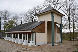
 Town hall (Mairie) of Villers-sous-Foucarmont |
||
Villers-sous-Foucarmont is a French municipality with 193 inhabitants (as of January 1 2017) in the department of Seine-Maritime in the region Normandy . It belongs to the Arrondissement of Dieppe and the canton of Eu . The unemployment rate in Villers-sous-Fourcamont is 11% (as of January 1, 2016).
geography
Villers-sous-Foucarmont is located about 50 kilometers east-southeast of Dieppe . Villers-sous-Foucarmont is surrounded by the neighboring communities of Foucarmont in the north, Saint-Léger-aux-Bois in the east and northeast, Rétonval in the east and southeast, Aubermesnil-aux-Érables in the south, Saint-Germain-sur-Eaulne and Vatierville in the South and southwest and Callengeville to the west.
Population development
| year | 1962 | 1968 | 1975 | 1982 | 1990 | 1999 | 2006 | 2007 | 2008 | 2009 | 2010 | 2011 | 2012 | 2013 | 2014 | 2015 | 2016 | 2017 |
| Residents | 179 | 164 | 170 | 160 | 172 | 205 | 203 | 201 | 200 | 198 | 193 | 196 | 197 | 197 | 197 | 197 | 195 | 193 |
Attractions
- church
Web links
Commons : Villers-sous-Foucarmont - Collection of images, videos and audio files

