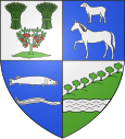
Cany-Barville
| Cany-Barville | ||
|---|---|---|

|
|
|
| region | Normandy | |
| Department | Seine-Maritime | |
| Arrondissement | Dieppe | |
| Canton | Saint-Valery-en-Caux | |
| Community association | Côte d'Albâtre | |
| Coordinates | 49 ° 47 ' N , 0 ° 38' E | |
| height | 10-126 m | |
| surface | 13.57 km 2 | |
| Residents | 3,052 (January 1, 2017) | |
| Population density | 225 inhabitants / km 2 | |
| Post Code | 76450 | |
| INSEE code | 76159 | |
Cany-Barville is a French municipality with 3052 inhabitants (at January 1, 2017) in the department of Seine-Maritime in the region Normandy . It belongs to the Arrondissement of Dieppe and the canton of Saint-Valery-en-Caux .
The community was created in 1827 by amalgamating the communities of Cany and Barville.
geography
The municipality is located around 50 kilometers northwest of Rouen in the natural landscape of the Pays de Caux and is crossed by the Durdent river.
history
The medieval fief of Cany-Caniel was part of the royal property from the conquest of Normandy by King Philip II . From 1370 it belonged to the House of Valois-Alençon and thus to the Dukes of Alençon , later to the Condé and finally to the Becdelièvre family.
Population development
| year | 1962 | 1968 | 1975 | 1982 | 1990 | 1999 | 2006 | 2017 |
| Residents | 1629 | 1704 | 2209 | 3202 | 3349 | 3364 | 3150 | 3052 |
| Sources: Cassini and INSEE | ||||||||
Attractions
- Cany Castle , built between 1640 and 1656
- Saint Martin Church
Town twinning
- Wörth am Rhein- Maximiliansau , Germany
Web links
Commons : Cany-Barville - Collection of images, videos and audio files


