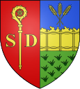
Saint-Denis-d'Aclon
| Saint-Denis-d'Aclon | ||
|---|---|---|

|
|
|
| region | Normandy | |
| Department | Seine-Maritime | |
| Arrondissement | Dieppe | |
| Canton | Dieppe-1 | |
| Community association | Terroir de Caux | |
| Coordinates | 49 ° 52 ' N , 0 ° 57' E | |
| height | 8-74 m | |
| surface | 2.42 km 2 | |
| Residents | 132 (January 1, 2017) | |
| Population density | 55 inhabitants / km 2 | |
| Post Code | 76860 | |
| INSEE code | 76572 | |
Saint-Denis-d'Aclon is a French municipality with 132 inhabitants (at January 1, 2017) in the department of Seine-Maritime in the region Normandy (before 2016 Haute-Normandie ). Administratively it belongs to the Arrondissement Dieppe and is part of the canton Dieppe-1 ( Offranville until 2015 ). The inhabitants are called Dionysia .
geography
Saint-Denis-d'Aclon is about twelve kilometers west-southwest of Dieppe near the alabaster coast of the English Channel . The Saâne flows on the eastern edge of the municipality . Saint-Denis-d'Aclon is surrounded by the neighboring communities of Longueil in the north and northeast, Ouville-la-Rivière in the east, Ambrumesnil in the southeast and Avremesnil in the south and west.
Population development
| 1962 | 1968 | 1975 | 1982 | 1990 | 1999 | 2006 | 2013 |
|---|---|---|---|---|---|---|---|
| 184 | 209 | 271 | 274 | 235 | 196 | 179 | 140 |
| Source: Cassini and INSEE | |||||||
Attractions
- Saint-Denis church
- Monceau Castle
Web links
Commons : Saint-Denis-d'Aclon - Collection of images, videos and audio files
