Adams County, Iowa
 Adams County Courthouse |
|
| administration | |
|---|---|
| US state : | Iowa |
| Administrative headquarters : | Corning |
| Address of the administrative headquarters: |
County Courthouse P.O. Box 28, Corning, IA 50841-0028 |
| Foundation : | January 15, 1851 |
| Made up from: | Pottawattamie County |
| Area code : | 001 641 |
| Demographics | |
| Residents : | 4029 (2010) |
| Population density : | 3.7 inhabitants / km 2 |
| geography | |
| Total area : | 1102 km² |
| Water surface : | 5 km² |
| map | |
| Website : www.adamscountyia.com | |
The Adams County is a county in the US -amerikanischen State Iowa . In 2010 the county had 4,029 residents and a population density of 3.7 people per square kilometer. By 2013 the population decreased to 3894. The administrative seat ( county seat ) is Corning .
geography
The county is located in southwest Iowa and has an area of 1,102 square kilometers, of which five square kilometers are water.
The following neighboring counties border Adams County:
| Cass County | Adair County | |
| Montgomery County |

|
Union County |
| Page County | Taylor County | Ringgold County |
history
| Population development | |||
|---|---|---|---|
| Census | Residents | ± in% | |
| 1860 | 1533 | - | |
| 1870 | 4614 | 201% | |
| 1880 | 11,888 | 157.7% | |
| 1890 | 12,292 | 3.4% | |
| 1900 | 13,601 | 10.6% | |
| 1910 | 10,998 | -19.1% | |
| 1920 | 10,521 | -4.3% | |
| 1930 | 10,437 | -0.8% | |
| 1940 | 10.156 | -2.7% | |
| 1950 | 8753 | -13.8% | |
| 1960 | 7468 | -14.7% | |
| 1970 | 6322 | -15.3% | |
| 1980 | 5731 | -9.3% | |
| 1990 | 4866 | -15.1% | |
| 2000 | 4482 | -7.9% | |
| 2010 | 4029 | -10.1% | |
| 2013 estimate | 3894 | -3.4% | |
| Before 1900 1900–1990 2000 2010–2013 | |||
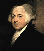
Adams County was formed on January 15, 1851 from parts of Pottawattamie County. It was named either after John Adams (1735-1826), the second President of the United States (1797-1801).
The original size of the county was later reduced by the formation of Montgomery Counties and Union Counties . The first county seat was in Quincy. In 1872 the seat was moved to Corning.
population
As of the 2010 census , Adams County had 4,029 people in 1,914 households. The population density was 3.7 inhabitants per square kilometer. Statistically, 2.12 people lived in the 1,914 households.
The racial the population was composed of 98.1 percent white, 0.2 percent African American, 0.5 percent Native American, 0.6 percent Asian and other ethnic groups; 0.5 percent were descended from two or more races. Hispanic or Latino of any race was 0.9 percent of the population.
21.9 percent of the population were under 18 years old, 56.4 percent were between 18 and 64 and 21.7 percent were 65 years or older. 50.3 percent of the population was female.
The median income for a household was 38,191 USD . The per capita income was $ 26,835. 12.4 percent of the population lived below the poverty line.
Adams County localities
1 - partially in Taylor County
structure
Adams County is divided into 12 townships :
|
|
See also
Individual evidence
- ^ Adams County ( English ) In: Geographic Names Information System . United States Geological Survey . Retrieved January 30, 2011.
- ↑ a b c U.S. Census Bureau, State & County QuickFacts - Adams County, IA. Retrieved September 19, 2014
- ↑ a b National Association of Counties.Retrieved September 19, 2014
- ^ US Census Bureau - Census of Population and Housing.Retrieved March 15, 2011
- ^ Extract from Census.gov.Retrieved February 16, 2011
- ↑ 2010 US Census Iowa Township and Other Subdivision Population. Retrieved July 23, 2019 .
Web links
Coordinates: 41 ° 2 ′ N , 94 ° 42 ′ W

