Black Hawk County
 Black Hawk County Courthouse |
|
| administration | |
|---|---|
| US state : | Iowa |
| Administrative headquarters : | Waterloo |
| Address of the administrative headquarters: |
County Courthouse 316 East Fifth Street Waterloo, IA 50703-4712 |
| Foundation : | February 17, 1843 |
| Made up from: | Buchanan County |
| Area code : | 001 319 |
| Demographics | |
| Residents : | 131,090 (2010) |
| Population density : | 89.2 inhabitants / km 2 |
| geography | |
| Total area : | 1481 km² |
| Water surface : | 12 km² |
| map | |
| Website : www.co.black-hawk.ia.us | |
The Black Hawk County is a county in the US -amerikanischen State Iowa . In 2010 , the county had 131,090 people and a population density of 89.2 people per square kilometer. By 2013 the population increased to 132,546. The county seat is Waterloo .
geography
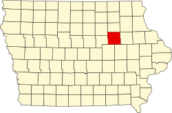
Black Hawk County is located in northeastern Iowa and is traversed by the Cedar River , which is part of the Mississippi River basin over the Iowa River . The county has an area of 1,481 square kilometers, of which twelve square kilometers are water. The following neighboring counties border Black Hawk County:
| Butler County | Bremer County | Fayette County |
| Grundy County |

|
Buchanan County |
| Tama County | Benton County |
history
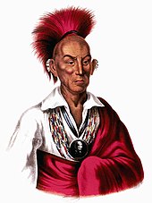
Black Hawk County was formed on February 17, 1843 from parts of Buchanan County. It was named after Makataimeshekiakiak (as Black Hawk - Black Hawk known), a chief of the united Sauk and Fox -Indianer formed by the Black Hawk War was known.
Initially the county was administered from Delaware County, in 1845 this took over the administration of Benton County, in 1851 Buchanan County. It was not until 1853 that the state of Iowa passed a law that allowed the formation of its own administration. In the same year, elections were held for the first time for a legislative assembly of Black Hawk County. In the same year an administrative seat was chosen. Because of its central location in the county, Waterloo was elected and officially appointed in 1855.
In 1861 it was connected to the railroad network, and in 1870 Waterloo was the location of a repair shop for the Illinois Central Railroad . As a result, the city and its surroundings became an industrial center at the end of the 19th century.
| Population development | |||
|---|---|---|---|
| Census | Residents | ± in% | |
| 1850 | 135 | - | |
| 1860 | 8244 | 6,006.7% | |
| 1870 | 21,706 | 163.3% | |
| 1880 | 23,913 | 10.2% | |
| 1890 | 24,219 | 1.3% | |
| 1900 | 32,399 | 33.8% | |
| 1910 | 44,865 | 38.5% | |
| 1920 | 56,570 | 26.1% | |
| 1930 | 69,146 | 22.2% | |
| 1940 | 79,946 | 15.6% | |
| 1950 | 100,448 | 25.6% | |
| 1960 | 122,482 | 21.9% | |
| 1970 | 132.916 | 8.5% | |
| 1980 | 137.961 | 3.8% | |
| 1990 | 123,798 | -10.3% | |
| 2000 | 128.012 | 3.4% | |
| 2010 | 131,090 | 2.4% | |
| 2013 estimate | 132,546 | 1.1% | |
| Before 1900 1900–1990 2000 2010–2013 | |||
In 1876, a teacher training college was established in the city of Cedar Falls , laying the foundation for what is now the college town of northeast Iowa. Today the University of Northern Iowa and a number of other educational institutions are located here.
population
As of the 2010 census , Black Hawk County had 131,090 people in 51,366 households. The population density was 89.2 inhabitants per square kilometer. In the 51,366 households there were statistically 2.36 people each.
The racial the population was composed of 85.6 percent white, 8.9 percent African American, 0.2 percent Native American, 1.3 percent Asian and other ethnic groups; 2.3 percent were descended from two or more races. Regardless of ethnicity, 3.7 percent of the population was Hispanic or Latino of any race.
21.7 percent of the population were under 18 years old, 64.5 percent were between 18 and 64 and 13.8 percent were 65 years or older. 51.4 percent of the population was female.
The median income for a household was 42,753 USD . The per capita income was $ 22,380. 17.3 percent of the population lived below the poverty line.
Black Hawk County localities
Other Unincorporated Communities
1 - partly in Bremer County
2 - mostly in Buchanan County
3 - partly in Grundy County
structure
Black Hawk County is divided into 17 townships :
|
|
The cities of Cedar Falls , Evansdale and Waterloo are not part of any township.
See also
Individual evidence
- ↑ Black Hawk County ( English ) In: Geographic Names Information System . United States Geological Survey . Retrieved January 14, 2011.
- ↑ a b c U.S. Census Bureau, State & County QuickFacts - Black Hawk County, IA. Retrieved October 19, 2014
- ^ A b National Association of Counties.Retrieved October 21, 2011
- ^ US Census Bureau - Census of Population and Housing.Retrieved March 15, 2011
- ^ Extract from Census.gov.Retrieved February 16, 2011
- ^ Brief History of Black Hawk County ( October 13, 2007 memento on the Internet Archive ). Retrieved February 20, 2011
- ↑ 2010 US Census Iowa Township and Other Subdivision Population. Retrieved July 23, 2019 .
Web links
Coordinates: 42 ° 28 ′ N , 92 ° 18 ′ W


