Jefferson County, Iowa
![The Jefferson County Courthouse in Fairfield, listed on NRHP No. 81000250 [1]](https://upload.wikimedia.org/wikipedia/commons/thumb/c/c7/Jefferson_County%2C_Iowa_Courthouse.jpg/298px-Jefferson_County%2C_Iowa_Courthouse.jpg) The Jefferson County Courthouse in Fairfield, listed on NRHP No. 81000250 |
|
| administration | |
|---|---|
| US state : | Iowa |
| Administrative headquarters : | Fairfield |
| Address of the administrative headquarters: |
County Courthouse P.O. Box 984 Fairfield, IA 52556-0017 |
| Foundation : | January 21, 1839 |
| Made up from: | Henry County |
| Area code : | 001 641 |
| Demographics | |
| Residents : | 16,843 (2010) |
| Population density : | 14.9 inhabitants / km 2 |
| geography | |
| Total area : | 1131 km² |
| Water surface : | 4 km² |
| map | |
| Website : www.jeffersoncountyiowa.com | |
The Jefferson County is a county in the US state of Iowa . At the 2010 census , the county had 16,843 residents and a population density of 14.9 people per square kilometer. The county seat is Fairfield .
geography
The county is located in southeast Iowa, about 25 miles south of Missouri , and about 40 miles east of Illinois , the border being formed by the Mississippi . It has an area of 1,131 square kilometers, of which four square kilometers are water. The following counties border Jefferson County:
| Keokuk County | Washington County | |
| Wapello County |

|
Henry County |
| Davis County | Van Buren County |
history
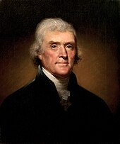
Jefferson County was formed on January 21, 1839 on former Indian land. It was named after Thomas Jefferson (1743–1826), the third President of the USA (1801–1809).
21 structures and sites in the county are on the National Register of Historic Places .
Demographic data
| growth of population | |||
|---|---|---|---|
| Census | Residents | ± in% | |
| 1840 | 2773 | - | |
| 1850 | 9904 | 257.2% | |
| 1860 | 15,038 | 51.8% | |
| 1870 | 17,839 | 18.6% | |
| 1880 | 17,469 | -2.1% | |
| 1890 | 15.184 | -13.1% | |
| 1900 | 17,437 | 14.8% | |
| 1910 | 15,951 | -8.5% | |
| 1920 | 16,440 | 3.1% | |
| 1930 | 16,241 | -1.2% | |
| 1940 | 15,762 | -2.9% | |
| 1950 | 15,696 | -0.4% | |
| 1960 | 15,818 | 0.8% | |
| 1970 | 15,774 | -0.3% | |
| 1980 | 16,316 | 3.4% | |
| 1990 | 16,310 | -0% | |
| 2000 | 16,181 | -0.8% | |
| 2010 | 16,843 | 4.1% | |
| Before 1900 1900–1990 2000–2010 | |||
According to the 2010 census , Jefferson County had 16,843 people in 6,846 households. The population density was 14.9 inhabitants per square kilometer.
The racial the population was composed of 87.6 percent white, 1.3 percent African American, 0.2 percent Native American, 8.5 percent Asian and other ethnic groups; 1.6 percent were descended from two or more races. Hispanic or Latino of any race was 2.4 percent of the population.
Statistically, 2.17 people lived in each of the 6,846 households.
18.2 percent of the population were under 18 years old, 67.0 percent were between 18 and 64 and 14.8 percent were 65 years or older. 46.6 percent of the population was female.
The median income for a household was 41,523 USD . The per capita income was $ 22,668. 15.4 percent of the population lived below the poverty line
Places in Jefferson County
1 - partially in Henry and Washington Counties
structure
Jefferson County is divided into 12 townships :
The city of Fairfield does not belong to any township.
Individual evidence
- ^ Extract from the National Register of Historic Places.Retrieved March 13, 2011
- ↑ Jefferson County in the United States Geological Survey's Geographic Names Information System.Retrieved February 26, 2011
- ↑ a b c U.S. Census Bureau, State & County QuickFacts - Jefferson County, IA ( July 12, 2011 memento on WebCite ) Retrieved April 10, 2012
- ^ National Association of Counties.Retrieved January 3, 2012
- ↑ Search mask database in the National Register Information System. National Park Service , accessed August 26, 2017.
- ^ US Census Bureau - Census of Population and Housing.Retrieved March 15, 2011
- ^ Extract from Census.gov.Retrieved February 16, 2011
- ↑ 2010 US Census Iowa Township and Other Subdivision Population. Retrieved July 23, 2019 .
Web links
Coordinates: 41 ° 2 ′ N , 91 ° 57 ′ W

