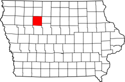
Pocahontas County, Iowa
![The Pocahontas County Courthouse in Pocahontas, listed in the NRHP since 1981 [1]](https://upload.wikimedia.org/wikipedia/commons/thumb/f/fd/Pocahontas_County_Courthouse.JPG/298px-Pocahontas_County_Courthouse.JPG) The Pocahontas County Courthouse in Pocahontas , listed on the NRHP since 1981 |
|
| administration | |
|---|---|
| US state : | Iowa |
| Administrative headquarters : | Pocahontas |
| Address of the administrative headquarters: |
County Courthouse 99 Court Square Pocahontas, IA 50574-1629 |
| Foundation : | 1851 |
| Area code : | 001 712 |
| Demographics | |
| Residents : | 7008 (2015) |
| Population density : | 4.7 inhabitants / km 2 |
| geography | |
| Total area : | 1500 km² |
| Water surface : | 4 km² |
| map | |
| Website : www.pocahontas-county.com | |
The Pocahontas County is a county in the US -amerikanischen State Iowa . In 2010 , the county had 7,310 people and a population density of 4.9 people per square kilometer. By 2015 the population decreased to 7008. The county seat is Pocahontas .
geography
The county is located in central northwest Iowa and covers an area of 1,500 square kilometers, of which four square kilometers are water. The northwest of the county is traversed by the western headwaters of the Des Moines River .
The following neighboring counties border Pocahontas County:
| Clay County | Palo Alto County | Kossuth County |
| Buena Vista County |

|
Humboldt County |
| Sac County | Calhoun County | Webster County |
history
| Population development | |||
|---|---|---|---|
| Census | Residents | ± in% | |
| 1860 | 103 | - | |
| 1870 | 1446 | 1,303.9% | |
| 1880 | 3713 | 156.8% | |
| 1890 | 9553 | 157.3% | |
| 1900 | 15,339 | 60.6% | |
| 1910 | 14,808 | -3.5% | |
| 1920 | 15,602 | 5.4% | |
| 1930 | 15,687 | 0.5% | |
| 1940 | 16,266 | 3.7% | |
| 1950 | 15,496 | -4.7% | |
| 1960 | 14,234 | -8.1% | |
| 1970 | 12,729 | -10.6% | |
| 1980 | 11,369 | -10.7% | |
| 1990 | 9525 | -16.2% | |
| 2000 | 8662 | -9.1% | |
| 2010 | 7310 | -15.6% | |
| 2015 estimate | 7008 | -4.1% | |
| Before 1900 1900–1990 2000–2015 | |||
Pocahontas County was formed in 1851. It was named after the legendary Indian princess Pocahontas (around 1595-1617), daughter of Chief Powhatan and wife of the Englishman John Rolfe .
population
According to the 2010 census , Pocahontas County had 7,310 people in 3,317 households. The population density was 4.9 inhabitants per square kilometer. Statistically, 2.18 people lived in each of the 3317 households.
The racial the population was composed of 97.5 percent white, 0.4 percent African American, 0.2 percent Native American, 0.2 percent Asian and other ethnic groups; 1.1 percent were descended from two or more races. Hispanic or Latino of any race was 2.3 percent of the population.
21.5 percent of the population were under 18 years old, 56.4 percent were between 18 and 64 and 22.1 percent were 65 years or older. 50.3 percent of the population was female.
The median income for a household was in 2015 at 45,069 USD . The per capita income was $ 26,406. 13.1 percent of the population lived below the poverty line.
Localities
Incorporated cities :
| place | Residents 2010 |
Residents 2015 |
|---|---|---|
| Pocahontas | 1789 | 1740 |
| Laurens | 1258 | 1180 |
| Fonda | 631 | 607 |
| Rolfe | 584 | 559 |
| Gilmore City 1 | 504 | 491 |
| Palmer | 165 | 160 |
| Havelock | 138 | 133 |
| Plover | 77 | 74 |
| Varina | 71 | 69 |
Unincorporated communities not recorded separately from the census :
1 - predominantly in Humboldt County
structure
Pocahontas County is divided into 17 townships :
|
|
The city of Rolfe does not belong to any township.
See also
- Pocahontas County Courthouse
- List of entries on the National Register of Historic Places in Pocahontas County, Iowa
Individual evidence
- ↑ Extract from the National Register of Historic Places - No. 81000264 Retrieved January 18, 2017
- ↑ GNIS-ID: 465264. Retrieved on February 22, 2011 (English).
- ↑ a b c U.S. Census Bureau, State & County QuickFacts - Pocahontas County, IA. Retrieved January 18, 2017
- ^ National Association of Counties. Retrieved January 18, 2017
- ^ US Census Bureau - Census of Population and Housing.Retrieved March 15, 2011
- ^ Extract from Census.gov.Retrieved February 16, 2011
- ↑ a b American Fact Finder. Retrieved January 18, 2017
- ↑ Missouri Census Data Center. Retrieved January 18, 2017
Web links
Coordinates: 42 ° 44 ′ N , 94 ° 41 ′ W

