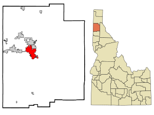
Coeur d'Alene, Idaho
| Coeur d'Alene | |
|---|---|
 Coeur d'Alene |
|
| Coeur d'Alene in Kootenai County | |
| Basic data | |
| Foundation : | 1878/1887 (city rights) |
| State : | United States |
| State : | Idaho |
| County : | Kootenai County |
| Coordinates : | 47 ° 42 ′ N , 116 ° 47 ′ W |
| Time zone : | Pacific ( UTC − 8 / −7 ) |
|
Inhabitants : - Metropolitan Area : |
50,285 (as of 2016) 154,311 (as of 2016) |
| Population density : | 1,479 inhabitants per km 2 |
| Area : | 35.2 km 2 (approx. 14 mi 2 ) of which 34.0 km 2 (approx. 13 mi 2 ) are land |
| Height : | 664 m |
| Postcodes : | 83814-83816 |
| Area code : | +1 208 |
| FIPS : | 16-16750 |
| GNIS ID : | 0379485 |
| Website : | www.cdaid.org |
| Mayor : | Steve Widmyer (2018-2022) |
Coeur d'Alene [ ˈkɒr.dəˈleɪn ], also known locally by its abbreviation CDA, is the largest city in the north of the US state Idaho and the administrative seat of Kootenai County . It is located on the lake of the same name, Lake Coeur d'Alene and at the western end of the Coeur d'Alene National Forest . According to the census, there were 44,137 inhabitants in the city in 2010. Coeur d'Alene is a popular holiday destination, mainly thanks to the lake.
The place is particularly known for the golf course The Coeur d'Alene Resort Golf Course , which is considered one of the most beautiful golf courses in the USA. A special feature is the fourteenth hole, which is located on Lake Coeur d'Alene.
North Idaho College as well as branch offices of the University of Idaho and Lewis-Clark State College are located in Coeur d'Alene . One of the largest US silver producers, Coeur Mining , has its origins here.
Highway I-90 , the longest highway in the United States, crosses the city.
geography
location
According to the United States Census Bureau , the city has a total area of 35.2 km². 34.0 km² of this is land and 1.2 km² (3.46%) is water. The city lies at an altitude of 664 m .
climate
In the city, an average rainfall of 660 mm is measured as rain and an average snowfall of 127 cm. The frost-free time is around 120 days and usually lasts from mid-May to mid-September. The average temperature is 17.5 ° C in summer and −0.3 ° C in winter.
history
The town and the lake were both supposedly named by French traders after the Coeur d'Alene Indian tribe . The area was toured and described from 1807 by David Thompson of the North West Company . It was the bone of contention between the United States and Great Britain . The Oregon Treaty ended the dispute in 1846 when Great Britain renounced all territorial claims south of the 49th parallel. General William T. Sherman ordered a fortress to be built in the area in the 1870s and named it Fort Coeur d'Alene ; this name was then adopted from the settlement that developed around the fort. Later, the name Fort Sherman was chosen for the fort in honor of the great general. The North Idaho College is now housed therein. In 1890 the city was the scene of trade union battles.
Population development
| year | Residents¹ |
|---|---|
| 1980 | 19,913 |
| 1990 | 24,563 |
| 2000 | 34,514 |
| 2010 | 44,137 |
¹ 1980–2010: Census Results
Twin town
Coeur d'Alene's twin town is Cranbrook in British Columbia in Canada .
Personalities
- Jack Lemley (* 1935), civil engineer and manager
- Douglas Crimp (1944–2019), art sociologist, art critic and AIDS activist
- Tom Von Ruden (1944–2018), middle-distance runner
- Kevin MacPhee (born 1980), poker player
- Luke Ridnour (born 1981), basketball player
- Brock Osweiler (born 1990), American football player
- Sage Kotsenburg (* 1993), snowboarder
swell
- ↑ Archived copy ( memento of the original dated October 11, 2007 in the Internet Archive ) Info: The archive link was inserted automatically and has not yet been checked. Please check the original and archive link according to the instructions and then remove this notice.
- ↑ Rodney Frey: Coeur d'Alene (Schitsu'umsh) . Retrieved July 17, 2013.
- ↑ An Illustrated History of North Idaho , Western Historical Publishing Company, Spokane, Washington (1903).
- ↑ Roughneck — The Life and Times of Big Bill Haywood, Peter Carlson, 1983, pp. 53-54.
Web links
- www.coeurdalene.org Chamber of Commerce
- www.cdaresort.com/golf Golf course The Coeur d'Alene Resort Golf Course

