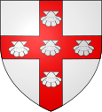
Gondecourt
| Gondecourt | ||
|---|---|---|

|
|
|
| region | Hauts-de-France | |
| Department | North | |
| Arrondissement | Lille | |
| Canton | Faches-Thumesnil | |
| Community association | Pévèle-Carembault | |
| Coordinates | 50 ° 33 ' N , 2 ° 59' E | |
| height | 19–31 m | |
| surface | 8.22 km 2 | |
| Residents | 4,055 (January 1, 2017) | |
| Population density | 493 inhabitants / km 2 | |
| Post Code | 59147 | |
| INSEE code | 59266 | |
| Website | http://gondecourt.fr/ | |
Gondecourt is a French municipality with 4055 inhabitants (as of January 1 2017) in the department of Nord in the region of Hauts-de-France . The municipality is located in the arrondissement of Lille and is part of the canton of Faches-Thumesnil (until 2015: canton of Seclin-Sud ). The inhabitants are called Gondecourtois (es) .
geography
Gondecourt is in the Carembault countryside . The canalised Deûle flows along the extreme north-western boundary of the municipality . Gondecourt is surrounded by the neighboring communities of Santes in the north, Houplin-Ancoisne in the northeast, Seclin in the east, Chemy in the south, Carnin in the southwest, Allennes-les-Marais and Herrin in the west and Wavrin in the northwest.
Population development
| 1962 | 1968 | 1975 | 1982 | 1990 | 1999 | 2006 | 2011 |
|---|---|---|---|---|---|---|---|
| 2,521 | 2,600 | 2,800 | 3,410 | 3,777 | 3,902 | 3,943 | 3,943 |
Attractions
- Saint-Martin church, originally built in the 12th century,
- Collège Georges Rémi
literature
- Le Patrimoine des Communes du Nord. Flohic Editions, Volume 2, Paris 2001, ISBN 2-84234-119-8 , pp. 1471-1472.
Web links
Commons : Gondecourt - collection of images, videos and audio files

