Leers (north)
| Empty | ||
|---|---|---|

|
|
|
| region | Hauts-de-France | |
| Department | North | |
| Arrondissement | Lille | |
| Canton | Roubaix-2 | |
| Community association | Métropole Européenne de Lille | |
| Coordinates | 50 ° 41 ′ N , 3 ° 15 ′ E | |
| height | 16-37 m | |
| surface | 5.4 km 2 | |
| Residents | 9,473 (January 1, 2017) | |
| Population density | 1,754 inhabitants / km 2 | |
| Post Code | 59115 | |
| INSEE code | 59339 | |
| Website | http://www.ville-leers.fr/ | |
 Road towards the Saint-Vaast church with the bell tower |
||
Leers is a northern French municipality with 9473 inhabitants (as of January 1 2017) in the department of Nord in the region of Hauts-de-France . Leers belongs to the arrondissement of Lille and is part of the canton of Roubaix-2 . The inhabitants are called Leersoisse .
location
The municipality is located directly on the border with Belgium . The district of Leers-Nord (municipality of Estaimpuis) already belongs to Belgium. Leers is surrounded by the municipalities of Wattrelos in the north, Estaimpuis (Belgium) in the east (with the districts Leers-Nord and Néchin), Toufflers in the south, Lys-lez-Lannoy in the southwest and Roubaix in the west.
history
1106 Leers is mentioned for the first time in the books of Hasnon Abbey .
| Population development | ||||||||
|---|---|---|---|---|---|---|---|---|
| year | 1962 | 1968 | 1975 | 1982 | 1990 | 1999 | 2008 | 2017 |
| Residents | 5360 | 5848 | 7788 | 8558 | 9627 | 9651 | 9189 | 9473 |
Attractions
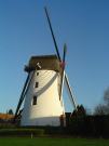
- The Leers Mill
- Church Saint-Vaast of the 16th century
- Bourloire du cercle Saint-Louis (historical square from 1891 for the Bourle , a variant of the game of boules , monument historique since 2006)
See also: List of Monuments historiques in Leers (North)
Community partnerships
- Juchen , North Rhine-Westphalia, Germany
- Estaimpuis , Wallonia, Belgium
- Coquelles , Pas-de-Calais, France
- Rebesgrün (City of Auerbach / Vogtl. ), Saxony, Germany
literature
- Le Patrimoine des Communes du Nord. Flohic Editions, Volume 2, Paris 2001, ISBN 2-84234-119-8 , pp. 954-955.

