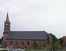
Pont-à-Marcq
| Pont-à-Marcq | ||
|---|---|---|

|
|
|
| region | Hauts-de-France | |
| Department | North | |
| Arrondissement | Lille | |
| Canton | Templeuve | |
| Community association | Pévèle-Carembault | |
| Coordinates | 50 ° 31 ' N , 3 ° 7' E | |
| height | 29-42 m | |
| surface | 2.22 km 2 | |
| Residents | 2,884 (January 1, 2017) | |
| Population density | 1,299 inhabitants / km 2 | |
| Post Code | 59710 | |
| INSEE code | 59466 | |
| Website | http://www.ville-pontamarcq.fr/ | |
Pont-à-Marcq ( Flemish : Pont de brand ) is a French municipality with 2,884 inhabitants (as of January 1 2017) in the department of Nord in the region of Hauts-de-France . It belongs to the arrondissement of Lille and the canton of Templeuve . The inhabitants call themselves Pontamarcquois (es) .
geography
Pont-à-Marcq is located about 13 kilometers south-southeast of Lille on the Marque River . Pont-à-Marcq is surrounded by the neighboring communities Ennevelin in the north and east, Mérignies in the south and Avelin in the west and north-west.
The former Route nationale 17 (today's D917) and the former Route nationale 49 run through the municipality .
Population development
| year | Residents | year | Residents | year | Residents | year | Residents |
|---|---|---|---|---|---|---|---|
| 1793 | 508 | 1846 | 826 | 1886 | 856 | 1954 | 1,050 |
| 1800 | 406 | 1851 | 869 | 1891 | 921 | 1962 | 1,492 |
| 1806 | 498 | 185 | 870 | 1901 | 883 | 1968 | 1,486 |
| 1821 | 624 | 1861 | 830 | 1911 | 900 | 1975 | 1,652 |
| 1831 | 714 | 1872 | 765 | 1921 | 813 | 1982 | 1,940 |
| 1836 | 764 | 1876 | 745 | 1926 | 869 | 2006 | 2,393 |
| 1841 | 794 | 1881 | 806 | 1931 | 875 | 2011 | 2,733 |
Attractions
- Saint-Quentin Church
- World War II British military cemetery
Personalities
- Philippe-Laurent Roland (1746–1816), sculptor
literature
- Le Patrimoine des Communes du Nord. Flohic Editions, Volume 2, Paris 2001, ISBN 2-84234-119-8 , pp. 1308-1309.
Web links
Commons : Pont-à-Marcq - collection of images, videos and audio files
- Monuments historiques (objects) in Pont-à-Marcq in the Palissy base of the French Ministry of Culture
Individual evidence
- ^ Pont-à-Marcq on cassini.ehess.fr (French).

