
Karachay Cherkessia
|
Subject of the Russian Federation
Karachay-Circassian Republic
Карачаево-Черкесская Республика ( Russian ) Къарачай-Черкес Республика ( Karachay-Balkar ) Къэрэшей-Шэрджэс Республикэ ( Kabardian )
|
||||||||||||||||||||||||||||||||||||
  |


Coordinates: 43 ° 51 ' N , 41 ° 42' E
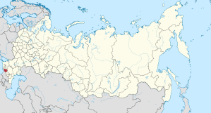
Located in the North Caucasus Karachai-Circassian Republic, short Karachay-Cherkessia ( Russian Карачаево-Черкесская Республика / Karachaevo-Tscherkesskaja Respublika ; Karachay-Balkar Къарачай-Черкес Республика ; Kabardian Къэрэшей-Шэрджэс Республикэ ; abasinisch Къарча-Черкес Республика ; Nogai Карашай-Шеркеш Республикасы ) has been a republic in the southern part of European Russia since 1991 .
geography

Karachay-Cherkessia lies on the northern slope of the Caucasus west and north of the Elbrus . At 80 percent, the largest part is in the mountains. The southern part of the republic is covered by the mountains of the Great Caucasus , which are up to 5000 m high , and the country becomes flatter in the north. The rivers Kuban , Great Selentschuk and Teberda have their source here in the central mountain range of the Great Caucasus . Countless other waterfalls and streams run down from the glaciers into the valleys.
Karachay-Cherkessia borders in the west with the Krasnodar Territory , in the north with the Stavropol Territory , in the east with the Republic of Kabardino-Balkaria , in the south, along the central mountain ridge of the Greater Caucasus, with Abkhazia and Georgia . The climate is different depending on the altitude. The climatic conditions and the soil favor agriculture in the north, which turns into alpine farming in the south. The climate in the north is moderately warm. The winter is short, the summer warm, long and rich in precipitation. The mean temperature in January is −3.2 ° C, in July 20.6 ° C. In the republic there are around 130 high mountain lakes created by glaciers and the Teberda nature reserve .
Various mineral resources can be found in the republic: copper pebbles , metal ores, gold , silver , hard coal , granite and marble in different colors, raw materials for cement production and limestone .
Population, language and religion
Karachay-Cherkessia is a multinational republic. Members of over 80 nationalities live here. The population of the republic in the 2010 census was 477,859. The two ethnically unrelated peoples that give it their name are the Karachay , a Turkic people who first settled here, and the Circassian , a north-west Caucasian people. Together they make up just over half of the residents. Then came the Abasins , Nogaiians and finally, in the second half of the 19th century, Russian Cossacks. With 33.5% of the population, these form the largest minority. Smaller minorities are the Armenians (2002: 3,197 people) and the Tatars (2002: 2,021 people).
While the Karachay and Nogai languages belong to the Turkic languages , the Circassian languages ( Adygean and Kabardian ) and Abasinian are Caucasian languages . The languages of these five ethnic groups are official as "state languages" in the republic , but only Russian is the official language . The majority of the population is of Islamic faith, a minority belongs to the Russian Orthodox Church .
| Ethnic group | VZ 1926 1 | VZ 1939 1 | VZ 1959 1 | VZ 1970 | VZ 1979 | VZ 1989 | VZ 2002 | VZ 2010 3 | ||||||||
|---|---|---|---|---|---|---|---|---|---|---|---|---|---|---|---|---|
| number | % | number | % | number | % | number | % | number | % | number | % | number | % | number | % | |
| Karachay | 53,175 | 31.3% | 70,932 | 29.2% | 67,830 | 23.8% | 97.104 | 28.2% | 109,196 | 29.7% | 129,449 | 31.2% | 169.198 | 38.5% | 194,324 | 40.7% |
| Circassian 2 | 16,186 | 9.5% | 17,667 | 7.3% | 24,145 | 8.7% | 32,067 | 9.3% | 35,406 | 9.6% | 41,271 | 9.9% | 50,815 | 11.6% | 56,466 | 11.8% |
| Russians | 40,072 | 23.6% | 118,785 | 48.8% | 146.228 | 51.4% | 162,442 | 47.1% | 165.451 | 45.1% | 175.931 | 42.4% | 147,878 | 33.6% | 150.025 | 31.4% |
| Abasins | 13,731 | 8.1% | 14,138 | 5.8% | 18,159 | 6.4% | 22,896 | 6.6% | 24,245 | 6.6% | 27,475 | 6.6% | 32,346 | 7.4% | 36,919 | 7.7% |
| Nogaier | 6.263 | 3.7% | 6,872 | 2.8% | 8,903 | 3.1% | 11,062 | 3.2% | 11,872 | 3.2% | 12,993 | 3.1% | 14,873 | 3.4% | 15,654 | 3.3% |
| Ukrainians | 32,518 | 19.1% | 4,104 | 1.7% | 4,199 | 1.5% | 4,819 | 1.4% | 4,555 | 1.2% | 6,308 | 1.5% | 3,331 | 0.8% | 1,990 | 0.4% |
| Ossetians | 3,276 | 1.9% | 3,846 | 1.6% | 3,644 | 1.3% | 3,724 | 1.1% | 3,832 | 1.0% | 3,806 | 0.9% | 3,333 | 0.8% | 3,142 | 0.7% |
| Greeks | 996 | 0.6% | 1,452 | 0.6% | 1,945 | 0.7% | 1,744 | 0.5% | 1,576 | 0.4% | 1,630 | 0.4% | 1,349 | 0.3% | 1,276 | 0.3% |
| Other | 3810 | 2.2% | 5,405 | 2.2% | 9,670 | 3.4% | 8,793 | 2.6% | 10,978 | 3.0% | 16,107 | 3.9% | 16,347 | 3.7% | 18,063 | 3.8% |
| Residents | 170.027 | 100% | 243.201 | 100% | 284,723 | 100% | 344,651 | 100% | 367.111 | 100% | 414.970 | 100% | 439,470 | 100% | 477.859 | 100% |
|
1 Today's territory 2 1926 13,496 Cabardians and 2,690 Circassians, 1970 31,190 Circassians, 735 Kabardians and 142 Adygenes, 1979 34,430 Circassians, 756 Cabardians and 220 Adygenes, 1989 40,241 Circassians and 1,030 Cabardians 3 3,499 people could not be assigned to any ethnic group. These people are probably distributed in the same proportion as the ethnically assigned residents. |
||||||||||||||||
history

The territory of Karachay-Cherkessia belonged to since the end of the first millennium BC. To the state of the Alans . In the 16th to 18th centuries, part of this area was ruled by the Crimean Khanate . Since the first half of the 19th century, according to the Russian-Turkish peace treaty of Adrianople of 1829, the territory of today's Karachay-Cherkessia has belonged to Russia. But even in the Caucasus War (1817–1864) , most of the Karachay, Circassian, Abazine and Nogai were fighting for their independence. On January 12, 1922, the Karachay and Circassian Autonomous Region within the Southeastern Region ( Krai ) was formed; on April 26, 1926, the area was divided into the Karachay Autonomous Region, the Circassian National District and two Rajons .
By decree of the Presidium of the Supreme Soviet of the USSR, the Karachay Autonomous Region was liquidated on October 12, 1943 and the Karachay people were deported because of alleged collaboration with the German occupiers . The southern part of the Karachay region was annexed to Georgia , the larger northern part was united with the Stavropol region .
During and after the deportation, many Karachay people (according to some estimates 50%) were killed. The deportation of the Karachay , mainly to Siberia, lasted until 1957; at that time the republic did not exist. In 1957 the Karachayers were allowed to return and the republic with the former double name and the old borders was restored as the Autonomous Oblast ( AO ) in the holdings of the Russian SFSR . With the dissolution of the Soviet Union , it became a republic within Russia. Head of state was Vladimir Chubiyev , who had been chairman of the Soviet Republic since 1979 and head of government from 1990–1992 .
Compared with Chechnya, Dagestan and Kabardino-Balkaria, the republic of Karachay-Cherkessia was spared from prolonged violent political upheavals with the exception of the severe nationalist crises in 1994 and 1999/2000. After the end of the second crisis through the intervention of the Moscow central government, a comparatively plural political system was formed under the Karachay-Cherkess people's assembly with a low influx of Islamist groups. The region is therefore now referred to in Russia as the "quiet republic" in the troubled North Caucasus. After the regional presidential elections in Karachay-Cherkessia in 1999, the division of this autonomous republic threatened. The Circassians and Abasins, inferior to the numerous Karachayers, want to rebuild their own autonomous republic, which had existed until 1957. President Vladimir Semjonow was head of state until 2003 , then Mustafa Batdyjew until 2008 . In August 2008 Boris Ebsejew was elected as the new President of Karachay-Cherkessia - according to the Russian Constitution on the proposal of President Dmitry Medvedev . As head of government, Alik Kardanow has led the republic since 2005 (already head of government 2000–2003). In February 2011, Rashid Temrezov was appointed the new head of state of Karachay-Cherkessia.
Economy and Transport

Industry and agriculture are equally strong in the republic. The republic can be divided into two areas, a more industrial north and a south that is more dominated by the primary sector . In the north, the chemical, mechanical engineering and consumer goods industries are mainly located around the capital Cherkessk. In the fertile northern steppe, maize , wheat , potatoes , sunflowers and sugar beets are grown , favored by the warm and humid climate . The wood processing industry and animal husbandry are more typical of the south. In addition, mining with hard coal production and the extraction of tin, zinc and copper ores form the economic basis in the south. Tourism and mountain sports are of great importance for the region . The resorts of Dombai , Archys and Teberda are well known . Archys is also known for the astrophysical observatory of the Russian Academy of Sciences . The many rivers and mineral springs, from which mineral water is partially obtained, are also an important industry.
The capital Cherkessk is connected to the North Caucasian Railway by a branch line . Most of the country is only accessible to traffic by roads.
Administrative division
The Republic of Karachay-Cherkessia is divided into ten Rajons and two districts . A total of 5 urban and 82 rural communities are subordinate to the Rajons (status: 2010).
| Urban district | Residents | Area (km²) |
Population density (inh / km²) |
Urban population |
Rural population |
More places | Number of urban settlements |
Number of rural settlements |
|
|---|---|---|---|---|---|---|---|---|---|
| I. | Karachayevsk | 33,871 | 27 | 1254 | 29,305 | 4,566 | Elbrusski , Dombai , Ordzhonikidsewski , Teberda | 5 | 1 |
| II | Cherkessk | 116,455 | 67 | 1738 | 116,455 | - | 1 | - |
| Rajon | Residents | Area (km²) |
Population density (inh / km²) |
Urban population |
Rural population |
Administrative headquarters | More places | Number of urban communities |
Number of rural communities |
|
|---|---|---|---|---|---|---|---|---|---|---|
| 1 | Abasin | 13,280 | 300 | 44 | - | 13,280 | Inschitsch-Chukun | - | 5 | |
| 2 | Adyge-Chabl | 11,931 | 323 | 37 | - | 11,931 | Adyge-Chabl | - | 6th | |
| 10 | Chabes | 28,188 | 565 | 50 | - | 28,188 | Chabes | - | 10 | |
| 4th | Karachay | 24,836 | 3916 | 6th | 4,533 | 20,303 | Karachayevsk | Novy Karachay , Prawokubanski | 2 | 13 |
| 5 | Little Karachay | 40,012 | 1365 | 29 | - | 40,012 | Utschkeken | - | 10 | |
| 6th | Nogaischer | 13,671 | 208 | 66 | - | 13,671 | Erken chachar | - | 5 | |
| 7th | Pricuban | 28,018 | 939 | 30th | 1,031 | 26,987 | Kawkasski | Udarny | 1 | 11 |
| 3 | Zelenchukskaya | 49.033 | 2931 | 17th | - | 49.033 | Zelenchukskaya | - | 9 | |
| 8th | Urup | 17,683 | 2782 | 6th | 4.131 | 13,552 | Pregradnaja | Mednogorski | 1 | 6th |
| 9 | Ust-Dscheguta | 50,039 | 943 | 53 | 29,857 | 20.182 | Ust-Dscheguta | 1 | 7th |
Remarks:
- ↑ a b number of the district / district (in alphabetical order of the names in Russian )
- ↑ a b Population figures from January 1, 2010 (calculation)
- ^ Urban-type settlements
- ^ Urban-type settlements or municipalities
- ↑ City does not belong to the Rajon, but forms an independent urban district; Population of the city not included in the calculation of population density
Cities
The capital Cherkessk is the only big city. Other significant settlements are Ust-Dscheguta , Karachayevsk and Zelenchukskaya . There are a total of four cities and seven urban-type settlements in Karachay-Cherkessia .
![]() Map with all coordinates: OSM | WikiMap
Map with all coordinates: OSM | WikiMap
| City * / City settlement | Russian | City district / Rajon | Residents (October 14, 2010) |
location |
|---|---|---|---|---|
| Dombai | Домбай | Karachayevsk District | 657 | 43 ° 17 ' N , 41 ° 37' E |
| Elbrusski | Эльбрусский | Karachayevsk District | 320 | 43 ° 35 ' N , 42 ° 8' E |
| Karachayevsk * | Карачаевск | Urban district | 21,483 | 43 ° 46 ' N , 41 ° 54' E |
| Mednogorski | Медногорский | Urupskaya | 5,960 | 43 ° 55 ' N , 41 ° 11' E |
| Novy Karachay | Новый Карачай | Karachayevsk | 3,035 | 43 ° 49 ' N , 41 ° 54' E |
| Ordzhonikidsewski | Орджоникидзевский | Karachayevsk District | 3,039 | 43 ° 51 ' N , 41 ° 54' E |
| Prawokubanski | Правокубанский | Karachayevsk | 3,187 | 43 ° 55 ' N , 41 ° 53' E |
| Teberda * | Теберда | Karachayevsk District | 9,058 | 43 ° 27 ' N , 41 ° 45' E |
| Cherkessk * | Черкесск | Urban district | 129,069 | 44 ° 13 ' N , 42 ° 3' E |
| Udarny | Ударный | Prikubanski | 1,083 | 44 ° 21 ' N , 42 ° 30' E |
| Ust-Jeguta * | Усть-Джегута | Ust-Dscheguta | 30,566 | 44 ° 5 ' N , 41 ° 58' E |
Web links
- Official website of Karachay-Cherkessia
- Karachay-Cherkessia - Pictures
- English and Russian short messages from Kawkaski Usel from Karachay-Cherkessia
Individual evidence
- ↑ Administrativno-territorialʹnoe delenie po subʺektam Rossijskoj Federacii na 1 janvarja 2010 goda (administrative-territorial division according to subjects of the Russian Federation as of January 1, 2010). ( Download from the website of the Federal Service for State Statistics of the Russian Federation)
- ↑ a b Itogi Vserossijskoj perepisi naselenija 2010 goda. Tom 1. Čislennostʹ i razmeščenie naselenija (Results of the All-Russian Census 2010. Volume 1. Number and distribution of the population). Tables 5 , pp. 12-209; 11 , pp. 312–979 (download from the website of the Federal Service for State Statistics of the Russian Federation)
- ↑ Nacional'nyj sostav naselenija po sub "ektam Rossijskoj Federacii. (XLS) In: Itogi Vserossijskoj perepisi naselenija 2010 goda. Rosstat, accessed on June 30, 2016 (Russian, ethnic composition of the population according to federal subjects , results of the 2010 census).
- ↑ Constitution of the Republic of Karachay-Cherkessia , Article 11 (1, 2) (Russian)
- ↑ Population of the Republic of Karachay-Cherkessia 1926-2010 (in Russian) ( ethno-kavkaz.narod.ru )
- ↑ demoscope.ru
- ↑ demoscope.ru
- ^ Population of Russian territorial units by nationality 2010 (Russian; lines 486–498) gks.ru
- ^ Isabelle Kreindler: The Soviet Deportated Nationalities: A Summary and an Update . In: Soviet Studies . tape 38 , no. 3 , July 1986, p. 391 .
- ↑ Konstantin Kazenin: Село вместо города: как сохранили мир в Карачаево-Черкесии. In: carnegie.ru. February 3, 2016, Retrieved October 7, 2017 (Russian).
- ↑ Пост главы Карачаево-Черкесии занял Рашид Темрезов . ( ng.ru [accessed October 7, 2017]).
Republics: Adygea | Altai | Bashkortostan | Buryatia | Khakassia | Dagestan | Ingushetia | Kabardino-Balkaria | Kalmykia | Karachay-Cherkessia | Karelia | Komi | Crimea 1 | Mari El | Mordovia | North Ossetia-Alania | Sakha (Yakutia) | Tatarstan | Chechnya | Chuvashia | Tuva | Udmurtia
Regions ( Krai ): Altai | Khabarovsk | Kamchatka | Krasnodar | Krasnoyarsk | Perm | Primorye | Stavropol | Transbaikalia
Areas ( Oblast ): Amur | Arkhangelsk | Astrakhan | Belgorod | Bryansk | Irkutsk | Ivanovo | Yaroslavl | Kaliningrad | Kaluga | Kemerovo | Kirov | Kostroma | Kurgan | Kursk | Leningrad | Lipetsk | Magadan | Moscow | Murmansk | Nizhny Novgorod | Novgorod | Novosibirsk | Omsk | Orenburg | Oryol | Penza | Pskov | Ryazan | Rostov | Sakhalin | Samara | Saratov | Smolensk | Sverdlovsk | Tambov | Tyumen | Tomsk | Chelyabinsk | Tula | Tver | Ulyanovsk | Vladimir | Volgograd | Vologda | Voronezh
Cities with subject status: Moscow | Saint Petersburg | Sevastopol 1
Autonomous Oblasts: Jewish Autonomous Oblast
Autonomous circles : Khanty and Mansi / Ugra | Yamal-Nenets | Nenets | Chukchi
1 Internationally Disputed Areas