
Krautheim (Volkach)
|
Krautheim
City of Volkach
|
|
|---|---|
 |
|
| Height : | 220 m |
| Area : | 2.84 km² |
| Residents : | 185 (1987) |
| Population density : | 65 inhabitants / km² |
| Incorporation : | January 1, 1977 |
| Postal code : | 97332 |
| Area code : | 09381 |
 Location of Krautheim (bold) within the Volkach urban area
|
|
 Aerial photo of Krautheim approaching from the southwest, height approx. 240 m
|
|
Krautheim is a district of the town of Volkach in the Bavarian district of Kitzingen in Lower Franconia. Krautheim was an independent municipality until the voluntary merger with Volkach on January 1, 1977. Historically, the village was part of the county of Castell for a long time . The Counts of Castel introduced the Reformation in the 16th century and Krautheim is still predominantly Evangelical-Lutheran today.
Krautheim is away from the major tourist centers on the Volkacher Mainschleife . Only a few architectural monuments have survived. Next to the church is a small castle, which was inhabited by the Lords of Buttlar. Unlike in the surrounding area, viticulture only plays a subordinate role, in Krautheim there is the Friedrich Düll private brewery
Geographical location
Geography and natural structure
Krautheim is located in the extreme northeast of the Volkach municipality. In the north, the district of Schweinfurt begins with the Frankenwinheim district of Brünnstadt . To the west is the Weinbergsmühle , which was part of the Krautheim district until 1940 and is now part of Frankenwinheim. In the south is Rimbach , while in the south-west on the Krautheim area the desert Wenzelsmühle and Ziegelhütte line up; further to the southwest lies Obervolkach . In the northwest is the Kolitzheim district of Zeilitzheim in the district of Schweinfurt.
The closest larger cities are Kitzingen with a distance of about 19 kilometers and Schweinfurt , which is about 18 kilometers away. The next big city is Würzburg, 28 kilometers away .
In terms of natural space, the Krautheim district lies in the Steigerwald foreland of Neuses , which is part of the Iphofen-Gerolzhofener Steigerwald forland within the Main Franconian Plates .
The village lies in the Maingau climate zone , which is one of the driest and warmest in Germany. This also explains the local viticulture. Krautheim is surrounded by the Lettenkeuper landscape in the immediate foreland of the Steigerwald and the loess area with drift sand areas near Gaibach. The Weidachbach flows through the village and flows into the Volkach at Obervolkach. The district is traversed by the Weinbergsleitengraben , also a tributary of the Volkach.
Village structure

The Krautheim district takes up an area of about 3 km², on which the street village on Weidach is centrally located. The church is in the north of the village, while the castle is on the opposite half of the village. The brewery site is to the east of the church. In 1966, the Am Bühl building area to the west of the church was designated.
Since the 1970s, the village's sports field has been attached to the built-up area in the southwest. The sewage treatment plant is located further to the southwest . The deserted Wenzelsmühle and Ziegelhütte are even further to the west on the Krautheimer district halfway between the village and Obervolkach. The Weinbergsleitengraben natural monument is located in the direction of the Ziegelhütte . Immediately to the north of the church is a water tower.
South of the village center on the road to Rimbach there is a clay quarry , originally the brewery's beer was stored on the area; there was an old rock cellar . Krautheim has only a few named hallways . To the southwest is the former Muschelkalkbruch geotope, southwest of Krautheim, and the so-called Eckartsgraben to the west of the district. In the northwest the foothills of the Owl Mountain rise.
history
Prehistory and early history (up to 888)
The first traces of settlement on a hill south of today's town center have been handed down from the Paleolithic and Middle Stone Age . Two blade scratches and a blade fragment came to light during excavations. In the Neolithic Age there was probably a ceramic settlement at the same place, which is documented by ceramic, amphibolite and rubstone finds. In addition, the people of the Rössen culture settled in the Weidachtal. For the following time only a few ceramic remains from the Hallstatt period have survived.
During the Latène period there was an overlay of population everywhere in the Main loop region. The Celts who moved in displaced the originally resident population. There are no records of any finds from this era for Krautheim, but a Celtic coin was discovered in nearby Rimbach . In the first century AD, Germanic tribes began to colonize the place. Roman ceramics have also come down to us from this period . In the neighboring Frankenwinheim a sesterce of the Nerva from 96/97 AD was excavated .
The place goes back to the planned Franconian development of the 6th and 7th centuries. The Franks came to the region as conquerors and brought the first administrative structures to Krautheim, as well as promoting Christianization . The colonization was based on the natural conditions and was driven by the Volkach and Weidach streams . The focus was the fortification of the Vogelsburg .
The Zollner in Krautheim (until around 1525)
The place was first mentioned on March 13, 888 as "Chrûtheim". The village originally belonged to the widespread estates of King Arnulf of Carinthia and consisted of a Fronhof with a serf settlement. In the 9th century these royal estates were given away to deserving ministerials or monasteries to ensure their loyalty to the king. Unlike most of the settlements around the Mainschleife, which were awarded to the Fulda monastery, Krautheim came to the ministerial Epo. After his death, the Boniface monastery received the village.
In the period that followed, the power of the monastery in the region declined and the regional nobility and the Würzburg diocese filled the power vacuum that had developed. Krautheim came into the hands of the Counts of Castell , who ruled the village until the beginning of the 19th century. In addition, from 1074 a separate manor of the nearby Münsterschwarzach monastery was established on the grounds of a farm . The Lords of Weinsberg and the Cistercian monastery in Ebrach were also wealthy in the village.
In the late Middle Ages, the Casteller counts handed over the management of their property to the Zollner von der Hallburg . In 1376 Stephan Zollner von Hallburg and Endres Zollner von Rimbach received the village of Krautheim from Johann zu Castell as a fiefdom. As early as June 12, 1454, after disputes over inheritance, the bailiwick was divided . Endres Zollner von Hallburg and Peter Zollner von Rimbach from then on shared the rights in the village. In 1488, the Fuchs von Wonfurt also received a quarter of the village bailiwick.
Church conditions in Krautheim also changed in the 15th century. For a long time the village was a branch of the original parish on the Kirchberg in Volkach . Now the distant church of Maria im Weingarten was alienated and a new, larger church was built in the village. At the beginning of the 16th century, more and more evangelical preachers like Argula von Grumbach from Zeilitzheim gained influence, so that the population of Krautheim was soon completely Lutheran.
Reformation and religious wars (until around 1630)

The dissatisfaction with the Catholic authorities in the diocese of Würzburg went hand in hand with the new confession . It reached its climax in the events of the German Peasant War of 1525. The Krautheimers organized themselves in the Volkacher Fähnlein and marched against the aristocratic residences in Rimbach , Gaibach , the Hallburg , the Vogelsburg and the Astheim Charterhouse. Then Bishop Conrad III. von Thüngen punished the rebels in 1526.
The village also suffered in the Second Margrave War from 1552 to 1554, when Brandenburg troops plundered Krautheim. In 1546 the rule of the Münsterschwarzach monastery in the village ended. On July 25th of that year, Friedrich Zollner the Younger bought the monastery courtyard from Abbot Nikolaus Scholl and had it converted into a mansion. His successor, Wilhelm Balthasar Zollner, moved into the newly built center of the village, thereby donating the Zollner line of Krautheim.
An independent evangelical parish was established in Krautheim when a married man took over pastoral care when Pastor Paulus Bantz took office. The Krautheimers were supported in the new denomination by the Counts of Castell, who had converted in 1549. In the following years there were several inheritance disputes between the customs officers, with various lines of the noble family being endowed with the Krautheimer fief.
Only under Friedrich von Zollner could the bailiwick in the village be reunited in one hand in 1626. Previously, in 1601, the new ecclesiastical conditions were officially recognized when the county of Castell was granted sovereignty and church sovereignty over Krautheim. In court, however, the Catholic tithe court in Gerolzhofen was still responsible for the village. A witch trial has come down to us from 1617 . Margaretha Hirschveit confessed and was burned in Gerolzhofen.
The county of Castell (until 1806)
The events of 1629 show how fragile the peace was in the denominationally divided area around Krautheim. Troops of Prince-Bishop Philipp Adolf von Ehrenberg invaded Krautheim to get the village back to Catholicism, but remained unsuccessful. In 1630 Hans Friedrich Zollner had to pledge the bailiwick of the village, which soon fell to the Grafschaft Castell. This ended the rule of the Zollner in Krautheim for the time being.
During the turmoil of the Thirty Years' War , Georg Michel Zollner von Kleinlangheim tried to bring the village back into the possession of the family with the help of the Swedes. However, after the Swedes withdrew in 1634, he had to flee with them. Krautheim had finally become part of the Grafschaft Castell, from 1662 the court in Rüdenhausen was also given the highest jurisdiction. From then on, the estate and later castle was inhabited by Fritz Eitel von Buttlar , a brother-in-law of the Zollner. The Lords of Buttlar were never enfeoffed with the bailiwick over the village. At the same time, the reconstruction of the infrastructure, which had fallen apart after the 30-year war, began. A brewery was first handed down in the village from 1654 , in 1694 Krautheim received a new school house, and in 1711 a new parsonage. In the years 1731, 1732 and 1760 the rinderpest raged in the village and decimated the cattle of the farmers. In July 1796, Krautheim was attacked by French troops in the coalition wars, a few days later several skirmishes between French and Austrian troops took place near the place.
In Bavaria (until today)
The time of the Grafschaft Castell ended on September 3, 1806. In the course of mediatization , the county was dissolved and Krautheim was added to the Principality of Electoral Palatinate Bavaria. The community only stayed there for a short time, because soon afterwards the Grand Duchy of Würzburg was founded as a Napoleonic satellite state. It was not until 1814 that the region around Würzburg and with it Krautheim fell back to Bavaria. Krautheim was first a rural community in the district of Wiesentheid . Until 1848, however, the Counts of Castell continued to exercise lower jurisdiction. In 1853 the place came to the Volkach Regional Court.
From 1872 Krautheim moved to the Gerolzhofen district office , which was later converted into the district of the same name. In the wars of unification, three Krautheimers went to the front, all of them survived. At the same time, a new village center was created when a large linden tree was planted in the center of the village. In 1874 the local volunteer fire brigade was founded, and in 1911 the village was connected to the power grid.
Many people died in the two world wars. Out of 53 Krautheimers, 12 did not return in the First World War . In World War II , there were 17 casualties. On April 11, 1945, the Americans occupied the community without a fight after a white flag had previously been hoisted. The immediate post-war period brought the modernization of farms.
In 1966, the Am Bühl construction area was designated west of the town center, and the sewer system was laid in 1967. In 1970 Krautheim was connected to the long-distance water supply. Since the district reform in 1972, Krautheim has belonged to the Kitzingen district , and since January 1, 1977 to the city of Volkach. The Wenzelsmühle and Ziegelhütte wastelands are in the Krautheim district .
Place name
There are several theories about the origin of the name Krautheim. Egert suspects that the part of the name Kraut-sich is derived from the agricultural products that were grown there and in the vicinity. The Old High German Chrût and the Middle High German krût describe everything green that grows directly out of the ground with leaves. Grains, vegetables and herbs were grown. Treutwein suspects a center for powder production, because gunpowder was often called herb.
The ending -heim refers to the planned settlement by the Franconian conquerors, who partly continued to use old settlements and partly also created completely new places. Krautheim was therefore probably founded in the 6th or 7th century. The name has changed frequently over time. In 888 the village was called "Chrûtheim", in 1265/1267 "Chrutheim". In 1376 "Krutheym" and in 1557 "Krautheim" appeared for the first time.
Administration and courts
|
The following administrative units were superordinate to the municipality of Krautheim:
|
Krautheim was subject to the following courts:
|
coat of arms
|
|
Blazon : "In blue a red flower with a yellow clump and three, two-to-one, green leaves." |
| Reasons for the coat of arms: The origin of the coat of arms is unclear. The flower probably refers to the Luther rose , which, however, has a different color (only the blue is right). Perhaps it also serves as a reference to the name of the place. |
politics
From mayor to local spokesman
Already in the early modern period there was a representation of the villagers, which in a document from 1558 was called the "whole community". In Krautheim a kind of mayor was elected, who mostly bore the title of village master or village chief. The respective village master represented the community towards the respective village authorities, i.e. the customs officers or the Counts of Castell. However, he had no authority and every peasant had to take an oath to the masters .
After the dissolution of the Old Kingdom at the beginning of the 19th century, Krautheim became an independent municipality, which from then on was headed by an elected mayor. After the Second World War, Andreas Elflein was elected mayor and he represented the community until 1966. Afterwards Ludwig Feldhäuser was elected mayor. After the incorporation in Volkach, Feldhäuser was awarded the title of former mayor .
In the course of the regional reform in Bavaria , the municipality of Krautheim should be dissolved. Initially, it was planned to join the Schweinfurt district together with Zeilitzheim and Rimbach . At a hearing, however, the local council decided against it and pushed the connection with the larger Volkach. The modalities of accession were negotiated in two meetings on October 17 and November 4, 1975. Among other things, the local roads should be expanded.
On January 1, 1977 the incorporation to Volkach was completed and the local council with the councilors Hermann Frieß, Wilhelm Söllner, Ernst Elflein, Max Rausch and the second mayor Martin Scheckenbach was dissolved. The former mayor Ludwig Feldhäuser was elected as the first local spokesman for Krautheim in the Volkach city council, an office he held until 1984. Today city councilor Dieter Söllner is Krautheimer's local spokesman.
Population development
Reliable figures on the inhabitants of Krautheim have only been available since the first half of the 19th century. Before that time, the population probably consisted of around 200 people. The number of inhabitants fluctuated between 200 and 250 in the 19th century, but the 250-inhabitant mark was only exceeded in the first decade of the 20th century. After the Second World War , over 300 people lived in Krautheim at times. In the second half of the century, the population decreased again.
| year | Residents | year | Residents | year | Residents |
|---|---|---|---|---|---|
| 1830 | 217 | 1885 | 202 | 1946 | 327 |
| 1840 | 230 | 1900 | 248 | 1950 | 346 |
| 1855 | 234 | 1907 | 262 | 1956 | 275 |
| 1875 | 213 | 1939 | 228 | 1988 | 208 |
Culture and sights
Architectural monuments
Evangelical Church, Kirchgaden and Epitaphs

The center of the village is the Evangelical Lutheran parish church . For a long time it was a branch of the greater parish on the Volkacher Kirchberg and was rebuilt in the first half of the 15th century. Evangelical Lutheran services were held there by the 16th century at the latest. For several decades, Krautheim received pastoral care from nearby Eichfeld.
In the 1970s, the community decided to completely rebuild the nave ; it was re-consecrated in 1973. The people of Krautheim celebrate their parish fair in the first week of June . The choir tower from the 16th century is an architectural trademark. It was built in the style of the so-called genuine Gothic , which was typical of the Würzburg monastery , although the community was already Lutheran at that time.
Despite the renovations in the 20th century, several Kirchgaden around the church have been preserved as fortifications that originally surrounded the church and were built at the beginning of the 18th century. A total of six partially richly decorated epitaphs for several people buried in the church were set up in the morgue . Further, heavily weathered epitaphs can be found in the cemetery , which is directly adjacent to the parish church.
Krautheim Castle
The small Krautheim Castle is in the immediate vicinity of the church. For a long time there was a small tithe farm on the property , to which the villagers had to bring their taxes for the Münsterschwarzach monastery, which is well-off in the village . In the 16th century, the Zollner acquired the farm from the monks and converted it into a palace-like aristocratic residence, which represented the center of the village rule.
When the Lords of Buttlar came to live in the village with the blessing of the Counts of Castell, the castle also underwent some changes in 1736 that still shape the property. At that time, half a storey of plastered half-timbering was added to the two-storey building and a mansard roof was built. On the west side there is a walled up portal with the alliance coat of arms of the barons of Buttlar. Today it is privately owned.
Farmhouse
Another monument has been preserved in the street Am Weidach at the corner of Landstrasse . It is a large farmhouse that was built around 1800, a two-story half-timbered building with a half-hipped roof. The outbuilding from the first half of the 19th century is also a hipped roof building with a half-timbered upper floor and a gate passage.

The remains of the Gaden around the church

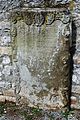
The epitaph of Alexander von Giech
A weathered stone in the cemetery

The Krautheim Castle

The west portal of the castle

The farmhouse in the village

The outbuilding with a gate passage


Wenceslas Mill
The Wenzelsmühle is a separate Volkach district . However, it lies in the district of Krautheim and is historically closely linked to the neighboring village. It was first handed down in the 17th century as the "lower mill " and formed the counterpart to the vineyard mill, as the "upper mill", since 1940 in the district of Frankenwinheim in the Schweinfurt district.
As in Krautheim, the customs officers of Krautheim ruled over the Wenzelsmühle for a long time. The old mill building from the 18th or 19th century has been preserved and is a monument. It is a two-storey half-hipped roof building with a hook-shaped floor plan . The barn next to it from the same period was placed under special protection by the State Office for Monument Preservation.
Economy and Infrastructure
economy

Krautheim is particularly characterized by its brewery as the only one in the wine region around Volkach. Shortly after the Thirty Years' War in 1654, a brewery was first handed down in the village. In 1695 the Counts of Castell granted inheritance and brewing privileges . After many changing owners had brewed in Krautheim, Friedrich Düll acquired the company in 1881. It is currently owned by the Düll family.
The brewery produces around 30,000 hectoliters of beer every year and sells its products throughout Lower Franconia. Many different types of beer are produced, including lemonades and table water. The private brewery Friedrich Düll draws its water from its own well on the site in the east of the village. The company also has its own malt house . There is a beer garden on the premises of the brewery .
In the past, the village mainly grew grain, especially wheat, rye and barley. In the 19th century attempts were made to establish fruit growing , but largely failed. After all, in 1887 a total of 1,000 quintals of fruit from Krautheim were traded on the Volkach wholesale market. In 1907 there were a total of 45 farms in Krautheim, in 1988 ten families were still living from agriculture.
Cattle breeding always played an insignificant role in Krautheim, although the villagers kept a village bull to maintain the population until the 1960s . The viticulture also does not matter, in 1850 there was the situation vineyard Leite in the south of the village. Today the Sonnenleite site exists with an area of 10 hectares, which is cultivated by external winegrowers.
| Vineyard | Size 1970 | Size 1988 | Size 1993 | Compass direction | Slope | Main grape varieties | Great location |
|---|---|---|---|---|---|---|---|
| Sonnenleit | 2 ha | 10 ha | 10 ha | south | 20-30% | Müller-Thurgau , Silvaner | Volkacher Kirchberg |
traffic
In the past, an important connecting road between Gerolzhofen , Volkach and Würzburg ran through Krautheim . Today the state road St 2274 takes over this task coming from Obervolkach. It is called Landstrasse in the village and continues to Gerolzhofen. It is ailing and should be repaired in the future. In addition, the district road KT 37 from Rimbach connects the village with Zeilitzheim in the north. It runs in place as street Am Weidach or Zeilitzheimer street.
After the direct bus connections between Volkach and Gerolzhofen were discontinued, only the Volkacher Mainschleife citizen bus makes a stop in Krautheim. It drives to the Am Weidach stop every Tuesday and Friday. Originally, Krautheim was the seat of a post office halfway between Volkach and Gerolzhofen, which was closed in 1980.
education
| List of schoolmasters in Krautheim (selection) | |||||||
|---|---|---|---|---|---|---|---|
| Hans Raufenstein | 1589 | ||||||
| Michael Schmitt | 16th Century | ||||||
| Hans Weber | 1610 | ||||||
| Martin Weingarten | 1624 | ||||||
| Michael Rauh | unknown | ||||||
| Heinrich Georg Fuchs | 1816-1843 | ||||||
| N. Geuder | 1927 | ||||||
| Hubert Spöhrer | until 1972 | ||||||
A schoolhouse has been proven as early as the 16th century. In 1589, the Kirchner Hans Raufenstein taught the children. The teachers also promoted the spread of Luther's teachings in the village and taught in German from an early age. They also promoted German church singing. In 1795 Krautheim taught according to the Casteller hymn book. Most of the teachers were also Kirchner, community clerks or craftsmen.
After the Thirty Years' War, a new school building was built in 1694, which also housed the community forge. In 1839, Krautheim received a two-story building exclusively for school lessons. It was house number 5 in the immediate vicinity of the church. In 1906 the house was converted into a rectory and the community had a new school house built.
In Krautheim, teaching was sponsored by several foundations . School supervision was taken over in the 19th century by the Counts of Castell and their consistory . In 1874 32 students attended the week school, 14 children were taught in the Sunday school. By 1924 the number of pupils fell significantly, so in 1912 54 children were taught in Krautheim, and in 1923 only 16. It was decided to close the school in Krautheim.
The children then attended classes in the nearby Zeilitzheim . However, in 1927 the community was able to set up a school again. The village school survived the Second World War and was only dissolved in the course of the centralization of the school system in the 1970s. The last school teacher was Hubert Spöhrer from Schweinfurt . Krautheim students have been taught in Volkach since 1969/1970.
In 1972 the school finally became part of the Volkach school district . In Krautheim, primary school students are taught up to fourth grade. From the fifth grade onwards, the Volksach elementary school takes on teaching. Schoolchildren can obtain the qualifying secondary school leaving certificate and, via the so-called M-branch , the secondary school leaving certificate. Extracurricular education is provided by the Volkach Adult Education Center.
There is a girls' secondary school in Volkach for higher education. In the Volkach district of Gaibach there is the Franken-Landschulheim Schloss Gaibach, a grammar school with secondary school and boarding school. The Steigerwald-Landschulheim in Wiesentheid is located near Krautheim. In addition, the pupils can visit the private monastery high school in Münsterschwarzach.
Associations and associations
Krautheim has several associations, the oldest is the volunteer fire brigade , which is organized in a fire brigade association. In 1874, the Reich Ministry of the Interior called for the establishment of fire brigades and Krautheim founded the defense in the same year. In 1879 a first tool shed was acquired , and in 1951 a building built exclusively for the fire brigade could be moved into.

During the Second World War, most of the firefighters were drafted and the service was taken over by so-called firefighters. Today the Wehr maintains a tool shed on Am Weidach. It is part of the District Fire Service Association Kitzingen and has a large portable pump vehicle (TSF) and a fire brigade trailer (FWA-SA600). The current commander is Erwin Strobel.
In 1951 a trombone quartet under the direction of Heinrich Dürr established itself in the village. Dürr had already co-founded a trombone choir in Haag im Steigerwald . After a period of practice, the trombone choir was able to perform in front of the church for the first time at Christmas 1951. The choir takes on the musical design of the services.
On January 9, 1954, the Comradeship Association of Former War Participants Krautheim was founded in Krautheim, which has set itself the task of commemorating the deceased, former combatants of 1914/1918 and 1939/1945. The Comradeship Association helps shape social life, so a carnival meeting is organized every year . In 1988, the union was affiliated with the Bavarian Soldiers' Union and renamed the Comradeship Association of Former Soldiers, Reservists and Friends.
At the initiative of Reinhard Söllner, 57 men and women founded SV 76 Krautheim on March 6, 1976 . Initially, club life was limited to football. In 1977 a gymnastics group was formed. In 1980 the sports area with community center was inaugurated in the west of the village. The soccer team of the Krautheim sports club plays in the B class.
Personalities

Several personalities worked in Krautheim and shaped the village. The oldest was the nobleman Epo (also Ebo, Eberhard, † near Krautheim), nephew of the East Franconian King Konrad I and Count of the Volkfeldgau. In the year 888 he received the village of Krautheim from King Arnulf of Carinthia . In the year 891 he was recorded in the farms of Rügshofen and Sulzheim. The nobleman died during a feud with the Babenberg family near his village of Krautheim.
In the Middle Ages and in the early modern period, Krautheim was in the hands of the Zollner von der Hallburg . First, the brothers Stephan Zollner von Hallburg (1356-1385) and Endres Zollner zu Rimbach (1374-1405) came into possession of the village. For a long time, the family sat in the villages of Rimbach, Gaibach or on the Hallburg because there was no manorial seat in Krautheim. It was not until Friedrich Zollner the Younger († 1563) acquired the Schwarzach court and made it his seat.
In the 17th century the Zollner line died out. Before that, the daughter of the last Zollner, Maria Magdalena Zollner zu Krautheim, married the nobleman Friedrich Eitel von Buttlar zu Grumbach, who inherited the estate. The Buttlars lived in the estate for around 130 years . The castle was built under Carl Heinrich von Buttlar and his wife Juliana Maria (née von Wildenstein ).
In addition to the village lords and aristocrats, the Evangelical Lutheran clergy of the parish church had a lasting impact on village life. Pastor Johann Wilhelm Baumer (* 1719 in Rehweiler , † 1788 in Gießen ) worked in Krautheim between 1742 and 1746 . He had studied in Halle and left his congregation after four years for health reasons. Baumer later received his doctorate and taught medicine, chemistry and mineralogy at the University of Giessen .
literature
Literature about Krautheim
- Gerhard Egert: The gentlemen from Buttlar zu Krautheim . In: Ute Feuerbach (Ed.): Volkach. 906-2006 . Volkach 2006. pp. 149-154.
- Gerhard Egert: Krautheim . In: Jesko Graf zu Dohna (ed.): Kulturpfad. In the footsteps of the Counts of Castell . Castell 2004. pp. 128-129.
- Gerhard Egert: Krautheim in Franconia. 888–1988 (= Volkacher Hefte No. 8) . Krautheim 1988.
- Johannes Feldhäuser: Krautheim . In: Georg Güntsch (ed.): Castell - Grafschaft and Dean's Office. Portrait of a deanery district . Erlangen 1991. pp. 107-110.
- oA: 100 years of the Krautheim volunteer fire department . In: 100 Years of the Krautheim Volunteer Fire Brigade 12. – 14. June 1976. 4th district fire brigade festival . Krautheim 1976. pp. 17-21.
- Wolfgang Schmiedel: 1000 years of Krautheim history . In: 100 Years of the Krautheim Volunteer Fire Brigade 12. – 14. June 1976. 4th district fire brigade festival . Krautheim 1976. pp. 29-35.
Other literature used
- Hans Bauer: District of Kitzingen. An art and culture guide . Market wide 1993.
- Gerhard Egert: The place names as a historical settlement source. Situation structure and interpretation . In: Ute Feuerbach (Ed.): Volkach. 906-2006 . Volkach 2006. pp. 11-16.
- Gerhard Egert: The political spatial planning in the area of the Volkacher Mainschleife around 1814 . Ute Feuerbach (Ed.): Our Main Loop. 1978-1992 . Volkach 2008. pp. 267-270.
- Gerhard Egert: On the history of fruit growing on the Mainschleife 1700–1900 . In: Ute Feuerbach (Ed.): Our Main Loop. 1978-1992 . Volkach 2008. pp. 47-58.
- Ute Feuerbach: Court and Office Volkach . In: Ute Feuerbach (Ed.): Volkach. 906-2006 . Volkach 2006. pp. 47-57.
- Ute Feuerbach, Christa Volk: Volkach and its districts . Erfurt 2011.
- Victor Metzner: The Protestant community in Volkach becomes independent . In: Ute Feuerbach (Ed.): Volkach. 906-2006 . Volkach 2006. pp. 277-280.
- Karl Schneider: The breweries on the Mainschleife. Your present and past . Dettelbach 2013.
- Karl Treutwein: From Abtswind to Zeilitzheim. History, sights, traditions . Volkach 4 1987.
Web links
Individual evidence
- ^ Bavarian State Office for Statistics and Data Processing (Ed.): Official local directory for Bavaria, territorial status: May 25, 1987. Issue 450 of the articles on Statistics Bavaria. Munich November 1991, p. 366 ( digitized version ).
- ^ Infranken: Krautheim has a lively club life , accessed on October 14, 2017.
- ↑ Geography Giersbeck: Map 152 Würzburg , PDF file, accessed on January 8, 2019.
- ^ Egert, Gerhard: Krautheim in Franconia . P. 7.
- ^ Egert, Gerhard: Krautheim in Franconia . P. 9.
- ^ Bauer, Hans: District of Kitzingen . P. 23.
- ^ Egert, Gerhard: Krautheim in Franconia . P. 18.
- ↑ Kulturpfad Castel: Krautheim , accessed on February 13, 2015.
- ^ Egert, Gerhard: Krautheim in Franconia . P. 23.
- ^ Schmiedel, Wolfgang: 1000 years of Krautheim history . P. 31.
- ↑ Egert, Gerhard: The Lords of Buttlar zu Krautheim . P. 150.
- ^ Treutwein, Karl: From Abtswind to Zeilitzheim . P. 136.
- ^ Egert, Gerhard: Krautheim in Franconia . P. 42.
- ^ Federal Statistical Office (ed.): Historical municipality directory for the Federal Republic of Germany. Name, border and key number changes in municipalities, counties and administrative districts from May 27, 1970 to December 31, 1982 . W. Kohlhammer GmbH, Stuttgart and Mainz 1983, ISBN 3-17-003263-1 , p. 747 .
- ^ Egert, Gerhard: The place names as a historical settlement source . P. 13.
- ^ Karl Treutwein : From Abtswind to Zeilitzheim . P. 135.
- ^ Egert, Gerhard: Krautheim in Franconia . P. 31.
- ^ Egert, Gerhard: Krautheim in Franconia . P. 15 f.
- ↑ infranken: Farewell to the former mayor , accessed on June 5, 2017.
- ↑ Feuerbach, Ute (and others): Volkach and its districts . P. 119.
- ^ Egert, Gerhard: Krautheim in Franconia . Pp. 40 f., 46.
- ^ Infranken: Krautheim invites you to the parish fair this weekend , accessed on June 5, 2017.
- ^ Egert, Gerhard: Krautheim in Franconia . P. 34.
- ↑ Egert, Gerhard: On the history of fruit growing on the Main loop . P. 57.
- ^ Egert, Gerhard: Krautheim in Franconia . P. 47.
- ^ Bauer, Hans: District of Kitzingen . P. 191.
- ↑ infranken: Two places without fancy dress , accessed on June 5, 2017.
- ↑ VVM-Info: Folder Bürgerbus , PDF, accessed on June 5, 2017.
- ^ Egert, Gerhard: Krautheim in Franconia . P. 35 f.
- ↑ oA: 100 years of the Krautheim volunteer fire department . P. 19.
- ↑ KFV-Kitzingen: Krautheim Fire Brigade , accessed on June 5, 2017.
- ^ Egert, Gerhard: Krautheim in Franconia . Pp. 59-70.
- ^ Egert, Gerhard: Krautheim in Franconia . P. 9.
- ^ Schmiedel, Wolfgang: 1000 years of Krautheim history . P. 29.
- ↑ Egert, Gerhard: The Lords of Buttlar zu Krautheim . P. 153.

Astheim | Dimbach | Eichfeld | Elgersheim | Escherndorf | Drive | Gaibach | Hallburg | Koehler | Krautheim | Obervolkach | Öttershausen | Rimbach | Stettenmühle | Strehlhof | Vogelsburg | Volkach | Wenceslas Mill | Ziegelhütte (Krautheim)
Former districts : Herrenmühle | Kirchberg | Schaubmühle | Ziegelhütte (Escherndorf)