
La Chaux (Saône-et-Loire)
| La Chaux | ||
|---|---|---|
|
||
| region | Bourgogne-Franche-Comté | |
| Department | Saône-et-Loire | |
| Arrondissement | Louhans | |
| Canton | Pierre-de-Bresse | |
| Community association | Bresse North Intercom ' | |
| Coordinates | 46 ° 50 ′ N , 5 ° 16 ′ E | |
| height | 188-214 m | |
| surface | 11.0 km 2 | |
| Residents | 302 (January 1, 2017) | |
| Population density | 27 inhabitants / km 2 | |
| Post Code | 71310 | |
| INSEE code | 71121 | |

La Chaux is a French commune in the department of Saone-et-Loire in the region of Bourgogne Franche-Comté . It belongs to the Arrondissement of Louhans and the canton of Pierre-de-Bresse . The place has 302 inhabitants (as of January 1, 2017), they are called Chaulais or Chaulaises .
geography
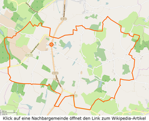

The municipality is located in the Bresse countryside , south of La Chapelle-Saint-Sauveur , whose municipality La Chaux embraces on three sides. From the central part, the Ruisseau des Armetières drains most of the municipality and discharges the water towards the northeast. The Ruisseau de Grange rises in the north-west of the municipality and drains to the north-west until it flows into the Guyotte . In a north-south direction, the municipality is crossed by the D13 department road from La Chapelle-Saint-Sauveur to Louhans . The route of the D13 largely coincides with the Roman road that led from Pierre to Louhans . Immediately north of the Bourg and on the border with La Chapelle-Saint-Sauveur , the D313 branches off to the southwest to reach Mervans . The municipality has no large forest areas, the area is almost entirely used for agriculture. The community is highly sprawled and has around 25 inhabited hamlets, even if some only have one or two houses. The municipality includes the following hamlets and corridors: Accrochoux, Bacheley, Bernards, Berteaux, Bois-Brûlé, Bois-de-Feures, Borgeot, Chapots, Chivière, Champ-Renaud, Cocagne, Communauté, Défriché, Désert, Folie, Fontenay, Fontenelles, Guinards, Maison-Blanche, Mirbel, Moireaux, Moutons, Petites-Fontenelles, Pins, Rabuts, Repesses, Truchards, Us, Vernet .
climate
The climate in La Chaux is warm and temperate. There is significant rainfall throughout the year, even the driest month still has high rainfall. The effective climate classification according to Köppen and Geiger is Cfb . The annual average temperature is 10.9 ° C. Over a year, the rainfall adds up to 826 mm.
| La Chaux | ||||||||||||||||||||||||||||||||||||||||||||||||
|---|---|---|---|---|---|---|---|---|---|---|---|---|---|---|---|---|---|---|---|---|---|---|---|---|---|---|---|---|---|---|---|---|---|---|---|---|---|---|---|---|---|---|---|---|---|---|---|---|
| Climate diagram | ||||||||||||||||||||||||||||||||||||||||||||||||
| ||||||||||||||||||||||||||||||||||||||||||||||||
Toponymy
In the 12th century, La Chaux is mentioned in the Pouillés de Besançon as La Chaz . There are various theories about the exact origin of the name. Guillemaut suspects that the name could be derived from the Latin callis = street, alley, also Chaussee , because of the proximity to the Roman road. The place La Chaux-en-Bresse is also on the Roman road to Poligny, so ultimately a plausible explanation.
Today it is assumed that the name goes back to the Middle Latin calma (contracted from calamus ) = treeless field. Chaux, often with supplements and in compounds, occurs frequently in the Jura and Bresse regions, but is hardly related to its current meaning (Chaux = lime), especially since limestone does not occur in the Bresse at all.
history
Since the 13th century, La Chaux was a fiefdom that later featured a motte and a fortress. In the toboggan from 1553, among other things, the jurisdiction, the costs of changes of hands, the confiscation of abandoned goods are regulated. The right to hunt belongs exclusively to the feudal lord; the tongues of all slaughtered cows and bulls must also be delivered to him. On the day after the wedding, newlyweds have to bring half a measure of wheat flour to the castle together. The duties of the self-employed with regard to guard duty, maintenance work such as cleaning the moat and maintaining the castle bridge are also regulated . Each resident also has to deliver a chicken every year.
Lords of La Chaux were Knight Charles de Poupet in 1511 , Estienne d'Ugny in 1555 , then the Bataille de Mandelot , an old family that produced several high officers, especially in the 18th century. Her motto was: ex bello pax (War becomes peace).
La Chaus , later La Chaz and La Chaulx, is located on the old Roman road from Pierre-de-Bresse to Louhans . Since the end of the 16th century, the manor belonged to the de Bataille de Mandelot . Of the fortress, first mentioned in 1473, only the trenches are visible. The church dates from the 18th century. In the old chapel of the Lords of La Chaux, today's village church, there were formerly several graves of the Batailles , with the motto Bataille pour Dieu, ex bello pax . Opposite the church is the rectory with a beautifully carved front door. In 1902 the new Mairie-École was built, the old one still consisted of clay walls and was covered with thatch. In 1923 the current cemetery was built and in 1950 the foyer rural (multi-purpose building). Formerly there were three mills on the numerous Étangs , in 1988 there were still 35 farms.
population
| year | 1793 | 1800 | 1821 | 1831 | 1841 | 1851 | 1861 | 1872 | 1881 | 1891 | 1901 | 1911 | 1921 | 1931 | 1946 | 1962 | 1975 | 1982 | 1990 | 1999 | 2006 | 2011 | ||||||||||||||||||||||||||||||||||||||||||||||||||||||||||||||||||||||||||||||||||||||||||||||||||||||||||||||||||||||||||||||||||||||||||||||||||||||||||||||||||||||||||||||||||||||||||||||||||||||||||||||||||||||||||||||||||||||||||||||||||||||||||||||||||||||||||||||||||||||||||||||||||||||||||||||||||||||||||||||||||||||||||||||||||||||||||||||||||||||||||||||||||||||||||||||||||||||||||||||||||||||||||||||||||||||||||||||||||||||||||||||||||||||||||||||||||||||||||||||
|---|---|---|---|---|---|---|---|---|---|---|---|---|---|---|---|---|---|---|---|---|---|---|---|---|---|---|---|---|---|---|---|---|---|---|---|---|---|---|---|---|---|---|---|---|---|---|---|---|---|---|---|---|---|---|---|---|---|---|---|---|---|---|---|---|---|---|---|---|---|---|---|---|---|---|---|---|---|---|---|---|---|---|---|---|---|---|---|---|---|---|---|---|---|---|---|---|---|---|---|---|---|---|---|---|---|---|---|---|---|---|---|---|---|---|---|---|---|---|---|---|---|---|---|---|---|---|---|---|---|---|---|---|---|---|---|---|---|---|---|---|---|---|---|---|---|---|---|---|---|---|---|---|---|---|---|---|---|---|---|---|---|---|---|---|---|---|---|---|---|---|---|---|---|---|---|---|---|---|---|---|---|---|---|---|---|---|---|---|---|---|---|---|---|---|---|---|---|---|---|---|---|---|---|---|---|---|---|---|---|---|---|---|---|---|---|---|---|---|---|---|---|---|---|---|---|---|---|---|---|---|---|---|---|---|---|---|---|---|---|---|---|---|---|---|---|---|---|---|---|---|---|---|---|---|---|---|---|---|---|---|---|---|---|---|---|---|---|---|---|---|---|---|---|---|---|---|---|---|---|---|---|---|---|---|---|---|---|---|---|---|---|---|---|---|---|---|---|---|---|---|---|---|---|---|---|---|---|---|---|---|---|---|---|---|---|---|---|---|---|---|---|---|---|---|---|---|---|---|---|---|---|---|---|---|---|---|---|---|---|---|---|---|---|---|---|---|---|---|---|---|---|---|---|---|---|---|---|---|---|---|---|---|---|---|---|---|---|---|---|---|---|---|---|---|---|---|---|---|---|---|---|---|---|---|---|---|---|---|---|---|---|---|---|---|---|---|---|---|---|---|---|---|---|---|---|---|---|---|---|---|---|---|---|---|---|---|---|---|---|---|---|---|---|---|---|---|---|---|---|---|---|---|---|---|---|---|---|---|---|---|---|---|---|---|---|---|---|---|---|---|---|---|---|---|---|---|---|---|---|---|---|---|---|---|---|---|---|---|---|---|---|---|---|---|---|---|---|---|---|---|---|---|---|---|---|---|---|---|---|---|---|---|---|---|---|---|---|---|---|---|
| Residents | 560 | 535 | 646 | 708 | 651 | 663 | 598 | 555 | 662 | 587 | 611 | 621 | 523 | 476 | 462 | 390 | 358 | 293 | 288 | 286 | 294 | 300 | ||||||||||||||||||||||||||||||||||||||||||||||||||||||||||||||||||||||||||||||||||||||||||||||||||||||||||||||||||||||||||||||||||||||||||||||||||||||||||||||||||||||||||||||||||||||||||||||||||||||||||||||||||||||||||||||||||||||||||||||||||||||||||||||||||||||||||||||||||||||||||||||||||||||||||||||||||||||||||||||||||||||||||||||||||||||||||||||||||||||||||||||||||||||||||||||||||||||||||||||||||||||||||||||||||||||||||||||||||||||||||||||||||||||||||||||||||||||||||||||
| From 1962 official figures excluding residents with a second residence | ||||||||||||||||||||||||||||||||||||||||||||||||||||||||||||||||||||||||||||||||||||||||||||||||||||||||||||||||||||||||||||||||||||||||||||||||||||||||||||||||||||||||||||||||||||||||||||||||||||||||||||||||||||||||||||||||||||||||||||||||||||||||||||||||||||||||||||||||||||||||||||||||||||||||||||||||||||||||||||||||||||||||||||||||||||||||||||||||||||||||||||||||||||||||||||||||||||||||||||||||||||||||||||||||||||||||||||||||||||||||||||||||||||||||||||||||||||||||||||||||||||||||||||||||||||


Infrastructure
Today La Chaux is an agricultural place. It has the Mairie (parish hall), a church (consecrated to Saint Paul ), 17 farms, two construction companies, a locksmith's shop and a restaurant. As AOC products are in La Chaux de Bresse Volaille and Dinde de Bresse admitted.
Educational institutions
There is an École élémentaire in the municipality , which is subordinate to the Académie de Dijon and attended by 22 children. The vacation schedule for zone A applies to the school.
literature
- Claude Courtépée (1721–1781): Description historique et topographique du Duché de Bourgogne . tape 5 . Chez Causse, Dijon 1780 (French, Google Books ).
- Lucien Guillemaut (1842-1917): Histoire de la Bresse Louhannaise. Vol. 1, Louhans 1897.
- Lucien Guillemaut (1842–1917): Armoiries et familles nobles de la Bresse louhannaise: armoiries ouvrières, armoiries particulières et de familles . Vve L. Romand, Louhans 1909 (French, gallica ).
Web links
- La Chaux. on INSEE. Institut national de la statistique et des études économiques , accessed on January 18, 2015 (French).
- La Chaux. in the register of communes in France. Retrieved January 18, 2015 (French).
- La Chaux. in the Base Mérimée . Ministère de la Culture, accessed January 18, 2015 (French).
- La Chaux. in Archives départementales. Saône-et-Loire department, accessed on January 21, 2016 (French).
Individual evidence
- ↑ La Chaux. on habitants.fr. Retrieved April 26, 2015 .
- ↑ Ruisseau des Armetières , length 6.1 km, tributary to the Brenne , source at 46 ° 48 ′ 59.4 ″ N , 5 ° 17 ′ 9.2 ″ E in La Chaux at approx. 195 m, mouth at 46 ° 50 ' "4.6 N , 5 ° 19' 39" O in Torpes m to about 184 Ruisseau of Armetières on sandre.eaufrance.fr
- ↑ Ruisseau de Grange , length 5.7 km, tributary to the Guyotte , source at 46 ° 49 ′ 22.4 ″ N , 5 ° 14 ′ 44.5 ″ E in La Chaux at approx. 205 m, mouth at 46 ° 50 ′ 30.8 ″ N , 5 ° 11 ′ 34.8 ″ E in Saint-Bonnet-en-Bresse at approx. 181 m, Ruisseau de Grange on sandre.eaufrance.fr
- ^ Department road D13. on routes.wikia.com. Retrieved April 6, 2015 (French).
- ^ Department road D131. on routes.wikia.com. Retrieved April 26, 2015 (French).
- ↑ La Chaux. (PDF) in the Dictionnaire Topographique de Saône-et-Loire. Comité des Travaux Historiques et Scientifiques, accessed on April 6, 2015 (French, search term: Ctrl+ FLa Chaux).
- ^ Joseph Calmette, Étienne Clouzot: Recueil des historiens de la France. Pouillés des Provinces de Besançon, de Tarentais et de Vienne, 1940. Imprimerie nationale, accessed April 8, 2015 (French).
- ^ Charles Knapp, Maurice Borel, Victor Attinger, Heinrich Brunner, Société neuchâteloise de geographie (editor): Geographical Lexicon of Switzerland . Volume 1: Aa - Emmengruppe . Verlag Gebrüder Attinger, Neuenburg 1902, p. 466, keyword Chaux ( scan of the lexicon page ).
- ^ Architecture et patrimoine. Retrieved October 19, 2011 (French).
- ↑ Population statistics on cassini.ehess.fr. Retrieved September 18, 2011 (French).
- ^ Chicken de Bresse. to INAO, L'Institut national de l'origine et de la qualité. Retrieved June 26, 2015 (French).
- ↑ Dinde de Bresse. to INAO, L'Institut national de l'origine et de la qualité. Retrieved June 26, 2015 (French).
- ^ Homepage of the Académie de Dijon. Retrieved January 10, 2016 (French).
- ↑ Vacation and holiday schedule for Zone A. La Chaux. Retrieved January 10, 2016 (French).