
Charette-Varennes
| Charette-Varennes | ||
|---|---|---|
|
||
| region | Bourgogne-Franche-Comté | |
| Department | Saône-et-Loire | |
| Arrondissement | Louhans | |
| Canton | Pierre-de-Bresse | |
| Community association | Bresse North Intercom ' | |
| Coordinates | 46 ° 55 ' N , 5 ° 12' E | |
| height | 173-196 m | |
| surface | 16.47 km 2 | |
| Residents | 456 (January 1, 2017) | |
| Population density | 28 inhabitants / km 2 | |
| Post Code | 71270 | |
| INSEE code | 71101 | |

Charette-Varennes is a French commune in the department of Saone-et-Loire in the region of Bourgogne Franche-Comté . It belongs to the Arrondissement of Louhans and the canton of Pierre-de-Bresse . The place has 456 inhabitants (as of January 1, 2017), they are Charettois , resp. Called Charettoises . The municipality of Charette merged with the then municipality of Varennes-sur-le-Doubs on January 1st, 1970 .
geography
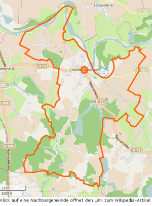


The municipality of Charette-Varennes is located in the Bresse countryside , on a hill on the left (south) bank of the Doubs . Varennes lies a little to the northwest in a loop of the Doubs. The Bourg lies west of a bend in the Doubs at about 340 °, from which a still water , called Les Mortes, branches off to the south , into the La Charetelle . The municipal boundary today does not exactly follow the course of the Doubs , but runs to Longepierre both south and north of the river. The Guyotte also flows through the southern municipal area and then forms part of the western municipal boundary. The department road D73 runs through the municipality from Frontenard to the west through Charette and then south towards Pierre-de-Bresse . The D73 runs partly on the route of the old Roman road that connected Chalon-sur-Saône with Pierre-de-Bresse and Tavaux . In the southern part of the municipality there is a chain of four Étangs , which are drained into the Guyotte by a Bief , an artificial watercourse for the management of the Étangs . The southern municipality - especially in the area of the Étangs - is heavily forested, furthermore there is only a larger wooded area between the districts of Charette and Varennes. The following hamlets and corridors belong to the municipality: Bas-de-Charette, Boucherie, Bourg-Neuf, Chapelle, Longbois, Maison-Rouge, Palette, Pommelée, Quintin, Rapilles, Recule, Reppe .
climate
The climate in Charette-Varennes is warm and temperate. There is significant rainfall throughout the year, even the driest month still has high rainfall. The effective climate classification according to Köppen and Geiger is Cfb . The average annual temperature is 10.9 ° C. Spread over a year, the rainfall adds up to 804 mm.
| Charette-Varennes | ||||||||||||||||||||||||||||||||||||||||||||||||
|---|---|---|---|---|---|---|---|---|---|---|---|---|---|---|---|---|---|---|---|---|---|---|---|---|---|---|---|---|---|---|---|---|---|---|---|---|---|---|---|---|---|---|---|---|---|---|---|---|
| Climate diagram | ||||||||||||||||||||||||||||||||||||||||||||||||
| ||||||||||||||||||||||||||||||||||||||||||||||||
Toponymy
Varennes probably originated from the Middle Latin Varenna as a name for uncultivated, swampy land, but also had the meaning of woodland , which was mostly reserved for the landlord for hunting. Charette seems to derive its name from the fact that the residents of Quintin used to park their cars there.
history
In the 10th and 11th centuries the district of Charette was inhabited by lepers , the village did not come into being here until the 15th century. Until then, Quintin (now a hamlet SSW of Charette) was the main settlement area. Quintin and the neighboring hamlet of Longbois were a fief of the lords of Verdun . In the hamlet of Quintin you can still see the remains of the former castle that existed there in the 14th century. The residents preferred to live in Quintin , where the climate was less humid, but they used to park their carts (French: la charrette ) in what is now the settlement area, which later gave rise to the place name.
A 13th-century chapel was located near the river bank, housed a Blessed Virgin of the Sick and the boatmen, survived several floods until it was finally destroyed in 1920. The current church dates from the middle of the 18th century, is dedicated to Saint Remigius and the tower is covered with glazed bricks . The rescued Holy Virgin is in an annex. According to the toboggan of 1481, the residents of Charette were required to bake their bread in the landlord's oven. As wages the people had to deliver the 18th bread. In 1518 a mill was built on the Doubs and from the toboggan it can be seen that the Lords of Varennes had the right to mine gold from the Doubs . In 1740, the Marquis de Broissia, Lord of Neublans, Knight of Honor of the Parlements, owned a ring made from gold fragments from the Doubs.
In 1880 there was still a brick factory (founded by Emile Jacob). The Mairie- École was completed in 1907. Today's retirement home was originally a house for sisters and today's hotel-restaurant is located in the Villa Crays .
The lordship of Varennes was a fiefdom of Longepierre (municipality north of the Doubs) and was sold to the Counts of Burgundy by the de Vienne family at the end of the 13th century . In 1729 the rule was taken over by the de Truchis family , who are still the owners of the new castle (built at the beginning of the 19th century). In 1988 there were still 18 farms in Charette and three in Varennes.
A large cross in the center of the village was erected in 1862 as a reminder that the church was destroyed in 1793. Since then the people of Varennes have belonged to the parish of Charette. The school that later became Mairie was built in 1847.
population
| year | 1793 | 1800 | 1821 | 1831 | 1841 | 1851 | 1861 | 1872 | 1876 | 1881 | 1891 | 1901 | 1911 | 1921 | 1931 | 1946 | 1962 | 1975 | 1982 | 1990 | 1999 | 2006 | 2011 | |||||||||||||||||||||||||||||||||||||||||||||||||||||||||||||||||||||||||||||||||||||||||||||||||||||||||||||||||||||||||||||||||||||||||||||||||||||||||||||||||||||||||||||||||||||||||||||||||||||||||||||||||||||||||||||||||||||||||||||||||||||||||||||||||||||||||||||||||||||||||||||||||||||||||||||||||||||||||||||||||||||||||||||||||||||||||||||||||||||||||||||||||||||||||||||||||||||||||||||||||||||||||||||||||||||||||||||||||||||||||||||||||||||||||||||||||||||||||||||
|---|---|---|---|---|---|---|---|---|---|---|---|---|---|---|---|---|---|---|---|---|---|---|---|---|---|---|---|---|---|---|---|---|---|---|---|---|---|---|---|---|---|---|---|---|---|---|---|---|---|---|---|---|---|---|---|---|---|---|---|---|---|---|---|---|---|---|---|---|---|---|---|---|---|---|---|---|---|---|---|---|---|---|---|---|---|---|---|---|---|---|---|---|---|---|---|---|---|---|---|---|---|---|---|---|---|---|---|---|---|---|---|---|---|---|---|---|---|---|---|---|---|---|---|---|---|---|---|---|---|---|---|---|---|---|---|---|---|---|---|---|---|---|---|---|---|---|---|---|---|---|---|---|---|---|---|---|---|---|---|---|---|---|---|---|---|---|---|---|---|---|---|---|---|---|---|---|---|---|---|---|---|---|---|---|---|---|---|---|---|---|---|---|---|---|---|---|---|---|---|---|---|---|---|---|---|---|---|---|---|---|---|---|---|---|---|---|---|---|---|---|---|---|---|---|---|---|---|---|---|---|---|---|---|---|---|---|---|---|---|---|---|---|---|---|---|---|---|---|---|---|---|---|---|---|---|---|---|---|---|---|---|---|---|---|---|---|---|---|---|---|---|---|---|---|---|---|---|---|---|---|---|---|---|---|---|---|---|---|---|---|---|---|---|---|---|---|---|---|---|---|---|---|---|---|---|---|---|---|---|---|---|---|---|---|---|---|---|---|---|---|---|---|---|---|---|---|---|---|---|---|---|---|---|---|---|---|---|---|---|---|---|---|---|---|---|---|---|---|---|---|---|---|---|---|---|---|---|---|---|---|---|---|---|---|---|---|---|---|---|---|---|---|---|---|---|---|---|---|---|---|---|---|---|---|---|---|---|---|---|---|---|---|---|---|---|---|---|---|---|---|---|---|---|---|---|---|---|---|---|---|---|---|---|---|---|---|---|---|---|---|---|---|---|---|---|---|---|---|---|---|---|---|---|---|---|---|---|---|---|---|---|---|---|---|---|---|---|---|---|---|---|---|---|---|---|---|---|---|---|---|---|---|---|---|---|---|---|---|---|---|---|---|---|---|---|---|---|---|---|---|---|---|---|---|---|---|---|---|---|---|---|---|---|---|---|---|---|---|---|---|
| Residents | 456 | 640 | 599 | 616 | 684 | 726 | 756 | 761 | 798 | 787 | 719 | 680 | 668 | 553 | 509 | 418 | 406 | 352 | 349 | 316 | 354 | 371 | 437 | |||||||||||||||||||||||||||||||||||||||||||||||||||||||||||||||||||||||||||||||||||||||||||||||||||||||||||||||||||||||||||||||||||||||||||||||||||||||||||||||||||||||||||||||||||||||||||||||||||||||||||||||||||||||||||||||||||||||||||||||||||||||||||||||||||||||||||||||||||||||||||||||||||||||||||||||||||||||||||||||||||||||||||||||||||||||||||||||||||||||||||||||||||||||||||||||||||||||||||||||||||||||||||||||||||||||||||||||||||||||||||||||||||||||||||||||||||||||||||||
| From 1962 official figures excluding residents with a second residence | ||||||||||||||||||||||||||||||||||||||||||||||||||||||||||||||||||||||||||||||||||||||||||||||||||||||||||||||||||||||||||||||||||||||||||||||||||||||||||||||||||||||||||||||||||||||||||||||||||||||||||||||||||||||||||||||||||||||||||||||||||||||||||||||||||||||||||||||||||||||||||||||||||||||||||||||||||||||||||||||||||||||||||||||||||||||||||||||||||||||||||||||||||||||||||||||||||||||||||||||||||||||||||||||||||||||||||||||||||||||||||||||||||||||||||||||||||||||||||||||||||||||||||||||||||||

Economy and Infrastructure
Number and type of establishments and shops
In addition to Mairie and Church, there are 9 farms and 18 other businesses in the community. A hotel-restaurant and various fishing options make up the tourist infrastructure.
| Operating area | number | from that | from that |
|---|---|---|---|
| Agriculture | 9 | ||
| Agriculture and forestry | 7th | ||
| Cereals legumes oil fruits | 3 | ||
| Vegetable growing | 3 | ||
| Feed | 2 | ||
| Forest management | 1 | ||
| Agriculture + horticulture services | 1 | ||
| Breeding and fishing companies | 3 | ||
| Cattle breeding | 1 | ||
| rearing | 2 | ||
| Food manufacturing | 1 | ||
| Bread patisserie | 1 |
| Branch | number |
|---|---|
| Manufacture of food beverages tobacco products | 1 |
| Building trade | 3 |
| Trade + repair of motor vehicles | 5 |
| Hotels and restaurants | 3 |
| Science administration advice | 1 |
| Public administration, education, health | 1 |
| other services | 4th |
| Type of store | number |
|---|---|
| bakery | 1 |
| Electrical and audio / video equipment | 1 |
| Sports and leisure articles | 1 |
Protected products in the community
Volaille de Bresse and Dinde de Bresse are approved as AOC products in Charette-Varennes .
Educational institutions
Charette-Varennes does not have its own school facilities. The children are educated in schools in the surrounding communities.
literature
- Claude Courtépée (1721–1781): Description historique et topographique du Duché de Bourgogne . tape 5 . Chez Causse, Dijon 1780 (French, Google Books ).
- Lucien Guillemaut (1842-1917): Histoire de la Bresse Louhannaise. Vol. 1, Louhans 1897.
- Lucien Guillemaut (1842–1917): Armoiries et familles nobles de la Bresse louhannaise: armoiries ouvrières, armoiries particulières et de familles . Vve L. Romand, Louhans 1909 (French, gallica ).
Web links
- Charette-Varennes. on INSEE. Institut national de la statistique et des études économiques , accessed on January 18, 2015 (French).
- Charette-Varennes. in the register of communes in France. Retrieved January 18, 2015 (French).
- Charette-Varennes. in the Base Mérimée . Ministère de la Culture, accessed January 18, 2015 (French).
- Charette-Varennes. in Archives départementales. Saône-et-Loire department, accessed on January 21, 2016 (French).
Individual evidence
- ^ Charette-Varennes. on habitants.fr. Retrieved April 1, 2015 (French).
- ↑ Le Doubs , length 453.1 km, tributary to the Saône , source at 46 ° 42 ′ 17.6 ″ N , 6 ° 12 ′ 32.4 ″ E in Mouthe at approx. 940 m, mouth at 46 ° 54 ′ 9 ″ N , 5 ° 1 ′ 19.6 ″ E in Verdun-sur-le-Doubs at approx. 175 m, Le Doubs on sandre.eaufrance.fr
- ↑ Les Mortes , length 1.6 km, tributary to the Doubs , source at 46 ° 55 ′ 2.3 ″ N , 5 ° 12 ′ 45.4 ″ E in Longepierre at approx. 175 m, mouth at 46 ° 54 ′ 50 , 8 ″ N , 5 ° 12 ′ 11.9 ″ E in Charette-Varennes at approx. 175 m, Les Mortes on sandre.eaufrance.fr
- ↑ La Charetelle , length 9.3 km, tributary to Les Mortes, source at 46 ° 50 ′ 49.9 ″ N , 5 ° 16 ′ 0 ″ E in La Chapelle-Saint-Sauveur at approx. 199 m, mouth at 46 ° 54 '37.1 " N , 5 ° 12' 29.2" O m in Charette-Varennes to about 175, La Charetelle on sandre.eaufrance.fr
- ↑ La Guyotte , length 41.1 km, tributary to the Doubs , source at 46 ° 43 ′ 7 ″ N , 5 ° 14 ′ 26.9 ″ E in Saint-Usuge at approx. 205 m, mouth at 46 ° 56 ′ 25.1 ″ N , 5 ° 8 ′ 26.9 ″ E in Navilly at approx. 175 m, La Guyotte on sandre.eaufrance.fr
- ↑ Departementsstrasse D73. on routes.wikia.com. Retrieved April 1, 2015 (French).
- ^ Charette-Varennes. (PDF) in the Dictionnaire Topographique de Saône-et-Loire. Comité des Travaux Historiques et Scientifiques, accessed on April 1, 2015 (search term: Ctrl+ FCharette and Varennes-sur-le-Doubs).
- ^ Tuiles Jacob. Retrieved October 21, 2011 (French).
- ↑ Population statistics on cassini.ehess.fr. Retrieved March 28, 2015 (French).
- ^ Company in Charette-Varennes. Kompass.fr, accessed February 13, 2016 (French).
- ^ Company in Charette-Varennes. Nombre d'établissements par secteur d'activité et par taille en 2014 (Téléchargement). INSEE.fr, accessed on February 13, 2016 (French).
- ^ Company in Charette-Varennes. Nombre d'équipements et de services dans le domaine du commerce en 2014 (Téléchargement). INSEE.fr, accessed on February 13, 2016 (French).
- ^ Chicken de Bresse. to INAO, L'Institut national de l'origine et de la qualité. Retrieved June 26, 2015 (French).
- ↑ Dinde de Bresse. to INAO, L'Institut national de l'origine et de la qualité. Retrieved June 26, 2015 (French).