
Serrigny-en-Bresse
| Serrigny-en-Bresse | ||
|---|---|---|
|
||
| region | Bourgogne-Franche-Comté | |
| Department | Saône-et-Loire | |
| Arrondissement | Louhans | |
| Canton | Pierre-de-Bresse | |
| Community association | Bresse Revermont 71 | |
| Coordinates | 46 ° 49 ' N , 5 ° 7' E | |
| height | 182-204 m | |
| surface | 12.36 km 2 | |
| Residents | 200 (January 1, 2017) | |
| Population density | 16 inhabitants / km 2 | |
| Post Code | 71310 | |
| INSEE code | 71519 | |

Serrigny-en-Bresse is a commune in the Saône-et-Loire in the region of Bourgogne Franche-Comté . It belongs to the Arrondissement of Louhans and the canton of Pierre-de-Bresse . The place has 200 inhabitants (as of January 1, 2017).
geography
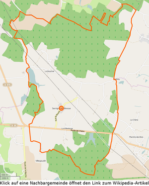

The municipality is located in the Bresse countryside , in the west of the Louhans arrondissement and borders the Chalon-sur-Saône arrondissement to the north, south and west . The northern municipal boundary touches Saint-Didier-en-Bresse , which belongs to the canton of Gigny . To the west is Saint-Martin-en-Bresse , to the south and southwest of Villegaudin, the neighboring town, both of which belong to the canton of Ouroux-sur-Saône . The Bief de l'Étang Saint-Didier flows through the western municipality . A large number of biefs flow into this , which are used to manage the six étangs . The southern municipal area is crossed by the department road D970, which then reaches Mervans . In the northern third of the municipality is the Forêt de Truchy , in the southern part of the Bois du Velar . The community is sparsely populated and also heavily sprawled, around three quarters of the population lives in different hamlets. The municipal area includes the following hamlets and meadows : Barraud, Bois-Garlot, Bouchat, Coltière, Communauté, Étang-Dioche, Fussey, Grange-des-Bois, Grange-Neuve, Morins, Motte, Moulin-Moissonnier, Pire, Pouilly, Rothey , Teppes-Rousset, Velard, Villeneuve .
climate
The climate in Serrigny-en-Bresse is warm and temperate. There is significant rainfall throughout the year, even the driest month still has high rainfall. The effective climate classification according to Köppen and Geiger is Cfb . The annual average temperature is 11.0 ° C. Spread over a year, the rainfall adds up to 794 mm.
| Serrigny-en-Bresse | ||||||||||||||||||||||||||||||||||||||||||||||||
|---|---|---|---|---|---|---|---|---|---|---|---|---|---|---|---|---|---|---|---|---|---|---|---|---|---|---|---|---|---|---|---|---|---|---|---|---|---|---|---|---|---|---|---|---|---|---|---|---|
| Climate diagram | ||||||||||||||||||||||||||||||||||||||||||||||||
| ||||||||||||||||||||||||||||||||||||||||||||||||
Toponymy
The first mention of the place goes back to 1317 as Sarrigney . The name of the place is likely to be of Gallo-Roman origin. Presumably it referred to the possession of a Sarignius , in Gallo-Roman form Sarigniacum and finally became today's Serrigny . The addition en Bresse appears for the first time in 1598 and has been an integral part of the place name since 1844.
history
From the 14th to the beginning of the 18th century, the parish belonged to the Fussey family , then it passed to Thomas de la Valette . In 1736 Serrigny became part of the Marquisate of Marche . The Roman road between Seurre and Cuisery brushes the community to the east, there was a moth in the hamlet of Petit Velar and in 1856 there were still three flour mills, two of which were windmills. Until 1685 the place belonged to the parish of Saint-Martin-en-Bresse , the church is consecrated to Saint Francis of Assisi , the apse was built in 1867. The school, built in 1881, was closed in 1971. Allegedly, some of the houses on the west side of Chemin de Villeneuve are still of the Maison de la Lune type . In any case, one was built in 1851 on 50 m² of the municipal area, but had to be demolished in the same year on the instructions of the municipality. Another one exists in the hamlet of Bouchat, but has unfortunately been heavily rebuilt. At the end of the 19th century, the population lived largely from agriculture, fishing and carving clogs. All that remains of the Morin family's homestead is the stable; the 33-meter long house was rebuilt in 2000 at the entrance to Saint-Martin-en-Bresse . Serrigny-en-Bresse has a large proportion of Swiss and Dutch residents. In 1988 there were still 12 farms.
population
| year | 1793 | 1800 | 1821 | 1831 | 1841 | 1846 | 1851 | 1861 | 1872 | 1881 | 1891 | 1901 | 1911 | 1921 | 1931 | 1946 | 1962 | 1975 | 1982 | 1990 | 1999 | 2006 | 2011 | |||||||||||||||||||||||||||||||||||||||||||||||||||||||||||||||||||||||||||||||||||||||||||||||||||||||||||||||||||||||||||||||||||||||||||||||||||||||||||||||||||||||||||||||||||||||||||||||||||||||||||||||||||||||||||||||||||||||||||||||||||||||||||||||||||||||||||||||||||||||||||||||||||||||||||||||||||||||||||||||||||||||||||||||||||||||||||||||||||||||||||||||||||||||||||||||||||||||||||||||||||||||||||||||||||||||||||||||||||||||||||||||||||||||||||||||||||||||||||||
|---|---|---|---|---|---|---|---|---|---|---|---|---|---|---|---|---|---|---|---|---|---|---|---|---|---|---|---|---|---|---|---|---|---|---|---|---|---|---|---|---|---|---|---|---|---|---|---|---|---|---|---|---|---|---|---|---|---|---|---|---|---|---|---|---|---|---|---|---|---|---|---|---|---|---|---|---|---|---|---|---|---|---|---|---|---|---|---|---|---|---|---|---|---|---|---|---|---|---|---|---|---|---|---|---|---|---|---|---|---|---|---|---|---|---|---|---|---|---|---|---|---|---|---|---|---|---|---|---|---|---|---|---|---|---|---|---|---|---|---|---|---|---|---|---|---|---|---|---|---|---|---|---|---|---|---|---|---|---|---|---|---|---|---|---|---|---|---|---|---|---|---|---|---|---|---|---|---|---|---|---|---|---|---|---|---|---|---|---|---|---|---|---|---|---|---|---|---|---|---|---|---|---|---|---|---|---|---|---|---|---|---|---|---|---|---|---|---|---|---|---|---|---|---|---|---|---|---|---|---|---|---|---|---|---|---|---|---|---|---|---|---|---|---|---|---|---|---|---|---|---|---|---|---|---|---|---|---|---|---|---|---|---|---|---|---|---|---|---|---|---|---|---|---|---|---|---|---|---|---|---|---|---|---|---|---|---|---|---|---|---|---|---|---|---|---|---|---|---|---|---|---|---|---|---|---|---|---|---|---|---|---|---|---|---|---|---|---|---|---|---|---|---|---|---|---|---|---|---|---|---|---|---|---|---|---|---|---|---|---|---|---|---|---|---|---|---|---|---|---|---|---|---|---|---|---|---|---|---|---|---|---|---|---|---|---|---|---|---|---|---|---|---|---|---|---|---|---|---|---|---|---|---|---|---|---|---|---|---|---|---|---|---|---|---|---|---|---|---|---|---|---|---|---|---|---|---|---|---|---|---|---|---|---|---|---|---|---|---|---|---|---|---|---|---|---|---|---|---|---|---|---|---|---|---|---|---|---|---|---|---|---|---|---|---|---|---|---|---|---|---|---|---|---|---|---|---|---|---|---|---|---|---|---|---|---|---|---|---|---|---|---|---|---|---|---|---|---|---|---|---|---|---|---|---|---|---|---|---|---|---|---|---|---|---|---|---|---|---|---|---|
| Residents | 363 | 397 | 409 | 423 | 430 | 443 | 420 | 403 | 354 | 357 | 329 | 325 | 335 | 245 | 288 | 212 | 189 | 136 | 146 | 114 | 130 | 156 | 196 | |||||||||||||||||||||||||||||||||||||||||||||||||||||||||||||||||||||||||||||||||||||||||||||||||||||||||||||||||||||||||||||||||||||||||||||||||||||||||||||||||||||||||||||||||||||||||||||||||||||||||||||||||||||||||||||||||||||||||||||||||||||||||||||||||||||||||||||||||||||||||||||||||||||||||||||||||||||||||||||||||||||||||||||||||||||||||||||||||||||||||||||||||||||||||||||||||||||||||||||||||||||||||||||||||||||||||||||||||||||||||||||||||||||||||||||||||||||||||||||
| From 1962 official figures excluding residents with a second residence | ||||||||||||||||||||||||||||||||||||||||||||||||||||||||||||||||||||||||||||||||||||||||||||||||||||||||||||||||||||||||||||||||||||||||||||||||||||||||||||||||||||||||||||||||||||||||||||||||||||||||||||||||||||||||||||||||||||||||||||||||||||||||||||||||||||||||||||||||||||||||||||||||||||||||||||||||||||||||||||||||||||||||||||||||||||||||||||||||||||||||||||||||||||||||||||||||||||||||||||||||||||||||||||||||||||||||||||||||||||||||||||||||||||||||||||||||||||||||||||||||||||||||||||||||||||


Economy and Infrastructure
In the parish there is a church, a mairie , three agricultural businesses and two construction companies. Volaille de Bresse and Dinde de Bresse are approved as AOC products in Serrigny-en-Bresse .
Educational institutions
Serrigny-en-Bresse does not have its own school facilities. The children are educated in schools in the surrounding communities.
literature
- Claude Courtépée (1721–1781): Description historique et topographique du Duché de Bourgogne . tape 5 . Chez Causse, Dijon 1780 (French, Google Books ).
- Lucien Guillemaut (1842-1917): Histoire de la Bresse Louhannaise. Vol. 1, Louhans 1897.
- Lucien Guillemaut (1842–1917): Armoiries et familles nobles de la Bresse louhannaise: armoiries ouvrières, armoiries particulières et de familles . Vve L. Romand, Louhans 1909 (French, gallica ).
Web links
- Serrigny-en-Bresse. on INSEE. Institut national de la statistique et des études économiques , accessed on January 18, 2015 (French).
- Serrigny-en-Bresse. in the register of communes in France. Retrieved January 18, 2015 (French).
- Serrigny-en-Bresse. in the Base Mérimée . Ministère de la Culture, accessed January 18, 2015 (French).
- Serrigny-en-Bresse. in Archives départementales. Saône-et-Loire department, accessed on January 21, 2016 (French).
Single receipts
- ↑ Bief de l'Étang Saint-Didier , length 9.5 km, tributary to La Cosne d'Épinossous, source at 46 ° 47 ′ 46.7 ″ N , 5 ° 7 ′ 0.5 ″ E in Villegaudin at approx. 207 m, mouth at 46 ° 51 ′ 8.3 ″ N , 5 ° 3 ′ 2.2 ″ E in Ciel at approx. 177 m, Bief de l'Étang Saint-Didier on sandre.eaufrance.fr
- ^ Department road D970. on routes.wikia.com. Retrieved May 1, 2015 (French).
- ↑ Serrigny-en-Bresse. (PDF) in the Dictionnaire Topographique de Saône-et-Loire. Comité des Travaux Historiques et Scientifiques, accessed on May 1, 2015 (French, search term: Ctrl+ FSerrigny-en-Bresse).
- ↑ Population statistics on cassini.ehess.fr. Retrieved April 30, 2015 (French).
- ^ Chicken de Bresse. to INAO, L'Institut national de l'origine et de la qualité. Retrieved June 26, 2015 (French).
- ↑ Dinde de Bresse. to INAO, L'Institut national de l'origine et de la qualité. Retrieved June 26, 2015 (French).