
Authumes
| Authumes | ||
|---|---|---|
|
||
| region | Bourgogne-Franche-Comté | |
| Department | Saône-et-Loire | |
| Arrondissement | Louhans | |
| Canton | Pierre-de-Bresse | |
| Community association | Bresse North Intercom ' | |
| Coordinates | 46 ° 53 ' N , 5 ° 18' E | |
| height | 180-213 m | |
| surface | 12.88 km 2 | |
| Residents | 252 (January 1, 2017) | |
| Population density | 20 inhabitants / km 2 | |
| Post Code | 71270 | |
| INSEE code | 71013 | |

Authumes is a French commune in the department of Saone-et-Loire in the region of Bourgogne Franche-Comté . It belongs to the Arrondissement of Louhans and the canton of Pierre-de-Bresse . The place has 252 inhabitants (as of January 1, 2017). The inhabitants are Authumois , resp. Called Authumoises . The inhabitants are jokingly called r'noillats (frog in patois ), in memory of the times when the farmers had to beat the water in the castle moat with rods so that the mistress was not disturbed by the croaking frogs in her sleep.
geography
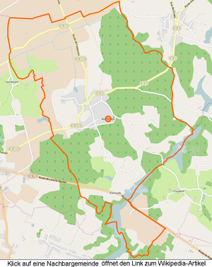

The municipality is on the northern border of the Bresse landscape , in the northeast it borders on the Jura department . The Ruisseau des Tenaudins flows along the southern municipal boundary and drains numerous étangs along the southern municipal boundary . La Breux rises in the north of the municipality and the Coursière de Brenae forms the northeastern municipal boundary in the east. The municipality forms a clear watershed between the Doubs and Brenne . Almost 40% of the total area is covered with forest, the areas are mainly south and east of the Bourg . In north-south direction the D373 departmental road runs from Fretterans towards Pierre-de-Bresse , in east-west direction the D29 department road , on the route of the Roman road , the Pierre-de-Bresse with Chalon-sur-Saône , Tavaux and Besançon linked. The following hamlets and meadows belong to the municipality: Bois, Crotte, Faubourg, Forêt, Fay, Grands-Prés, Hays, Hauts-et-Bas, Malatière, Pérouse, Quenoncère, Ramouille, Rippes-Saint-Paul .
climate
The climate in Authumes is warm and temperate. There is significant rainfall throughout the year, even the driest month still has high rainfall. The effective climate classification according to Köppen and Geiger is Cfb . The annual average temperature is 10.8 ° C. Spread over a year, the rainfall adds up to 833 mm.
| Authumes | ||||||||||||||||||||||||||||||||||||||||||||||||
|---|---|---|---|---|---|---|---|---|---|---|---|---|---|---|---|---|---|---|---|---|---|---|---|---|---|---|---|---|---|---|---|---|---|---|---|---|---|---|---|---|---|---|---|---|---|---|---|---|
| Climate diagram | ||||||||||||||||||||||||||||||||||||||||||||||||
| ||||||||||||||||||||||||||||||||||||||||||||||||
Toponymy
The name goes back to the Gallo-Roman settlement period, originally altus tumulus , meaning a high hill. In fact, the Authumes area appears to be a distinct elevation when viewed from the Roman road , which lies at around 180 meters.
history
Authumes borders the Franche-Comté and lies on the edge of the Bresse , on a small ridge called Tertre (small hill). It was in the border area between the Sequani and the Haeduers . Remains of Roman buildings, shards and objects, including a small bronze statuette, have been found in the area. The finds suggest that there was a Gallo-Roman settlement here that was destroyed by the immigrating Franks . A familiarity was attached to the parish . There was a leprosarium , after which the old field name La Malatière points.
In 1302 Jean de Vienne sold his entire estate in Authumes to Duke Robert II. In the 15th century, Philip the Good gave the barony to his chancellor Nicolas Rolin . The place had a city wall with two gates and a castle with towers. It dates back to 950, was expanded under Rollin and turned into a true fortress. Due to the border location, the population suffered a lot during the Huguenot Wars and the War of Devolution . In 1637 Authumes was conquered by the Comtois , and in 1638 it was reconquered by the French. By order of the king, the castle was razed, all that remained was an old tower and traces of the former moats. The houses were also destroyed and the settlement was rebuilt at its current location.
From Nicolas Rolin, his daughter Philipote inherited the rule of Authume, which she in turn passed on to Anne d'Oiselet , the wife of Emart Bouton , chamberlain to the Duke of Burgundy and bailiff of Chalon-sur-Saône . In 1534 Charles Bouton sold the reign of Authumes to Philippe Chabot , Admiral of France . In 1666 Catherine de Neuville , Countess of Armagnac, owned the Authume estate, after several changes of ownership it came into the possession of the de Thiard family .
The Fontaine des Trois-Rois (Three Kings Fountain) is located between the cemetery and the village . This is where the parents used to bring their children with scrofula before they prayed and made offerings in the church. The church was built in 1686 from the material of the old castle and dedicated to the birth of the Virgin Mary . In 1988 there were 14 farms.
population
| year | 1793 | 1800 | 1821 | 1831 | 1841 | 1846 | 1851 | 1861 | 1872 | 1881 | 1891 | 1901 | 1911 | 1921 | 1931 | 1946 | 1962 | 1975 | 1982 | 1990 | 1999 | 2006 | 2011 | |||||||||||||||||||||||||||||||||||||||||||||||||||||||||||||||||||||||||||||||||||||||||||||||||||||||||||||||||||||||||||||||||||||||||||||||||||||||||||||||||||||||||||||||||||||||||||||||||||||||||||||||||||||||||||||||||||||||||||||||||||||||||||||||||||||||||||||||||||||||||||||||||||||||||||||||||||||||||||||||||||||||||||||||||||||||||||||||||||||||||||||||||||||||||||||||||||||||||||||||||||||||||||||||||||||||||||||||||||||||||||||||||||||||||||||||||||||||||||||
|---|---|---|---|---|---|---|---|---|---|---|---|---|---|---|---|---|---|---|---|---|---|---|---|---|---|---|---|---|---|---|---|---|---|---|---|---|---|---|---|---|---|---|---|---|---|---|---|---|---|---|---|---|---|---|---|---|---|---|---|---|---|---|---|---|---|---|---|---|---|---|---|---|---|---|---|---|---|---|---|---|---|---|---|---|---|---|---|---|---|---|---|---|---|---|---|---|---|---|---|---|---|---|---|---|---|---|---|---|---|---|---|---|---|---|---|---|---|---|---|---|---|---|---|---|---|---|---|---|---|---|---|---|---|---|---|---|---|---|---|---|---|---|---|---|---|---|---|---|---|---|---|---|---|---|---|---|---|---|---|---|---|---|---|---|---|---|---|---|---|---|---|---|---|---|---|---|---|---|---|---|---|---|---|---|---|---|---|---|---|---|---|---|---|---|---|---|---|---|---|---|---|---|---|---|---|---|---|---|---|---|---|---|---|---|---|---|---|---|---|---|---|---|---|---|---|---|---|---|---|---|---|---|---|---|---|---|---|---|---|---|---|---|---|---|---|---|---|---|---|---|---|---|---|---|---|---|---|---|---|---|---|---|---|---|---|---|---|---|---|---|---|---|---|---|---|---|---|---|---|---|---|---|---|---|---|---|---|---|---|---|---|---|---|---|---|---|---|---|---|---|---|---|---|---|---|---|---|---|---|---|---|---|---|---|---|---|---|---|---|---|---|---|---|---|---|---|---|---|---|---|---|---|---|---|---|---|---|---|---|---|---|---|---|---|---|---|---|---|---|---|---|---|---|---|---|---|---|---|---|---|---|---|---|---|---|---|---|---|---|---|---|---|---|---|---|---|---|---|---|---|---|---|---|---|---|---|---|---|---|---|---|---|---|---|---|---|---|---|---|---|---|---|---|---|---|---|---|---|---|---|---|---|---|---|---|---|---|---|---|---|---|---|---|---|---|---|---|---|---|---|---|---|---|---|---|---|---|---|---|---|---|---|---|---|---|---|---|---|---|---|---|---|---|---|---|---|---|---|---|---|---|---|---|---|---|---|---|---|---|---|---|---|---|---|---|---|---|---|---|---|---|---|---|---|---|---|---|---|---|---|---|---|---|---|---|---|---|---|---|---|
| Residents | 440 | 521 | 551 | 587 | 660 | 667 | 651 | 593 | 667 | 611 | 536 | 523 | 497 | 432 | 412 | 376 | 330 | 304 | 250 | 209 | 199 | 215 | 262 | |||||||||||||||||||||||||||||||||||||||||||||||||||||||||||||||||||||||||||||||||||||||||||||||||||||||||||||||||||||||||||||||||||||||||||||||||||||||||||||||||||||||||||||||||||||||||||||||||||||||||||||||||||||||||||||||||||||||||||||||||||||||||||||||||||||||||||||||||||||||||||||||||||||||||||||||||||||||||||||||||||||||||||||||||||||||||||||||||||||||||||||||||||||||||||||||||||||||||||||||||||||||||||||||||||||||||||||||||||||||||||||||||||||||||||||||||||||||||||||
| From 1962 official figures excluding residents with a second residence | ||||||||||||||||||||||||||||||||||||||||||||||||||||||||||||||||||||||||||||||||||||||||||||||||||||||||||||||||||||||||||||||||||||||||||||||||||||||||||||||||||||||||||||||||||||||||||||||||||||||||||||||||||||||||||||||||||||||||||||||||||||||||||||||||||||||||||||||||||||||||||||||||||||||||||||||||||||||||||||||||||||||||||||||||||||||||||||||||||||||||||||||||||||||||||||||||||||||||||||||||||||||||||||||||||||||||||||||||||||||||||||||||||||||||||||||||||||||||||||||||||||||||||||||||||||

Economy and Infrastructure
Number and type of establishments and shops
In addition to Mairie and Church, there are five agricultural and nine other businesses in the community
| Operating area | number | from that | from that |
|---|---|---|---|
| Agriculture | 5 | ||
| Agriculture and forestry | 4th | ||
| Grain cultivation | 1 | ||
| legumes | 1 | ||
| oleaginous plants | 1 | ||
| Garden maintenance | 3 | ||
| Breeding and fishing companies | 1 | ||
| Cattle breeding | 1 |
| Branch | number |
|---|---|
| Manufacture of other industrial products | 1 |
| Building trade | 1 |
| Trade + repair of motor vehicles | 3 |
| Real estate industry | 1 |
| Science administration advice | 3 |
The locals in neighboring Pierre-de-Bresse (3 km) supply themselves with everyday necessities . There is a public picnic area at the Étang de Fay .

Protected products in the community
Volaille de Bresse and Dinde de Bresse are approved as AOC products in Authumes .
Educational institutions
Authumes does not have its own school facilities. The children are educated in schools in the surrounding communities.
literature
- Claude Courtépée (1721–1781): Description historique et topographique du Duché de Bourgogne . tape 5 . Chez Causse, Dijon 1780 (French, Google Books ).
- Lucien Guillemaut (1842-1917): Histoire de la Bresse Louhannaise. Vol. 1, Louhans 1897.
- Lucien Guillemaut (1842–1917): Armoiries et familles nobles de la Bresse louhannaise: armoiries ouvrières, armoiries particulières et de familles . Vve L. Romand, Louhans 1909 (French, gallica ).
Web links
- Authumes. on INSEE. Institut national de la statistique et des études économiques , accessed on January 18, 2015 (French).
- Authumes. in the register of communes in France. Retrieved January 18, 2015 (French).
- Authumes. in the Base Mérimée . Ministère de la Culture, accessed January 18, 2015 (French).
- Authumes. in Archives départementales. Saône-et-Loire department, accessed on January 21, 2016 (French).
Individual evidence
- ↑ Authumes. on habitants.fr. Retrieved March 25, 2015 (French).
- ↑ Philippe BETRY: Les Villages de la Bresse. 2008, ISBN 978-2-916109-14-5 , p. 38.
- ↑ Ruisseau des Tenaudins , length 13.4 km, tributary to the Brenne , source at 46 ° 53 ′ 30.1 ″ N , 5 ° 22 ′ 57 ″ E in Mouthier-en-Bresse (as Bief Fourneau) at approx. 212 m , Mouth at 46 ° 50 '24.4 ″ N , 5 ° 19 ′ 32.2 ″ E in Torpes at about 186 m, Ruisseau des Tenaudins on sandre.eaufrance.fr
- ↑ La Breux , length 7.7 km, tributary to La Charetelle , source at 46 ° 54 ′ 28.8 ″ N , 5 ° 18 ′ 23.4 ″ E in Authumes at approx. 183 m, mouth at 46 ° 54 ′ 14 ″ N , 5 ° 12 ′ 56.2 ″ E in Charette-Varennes at approx. 178 m, La Breux on sandre.eaufrance.fr
- ↑ Coursière de Brenae , length 4.6 km, tributary to the Doubs , source at 46 ° 53 ′ 43.4 ″ N , 5 ° 19 ′ 14.9 ″ E in Authumes at approx. 209 m, mouth at 46 ° 55 ′ 43 " N , 5 ° 18 '7.6" O in Fretterans m to about 179, Coursière de Brenae on sandre.eaufrance.fr
- ↑ Authumes. (PDF) in the Dictionnaire Topographique de Saône-et-Loire. Comité des Travaux Historiques et Scientifiques, accessed on March 25, 2015 (French, search term: Ctrl+ FAuthumes).
- ↑ Population statistics on cassini.ehess.fr. Retrieved March 23, 2015 (French).
- ↑ Company in Authumes. Kompass.fr, accessed February 13, 2016 (French).
- ↑ Company in Authumes. Nombre d'établissements par secteur d'activité et par taille en 2014 (Téléchargement). INSEE.fr, accessed on February 13, 2016 (French).
- ^ Chicken de Bresse. to INAO, L'Institut national de l'origine et de la qualité. Retrieved June 26, 2015 (French).
- ↑ Dinde de Bresse. to INAO, L'Institut national de l'origine et de la qualité. Retrieved June 26, 2015 (French).