
La Chapelle-Thècle
| La Chapelle-Thècle | ||
|---|---|---|
|
||
| region | Bourgogne-Franche-Comté | |
| Department | Saône-et-Loire | |
| Arrondissement | Louhans | |
| Canton | Cuiseaux | |
| Community association | Terres de Bresse | |
| Coordinates | 46 ° 33 ' N , 5 ° 7' E | |
| height | 174-204 m | |
| surface | 16.48 km 2 | |
| Residents | 466 (January 1, 2017) | |
| Population density | 28 inhabitants / km 2 | |
| Post Code | 71470 | |
| INSEE code | 71097 | |
| Website | Homepage La Chapelle-Thècle | |

La Chapelle-Thècle is a French commune in the department of Saone-et-Loire in the region of Bourgogne Franche-Comté . It belongs to the Arrondissement Louhans and the Canton of Cuiseaux . The community has 466 inhabitants (as of January 1, 2017), who are called in the patois Tsapalats or Chapalais or Chapalaises .
geography
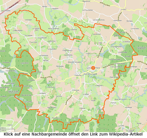

La Chapelle-Thècle is in the south of the Louhans arrondissement ; the southern municipal boundary touches the Arrondissement Mâcon and the municipality Romenay . The place is not crossed by any major road and is only sparsely forested, on the other hand it is heavily sprawled and has large agricultural areas. From the southeast the Sane-Vive flows in a north-northwest direction through the municipality, shortly before the Bourg La Voye flows into the Sane from the south . The Ruisseau des Fatys , which drains the Étangs of Romenay, flows about 700 meters after the village . Shortly thereafter, a bief flows from the east , which drains a chain of Étangs in the northern municipality. The municipality includes the following hamlets and corridors: Armes, Bordey, Bugeron, Carlottes, Carruge, Carruge-Ponsard, Chéniard, Coillat, Cour-Basse, Crezon, Croix, Devise, Dézaret, Fatys, Folie, Frettechise, Genèvres, Grande-Baisse , Grand-Pré, Grange-d'en-Bas, Grange-Renard, Lachée, Lebeau, Marcillat, Mardandon, Mathorand, Molard, Mont-du-Chat, Moulin-de-la-Chapelle, Moulin-de-l'Hirondelle , Moulin-Latrain, Moulin-Vairet, Petit-Bordey, Procureur, Quart-Bourgeois, Quart-des-Ponts, Quart-Joly, Quémont, Rivons, Robins, Rompois, Touppes-des-Champs, Ville-de-Fourne, Voye .
climate
The climate in La Chapelle-Thècle is warm and temperate. There is significant rainfall throughout the year, even the driest month still has high rainfall. The effective climate classification according to Köppen and Geiger is Cfb . The annual average temperature is 11.1 ° C. 801 mm of precipitation falls within one year.
| La Chapelle-Thècle | ||||||||||||||||||||||||||||||||||||||||||||||||
|---|---|---|---|---|---|---|---|---|---|---|---|---|---|---|---|---|---|---|---|---|---|---|---|---|---|---|---|---|---|---|---|---|---|---|---|---|---|---|---|---|---|---|---|---|---|---|---|---|
| Climate diagram | ||||||||||||||||||||||||||||||||||||||||||||||||
| ||||||||||||||||||||||||||||||||||||||||||||||||
Toponymy
The oldest known name of the place as Capella Sancte Thecle goes back to the year 1155. So the church must have already existed; it is dedicated to Saint Thecla of Iconium . In his Histoire de la Bresse louhannaise , Guillemaut states that the parish owes its name to Sainte Thècle from the Lyon area, whose veneration was widespread in the Middle Ages. Mâcon monks cleared the area and built a chapel in honor of Thekla, which was the beginning of the later church. The chapel later became the choir of today's church. During the revolution the parish was called Sâne-la-Vive , today the parish is often colloquially referred to as Chapal .
history
Half of the municipality belonged to the lordship of Montpont , the other half to the Bourg-en-Bresse bailiwick . During the revolution it still consisted of two communities of approximately the same size; part belonged to Louhans , the other to Pont-de-Vaux . An agreement regulated the association, according to which the merged congregation should belong where the church tower is located. As a result, today's municipality of La Chapelle-Thècle came to Louhans and the Saône-et-Loire department . However, the old municipal archives are still in Bourg-en-Bresse .
A special feature of the community is the fact that two types consist of roofs: on the one hand, the steep and high, with flat tiles covered, that for the Bresse house the bourguignonne Bresse are typical, on the other hand, the flat (<25% inclination) with overtiles and covered . Today more and more roofs are covered with flat tiles, so that this typical boundary of the architectural styles is less and less recognizable.
Historical events:
- In 1749 six children are said to have been eaten by a wolf.
- In 1940 an Italian plane dropped its bombs on the hamlet of Frettechise , thereby destroying a residential building.
- 1943: On December 23rd, two residents of Dézaret were tortured and killed by German soldiers looking for resistance fighters.
- 1944: On April 24, a British Avro Lancaster crashed in the hamlet of Petit-Bordey ; only one of the seven men survived.
- 1945: On September 4th, an American P-47 had to make an emergency landing east of the town. He was rescued by Allied forces and became a colonel in the American armed forces.
The municipality is located in a rather delicate area, in that the waters it traverses drain large stretches of the Jura. The following natural disasters are noted recently:
- Storm damage from November 6th to 10th, 1982
- Floods and debris flows from December 8 to 31, 1982
- Floods and debris flows from May 12-13, 1983
- Floods and debris flows from October 5 to 10, 1993
- Earthmoving as a result of the drought and subsequent water balance from July 1 to September 30, 2003
population
| year | 1793 | 1800 | 1821 | 1831 | 1841 | 1851 | 1856 | 1861 | 1872 | 1881 | 1891 | 1901 | 1911 | 1921 | 1931 | 1946 | 1962 | 1975 | 1990 | 1999 | 2006 | 2011 | ||||||||||||||||||||||||||||||||||||||||||||||||||||||||||||||||||||||||||||||||||||||||||||||||||||||||||||||||||||||||||||||||||||||||||||||||||||||||||||||||||||||||||||||||||||||||||||||||||||||||||||||||||||||||||||||||||||||||||||||||||||||||||||||||||||||||||||||||||||||||||||||||||||||||||||||||||||||||||||||||||||||||||||||||||||||||||||||||||||||||||||||||||||||||||||||||||||||||||||||||||||||||||||||||||||||||||||||||||||||||||||||||||||||||||||||||||||||||||||||
|---|---|---|---|---|---|---|---|---|---|---|---|---|---|---|---|---|---|---|---|---|---|---|---|---|---|---|---|---|---|---|---|---|---|---|---|---|---|---|---|---|---|---|---|---|---|---|---|---|---|---|---|---|---|---|---|---|---|---|---|---|---|---|---|---|---|---|---|---|---|---|---|---|---|---|---|---|---|---|---|---|---|---|---|---|---|---|---|---|---|---|---|---|---|---|---|---|---|---|---|---|---|---|---|---|---|---|---|---|---|---|---|---|---|---|---|---|---|---|---|---|---|---|---|---|---|---|---|---|---|---|---|---|---|---|---|---|---|---|---|---|---|---|---|---|---|---|---|---|---|---|---|---|---|---|---|---|---|---|---|---|---|---|---|---|---|---|---|---|---|---|---|---|---|---|---|---|---|---|---|---|---|---|---|---|---|---|---|---|---|---|---|---|---|---|---|---|---|---|---|---|---|---|---|---|---|---|---|---|---|---|---|---|---|---|---|---|---|---|---|---|---|---|---|---|---|---|---|---|---|---|---|---|---|---|---|---|---|---|---|---|---|---|---|---|---|---|---|---|---|---|---|---|---|---|---|---|---|---|---|---|---|---|---|---|---|---|---|---|---|---|---|---|---|---|---|---|---|---|---|---|---|---|---|---|---|---|---|---|---|---|---|---|---|---|---|---|---|---|---|---|---|---|---|---|---|---|---|---|---|---|---|---|---|---|---|---|---|---|---|---|---|---|---|---|---|---|---|---|---|---|---|---|---|---|---|---|---|---|---|---|---|---|---|---|---|---|---|---|---|---|---|---|---|---|---|---|---|---|---|---|---|---|---|---|---|---|---|---|---|---|---|---|---|---|---|---|---|---|---|---|---|---|---|---|---|---|---|---|---|---|---|---|---|---|---|---|---|---|---|---|---|---|---|---|---|---|---|---|---|---|---|---|---|---|---|---|---|---|---|---|---|---|---|---|---|---|---|---|---|---|---|---|---|---|---|---|---|---|---|---|---|---|---|---|---|---|---|---|---|---|---|---|---|---|---|---|---|---|---|---|---|---|---|---|---|---|---|---|---|---|---|---|---|---|---|---|---|---|---|---|---|---|---|---|---|---|---|---|---|---|---|---|---|---|---|---|---|---|---|---|
| Residents | 680 | 1,260 | 1,255 | 1,284 | 1,353 | 1,410 | 1,438 | 1,368 | 1,338 | 1,388 | 1,375 | 1,413 | 1,415 | 1,225 | 1,077 | 965 | 744 | 578 | 538 | 477 | 482 | 474 | ||||||||||||||||||||||||||||||||||||||||||||||||||||||||||||||||||||||||||||||||||||||||||||||||||||||||||||||||||||||||||||||||||||||||||||||||||||||||||||||||||||||||||||||||||||||||||||||||||||||||||||||||||||||||||||||||||||||||||||||||||||||||||||||||||||||||||||||||||||||||||||||||||||||||||||||||||||||||||||||||||||||||||||||||||||||||||||||||||||||||||||||||||||||||||||||||||||||||||||||||||||||||||||||||||||||||||||||||||||||||||||||||||||||||||||||||||||||||||||||
| From 1962 official figures excluding residents with a second residence | ||||||||||||||||||||||||||||||||||||||||||||||||||||||||||||||||||||||||||||||||||||||||||||||||||||||||||||||||||||||||||||||||||||||||||||||||||||||||||||||||||||||||||||||||||||||||||||||||||||||||||||||||||||||||||||||||||||||||||||||||||||||||||||||||||||||||||||||||||||||||||||||||||||||||||||||||||||||||||||||||||||||||||||||||||||||||||||||||||||||||||||||||||||||||||||||||||||||||||||||||||||||||||||||||||||||||||||||||||||||||||||||||||||||||||||||||||||||||||||||||||||||||||||||||||||

Economy and Infrastructure
In addition to Mairie and the church, there are 23 farms, a bakery, a construction company and a restaurant in the community. As AOC products are in La Chapelle-Thècle Crème et beurre de Bresse allowed further Volaille de Bresse and Dinde de Bresse .
Educational institutions
There is an École élémentaire in the municipality , which is subordinate to the Académie de Dijon and is attended by 35 children. The vacation schedule for zone A applies to the school.
literature
- Claude Courtépée (1721–1781): Description historique et topographique du Duché de Bourgogne . tape 5 . Chez Causse, Dijon 1780 (French, Google Books ).
- Lucien Guillemaut (1842-1917): Histoire de la Bresse Louhannaise. Vol. 1, Louhans 1897.
- Lucien Guillemaut (1842–1917): Armoiries et familles nobles de la Bresse louhannaise: armoiries ouvrières, armoiries particulières et de familles . Vve L. Romand, Louhans 1909 (French, gallica ).
Web links
- La Chapelle-Thècle. on INSEE. Institut national de la statistique et des études économiques , accessed on January 18, 2015 (French).
- La Chapelle-Thècle. in the register of communes in France. Retrieved January 18, 2015 (French).
- La Chapelle-Thècle. in the Base Mérimée . Ministère de la Culture, accessed January 18, 2015 (French).
- La Chapelle-Thècle. in Archives départementales. Saône-et-Loire department, accessed on January 21, 2016 (French).
- Web presence of the municipality of La Chapelle-Thècle
Individual evidence
- ↑ Le Langage Populaire de Macon et des Environs . Slatkine,.
- ↑ La Sane or Sane-Vive , length 46.8 km, tributary to the Seille , source at 46 ° 23 ′ 55 ″ N , 5 ° 9 ′ 4.7 ″ E in Lescheroux at approx. 217 m, mouth at 46 ° 32 ′ 24.7 ″ N , 5 ° 0 ′ 52.2 ″ E in La Genête at 172 m, La Sane-Vive on sandre.eaufrance.fr
- ↑ La Voye , length 17.5 km, tributary to Sane-Vive , source at 46 ° 26 '58.2 " N , 5 ° 1' 36.8" E in Chavannes-sur-Reyssouze at approx. 213 m, estuary at 46 ° 33 ′ 15.5 ″ N , 5 ° 6 ′ 47.9 ″ E in La Chapelle-Thècle at approx. 180 m, La Voye on sandre.eaufrance.fr
- ↑ Ruisseau des Fatys , length 5.0 km, tributary to Sane-Vive , source at 46 ° 31 ′ 30 ″ N , 5 ° 5 ′ 37.3 ″ E in Romenay at approx. 206 m, mouth at 46 ° 33 ′ 43.2 " N , 5 ° 6 '32.4" O m in La Chapelle-Thècle to about 177, Ruisseau of Fatys on sandre.eaufrance.fr
- ↑ Dictionnaire Topographique de Saône-et-Loire. (PDF) Comité des Travaux Historiques et Scientifiques, accessed on April 16, 2015 (French, search term: Ctrl+ FChapelle-Thècle).
- ↑ Brief description of the church. by La Chapelle-Thècle. Paroisse Saint Jean-Baptiste en Bresse, accessed February 7, 2016 (French).
- ↑ Die Heilige Thekla on Heiligenlexikon.de , accessed January 2, 2015
- ↑ In 1793 a roughly equal part of the municipality belonged to Bourg-en-Bresse
- ↑ Population statistics on cassini.ehess.fr. Retrieved January 2, 2015 (French).
- ↑ Crème de Bresse. to INAO L'Institut national de l'origine et de la qualité. Retrieved July 3, 2015 (French).
- ↑ Beurre de Bresse. to INAO L'Institut national de l'origine et de la qualité. Retrieved July 3, 2015 (French).
- ^ Chicken de Bresse. to INAO, L'Institut national de l'origine et de la qualité. Retrieved June 26, 2015 (French).
- ↑ Dinde de Bresse. to INAO, L'Institut national de l'origine et de la qualité. Retrieved June 26, 2015 (French).
- ^ Homepage of the Académie de Dijon. Retrieved January 10, 2016 (French).
- ↑ Vacation and holiday schedule for Zone A. La Chapelle-Thècle. Retrieved January 10, 2016 (French).