
Saint-Vincent-en-Bresse
| Saint-Vincent-en-Bresse | ||
|---|---|---|

|
|
|
| region | Bourgogne-Franche-Comté | |
| Department | Saône-et-Loire | |
| Arrondissement | Louhans | |
| Canton | Louhans | |
| Community association | Bresse Louhannaise Intercom ' | |
| Coordinates | 46 ° 40 ′ N , 5 ° 4 ′ E | |
| height | 183-212 m | |
| surface | 15.75 km 2 | |
| Residents | 573 (January 1, 2017) | |
| Population density | 36 inhabitants / km 2 | |
| Post Code | 71440 | |
| INSEE code | 71489 | |

Saint-Vincent-en-Bresse is a French commune in the department of Saone-et-Loire in the region of Bourgogne Franche-Comté . It belongs to the Arrondissement of Louhans and the Canton of Louhans . The municipality has 573 inhabitants (as of January 1, 2017)
geography
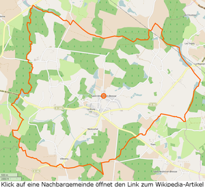

Saint-Vincent-en-Bresse is located in the Bresse countryside , around 13 kilometers north-west of Louhans , the eastern border of the municipality is formed by the La Serrée river . La Marlière rises in the center of the municipality . There are around 20 étangs in the municipality . There are no major road connections through the municipality, but the place is located on the crossroads of secondary roads to Saint-Étienne-en-Bresse , Montret , Saint-André-en-Bresse , La Frette and Baudrières . The following hamlets and corridors belong to the municipality: Allée, Berthod, Bretonnière, Curtil-Mathey, Fontaine-Morand, Grande-Chize, Grande-Rue, Maison-Bardotte, Mare-Pouron, Marlière, Meurots, Monine, Montcuchot, Montée-des- Charmes, Morts, Nuzeret, Petite-Chize, Pin, Planches, Priault, Putigny, Rougemont, Rue-Lesne, Touppe-Bouley, Tuilerie, Vêvre, Vignon, Villeveny.
climate
The climate in Saint-Vincent-en-Bresse is warm and temperate. There is significant rainfall throughout the year, even the driest month still has high rainfall. The effective climate classification according to Köppen and Geiger is Cfb . The annual average temperature is 11.0 ° C. Within one year there is 802 mm of precipitation.
| Saint-Vincent-en-Bresse | ||||||||||||||||||||||||||||||||||||||||||||||||
|---|---|---|---|---|---|---|---|---|---|---|---|---|---|---|---|---|---|---|---|---|---|---|---|---|---|---|---|---|---|---|---|---|---|---|---|---|---|---|---|---|---|---|---|---|---|---|---|---|
| Climate diagram | ||||||||||||||||||||||||||||||||||||||||||||||||
| ||||||||||||||||||||||||||||||||||||||||||||||||
Toponymy
A first mention goes back to the year 1019 in the Gallia christiana : In pago Cabilonensi… ecclesia in villa quae dicitur Tauriacus in honore invictissimi martyris Christi Vincentii dicata (German: In the Gau von Chalon… a church in the place called Tauriacus, consecrated Vincentius, dem Martyrs of the Invincible Christ). This text expresses that there was already a settlement called Tauriacus and that there was a church dedicated to Saint Vincent. It can therefore be assumed that the first settlement goes back to Gallo-Roman times and that it was the property of a Taurius . The original name was forgotten and the name for the church was retained as a place name. The suffix -en-Bresse has been guaranteed since the 14th century. After the revolution the place was called Vincent-des-Bois .
history
The hamlet of Putigny is located on a Roman road that led from Chalon-sur-Saône via Louhans to Lons-le-Saunier , some archaeological finds have been brought to light. The church, first mentioned in 1019, was enlarged in 1880, the bell tower and the foundation walls of the nave were preserved, but the frescoes from 1600 are hardly visible anymore. The church was consecrated to Saint Vincent from the beginning . In 1639 Marguerite de Ténarre was buried in the choir of the church. A castle has been mentioned since 1503, which was destroyed in 1798, it was located in the hamlet of Bardotte , on the departmental road D44 towards Montret. In the 17th and 18th centuries, the rule was owned by the de Châtenay family , whose first members participated in the Crusades. In 1582 Joachim de Châtenay was a member of the Chambre du Roi , Commissaire des guerres for Burgundy. In 1589, during the Wars of Religion , he was Governor of Chalon. The family united with the de Ténarre , Aimée-Cathérine de Ténarre was a baroness and from 1660 Countess of Saint-Vincent, followed by Count Charles de Châtenay , Baron of Baudrières and Lord of Saint-Étienne. Marie-Jeanne-Charlotte de Châtenay married Count de la Teyssonnière to Saint-Vincent around 1780 , his son Charles-Henri-François was the last noble lord.
A teacher is mentioned for the first time in 1774, and the girls' school was built in 1864. Iron ore was mined and processed in the community and there were two mills, one in Berthod and one in Morts . The term chize , which appears in two place names, means pond or pond in the local dialect. In 1869 101 of the 150 houses were still thatched, there were several wells and spring basins that were used for washing. In 1988 there were still 25 farms.
heraldry
The municipality uses a modern coat of arms that has little connection with historical heraldry. Blazon: In the drawbar cut red split into 1 in gold a silver cock, in 2 in gold a rooted, green tree, in 3 in green a blue lake . It can be assumed that with this coat of arms a logo was created that indicates the peculiarities of the municipality: the location in the Bresse and the reference to the Poulets de Bresse , the wealth of forests and the large number of étangs in the municipality, in his Total expression of the rural character of the community.
population
| year | 1793 | 1800 | 1821 | 1831 | 1841 | 1851 | 1861 | 1872 | 1881 | 1891 | 1901 | 1911 | 1921 | 1931 | 1946 | 1962 | 1975 | 1990 | 1999 | 2006 | 2011 | |||||||||||||||||||||||||||||||||||||||||||||||||||||||||||||||||||||||||||||||||||||||||||||||||||||||||||||||||||||||||||||||||||||||||||||||||||||||||||||||||||||||||||||||||||||||||||||||||||||||||||||||||||||||||||||||||||||||||||||||||||||||||||||||||||||||||||||||||||||||||||||||||||||||||||||||||||||||||||||||||||||||||||||||||||||||||||||||||||||||||||||||||||||||||||||||||||||||||||||||||||||||||||||||||||||||||||||||||||||||||||||||||||||||||||||||||||||||||||||||
|---|---|---|---|---|---|---|---|---|---|---|---|---|---|---|---|---|---|---|---|---|---|---|---|---|---|---|---|---|---|---|---|---|---|---|---|---|---|---|---|---|---|---|---|---|---|---|---|---|---|---|---|---|---|---|---|---|---|---|---|---|---|---|---|---|---|---|---|---|---|---|---|---|---|---|---|---|---|---|---|---|---|---|---|---|---|---|---|---|---|---|---|---|---|---|---|---|---|---|---|---|---|---|---|---|---|---|---|---|---|---|---|---|---|---|---|---|---|---|---|---|---|---|---|---|---|---|---|---|---|---|---|---|---|---|---|---|---|---|---|---|---|---|---|---|---|---|---|---|---|---|---|---|---|---|---|---|---|---|---|---|---|---|---|---|---|---|---|---|---|---|---|---|---|---|---|---|---|---|---|---|---|---|---|---|---|---|---|---|---|---|---|---|---|---|---|---|---|---|---|---|---|---|---|---|---|---|---|---|---|---|---|---|---|---|---|---|---|---|---|---|---|---|---|---|---|---|---|---|---|---|---|---|---|---|---|---|---|---|---|---|---|---|---|---|---|---|---|---|---|---|---|---|---|---|---|---|---|---|---|---|---|---|---|---|---|---|---|---|---|---|---|---|---|---|---|---|---|---|---|---|---|---|---|---|---|---|---|---|---|---|---|---|---|---|---|---|---|---|---|---|---|---|---|---|---|---|---|---|---|---|---|---|---|---|---|---|---|---|---|---|---|---|---|---|---|---|---|---|---|---|---|---|---|---|---|---|---|---|---|---|---|---|---|---|---|---|---|---|---|---|---|---|---|---|---|---|---|---|---|---|---|---|---|---|---|---|---|---|---|---|---|---|---|---|---|---|---|---|---|---|---|---|---|---|---|---|---|---|---|---|---|---|---|---|---|---|---|---|---|---|---|---|---|---|---|---|---|---|---|---|---|---|---|---|---|---|---|---|---|---|---|---|---|---|---|---|---|---|---|---|---|---|---|---|---|---|---|---|---|---|---|---|---|---|---|---|---|---|---|---|---|---|---|---|---|---|---|---|---|---|---|---|---|---|---|---|---|---|---|---|---|---|---|---|---|---|---|---|---|---|---|---|---|---|---|---|---|---|---|---|---|---|---|---|---|---|---|---|---|---|
| Residents | 573 | 606 | 657 | 680 | 777 | 820 | 875 | 868 | 972 | 901 | 862 | 827 | 738 | 668 | 556 | 481 | 349 | 420 | 468 | 435 | 509 | |||||||||||||||||||||||||||||||||||||||||||||||||||||||||||||||||||||||||||||||||||||||||||||||||||||||||||||||||||||||||||||||||||||||||||||||||||||||||||||||||||||||||||||||||||||||||||||||||||||||||||||||||||||||||||||||||||||||||||||||||||||||||||||||||||||||||||||||||||||||||||||||||||||||||||||||||||||||||||||||||||||||||||||||||||||||||||||||||||||||||||||||||||||||||||||||||||||||||||||||||||||||||||||||||||||||||||||||||||||||||||||||||||||||||||||||||||||||||||||||
| From 1962 official figures excluding residents with a second residence | ||||||||||||||||||||||||||||||||||||||||||||||||||||||||||||||||||||||||||||||||||||||||||||||||||||||||||||||||||||||||||||||||||||||||||||||||||||||||||||||||||||||||||||||||||||||||||||||||||||||||||||||||||||||||||||||||||||||||||||||||||||||||||||||||||||||||||||||||||||||||||||||||||||||||||||||||||||||||||||||||||||||||||||||||||||||||||||||||||||||||||||||||||||||||||||||||||||||||||||||||||||||||||||||||||||||||||||||||||||||||||||||||||||||||||||||||||||||||||||||||||||||||||||||||||||

Economy and Infrastructure
In addition to the Mairie and the church, there are 10 farms, 7 construction companies, a restaurant and a hairdressing salon in the community. As AOC products are in Saint-Vincent-en-Bresse de Bresse Volaille and Dinde de Bresse , further Crème et beurre de Bresse admitted.
Educational institutions
There is an École maternelle in the municipality , which is subordinate to the Académie de Dijon and is attended by 57 children. The vacation schedule for zone A applies to the school.
literature
- Claude Courtépée (1721–1781): Description historique et topographique du Duché de Bourgogne . tape 5 . Chez Causse, Dijon 1780 (French, Google Books ).
- Lucien Guillemaut (1842-1917): Histoire de la Bresse Louhannaise. Vol. 1, Louhans 1897.
- Lucien Guillemaut (1842–1917): Armoiries et familles nobles de la Bresse louhannaise: armoiries ouvrières, armoiries particulières et de familles . Vve L. Romand, Louhans 1909 (French, gallica ).
Web links
- Saint-Vincent-en-Bresse. on INSEE. Institut national de la statistique et des études économiques , accessed on January 18, 2015 (French).
- Saint-Vincent-en-Bresse. in the register of communes in France. Retrieved January 18, 2015 (French).
- Saint-Vincent-en-Bresse. in the Base Mérimée . Ministère de la Culture, accessed January 18, 2015 (French).
- Saint-Vincent-en-Bresse. in Archives départementales. Saône-et-Loire department, accessed on January 21, 2016 (French).
Individual evidence
- ↑ La Serrée , length 11.6 km, tributary to the Seille , source at 46 ° 41 ′ 34.8 ″ N , 5 ° 6 ′ 58 ″ E in Montret at approx. 204 m, mouth at 46 ° 36 ′ 57.2 " N , 5 ° 4 '45.5" O in Savigny-sur-Seille m to about 175, La Serrée on sandre.eaufrance.fr
- ↑ La Marlière , length 6.4 km, tributary to La Tenarre , source at 46 ° 40 ′ 27.5 ″ N , 5 ° 3 ′ 36.7 ″ E in Saint-Vincent-en-Bresse at approx. 202 m, Muzzle at 46 ° 40 ′ 20.3 ″ N , 4 ° 59 ′ 30.1 ″ E in Baudrières at approx. 177 m, La Marlière on sandre.eaufrance.fr
- ↑ Dictionnaire Topographique de Saône-et-Loire. (PDF) Comité des Travaux Historiques et Scientifiques, accessed on April 16, 2015 (French, search term: Strg+ FSaint-Vincent-en-Bresse).
- ↑ Denis de Sainte-Marthe: Gallia christiana in provincia ecclesiasticas distributa. T. 01-13: qua series et historia archiepiscoporum, episcoporum et abbatum Franciae vicinarumque ditionum, from origine ecclesiarum ad nostra tempora deducitur, et probatur ex authenticis instrumentis ad calcem appositis… opera et studio Domini Dionysii Sammarthani . Publisher JB Coignard T. 01, 1728, page 228.
- ↑ coat of arms of the municipality, original glazing: Tiercé en pairle renversé au 1) d'or au coq contourné au naturel, au 2) d'or à l'arbre arraché de sinople, au 3) de sinople au lac cousu d'azur; au pairle renversé en filet de gueules brochant sur la partition
- ↑ Population statistics on cassini.ehess.fr. Retrieved January 8, 2015 (French).
- ^ Chicken de Bresse. to INAO, L'Institut national de l'origine et de la qualité. Retrieved June 26, 2015 (French).
- ↑ Dinde de Bresse. to INAO, L'Institut national de l'origine et de la qualité. Retrieved June 26, 2015 (French).
- ↑ Crème de Bresse. to INAO L'Institut national de l'origine et de la qualité. Retrieved July 3, 2015 (French).
- ↑ Beurre de Bresse. to INAO L'Institut national de l'origine et de la qualité. Retrieved July 3, 2015 (French).
- ^ Homepage of the Académie de Dijon. Retrieved January 10, 2016 (French).
- ↑ Holiday and bank holiday schedule for zone A. Saint-Vincent-en-Bresse. Retrieved January 10, 2016 (French).