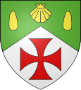
Le Gallet
| Le Gallet | ||
|---|---|---|

|
|
|
| region | Hauts-de-France | |
| Department | Oise | |
| Arrondissement | Beauvais | |
| Canton | Saint-Just-en-Chaussée | |
| Community association | Oise Picarde | |
| Coordinates | 49 ° 38 ' N , 2 ° 7' E | |
| height | 109-182 m | |
| surface | 3.47 km 2 | |
| Residents | 173 (January 1, 2017) | |
| Population density | 50 inhabitants / km 2 | |
| Post Code | 60360 | |
| INSEE code | 60267 | |
 Saint-Jacques church |
||
Le Gallet is a French municipality with 173 inhabitants (at January 1, 2017) in Oise in the region of Hauts-de-France . The municipality is located in the arrondissement of Beauvais and is part of the Communauté de communes de l'Oise Picarde and the canton of Saint-Just-en-Chaussée .
geography
The rural municipality is located on the plateau of the Picard plateau around four kilometers northeast of Crèvecœur-le-Grand .
Residents
| 1962 | 1968 | 1975 | 1982 | 1990 | 1999 | 2006 | 2011 |
|---|---|---|---|---|---|---|---|
| 77 | 60 | 62 | 48 | 111 | 117 | 146 | 169 |
administration
Mayor ( maire ) has been Mathieu Boureux since 2014.
Attractions
- Saint-Jacques church from the 19th century (see also: List of Monuments historiques in Le Gallet )
- The Notre-Dame du Bon Secours chapel, built around 1630 and renovated in 1776.
Individual evidence
Web links
Commons : Le Gallet - collection of images, videos and audio files
