Saint-Germer-de-Fly
| Saint-Germer-de-Fly | ||
|---|---|---|

|
|
|
| region | Hauts-de-France | |
| Department | Oise | |
| Arrondissement | Beauvais | |
| Canton | Grandvilliers | |
| Community association | Pays de Bray | |
| Coordinates | 49 ° 27 ' N , 1 ° 47' E | |
| height | 84-220 m | |
| surface | 19.90 km 2 | |
| Residents | 1,712 (January 1, 2017) | |
| Population density | 86 inhabitants / km 2 | |
| Post Code | 60850 | |
| INSEE code | 60577 | |
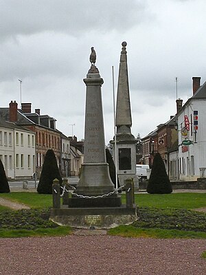
 War memorial |
||
Saint-Germer-de-Fly is a French commune with 1,712 inhabitants (at January 1, 2017) in Oise in the region of Hauts-de-France ; it belongs to the arrondissement of Beauvais and the canton of Grandvilliers .
geography
The municipality is located on the border with the Seine-Maritime department , around 8.5 kilometers south-east of Gournay-en-Bray . Route nationale 31 ( European route 46 ) runs through the north of the municipality, interspersed with several small streams . To the west it is bounded by the river Epte , which is followed by the railway line from Paris to Dieppe . The railway line from Goincourt to Gournay-Ferrières, which ran through the municipality, has been closed (tourist traffic has been suspended since 1939).
Residents
| 1962 | 1968 | 1975 | 1982 | 1990 | 1999 | 2006 | 2011 |
|---|---|---|---|---|---|---|---|
| 1169 | 1327 | 1332 | 1355 | 1585 | 1761 | 1744 | 1772 |
Town twinning
Saint-Germer-de-Fly maintains a partnership with the German city of Niedenstein in the Schwalm-Eder district .
Attractions
See also: List of Monuments historiques in Saint-Germer-de-Fly

