Brombos
| Brombos | ||
|---|---|---|
|
|
||
| region | Hauts-de-France | |
| Department | Oise | |
| Arrondissement | Beauvais | |
| Canton | Grandvilliers | |
| Community association | Picardy Verte | |
| Coordinates | 49 ° 39 ′ N , 1 ° 53 ′ E | |
| height | 175-207 m | |
| surface | 6.90 km 2 | |
| Residents | 256 (January 1, 2017) | |
| Population density | 37 inhabitants / km 2 | |
| Post Code | 60210 | |
| INSEE code | 60109 | |
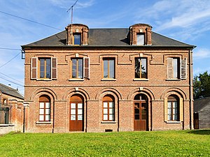
 Mairie (Town Hall) |
||
Brombos is a French commune of 256 inhabitants (at January 1, 2017) in Oise in the region of Hauts-de-France . The municipality is located in the arrondissement of Beauvais and is part of the Communauté de communes de la Picardie Verte and the canton of Grandvilliers .
geography
The municipality is located in the east of Feuquières about five kilometers southwest of Grandvilliers . It is touched in the north by the railway line from Aumale (Seine-Maritime) to Beauvais . The isolated homestead Flot Léger belongs to Brombos.
history
The Cistercian Abbey of Beaupré had ruled since the 12th century .
During the Second World War there was a field airfield to the west of the town, which was used by the German Air Force between June 1940 and June 1942 . Between June 1940 and April 1941 various squadrons of Jagdgeschwader 3 lay here with interruptions .
Residents
| 1962 | 1968 | 1975 | 1982 | 1990 | 1999 | 2006 | 2011 |
|---|---|---|---|---|---|---|---|
| 181 | 194 | 193 | 183 | 188 | 218 | 236 | 260 |
administration
Mayor ( maire ) has been Étienne Caux since 2001.
Attractions
- Church of Saint Hubert from the 17th and 18th centuries (see also: List of Monuments historiques in Brombos )
