Halloy (Oise)
| Halloy | ||
|---|---|---|
|
|
||
| region | Hauts-de-France | |
| Department | Oise | |
| Arrondissement | Beauvais | |
| Canton | Grandvilliers | |
| Community association | Picardy Verte | |
| Coordinates | 49 ° 39 ′ N , 1 ° 56 ′ E | |
| height | 187-204 m | |
| surface | 3.84 km 2 | |
| Residents | 452 (January 1, 2017) | |
| Population density | 118 inhabitants / km 2 | |
| Post Code | 60210 | |
| INSEE code | 60295 | |
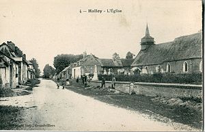
 Saint-Louis church at the beginning of the 20th century |
||
Halloy is a French municipality with 452 inhabitants (at January 1, 2017) in Oise in the region of Hauts-de-France . The municipality is located in the arrondissement of Beauvais and is part of the Communauté de communes de la Picardie Verte and the canton of Grandvilliers .
geography
The municipality is located around one and a half kilometers south of Grandvilliers and adjoins it on the former Route nationale 1 . It is touched in the north by the railway line from Aumale (Seine-Maritime) to Beauvais . The district of Petit-Halloy in the west belongs to the municipality.
history
The parish was founded by Lannoy Abbey .
Residents
| 1962 | 1968 | 1975 | 1982 | 1990 | 1999 | 2006 | 2011 |
|---|---|---|---|---|---|---|---|
| 318 | 340 | 351 | 353 | 395 | 471 | 462 | 456 |
administration
Mayor ( maire ) has been Gilles Boyenval since 2008.
Attractions
- Saint-Louis Church (see also: List of Monuments historiques in Halloy (Oise) )
Web links
Commons : Halloy - collection of images, videos and audio files
