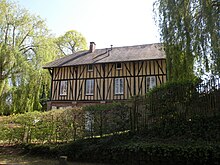
Saint-Léger-en-Bray
| Saint-Léger-en-Bray | ||
|---|---|---|
|
|
||
| region | Hauts-de-France | |
| Department | Oise | |
| Arrondissement | Beauvais | |
| Canton | Beauvais-2 | |
| Community association | Beauvaisis | |
| Coordinates | 49 ° 23 ' N , 2 ° 2' E | |
| height | 77-113 m | |
| surface | 4.43 km 2 | |
| Residents | 349 (January 1, 2017) | |
| Population density | 79 inhabitants / km 2 | |
| Post Code | 60155 | |
| INSEE code | 60583 | |
 The Saint-Léger church |
||
Saint-Léger-en-Bray is a French commune with 349 inhabitants (at January 1, 2017) in Oise in the region of Hauts-de-France . The municipality is located in the arrondissement of Beauvais and is part of the Communauté d'agglomération du Beauvaisis and des Beauvais-2 .
geography
The municipality traversed by the Route nationale 31 (southern bypass of Beauvais), which was developed as an expressway, is located around four kilometers north-northeast of Auneuil and eight kilometers southwest of Beauvais on the Ru d'Auneuil brook, which flows into the Avelon . There is an amusement park in the community.
Residents
| 1962 | 1968 | 1975 | 1982 | 1990 | 1999 | 2006 | 2011 |
|---|---|---|---|---|---|---|---|
| 171 | 163 | 170 | 227 | 301 | 337 | 309 | 373 |
administration
Mayor ( maire ) has been Laurent Delmas since 2014.
Attractions
- The Saint-Léger church, built in 1547, with relics of the titular saint.
- Six Calvaires
- Watermill
- 17th century pigeon house
Personalities
- Pierre Robert de Saint-Vincent (1882–1954), French general and resistance fighter, Righteous Among the Nations , born here.
Individual evidence
Web links
Commons : Saint-Léger-en-Bray - Collection of images, videos and audio files
- Monuments historiques (objects) in Saint-Léger-en-Bray in the base Palissy of the French Ministry of Culture


