Lormaison
| Lormaison | ||
|---|---|---|

|
|
|
| region | Hauts-de-France | |
| Department | Oise | |
| Arrondissement | Beauvais | |
| Canton | Méru | |
| Community association | Sablons | |
| Coordinates | 49 ° 15 ′ N , 2 ° 6 ′ E | |
| height | 102-186 m | |
| surface | 11.18 km 2 | |
| Residents | 1,306 (January 1, 2017) | |
| Population density | 117 inhabitants / km 2 | |
| Post Code | 60110 | |
| INSEE code | 60370 | |
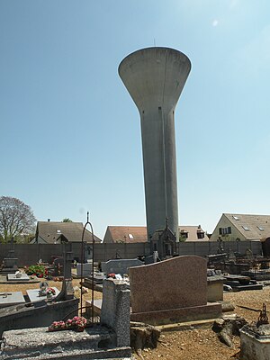
 Water tower |
||
Lormaison is a French commune with 1,306 inhabitants (at January 1, 2017) in Oise in the region of Hauts-de-France . The municipality is located in the arrondissement of Beauvais and is part of the Communauté de communes des Sablons and the canton of Méru .
geography
The community is located around four kilometers north-northwest of Méru, mainly east of the A16 autoroute .
history
During the First World War there was an airfield in Lormaison. On the night of May 31st, 1944, a British Avro Lancaster bomber was shot down.
| 1962 | 1968 | 1975 | 1982 | 1990 | 1999 | 2006 | 2011 |
|---|---|---|---|---|---|---|---|
| 488 | 567 | 639 | 958 | 1167 | 1371 | 1328 | 1287 |
administration

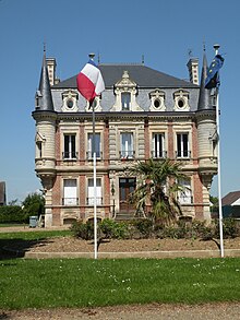
Mairie Lormaison
Mayor ( maire ) has been Jean-Pierre Lagny since 2001.
Community partnerships
A partnership with Uttershausen has existed since 1966 (now incorporated into Wabern ).
Attractions
- Church of Sainte-Marguerite from the 15th century (see also: List of Monuments historiques in Lormaison )
- 19th century castle, now Mairie
- Two pigeon houses
- War memorial
Web links
Commons : Lormaison - collection of images, videos and audio files

