
Mokrosuky
| Mokrosuky | |||||
|---|---|---|---|---|---|
|
|||||
| Basic data | |||||
| State : |
|
||||
| Region : | Plzeňský kraj | ||||
| District : | Klatovy | ||||
| Area : | 697.3281 ha | ||||
| Geographic location : | 49 ° 17 ' N , 13 ° 27' E | ||||
| Height: | 532 m nm | ||||
| Residents : | 125 (Jan. 1, 2019) | ||||
| Postal code : | 342 01 | ||||
| License plate : | P | ||||
| traffic | |||||
| Street: | Hrádek - Velhartice | ||||
| Railway connection: | Horažďovice předměstí – Klatovy | ||||
| structure | |||||
| Status: | local community | ||||
| Districts: | 2 | ||||
| administration | |||||
| Mayor : | Václav Matějka (as of 2014) | ||||
| Address: | Mokrosuky 66 342 01 Sušice |
||||
| Municipality number: | 556726 | ||||
| Website : | www.sumavanet.cz/mokrosuky | ||||


.jpg)

Mokrosuky (German Mokrosuk ) is a municipality in the Czech Republic . It is located three kilometers south of Kolinec and belongs to the Okres Klatovy .
geography
Mokrosuky is located in the Svatoborská vrchovina ( Swatobor Mountains ), a sub-unit of the Šumavské podhůří ( Bohemian Forest Foreland ). The core town lies on the right side above the valley of the Ostružná and is traversed by the brook potok Hory Matky Boží. In the north rise the Rendlíky (649 m), the Hostidráž (696 m) and the Křepčín (557 m), to the southeast the Na Chocholíku (548 m) and the Zabuza (575 m), in the south the V Kosách (636 m) and the Přenýř (702 m), to the southwest the Křížovka (765 m) and the Pavlínova hora (633 m), to the west the Vrch (703 m) and northwest the Rovina (723 m). The railway line Horaž verläuftovice předměstí – Klatovy runs east of the village , behind it the state road II / 187 between Sušice and Kolinec .
Neighboring towns are Stary Ovčín, Kolinec , Středka, Puchverk and Pazderna in the north, Čermná and Zbynice in the Northeast, Kašovice the east, Tedražice and Hradek in the southeast, Lešišov, Břetětice, Svojšice and Pozorka in the south, Cihelna, Horní Staňkov and Hory Mother of God in Southwest, Velhartice , Konín and Tajanov in the west and Ujčín, Nový Mlýn, Jindřichovice and Nový Ovčín in the northwest.
history
Mokrosuky has belonged to Velhartice Castle since the 14th century . The first written mention of the place was in 1418 in connection with a mill. The oldest evidence of the Mokrosuky farm was made in 1542. In the course of the division of the Velhartice estate, Václav Vintíř von Vlčkovice acquired Mokrosuky in 1560, which became part of the Kolinec estate . In 1579 Václav Vintíř sold the Mokrosuky estate to Wolf Gotthard Pergler von Perglas . This, or his son Wenzel Ottokar, had the fortress redesigned into a renaissance castle at the end of the 16th century. Because of his participation in the class uprising of 1618 , the goods of Wenzel Ottokar Pergler von Perglas were confiscated after the battle of the White Mountain and given to the imperial field marshal Baltasar von Marradas as pledge. Marradas used the castle several times during the Thirty Years' War as night quarters for himself and his people, and the income from the estate was used to pay for his army. From 1628 onwards, the income from the Mokrosuky estate went to the imperial colonel Martin de Hoeff Huerta for the same purpose. After the end of the Thirty Years' War, Humprecht Račín von Račín acquired the Mokrosuky estate with the castle, the farm and the village of Mokrosuky and the villages of Čermná, Lešišov and Nemanice. He could not manage the estate profitably and ran into debt. Afterwards his daughter Apollonia Ludmilla Countess Althann managed the estate; she left it in 1679 to her brother Ernst Adalbert Račín von Račín, who slammed it to his rule Bürgel . Mokrosuky remained subservient to Bürgel until the middle of the 19th century.
After the abolition of patrimonial formed Mokrosuky / Mokrosuk 1850 with the hamlet Lešišov a municipality in the judicial district Schüttenhofen. At that time, 123 exclusively Czech-speaking residents lived in the 45 houses of Mokrosuky. From 1868 the community belonged to the district of Schüttenhofen . At the beginning of the 20th century Mokrosuk was also used as a Czech place name, in 1924 it was changed back to Mokrosuky . In 1938 Mokrosuky consisted of 59 houses and had 332 inhabitants. In the course of the abolition of the Okres Sušice Mokrosuky came to the Okres Klatovy in 1960 . On July 1, 1980, it was incorporated into Kolinec . The Mokrosuky parish has existed again since November 24, 1990.
Community structure
The municipality Mokrosuky consists of the districts and cadastral districts Lešišov ( Leschischow ) and Mokrosuky ( Mokrosuk ). The hamlet of Pozorka also belongs to Mokrosuky.
Attractions
- Mokrosuky Renaissance Castle, the two-wing complex with arcades and a castle chapel, was built after 1579 for Wolf Gotthard Pergler von Perglas instead of a water festival
- Chapel of St. Wenceslaus
- Kašovice castle ruins, east of Mokrosuky above Ostružná. The Kašovice Fortress was first mentioned in 1341 as the seat of the Kašovice Sezema and has been desolate since the 16th century.
- Remains of gold soaps on the Ostružná near the Mokrosuky train station
- Lípa u Zelených , the 600-year-old summer linden tree grows on the western outskirts of Mokrosuky on the road to Hory Matky Boží in the courtyard wall of the former U Pavlíčků farm . The 27 m high courtyard tree with a trunk circumference of 8.37 m has been protected since 1978. There is a small chapel inside the hollow trunk.
- Pedunculate oak on the old burial site Na hřbitově or U svítivých hlav ( Near the Shining Heads ) east of Mokrosuky behind the football field. The 19 m high tree with a trunk circumference of 4.95 m has been protected as a tree monument since 1985. The hollow trunk of the approximately 400-year-old oak has burned out. According to tradition, the grave of Swedish soldiers from the time of the Thirty Years' War is said to be under the oak. Later the plague dead from Mokrosuky were buried near the tree. Around the square there are legends about skeletons that appear at night and skulls with fiery eyes.
- Winter linden tree at the southern exit of Lešišov. The 25 m high tree with a trunk circumference of 8.25 m has been protected since 1986. It is considered to be the third strongest winter linden tree in western Bohemia . Its age is estimated to be 400 years. There are also legends about the hollow tree, it is said to have served paschers and robbers as a hiding place and to be inhabited by ghosts.
Sons and daughters of the church
- Václav Vojta (1917-2000), neurologist
- Vladimír Boublík (1928–1974), theologian
gallery
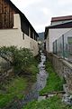
Potok


Individual evidence
- ↑ http://www.uir.cz/obec/556726/Mokrosuky
- ↑ Český statistický úřad - The population of the Czech municipalities as of January 1, 2019 (PDF; 7.4 MiB)
- ↑ http://www.uir.cz/casti-obce-obec/556726/Obec-Mokrosuky
- ↑ http://www.uir.cz/katastralni-uzemi-obec/556726/Obec-Mokrosuky
- ↑ Kašovice ruins on jiznicechy.org