Strážov
| Strážov | ||||
|---|---|---|---|---|
|
||||
| Basic data | ||||
| State : |
|
|||
| Region : | Plzeňský kraj | |||
| District : | Klatovy | |||
| Area : | 3570.0895 ha | |||
| Geographic location : | 49 ° 18 ' N , 13 ° 15' E | |||
| Height: | 482 m nm | |||
| Residents : | 1,417 (Jan 1, 2019) | |||
| Postal code : | 339 01 - 340 24 | |||
| License plate : | P | |||
| traffic | ||||
| Street: | Janovice nad Úhlavou - Běšiny | |||
| structure | ||||
| Status: | city | |||
| Districts: | 16 | |||
| administration | ||||
| Mayor : | Josef Rousek (as of 2014) | |||
| Address: | Strážov 71 340 21 Janovice nad Úhlavou |
|||
| Municipality number: | 557137 | |||
| Website : | mesto.strazov.cz | |||
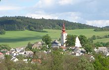
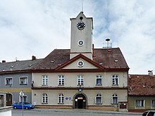
Strážov (German Drosau ) is a city in the Czech Republic . It is located twelve kilometers southwest of Klatovy and belongs to the Okres Klatovy .
geography
Strážov is located in the Strážovská vrchovina ( Drosauer Uplands ), a sub-area of the Šumavské podhůří ( Bohemian Forest Foreland ). The city lies in the shallow valley of the Strážovský potok ( Drosauer Bach ), which flows into the Jelenka in the district of Rovná . The Vinný vrch (535 m) and the Rovenská hora (571 m) rise to the north, the Chvojová hora (631 m) and the Úliště (690 m) to the northeast, the Smrková hora (628 m) to the east and the Na Vápenici to the south (532 m) and the Plošina (972 m), southwest of the Želivský vrch ( timber , 770 m), in the west of the U Ramene (723 m) and northwest of the Na Porovnání (639 m).
Neighboring towns are Rovná, Javor and Lehom in the north, Lukavice and Brtí in the east, Viteň, Splž and Krotějov in the south and Zahorčice and Opálka in the west. State road II / 171 between Janovice nad Úhlavou and Běšiny runs through Strážov .
history
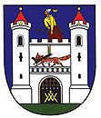
Strážov was first mentioned in a document in 1352. At that time, the single shift belonged to the Opálka fortress . After a silver find in the middle of the 15th century, the place grew rapidly and was granted city rights by Ludwig II in 1524 , including high jurisdiction , market rights , coat of arms law and the right to self-government.
After the silver deposits were exhausted and the mines closed and the smelters closed, a decline set in in the 16th century that affected all life in the city. The Thirty Years War brought further suffering when the Swedes invaded in 1641 and burned the town down. In the 18th century the lace making was established in Strážov . Until the middle of the 19th century, Drosau remained subordinate to the Opalka estate.
After the abolition of patrimonial formed STRÁŽOV / Drosau from 1850, a township in the judicial district Klatovy. From 1868 the city belonged to the Klattau district . The Czech place name Strážov has been used since 1880. In 1896 a lace school was founded in the village, which was closed in 1953. In 1954, Strážov together with Rejštejn and Nalžovské Hory lost the town charter. In 1961 Krotějov (with Hájek, Patraska and Splž), Lukavice (with Kněžice), Opálka (with České Hamry), Rovná (with Lehom and Malá Rovná) and Zahorčice were incorporated. At the beginning of 1976 Viteň was incorporated (with Božtěšice, Brtí, Horní Němčice, Javoříčko and Mladotice). The application for city status after the Velvet Revolution dragged on for a long time and finally became obsolete due to the amendment of the legal basis, as Strážov did not have the minimum number of 3000 inhabitants required at that time. Since January 23, 2007 Strážov is a town again.
Community structure
The town consists of the districts Strážov Božtěšice ( Boschtieschitz , formerly Boretitz ) Brtí ( Brty , 1939-45: Bienwald ) České Hamry ( Czech Hammer , formerly Hammer ), Horní Němčice ( Nemschitz , formerly Nemtschitz ), Javoříčko ( Jawoři , 1939 –45: Gaberl ), Kněžice ( Knieschitz ), Krotějov ( Krotiw ), Lehom, Lukavice ( Lukawitz , formerly Lukawetz ), Mladotice ( Mladotitz ), Opálka ( Opalka ), Rovná ( Ruwna ), Splž ( Spiel ), Strážov ( Drosau ) , Viteň ( Witten ) and Zahorčice ( Zahorčitz , 1939–45: Bingarten ). Basic settlement units are Božtěšice, Brtí, České Hamry, Horní Němčice, Krotějov, Lehom, Lukavice, Mladotice, Opálka, Rovná, Splž, Strážov, Viteň and Zahorčice. To Strážov also include Stamp Hajek ( Hajka ) and Patraska ( Potraska also Podraska ) and the monolayer Brtský Mlýn, Červený Mlýn ( Rothemühle ) Dvorecký Mlýn, Mala Rovná, Na strání, Na Strašidle, Pastouška, Plázky, U Soušků, U Stojzů, U Traxlů, V Americe and V Loužku.
The municipality is divided into the cadastral districts of Božtěšice na Šumavě, Brtí, České Hamry, Horní Němčice u Čachrova, Krotějov, Lehom, Lukavice u Strážova, Mladotice u Čachrova, Opálka, Rovná, Strážor, Věčite. The deserted Hynkovice ( Hinkowitz ) lies on the communal corridors .
Attractions
- St. George Church
- Column of St. John of Nepomuk in the market square
- Jewish cemetery east of the city on the northern slope of Smrková hora
- Festivals Opálka in Opálka
- Old tunnels from the mining era, some in the local cellars
Web links
Individual evidence
- ↑ http://www.uir.cz/obec/557137/Strazov
- ↑ Český statistický úřad - The population of the Czech municipalities as of January 1, 2019 (PDF; 7.4 MiB)
- ↑ http://www.uir.cz/casti-obce-obec/557137/Obec-Strazov
- ↑ http://www.uir.cz/zsj-obec/557137/Obec-Strazov
- ↑ http://www.uir.cz/katastralni-uzemi-obec/557137/Obec-Strazov


