Chudenín
| Chudenín | ||||
|---|---|---|---|---|
|
||||
| Basic data | ||||
| State : |
|
|||
| Region : | Plzeňský kraj | |||
| District : | Klatovy | |||
| Area : | 4585.3505 ha | |||
| Geographic location : | 49 ° 18 ' N , 13 ° 6' E | |||
| Height: | 478 m nm | |||
| Residents : | 625 (Jan. 1, 2019) | |||
| Postal code : | 340 22 | |||
| License plate : | P | |||
| traffic | ||||
| Street: | Nýrsko - Všeruby | |||
| structure | ||||
| Status: | local community | |||
| Districts: | 8th | |||
| administration | ||||
| Mayor : | Petr Zahrádka (as of 2014) | |||
| Address: | Chudenín 46 340 22 Nýrsko |
|||
| Municipality number: | 556386 | |||
| Website : | www.chudenin.cz | |||
Chudenín ( German Chudiwa ) is a municipality in the Czech Republic . It is located three kilometers west of Nýrsko on the German border and belongs to the Okres Klatovy .
geography
Chudenín is located in the northeast of the Všerubská vrchovina on a hill between the valleys of the Chodská Úhlava ( Chodenanglbach ) and its tributary Chudenínský potok ( Aubacherl ). The Orlovická hora (723 m) and the Havranice (665 m) rise to the north, the Hraničář ( Rantscher , 833 m) to the south, the Kameňák ( stone forest , 751 m) to the southwest, the Ratiště / Stangenruck (677 m) to the west northwest of the Lišák ( Plattenberg , 710 m) and the Jezvinec ( Gewintzyberg , 739 m). The Chudenínský rybník pond is located on the northern edge of the village. The Šumava Protected Landscape Area extends to the south in the Küni Mountains , and the state road II / 190 between Nýrsko and Všeruby runs through Chudenín .
Neighboring towns are Orlovice and Na Dvorcích in the north, Dvorce na Strání, Hadrava and Bystřice Úhlavou nad in the Northeast, Nýrsko in the east, Skelná Huť in the southeast, Suchý Kámen and Uhliště in the south, the St. Katherine, Spandlberg, Atzlern, Neukirchen in Heiligenblut , front Buchberg and Anger in the south-west, Zadní Fleky, Střední Fleky, Přední Fleky and Červené Dřevo in the west and Sruby, Liščí and Chalupy in the north-west.
history
Chudenín was probably founded around 1550 by the Lords of Schwanberg , to whom the Chodian rule was pledged between 1482 and 1572, and settled with Chodians from Pocinovice . Na Chudonině was first mentioned in a document in 1564 in a Pocinovice tax register. In occasion of the assumption of Chodenherrschaft under the administration of the city of dew on July 26, 1579 made by the imperial commissioners description of the rule was Chudienino listed as newly created village in the royal woods with five property and a pond. The town of Taus expanded its rule with settlers from Bavaria and also founded ten new villages, including Flecken, Fuchsberg, Rothenbaum and Hadruwa, whose residents gradually acquired the same rights as the Chod villages. The Chodenanglbach formed the border to the Bistritz an der Angel. The German residents gave the village the name Chudiwa . The settlers were Protestants, Chudiwa was parish to the utraquist church in Loučim . After the battle of the White Mountain , the town of Taus lost its rights to the Chodian rule, in 1621 it was pledged to Heinrich Burian von Guttenstein, who had also taken over the rule of Riesenberg - Zahořan . In the same year the pledge went to Wolf Wilhelm Lamminger von Albenreuth , who peculiarly bought out the Chodian rule in 1630. In the berní rula from 1654, 17 farmers, six of whom had the surname Zürhuet, and one gardener are listed for Chudiwa. A homestead was in desolation, and a chaluppe also served as an official keeper's house. The farmer Leonhart Reusser also operated a single-wheel mill, which, however, had suffered from a lack of impact water since the owners of the estate had introduced the Aubacherl directly into the manorial fish pond. The iron ore mine "For God's help" was operated south of Chudiwa in the 17th and 18th centuries. After the death of the Wolf Maximilian Laminger von Albenreuth , his widow and two daughters sold the Chodenschloß , Kauth and Zahoran domains to Johann Philipp and Heinrich Georg von Stadion in 1697 . The imperial counts of Stadion elevated the allodial rule of Kauth and Chodenschloß to a family affide. In 1819 a branch of the Rothenbaum village school was set up in Chudiwa. In 1830 the new road between Neuern and Neumark was built; before that, the route to Neumark led via Flecken and Rothenbaum. In 1848 the school became independent and started teaching all year round.
After the abolition of patrimonial formed Chudiwa / Chudiva 1850 a district of the municipality Rothenbaum in the judicial district moderns. At that time, 388 people lived in the village. From 1854 the village belonged to the Neuern district and after its abolition in 1870 to the Klattau district . A new school building was inaugurated in 1861. In 1869 the population of Chuduwa had grown to 400. In 1880 there were 410 residents in the 50 houses of Chudiwa. In 1894, Chudiwa broke away from Rothenbaum and formed its own community with the districts of Am Haus and Waffenhammer. In 1897 388 people lived in the 51 houses in Chudiwa / Chuděníno and Chudiva ; There was a one-class school in the village, two board saws, three mills, a chapel and a disused iron hammer. The rectory was Rothenbaum. After the two-class classes began, the school was too small, so a new, larger school building was built in 1915. In 1921 the place had 433 inhabitants. The Czech name Chudenín was introduced in 1924. In 1930 there were 422 people living in Chudiwa. After the Munich Agreement , Chudiwa was annexed to the German Reich in 1938 and belonged to the Markt Eisenstein district between 1939 and 1945 . In 1939 the community had 400 inhabitants. After the end of the Second World War, Chudenín came back to Czechoslovakia. In 1945 the Chudenín National Committee was established, to which the villages of Dvorce, Fleky and Liščí were also affiliated. The settlement of the Czech population began at this time. On January 1, 1946, a one-class Czech school began teaching in Chudenín. Between 1946 and January 1947, all Germans were expelled from Chudenín and transported from the Nýrsko train station to the Alžbětín transit camp . Between 1948 and 1953 the place was gradually connected to the electricity network. In 1950, only 180 people lived in the 62 houses in Chudenín. In the course of the construction of the Iron Curtain , the neighboring villages of Dolní Hutě ( Lower Hut ), Horní Hutě ( Upper Hut ) and Hvězda, as well as other courtyards, were cleared and destroyed. In 1949 Fleky (with Hvězda), Červené Dřevo and Liščí were incorporated. The Svatá Kateřina border crossing initially remained in place, but was heavily guarded. In 1960 Hadrava, Skelná Huť (with Suchý Kámen) and Uhliště (with Radošín and Svatá Kateřina) were incorporated. At the beginning of the 1960s, the border with the Federal Republic of Germany was completely closed. In 1961 Chudenín had 230 inhabitants, in 1970 there were 208. The Church of St. Katharina and the rectory in Svatá Kateřina were blown up by the army in the 1960s, and in the 1970s a large part of the village near the border was demolished. Most of the houses in Červené Dřevo, Fleky and Liščí were also demolished. In 1980, 186 people lived in the 42 houses in Chudenín, and the community had a total of 554 inhabitants. After the Velvet Revolution, the Svatá Kateřina / Geleitsbach car border crossing was opened in 1993 and the Fleky / Hofberg hiking border crossing in 1996. In 1995 there were 593 people living in the municipality including the districts, in 2000 there were 571.
Community structure
The municipality of Chudenín consists of the districts Chudenín ( Chudiwa ), Fleky ( Flecken ), Hadrava ( Hadruwa ), Liščí ( Fuchsberg ), Skelná Huť ( glassworks ), Suchý Kámen ( Dörrstein ), Svatá Kateřina ( St. Catherine ) and Uhliště ( Kohlheim) ). Basic settlement units are Chudenín, Fleky, Hadrava, Hvězda ( Sternhof ), Liščí, Skelná Huť, Suchý Kámen, Svatá Kateřina and Uhliště. To Chudenín also includes the hamlets and monolayer Červené Dřevo ( Rothenbaum ), Dvorce na Strání, Na Dvorcích ( at home ), Ovčín Radosin ( Ratschin ) Přední Fleky ( front spots ), Prostřední Fleky ( central spots ) and Zadní Fleky ( background stains ).
The municipality is divided into the cadastral districts of Chudenín, Fleky, Hadrava, Hvězda u Chudenína, Liščí u Chudenína, Skelná Huť, Suchý Kámen, Svatá Kateřina u Chudenína and Uhliště.
Attractions
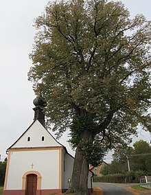
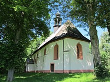
- Chapel of the Virgin Mary in Chudenín, built in 1834
- Church of St. Leonhard bei Uhliště, it was built between 1420 and 1430
- Church of St. Joseph in Hadrava, it was built in 1878 in place of one of St. Chapel dedicated to Anastasia. The church of the Fourteen Holy Helpers in Nýrsko, which was demolished in 1973, served as a model for the construction.
- Chapel of the Virgin Mary in Skelná Huť
- Chapel of St. Bernhard or Bear Chapel ( Medvědí kaple ) on the Kapellenberg near Liščí, it was built by Georg Kohlbeck from Fuchsberg, who was attacked by a bear on the spot in 1720 and was able to kill the animal after a difficult fight
- Cemetery in Červené Dřevo, the church of St. Mary in Sorrows, built between 1676 and 1680, burned down on May 3, 1953, its ruins were demolished between December 18 and 20, 1957. After 1990 the foundations of the church were exposed and a memorial stone was erected.
- Ruins of the Pajrek Castle , southeast of Skelná Huť
- Linden tree on the village square of Chudenín, the winter linden tree with a trunk circumference of 5.52 m and a crown height of 33.5 m has been protected as a tree monument since 1978
- Linden tree at house number 16 in Hadrava, the summer linden tree with a trunk circumference of 5.92 m and a crown height of 23.5 m has been protected as a tree monument since 1978
Sons and daughters of the church
- Anton Schott (1866–1945), Austrian writer
- Wolfgang Zierhut (1886–1946), German-Bohemian politician
- Sepp Skalitzky (1901–1992), German poet and storyteller
Individual evidence
- ↑ http://www.uir.cz/obec/556386/Chudenin
- ↑ Český statistický úřad - The population of the Czech municipalities as of January 1, 2019 (PDF; 7.4 MiB)
- ↑ Michael Rademacher: German administrative history from the unification of the empire in 1871 to the reunification in 1990. Landkreis Markt Eisenstein (Czech. Mestys Zelezná Ruda). (Online material for the dissertation, Osnabrück 2006).
- ↑ http://www.uir.cz/casti-obce-obec/556386/Obec-Chudenin
- ↑ http://www.uir.cz/zsj-obec/556386/Obec-Chudenin
- ↑ http://www.uir.cz/katastralni-uzemi-obec/578240/Obec-Hamry
Web links


