
Rhodes
|
Municipality of Rhodes Δήμος Ρόδου (Ρόδος) |
|||
|---|---|---|---|
|
|||
| Basic data | |||
| State : |
|
||
| Region : | South Aegean | ||
| Regional District : | Rhodes | ||
| Geographic coordinates : | 36 ° 11 ′ N , 27 ° 58 ′ E | ||
| Area : | 1,401,459 km² (2010) | ||
| Residents : | 115,490 (2011) | ||
| Population density : | 82.4 inhabitants per km² | ||
| Seat: | Rhodes | ||
| LAU-1 code no .: | 6901 | ||
| Districts : | 10 parishes | ||
| Local self-government : |
16 city districts 27 local communities |
||
| Website: | www.rhodes.gr | ||
| Location in the South Aegean region | |||
 |
|||

Rhodes ( modern Greek Ρόδος Ródos [ ˈrɔðɔs ] ( f. Sg. ); Ancient Greek Ῥόδος Rhódos ) is the fourth largest island in Greece with 1,401.459 km² and the main island of the Greek archipelago of the Dodecanese in the southeast Aegean . According to the 2011 census, the island had 115,490 inhabitants. Almost half of them live in the city of Rhodes , the main town and tourist center in the north. The heraldic animal of Rhodes is the leaping deer called Elafos .
The island has formed the municipality of Rhodes since 2011 and, together with the island municipalities of Megisti , Symi , Tilos and Chalki, the regional district of Rhodes (Περιφερειακή Ενότητα Ρόδου) in the South Aegean region .
Surname
The name Rhodes is not derived from ancient Greek τὸ ῥόδον 'rose' , but is pre-Greek. There is more a connection with the probably Phoenician origin of the modern Greek word for pomegranate , η ροδιά (rodia). Until 1982 the name in modern Greek as in ancient Greek with the touch character ( rough breathing written), which in German by h is reproduced (R h odos).
geography
location
Rhodes lies on the dividing line between the island-rich Aegean Sea , of which it forms part of the southeastern edge, and the island-poor Levantine Sea , both part of the Mediterranean Sea .
Rhodes is 78 km long and 38 km wide. Its center is around 430 km from Athens , the Greek capital on mainland Europe . From the north-west coast at Rhodes International Airport ( Diagoras ) it is only about 17.5 km north to the Turkish south-west coast, which is the smallest distance from the island to Asia Minor . Off the west coast are the smaller islands of Chalki (9 km) and Alimia (7 km) as well as other so-called shepherd islands.

Landscape image
The landscape is very mountainous, especially in the interior. The highest peaks are the Attavyros with 1215 m above sea level and the Akramitis with 825 m above sea level. The mountains that reach to the coast usually drop steeply to the sea. The southern and northern parts of the island are much flatter, its southern end merges into the Prasonisi peninsula .
climate
With over 3000 hours of sunshine a year, Rhodes is one of the sunniest regions in Europe. Hardly any rain is expected from mid-May to mid-September. Sufficient water supply is guaranteed all year round thanks to the limestone mountains . Among other things, the neighboring islands of Symi and Chalki are also supplied by ship deliveries.
In the months of July and August, temperatures of up to 40 ° C are not uncommon, not just inland. However, the sea breeze cools the temperatures on the west coast to around 28 to 32 ° C, on the east coast then usually 35 to 40 ° C are to be expected. The relatively low humidity makes the heat bearable. At night, temperatures drop to 23 to 20 ° C. The water temperature reaches around 27 ° C in August. Bathing is possible until November.
The coolest time is in January and February. During the day the temperatures are between 12 and 18 ° C, at night between 8 and 12 ° C. Frost can practically be ruled out, although there is sometimes snowfall on Attavyros (1,215 m), the highest mountain in Rhodes. The lowest water temperatures are reached at the end of February and beginning of March with 16 to 17 ° C.
| Rhodes | ||||||||||||||||||||||||||||||||||||||||||||||||
|---|---|---|---|---|---|---|---|---|---|---|---|---|---|---|---|---|---|---|---|---|---|---|---|---|---|---|---|---|---|---|---|---|---|---|---|---|---|---|---|---|---|---|---|---|---|---|---|---|
| Climate diagram | ||||||||||||||||||||||||||||||||||||||||||||||||
| ||||||||||||||||||||||||||||||||||||||||||||||||
|
Average monthly temperatures and rainfall for Rhodes
Source: wetterkontor.de
|
|||||||||||||||||||||||||||||||||||||||||||||||||||||||||||||||||||||||||||||||||||||||||||||||||||||||||||||||||||||||||||||||||||||||||||||||||||||||||||||||||||||||||||||||||||||||||||||||||||
Administrative division
From 1997 to 2010 the island of Rhodes was subdivided into ten municipalities with a total of 43 municipal districts according to the Kapodistrias program . The implementation of the administrative reform in 2010 led the former municipalities of the island to the newly created municipality of Rhodes ( Dimos Rodou Δήμος Ρόδου) together with the administrative center in the city of Rhodes . The previous municipalities have since formed municipal districts, which in turn are subdivided into city districts or local communities depending on the size of the population.
| Parish | Greek name | code | Area (km²) | 2001 residents | Residents 2011 | City districts / local communities (Δημοτική / Τοπική Κοινότητα) |
location |
|---|---|---|---|---|---|---|---|
| Rhodes (city) | Δημοτική Ενότητα Ρόδου | 690101 | 19,481 | 53,709 | 50,636 | Rhodes |
 |
| Archangelus | Δημοτική Ενότητα Αρχαγγέλου | 690102 | 115.375 | 7,779 | 7,615 | Archangelus, Malon, Masari |
 |
| Atavyros | Δημοτική Ενότητα Ατταβύρου | 690103 | 234,350 | 3,225 | 2,433 | Embonas , Agios Isidoros, Kritinia, Monolithos , Siana |
 |
| Afandou | Δημοτική Ενότητα Αφάντου | 690104 | 46.100 | 6.712 | 6,911 | Afandou, Archipolis |
 |
| Ialysus | Δημοτική Ενότητα Ιαλυσού | 690105 | 16,700 | 10,107 | 11,331 | Ialysus |
 |
| Kallithea | Δημοτική Ενότητα Καλυθιών | 690106 | 109.750 | 10,251 | 9,364 | Kalythies, Koskinou, Psinthos |
 |
| Kamiros | Δημοτική Ενότητα Καμείρου | 690107 | 211.875 | 5,145 | 4,720 | Soroni, Apollona, Dimylia, Kalavarda, Platania, Salakos, Fanes |
 |
| Lindos | Δημοτική Ενότητα Λίνδου | 690108 | 178,900 | 3,633 | 3,957 | Lindos, Kalathos, Laerma, Lardos, Pylonas |
 |
|
Notia Rodos (South Rhodes) |
Δημοτική Ενότητα Νότιας Ρόδου | 690109 | 379.050 | 4,313 | 3,561 | Gennadi , Apolakkia, Arnitha, Asklipiio, Vati, Istrios, Kattavia, Lachania , Mesanagros, Profilia |
 |
| Petaloudes | Δημοτική Ενότητα Πεταλούδων | 690110 | 89.150 | 12,133 | 14,962 | Kremasti, Damatria, Theologos, Maritsa, Paradisi, Pastida |
 |
| total | 6901 | 1400.731 | 117.007 | 115,490 | |||
mythology
The Greek mythology According to Rhodes said to have originated from the sea. One day Zeus , the father of the gods , decided to divide his empire among the gods of Olympus . The sun god Helios wanted a fertile island that he had seen on his travels around the earth. He got the island he wanted and named it Rhodes, after the enchanting nymph Rhode who lived there. Later Helios took Rhode as his wife. The couple is said to have had seven sons, the so-called Heliadai . The eldest of them is said to have had three sons who went down in history as the founding fathers of the island of Rhodes: Kameiros , Ialysos and Lindos .
Particularly in the older research, one wanted to localize the biblical Rodanim , descendants of Jawan , sometimes on Rhodes.
history
colonization
Rhodes has been inhabited since the Neolithic at the latest , when the settlement of Ialysos arose. Human remains from the Neolithic have been found in Neolithic caves of Rhodes such as the Kalythies Cave .
More important settlements emerged during the early Bronze Age (around 2800–2000 BC). From the early 2nd millennium, the Minoans settled and founded the settlement Trianda in the northwest in the 16th century . In the 14th century BC BC Mycenaeans came to the island, with their numerous graves indicating colonization.

From the 11th century BC Chr. To let Dorian Greeks settled on Rhodes. The three cities of Ialysos , Kameiros and Lindos were later founded by these . There were temples of national importance in Lindos. Rhodes was on a busy sea route from Greece to the Levant and, thanks to its good ports, was able to benefit from long-distance trade. Colonies were founded by the Rhodian cities, such as Gela in Sicily and Phaselis in Lycia .
Alliances
The three cities of Ialysos, Kameiros and Lindos had great importance as independent poleis for a long time. With Kos and the mainland cities of Knidos and Halicarnassus, they formed a six-city league that lasted for centuries, the Doric Hexapolis .
In the Archaic at the latest , Rhodes was an integral part of the Greek world and was accordingly also mentioned in the Iliad : According to Homer , Rhodes is said to have participated in the war of the Greeks against Troy with nine ships under the leadership of Tlepolemos .
After the defeat of neighboring Lydia against the Persians in 546 BC. In BC Rhodes came under the influence of the Persian Empire of the Achaemenids . Against this empire, the island's poleis, led by local tyrants, took part in the failed Ionian uprising in the other Greek cities of Asia Minor (500–494), but they had to fight in 490 BC. Subjugate.
After the defeat of the Persians at Plataiai in 479 BC. The three cities of Rhodes came into being in 478 BC. Joined the Attic League and freed themselves from Persian rule. 412 to 411 BC BC the island rose against the Athenian domination and changed to the side of Sparta.
Statehood (from 408/407 BC)


408/407 BC A new era began in the history of the island: the three cities merged and together founded a new city on the northern tip of the island, where the city of Rhodes is located. This made the island a coherent domain. It was built according to the plans of Hippodamos of Miletus , a famous town planner of his time. In the next century, the new establishment even outstripped Athens as a trading center. The territory of the Rhodians expanded to include possessions on the mainland (Rhodian Peraia), for which their own silver coins were minted based on the model of the minting on the island with Helios's head and rose, probably in Kaunos .
After the dissolution of the Attic League in 404 BC. BC Rhodes became completely independent. As of 395 BC When the pro-Spartan Diagoridai were overthrown by a pro-Athenian faction, a civil war broke out. In the Peace of Antalkidas in 387 BC, the island was preserved . Its independence from Persia and was 378/377 BC. Once again Athens was an alliance partner, but they were pushed out of the alliance by the Carian Maussolos as a Persian satrap . Rhodes allied itself in 364 BC BC with Thebes against the Second Attic League . 357 to 332 BC BC again dominated the Carians.
In the war of Macedonia against Athens and Thebes, Rhodes sided with Philip II. After the death of his son, Alexander the Great , who ruled the island in 332 BC. With a crew that met with rejection, it became independent again. The establishment of the Hellenistic states intensified trade in the eastern Mediterranean, from which Rhodes, which Delos replaced in this role, profited greatly. The general and son of the Macedonian Diadoch Antigonos , Demetrios Poliorketes , besieged Rhodes for a year in 305/304 because the city refused to enter into an alliance against the Egyptian Ptolemies and to take up Demetrios' fleet. For this purpose, he built the largest siege machine of antiquity, the Helepolis , but broke off the siege shortly before the final breakthrough.
From the sale of the siege engines, Rhodes was able to finance the construction of the Colossus of Rhodes , one of the seven wonders of the world , which was about 34 m high. However, it fell in an earthquake in 227 BC. Chr. Victim. According to a later legend, it stood here above the entrance to Mandraki Harbor. However, modern research assumes a statue on only one pedestal and in a different location, in the city. The colossus represented the sun god Helios, to whom the island was dedicated and to whom the victory of 304 was attributed. The island became the strongest sea power in the Aegean Sea in the second half of the 3rd century, while the Ptolemies lost their dominance despite the continuing alliance with Rhodes. At the same time, the mainland cities became an integral part of the Rhodian territory and their citizens were integrated into the island demes. This also applied to a number of islands, such as Karpathos. In Hellenistic Rhodes experienced its greatest flowering.
With a clever policy based on Rome, the island was able to survive in the early 2nd century BC. To a very prosperous trading metropolis. In 188 it was rewarded for its support of Rome against the Seleucids in the battle of Apamea with possessions in Caria and Lycia .
Incorporation into the Roman Empire
168 BC BC Rhodes tried to mediate between Rome and the Macedonian king Perseus , instead of unconditionally supporting the Romans. As a result, the island, like Pergamon, lost the favor of the new great power. The Roman Senate even considered a war and then decided in 167/166 to set up a free port on the island of Delos , which hit Rhodes badly , which also lost its holdings on the mainland. 164 BC BC Rhodes entered into an unequal alliance with Rome, which meant the end of its role as an independent power. But its fleet and its role in the long-distance trading center, especially as the center of the grain trade, remained until the beginning of the 1st century BC. Significant. Since the Romans did not have a permanent fleet in the Aegean Sea, Rhodes took over for them in 155-153 BC. The task of fighting the Cretan pirates. Only later did the center of east-west trade between Syria and Italy, especially the slave trade, shift to Delos.
A siege during the 1st Mithridatic War held Rhodes in 88 BC. Chr. Stood. The Romans under the Caesar murderer Cassius conquered and sacked the city of Rhodes during the civil war in 43 BC. BC, but Rome only formally incorporated the island under Vespasian in AD 74 together with Lycia . Henceforth Rhodes belonged to the province of Lycia et Pamphylia ; in late antiquity it was part of the Insulae Province of Diocese IV (Asiana). In the period between 43 BC In AD 74 and 74, Rhodes was famous for its philosophical school and sculpture, and continued to prosper economically. Until the severe earthquake in 142, the city was considered particularly beautiful.
Byzantine period
With the de facto division of the Roman Empire in 395, Rhodes became part of the Eastern Roman Empire , which was later called the Byzantine Empire . The Byzantine rule lasted with interruptions until 1309. In the meantime, the island experienced other rulers, about a two-year occupation by Genoese (1248-1250).
In 469 the island was probably sacked by Isaurian pirates. In the year 653 or 654 an Arab fleet defeated the East Romans for the first time off Rhodes, the island was sacked by the Muslims - more likely Syrians, Copts and Greeks - for the first time. In 672, Rhodes was temporarily occupied from Alexandria, as was Crete in 674.
In the period after the First Crusade , Domenico Michiel , Doge of the Republic of Venice , plundered some Byzantine islands, including Rhodes, on his way back from the Holy Land in 1124.
With the fourth crusade in 1204, the island formally fell to Venice , but it had already become independent shortly before. Under Leon Gabalas , it led a life of its own within the state landscape into which the Byzantine Empire had disintegrated since 1204. In 1232/1233, Emperor John III. from Nikaia , one of the sub-empires in western Asia Minor, to equip an expedition against the island. They attacked the island under the leadership of Megas Domestikos Andronikos Palaiologos , ancestor of the dynasty of palaeologists , but Gabalas was able to hold out into the 1240s. He called himself " Kaisar " and in August 1234 concluded an alliance with the Venetians. In another change of fronts, Gabalas took part in the siege of Constantinople, through which Johannes Vatatzes tried in vain in 1235 to regain the old capital. Gabalas also got into fights with Venice.
Leon Gabalas must have been dead by 1248 at the latest, because his brother Johannes Gabalas now called himself “Lord” of the island (but no longer “Kaisar”). In the same year Genoese occupied the island, but in 1250 the Nikaia Empire regained Rhodes, as did Constantinople in 1261.
Johanniter

In 1306 the Genoese Vignolo de 'Vignoli , who held various fiefs in the Dodecanese and wanted to establish his own rule on the island of Rhodes, which had belonged to the Byzantine Empire since 1250 or 1261, signed a treaty with the knights of the Order of Saint John . For their help in the implementation of his plans, he assured the knights of the order under their grand master Fulko de Villaret their own domain on the island. Secured diplomatically by the support of the Pope, who was to award them Rhodes as permanent property in 1307, the Johanniter began with the planned conquest of the island. In addition to Byzantine troops, there were also various Genoese competitors Vignolis and even a group of Turks who were subordinate to the Beylik Mentesche , their opponents. The occupation of Rhodes therefore took several years to complete and ended with the submission of the Greeks, the political disempowerment of the Genoese and the expulsion of the Turks.
After the Byzantine commander surrendered the besieged island capital in 1309, the conquest of Rhodes was essentially complete. Rhodes City was heavily fortified by the Hospitallers and defended against various attacks from the surrounding Muslim states. In 1440 and 1444 it withstood the attacks of the Mamluks under Jakmak , in 1480 a major attack by the Ottomans (see also Siege of Rhodes (1480) ).
Ottomans

Only under Suleiman the legislature could the island fortress be shot ready for storm by the Ottomans with heavy artillery after several months in 1522, whereupon the knights under Grand Master Philippe de Villiers de l'Isle-Adam surrendered and left the island on New Year's 1523. Immediately after the conquest, the Suleyman Pasha Mosque was built by Sultan Suleyman in 1523 . The Ottoman rule lasted until May 1912.
Only Ottomans and Jews were allowed to live within the city walls, the Greeks lived in the suburbs.
Italian occupation (from 1912)

During the Italo-Turkish War , troops of the Kingdom of Italy occupied Rhodes on May 4, 1912, as well as other parts of the Dodecanese. As a result, Rhodes was not affected by the Greek-Turkish agreement of 1922, which provided for the forced resettlement of the Turks from Greece to Turkey and the Greeks from Asia Minor to Hellas: There is therefore still a Turkish, Muslim minority on Rhodes.
Since the Italian occupation in 1912, the port entrance has been bordered by the statues of a deer (Elafos) and a doe (Elafina), which are considered the new symbol of Rhodes and, according to legend, stand where the pedestals of the Colossus of Rhodes were in antiquity. One of the statues, however, was replaced by the Roman Capitoline Wolf . The removed figure was given a new place on a small plinth on the edge of the Mandraki harbor. The Capitoline Wolf at the port entrance was often seen as a motif on postcards.
The Grand Master's Palace in the old town was also rebuilt. Since this was "rebuilt" one and a half times its size, the church that was still in existence at that time is now on the harbor promenade. The structural and urban planning interventions by the architect Florestano Di Fausto were of particular importance .
With the Treaty of Lausanne in July 1923, the Dodecanese became the Italian Aegean Islands as the sovereign territory of Italy.
German occupation (1943–45) and deportation of the Jews
After the armistice of Cassibile , Italy declared war on the German Empire . Thereupon troops of the Wehrmacht occupied the islands in autumn 1943. The Italian local administration on the Aegean Islands remained in place. During the time of the German occupation, mainly military installations were built, such as the positions on Mount Filerimos or the countless bunkers on the east coast. You can also make out the remains of an airfield of the German Air Force between Archangelos and Lindos .
Although the Jewish community in Rhodes was largely spared by first anti-Jewish measures, on 13 July 1944 but ordered Lieutenant General Ulrich Kleemann , stationed on the island commander eastern Aegean, the imprisonment of Jews to. A major reason for this order was the rapid decline in the Italian lira valid on Rhodes , which made it increasingly difficult for the German occupiers to cover the running costs for the crew and to buy the goods necessary for the troops. The Jews' belongings were therefore coveted as a barter item to prevent payment difficulties and supply bottlenecks on the German side.

The deportation of the Rhodian Jews began on July 24, 1944. First they were brought to Piraeus by sea , from there they were transported by train to the Auschwitz-Birkenau extermination camp , where they arrived on August 16, 1944. A total of 1,673 Jewish residents were deported from Rhodes and 94 from the neighboring island of Kos . 54 Jews on Rhodes and 6 on Kos had managed to avoid deportation. Only 151 members of the community on Rhodes and 12 of those on Kos survived. In 1947 Rhodes still had 60 Jewish inhabitants, Kos only one.
Until the end of the war, Rhodes remained under German rule. However, the island was completely blocked by British naval forces and could only be insufficiently supplied from the air. After the unconditional surrender of the Wehrmacht , German troops went into British captivity on May 9, 1945.
post war period
After the Second World War , Rhodes and the other islands of the Dodecanese initially became a protectorate under British supervision. In 1947 they were annexed to the Kingdom of Greece .
Economy and Infrastructure

The main branch of the economy is tourism (around 85%). Agriculturally , the island is mainly used for wine and olive cultivation. Some of the Rhodian wine is exported abroad (the two largest wineries Cair and Emery S. A. export around 5%), mostly the lower quality ones, while excellent wines are offered locally, mostly dry red and white wines .
Semi-wild goats and sheep populate mountains, valleys and sometimes the streets. Cheese is made from their milk .
traffic
The bus connections on the island are good. Buses run regularly to the city of Rhodes, especially in the north. The south, which is less developed for tourism, is not well connected to the bus network. Numerous taxis make it possible to reach all places on the island without any problems.
There are daily boat connections, some of which are car ferries, to the neighboring islands and Turkey . The passages are very cheap, especially if older boats are preferred (normal ferry: Rhodes - Kos one way, around four hours, around € 23 per person; hydrofoil : one way, around 2 1/2 hours, around € 30 per person). Most of the traffic between the islands and the mainland is handled by large catamarans , which are considerably faster than the steamers. They reach speeds of up to 32 knots (almost 60 km / h).
The Rhodes Airport (Rhodes International Airport Diagoras Airport) is located 16 km from Rhodes Town.
watch TV
On Rhodes there are the regional channels TV7, Kanali 4, Rhodos TV, Rhodos Cosmos, Tharri TV, Omega TV, Rhodos Channel and Irida TV.
Sports
The AS Rhodes plays in the Football League 2 , the third highest football class of the country. In the early 1980s he played in the top division. Another football club in Rhodes is Diagoras FC , which also reached the first division , Alpha Ethniki , in the late 1980s . In 2009 this club reached eighth place in the Beta Ethniki , the second Greek league.
The Kolossos Rhodos basketball team plays in the A1 Ethniki , the first Greek league. There is also a long tradition in tennis and cycling for Greek standards. Due to the strong seasonal winds in this part of the Aegean, sailing is very popular. Sailing regattas such as the Aegean Regatta are held at regular intervals with Rhodes as a stage. Furthermore , a wind and kitesurf scene has developed along the northern part of the west coast of Rhodes and at the southernmost point of the island, Prasonisi .
In some bays on the leeward east side, like Kallithea, there are many diving schools .
In 2007 Rhodes hosted the Island Games and finished second.
Tourism and sightseeing


Along with Crete, Rhodes is one of the most important tourist regions in Greece. Season is from the beginning of May to the end of October. The tourism focuses more on the northern half of the island, but the south is developed for tourists more and more.
Rhodes town
About half of the islanders live in the main town of Rhodes , the tourist center on the northern tip of the island. The old town with the Grand Master's Palace and mighty city walls has been declared a World Heritage Site by UNESCO . The palace houses, among other things, mosaics and a copy of the Laocoon group . Most of the city's tourist beaches can be found on the west coast.

View of the harbor entrance, 1960
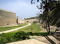
Fortifications

Harbor, in the background Nea Agora and on the left the Grand Master's Palace

View over the city center to the harbor


West side


Seen from Rhodes town, almost the entire west coast to Ialysos is a chain of hotels, discos and bars. In Trianda (1967 still a tranquil little village, which, according to its name, consisted of 30 still existing summer villas on the coastal road) you can turn to Filerimos, a complex of the Italian Franciscans , and the ruins of Ialysos.
In the north-west of the island, somewhat inward, is the Valley of the Butterflies (πεταλούδες, Petaloudes ), which can be visited for an admission fee. The Russian bear , also known as the Spanish flag (Euplagia quadripunctaria), which belongs to the bear moth family, can be found in large numbers in this valley . The reason for this is that this valley is populated by an important occurrence of the oriental sweetgum tree (Liquidambar orientalis) , the resinous smell of which attracts butterflies. The dotted harlequin can be recognized by its bright red color on the underside of the wing. The population has decreased drastically in the last few years, as the moths did not rest during the day due to the tourists in order to collect the necessary energy for the nocturnal mating.
Also on the west side of the island are the ruins of the city of Kameiros .
Further south, directly on the coast, is one of the three points at which the Johanniter defended their island. The ruins of Monolithos with the remains of the old castle, which later housed a monastery , are located on a dome of the rock, the rock walls of which rise up to 240 m . There is still a small chapel there .
East Side


The center of tourism is on the east side of the island. The reason for this is the climatic conditions, as there is much stronger wind and stronger waves on the west side.
On the east coast south of Rhodes town are the thermal baths of Kallithea , which were reconstructed and reopened in summer 2007. A little further south is the region around Faliraki , the stronghold of tourism. The place still consisted of a small village in 1970. The city has nothing to offer for visitors interested in culture and history.
One of the most visited attractions on the island is the town of Lindos with the Acropolis . It is the most visited Greece after the Acropolis of Athens . The numerous captains' houses and the Marienkirche with numerous frescoes are worth seeing .
The coastal road to the south is followed by holiday resorts ( Kolymbia , Gennadi ). In Kattavia you have reached the junction to Prasonisi , a peninsula that is connected to the southern end of the island of Rhodes via a sandbank sometimes washed over by the sea .
See also
literature
geology
- Ulrich Linse : The island of Rhodes (Greece). Geological stratigraphy and political strategy. Two hundred and fifty years of research history (1761–2008). Publishing house Documenta Naturae, Munich 2008, ISBN 978-3-86544-552-0 .
Flora and fauna
- Thomas Bader, Christoph Riegler, Heinz Grillitsch: The herpetofauna of the Island of Rhodes (Dodecanese, Greece) / Die Herpetofauna der Insel Rhodes (Dodecanese, Greece). In: Herpetozoa. 21 (2009), pp. 147-169. ( online, PDF ).
- Michael Hassler, Bernd Schmitt: Flora of Rhodes. ( online ).
swell
- Leza M. Uffer (Ed.): Peter Füesslis Jerusalemfahrt 1523 and letter about the fall of Rhodos 1522. In: Mitteilungen der Antiquarian Gesellschaft in Zürich. 50/3, 1982.
history
- Χριστόδουλος Παπαχριστοδούλου: Ιστορία τής Ρόδου: Από τούς προϊστορικούς χρόνους κέωας τδω ενωω ευτς (σοω ενωω ευτς (Δσω48η). Δέμοδ Ρόδου, Σεγέ Γαμματόν καί Τεχόν Δώδεκανήσου, Αθήνα 1994. ( Σείρα αυτότελόν εκδορεόν. Αρ. 1). Christódoulos Papachristodoúlou: History of Rhodes. From prehistory to the incorporation of the Dodecanese. ( Enosis , 1948). Athens 1994, ISBN 960-85568-0-5 .
- Mario Benzi: Rodi e la civiltà micenea. In: Incunabula Graeca. 94, Gruppo Ed. Internazionale, Rome 1992 ISSN 0073-5752 .
- Hans-Ulrich Wiemer : War, trade and piracy. Studies on the history of the Hellenistic Rhodes. Akademie-Verlag, Berlin 2002, ISBN 3-05-003751-2 ( Klio. Supplement. New Part 6) (partially also: Habilitation thesis , Marburg 2000).
- Richard M. Berthold: Rhodes in the Hellenistic Age. Cornell University Press, 2009.
- Hatto H. Schmitt : Rome and Rhodes. History of their political relations from the first contact to the rise of the island state in the Roman Empire (= Munich contributions to papyrus research and ancient legal history. 40), Beck, Munich 1957 (Zugl .: Diss. Munich 1955).
- Nicolas Vatin: Rhodes et l'Ordre de Saint-Jean-de-Jérusalem. CNRS éditions, Paris 2000, ISBN 2-271-05545-8 .
- Elias Kollias: The Knights of Rhodes. The palace and the city. The medieval city of Rhodes, UNESCO World Heritage Site 1988. Ektodike Athenon, Athens 1991, ISBN 960-213-255-8 .
- Jürgen Sarnowsky : Power and rule in the Order of St. John of the 15th century. Constitution and administration of the Johanniter on Rhodes (1421–1522). Lit, Münster u. a. 2001, ISBN 3-8258-5481-7 .
- Andreas Burtscher: About the conquest and loss of the beautiful island of Rhodes. The siege of Rhodes by the Ottomans in 1522. Diplomica, Hamburg 2014.
- Leonardo Ciacci: Rodi italiana 1912–1923. Marsilio, Venice 1991, ISBN 88-317-5581-1 .
- Esther Fintz Menascé: Gli Ebrei a Rodi. Storia di un'antica comunità annientata dai nazisti. 2nd Edition. Guerini e associati, Milan 2000, ISBN 88-7802-312-4 .
Web links
Individual evidence
- ^ Concise statistical yearbook of Greece. 2009. Piraeus 2010. PDF.
- ↑ a b c Results of the 2011 census, Greek Statistical Office (ΕΛ.ΣΤΑΤ). ( Memento from June 27, 2015 in the Internet Archive ). (Excel document, 2.6 MB).
- ^ E. Robertson: Notes on Javan. In: The Jewish Quarterly Review. 20, 1908, p. 473.
- ^ Toula Marketou: Time and Space in the Middle Bronze Age Aegean World. Ialysos (Rhodes), a gateway to the Eastern Mediterranean. In: Stella Souvatzi, Athena Hadji (Ed.): Space and Time in Mediterranean Prehistory. Routledge, 2013, pp. 176-195, here: p. 176.
- ^ M. Foundoulakis: Neolithic skeletal remains from the Kalythies cave, Rhodes. In: Søren Dietz, Ioannis Papachristodoulou (Ed.): Archeology in the Dodecanese. Copenhagen 1988, p. 17 ff.
- ↑ This and the following from: CB Mee, Ellen E. Rice: Rhodes. In: The Oxford Companion to Classical Civilization. Oxford University Press, 2014, p. 662 f.
- ^ Szaivert, Sear: Greek coin catalog . Volume 2, Munich 1983, pages 187 to 189
- ^ Michael Rostovtzeff: Social and economic history of the Hellenistic world. Vol. 2, Darmstadt 1998, p. 610 ff.
- ↑ Gereon Siebigs: Emperor Leo I: The Eastern Roman Empire in the first three years of his reign (457–460 AD). Walter de Gruyter, 2010, p. 272 f.
- ↑ Klaus-Peter Matschke : The cross and the half moon. The history of the Turkish wars. Artemis & Winkler, Düsseldorf / Zurich 2004, p. 32 f.
- ↑ Emile Y. Kolodny: Une comunauté insulaire en Méditerranée orientale: les Turcs de Chypre. In: Revue de geographie de Lyon. 46.1 (1971) 5-56, here: p. 18 ( online ).
- ↑ Hellasfreunde Bern: Bulletin 2/2009 September 2009 (PDF; 2.3 MB), accessed on April 27, 2011.
- ↑ Götz Aly : Hitler's People's State. Robbery, Race War and National Socialism. With an afterword: answer to the criticism . Fischer Taschenbuch Verlag , Frankfurt am Main 2006, p. 299-308 .
- ↑ Krystyna Boratyńska, Adam Boratyński: Distribution of Liquidambar orientalis Miller on Rhodes Iceland. In: Arboretum Kórnickie. Volume 29, pp. 3-11.