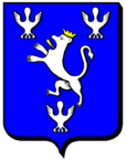
Théding
| Théding | ||
|---|---|---|

|
|
|
| region | Grand Est | |
| Department | Moselle | |
| Arrondissement | Forbach-Boulay-Moselle | |
| Canton | Stiring coil | |
| Community association | Forbach Porte de France | |
| Coordinates | 49 ° 8 ' N , 6 ° 54' E | |
| height | 223-378 m | |
| surface | 8.13 km 2 | |
| Residents | 2,501 (January 1, 2017) | |
| Population density | 308 inhabitants / km 2 | |
| Post Code | 57450 | |
| INSEE code | 57669 | |
| Website | http://www.theding.fr/ | |
 Sainte-Marguerite Church |
||
Théding (German Thedingen ) is a French commune with 2501 inhabitants (as of January 1, 2017) in the Moselle department in the Grand Est region (until 2015 Lorraine ). It belongs to the Forbach-Boulay-Moselle arrondissement .
geography
The municipality is located in the north of the historic Lorraine region near the border with Germany , five kilometers south of Forbach .
history
The community was first mentioned in 1252 as Tatinga or Tetinga , other names were Theitinga (1275), Thetingen (1324) and Thedingen (1429).
Population development
| year | 1962 | 1968 | 1975 | 1982 | 1990 | 1999 | 2009 |
| Residents | 1,127 | 1,559 | 1,561 | 1,761 | 2,059 | 2.132 | 2,433 |
Attractions
- Sainte-Marguerite Church from 1765.
Web links
Commons : Théding - collection of images, videos and audio files
