
Saarlouis district
| coat of arms | Germany map |
|---|---|

|

Coordinates: 49 ° 22 ' N , 6 ° 47' E |
| Basic data | |
| State : | Saarland |
| Administrative headquarters : | Saarlouis |
| Area : | 459.05 km 2 |
| Residents: | 194,319 (Dec. 31, 2019) |
| Population density : | 423 inhabitants per km 2 |
| License plate : | SLS |
| Circle key : | 10 0 44 |
| NUTS : | DEC04 |
| Circle structure: | 13 municipalities |
| Address of the district administration: |
Kaiser-Wilhelm-Strasse 4-6 66740 Saarlouis |
| Website : | |
| District Administrator : | Patrik Lauer ( SPD ) |
| Location of the Saarlouis district in Saarland | |
  |
|
The district Saarlouis [ zaːrlʊɪ ] is the most populous district of the Saarland , if the regional association Saarbruecken not count. It covers the southwest and the center of the country.
geography
Rivers
The most important rivers in the district are the Saar , which flows through the district northwest towards Trier from the southeast , and the Prims , which enters the district from the northeast and flows into the Saar in Dillingen.
Neighboring areas
The district borders in a clockwise direction in the northwest on the districts of Merzig-Wadern , St. Wendel and Neunkirchen as well as the Saarbrücken regional association and the French department of Moselle .
history


.JPG)
The area of today's Saarlouis district belonged to several principalities of the Holy Roman Empire from the Middle Ages to the 17th century : The areas of the district around Saarlouis belonged mainly to the German-speaking part of the Duchy of Lorraine . Wallerfangen was the capital of this administrative district called Deutsches Bellistum . Some areas to the right of the Saar belonged to smaller lordships, some of which belonged to condominiums that were subordinate to the Duke of Lorraine , the Count of Saarbrücken or the Elector of Trier . The Fraulautern and Wadgassen abbeys also had their own rulers .
When the city of Saarlouis was founded in 1680, it became an exclave of France with some surrounding towns . Wallerfangen was destroyed for the construction of the fortress, which is why the seat of the German Bellistum was relocated to Saargemünd .
After the death of the last duke in 1766, Lorraine fell to France. The villages of Überherrn and Friedrichweiler , which previously belonged to Nassau-Saarbrücken , also became French.
The French Revolution quickly reached the Saar as well. Saarlouis was renamed Sarre-Libre ("free Saar") and became the seat of a canton in the Moselle department . The area around Lebach formed its own canton in the Département de la Sarre .
After Napoleon's defeat , the area around Saarlouis fell to Prussia . The Saarlouis district was founded by the Prussians in 1816 and belonged to the Trier administrative district of the Rhine province for over a hundred years (until 1822 the province of the Grand Duchy of Lower Rhine ). The former borders of the district largely coincide with today's.
In the 20th century, the district reflected the history of the Saarland : in 1920 it came to the Saar area , which was administered by the League of Nations . After the referendum of January 13, 1935, the Saar area became part of the German Reich again on March 1, 1935 . Between the seizure of power of the Nazis in 1933 in the German Reich and the referendum in 1935, the district Saarlouis like the rest of the Saar region an important hub for German refugees from Nazi persecution, as well as the smuggling of anti-racist propaganda to the German Reich was. The National Socialists named Saarlouis Saarlautern in order not to remember the time of French rule. From 1947 to 1956 the Saarlouis district was part of the French Saar Protectorate and since 1957 it has belonged to the Federal Republic of Germany as part of the Saarland.
During the regional and administrative reform in Saarland in 1974 , the district was enlarged:
- The communities of Aschbach , Dörsdorf , Steinbach and Thalexweiler from the Ottweiler district became part of the city of Lebach in the Saarlouis district.
- The municipality of Michelbach from the Merzig-Wadern district became part of the Schmelz municipality in the Saarlouis district.
Population development
| year | Residents | source |
|---|---|---|
| 1816 | 32.001 | |
| 1847 | 47.174 | |
| 1871 | 60,052 | |
| 1885 | 70.104 | |
| 1900 | 89,535 | |
| 1910 | 113.025 | |
| 1939 | 148.271 | |
| 1960 | 183,400 | |
| 1970 | 203,700 | |
| 1980 | 208,100 | |
| 1990 | 213,000 | |
| 2000 | 211,700 | |
| 2010 | 203,308 |
religion
The vast majority of the population is Catholic. Each civil parish in the district has at least one Roman Catholic parish. All parishes belong to the Diocese of Trier , which has maintained the deaneries of Dillingen, Saarlouis and Wadgassen in the district since 2004 . With the Dillinger Saardom , the largest church in Saarland is located in the Saarlouis district.
The evangelical population of the district has belonged to the Evangelical Church in Prussia since 1817 (renamed the Evangelical Church of the Old Prussian Union from 1922 ; APU) and there since 1922 to the Church Province of the Rhine Province, with the Provincial Consistory in Koblenz . In 1947 the formerly old Prussian church province became independent as the Evangelical Church in the Rhineland , to which the Evangelical parishes in the district are now assigned.
In the area of Christian groups, there are still free church communities (Dillingen, Lebach, Saarlouis-Steinrausch), Jehovah's Witnesses (Saarlouis-Steinrausch) and New Apostolic communities (Dillingen, Saarwellingen, Wallerfangen etc.).
The Muslims maintain a mosque in Dillingen, among other places.
The formerly rich Jewish life was gradually destroyed by the National Socialist terror between the annexation ("re-organization") of the Saarland to Germany on March 1, 1935 and the end of Nazi rule. Before that, there were a number of synagogue communities in the district, the largest of which was Saarwellingen with its synagogue, schoolhouse in Engelgasse and its cemetery in Schliefgasse. Today there are again some Jews living in the district who belong to the Saar synagogue community.
politics
District council
The district elections on May 26, 2019 led to the result shown on the right and the following distribution of seats:
- Overview of the results of past district council elections
| Parties and constituencies | % 2019 |
Seats 2019 |
% 2014 |
Seats 2014 |
% 2009 |
Seats 2009 |
% 2004 |
Seats 2004 |
% 1999 |
Seats 1999 |
% 1994 |
% 1989 |
% 1984 |
|
|---|---|---|---|---|---|---|---|---|---|---|---|---|---|---|
| CDU | Christian Democratic Union of Germany | 34.4 | 12 | 37.4 | 14th | 36.3 | 15th | 45.4 | 19th | 44.7 | 20th | 37.4 | 36.0 | 44.6 |
| SPD | Social Democratic Party of Germany | 32.4 | 11 | 36.3 | 14th | 30.9 | 13 | 37.1 | 16 | 44.4 | 19th | 43.4 | 43.0 | 42.5 |
| GREEN | Alliance 90 / The Greens | 12.3 | 4th | 6.2 | 2 | 7.1 | 2 | 5.3 | 2 | 4.1 | 0 | 7.5 | 4.9 | 5.3 |
| AfD | Alternative for Germany | 8.8 | 3 | 5.0 | 1 | - | - | - | - | - | - | - | - | - |
| THE LEFT | THE LEFT | 7.8 | 2 | 6.6 | 2 | 13.0 | 5 | 2.4 | 0 | - | - | - | - | - |
| FDP | Free Democratic Party | 4.3 | 1 | 2.2 | 0 | 8.1 | 3 | 3.8 | 0 | 2.0 | 0 | 3.2 | 4.1 | 4.3 |
| FWG | Free group of voters | - | - | 2.5 | 0 | 2.5 | 1 | - | - | - | - | - | - | - |
| PIRATES | Pirate Party Germany | - | - | 2.2 | 0 | - | - | - | - | - | - | - | - | - |
| NPD | National Democratic Party of Germany | - | - | 1.5 | 0 | - | - | - | - | - | - | - | 0.6 | - |
| FW / FWG | Free group of voters | - | - | - | - | 2.2 | 0 | 6.0 | 2 | 4.7 | 0 | 5.0 | 2.3 | 2.5 |
| REP | The Republicans | - | - | - | - | - | - | - | - | - | - | 3.6 | 7.2 | - |
| total | 100 | 33 | 100 | 33 | 100 | 39 | 100 | 39 | 100 | 39 | 100 | 100 | 100 | |
| voter turnout | 65.0% | 52.8% | 58.7% | 57.8% | 60.8% | 75.5% | 80.3% | 80.0% | ||||||
In August 2019, a rainbow coalition made up of the SPD, the Greens, the Left and the FDP replaced the grand coalition of the SPD and CDU that had existed since the 2014 local elections.
District administrators
- 1816–1821 Jakob Christian Schmeltzer (official title "Landkommissar")
- 1821–1849 Joseph Jesse
- 1849–1851 Johann Saurborn (acting)
- 1851–1874 Heinrich Friedrich von Selasinsky
- 1874 Rudolph Fehres (acting)
- 1874-1881 Prosper Devens
- 1881 Nicolas Adolphe de Galhau (acting)
- 1881–1882 Otto von Dewitz (acting)
- 1882-1888 August of Harlem
- 1888–1890 Ludwig von Renvers
- 1890–1905 André Helfferich
- 1905–1918 Hans Schütz von Leerodt
- 1917–1919 Heinrich Schellen
- 1919–1920 Alfred von Boch
- 1920–1923 Julius Anton
- 1922–1935 Wilhelm Arweiler
- 1935–1945 Franz Schmitt
- 1945–1946 Hans Drehsen
- 1946–1956 Alfons Diwo
- 1956–1960 Erasmus Schmidt
- 1960–1985 August Riotte, CDU
- 1985–2004 Peter Winter, SPD
- 2004–2011 Monika Bachmann , CDU
- 2012– Patrik Lauer , SPD
coat of arms
- The coats of arms of important historical rulers in the Saarlouis district

Coat of arms of the Duchy of Lorraine with the three mutilated silver eagles

Lily coat of arms of the Kingdom of France

Coat of arms of the Hohenzollern with the Zollernvierung in silver and black

.svg)

The golden (yellow) coat of arms of the Saarlouis district is covered with a red sloping bar on which there are three silver (white) mutilated eagles of the Duchy of Lorraine , as the district was a historical part of the old duchy.
A lily hovers over the sloping beam in Lorraine . It is part of the city arms of Saarlouis and refers to the founding of Saarlouis by King Ludwig XIV. According to a legend that emerged in the Middle Ages, his predecessor and namesake Clovis I was supposed to have the lily of an angel descended from heaven after the battle of Zülpich ( 496) and this miracle is said to have brought about the conversion of the previously pagan Franconian ruler to the Catholic faith.
Under the Lorraine sloping beam is an eight-pointed star, which symbolically embodies the origins of the city of Saarlouis as a star-shaped French fortress. The lily and the star are blue.
The head of the shield is quartered in black and silver (white) fields. This part of the coat of arms represents the Hohenzollern dynasty , who incorporated the district area into the Kingdom of Prussia in 1815 . With the entry into force of the Versailles Treaty on January 10, 1920, the district was separated from what was then the Free State of Prussia .
Economy and Infrastructure
In the Future Atlas 2016 , the Saarlouis district was ranked 250th out of 402 districts, municipal associations and independent cities in Germany, making it one of the regions with a "balanced risk-opportunity mix" for the future. In May 2018 the unemployment rate in the district was 4.6%.
traffic
The most important national road in the district is the A 8 motorway (Luxembourg – Saarlouis – Pirmasens) and the A 620 that branches off at the Saarlouis triangle . The Saarlouis district can be reached directly by plane via the Saarlouis-Düren airport and indirectly via the Saarbrücken , Luxembourg and Metz airports .
The most important railway line is the Saar line Trier-Saarbrücken.
The network of trams and small railways in the Saarlouis district was also extensive .
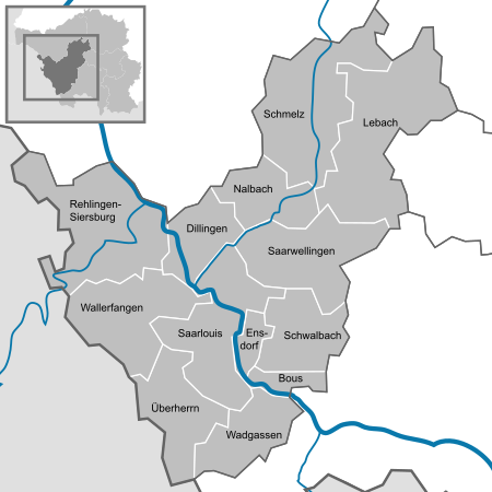
Communities

(Residents on December 31, 2019)
|
|
The largest city in the district is the district town of Saarlouis, while the smallest municipality is Ensdorf.
Former parishes
Most of the former municipalities in the district lost their independence on January 1, 1974 as part of a regional reform in the Saarland :
- Eidenborn , Falscheid , Gresaubach , Knorscheid , Landsweiler and Niedersaubach became part of the city of Lebach.
- Bilsdorf , Körprich and Piesbach became part of the Nalbach community.
- Biringen , Eimersdorf , Fremersdorf , Fürweiler , Gerlfangen , Hemmersdorf , Niedaltdorf , Oberesch , Rehlingen and Siersburg became part of the municipality of Rehlingen-Siersburg.
- Reisbach and Schwarzenholz became part of the Saarwellingen community.
- Dorf , Hüttersdorf , Limbach and Primsweiler became part of the community of Schmelz.
- Elm and Hülzweiler became part of the Schwalbach community.
- Altforweiler , Berus , Bisten and Felsberg became part of the municipality of Überherrn.
- Differten , Hostenbach , Schaffhausen and Werbeln became part of the municipality of Wadgassen.
- Bedersdorf , Düren , Gisingen , Ihn , Ittersdorf , Kerlingen , Leidingen , Rammelfangen and St. Barbara became part of the Wallerfangen community.
A number of municipalities had already lost their independence before 1974:
|
|
education
Elementary schools
- Roman school leases
- Philipp Schmitt School in Dillingen
- Odilienschule Dillingen
- Primsschule Dieffeln
- Landsweiler primary school
- Lebach primary school
- Elementary school Steinbach
- Nikolaus-Groß-Schule Lebach
- Elementary and all-day primary school "Im Vogelsang" Saarlouis
- Elementary school Römerberg Roden
- Primary school "In the old monastery" Fraulautern
- Elementary school Steinrausch
- Elementary school Prof. Ecker Lisdorf
- Elementary school in the Beaumarais Bruchwiesen
- Elementary School Bous
- Elementary School Ensdorf
- Elementary school Nalbach
- Niedschule Hemmersdorf
- Rehlingen primary school
- Elementary school Gutberg Saarwellingen
- Astrid Lindgren School Reisbach
- Stefanschule Schmelz with its Limbach branch
- Johannesschule Hüttersdorf
- Kirchberg School Schwalbach
- Bachtal School Elm
- Laurentius School Hülzweiler
- St. Oranna Berus
- St. Boniface Überherrn
- Wallerfangen primary school
- Gisingen primary school
Community schools
- School at the Roman fort in Dillingen
- Sophie Scholl Community School Dillingen
- Theeltal School Lebach
- Nikolaus-Groß-Schule Lebach
- Saarlouis Community School "In the Tiles"
- Martin Luther King School Saarlouis
- Community school Wadgassen-Bous
- Johannes Gutenberg School Schwalbach
- School at the Litermont Nalbach
- Lothar Kahn School in Rehlingen
- School at the Waldwies Saarwellingen
- Kettelerschule Schmelz
- Johannes Gutenberg School Schwalbach
- School at the Warndtwald Überherrn
- Primary school in the Bisttal Differten
- Hostenbach-Schaffhausen primary school
- Bisttalschule Wadgassen / Bous
- School at Limberg, Wallerfangen
High schools
- Albert-Schweitzer-Gymnasium Dillingen
- Technical and scientific high school in Dillingen
- Geschwister-Scholl-Gymnasium Lebach
- Johannes-Kepler-Gymnasium Lebach
- Gymnasium at Saarlouis Stadtgarten
- Max Planck Gymnasium Saarlouis
- Robert-Schuman-Gymnasium Saarlouis
Vocational schools
- KBBZ Dillingen
- TGBBZ Dillingen
- BBZ Lebach
- KBBZ Saarlouis
- TGSBBZ Saarlouis
- Nursing school DRK hospital Saarlouis
Special schools
- AWO-Förderschule intellectual development leases
- Anne Frank School Saarlouis
- District special school G Saarwellingen
- State special school for social development Wallerfangen
Protected areas
There are 23 designated nature reserves in the district (as of February 2017).
License Plate
On January 1, 1957, when the Saarland joined the Federal Republic of Germany, the district was assigned the distinctive sign SLS . It is still issued today.
See also
literature
- Anton Delges: Origin of the Saarlouis district, in: Local history yearbook of the Saarlouis district, 1966, Saarlouis 1966, pp. 63–129.
- Jo Enzweiler (Ed.): Art in Public Space Saarland, Saarlouis District, Saarbrücken 2009.
- Hilde Hoherz: Good housewives for the national economy, women's work in the late 19th and early 20th centuries using examples from the Saarlouis district (Schriften des Landkreis Saarlouis, vol. 2), St. Ingbert 1994.
- Werner Müller: The Jewish minority in the Saarlouis district, political, socio-economic and cultural aspects of their living situation from the Ancien Régime to National Socialism (writings of the Saarlouis district 1), St. Ingbert 1993.
- H. Niessen: History of the Saarlouis district, 2 volumes, Saarlouis 1893 and 1897.
- Alois Prediger: History of the Saarlouis district. Volume 1: 1815-1848, Saarlouis 1997. Volume 2: 1848-1890, Saarlouis 2004.
- Klaus Ries: The political movement, 1. The Prussian Saarkkreis, in: Johannes Schmitt (ed.): Restoration and Revolution, The Saar region between 1815 and 1850 (sources and materials on Saarland history 3), Saarbrücken 1990, pp. 61–89 .
- Saar Research Association (Hrsg.): The art monuments of the Ottweiler and Saarlouis districts, edited by Walter Zimmermann. 2nd, unchanged edition from 1934, Saarbrücken 1976.
- Johannes Schmitt (Ed.): Revolutionary Traces ..., Contributions of the Saarlouiser Geschichtswerkstatt to the French Revolution in the Saarlouis area, Saarbrücken 1991.
Web links
- Official website of the Saarlouis district
- Literature on the Saarlouis district in the Saarland Bibliography
Individual evidence
- ↑ Saarland.de - Official population figures as of December 31, 2019 (PDF; 20 kB) ( help ).
- ↑ Against forgetting - places of Nazi terror and resistance in the Saarlouis district (PDF; 1.9 MB), Action 3rd World Saar and Association for Local History in the Saarlouis District eV , December 2012.
- ^ Federal Statistical Office (ed.): Historical municipality directory for the Federal Republic of Germany. Name, border and key number changes in municipalities, counties and administrative districts from May 27, 1970 to December 31, 1982 . W. Kohlhammer, Stuttgart / Mainz 1983, ISBN 3-17-003263-1 , p. 807 f .
- ^ Contributions to the statistics of the Königl. Prussian Rhineland. 1829, p. 20 , accessed November 11, 2017 .
- ^ Description of the administrative district of Trier. 1849, p. 297 , accessed November 11, 2017 .
- ↑ a b Community encyclopedia for the Kingdom of Prussia 1885
- ↑ a b c d Michael Rademacher: German administrative history from the unification of the empire in 1871 to the reunification in 1990. saarlouis.html. (Online material for the dissertation, Osnabrück 2006).
- ↑ Statistical Yearbook for the Federal Republic of Germany 1972
- ↑ Statistical Yearbook for the Federal Republic of Germany 1981
- ↑ Statistical Yearbook for the Federal Republic of Germany 1992
- ↑ Statistical Yearbook for the Federal Republic of Germany 2002
- ^ District elections 1984 to 2009 in Saarland by district
- ↑ District results of Saarlouis LK 2019
- ↑ New colors in the Saarlouis district assembly are red-green-red-yellow , Saarbrücker Zeitung from August 12, 2019
- ↑ Future Atlas 2016. Archived from the original on October 2, 2017 ; accessed on March 23, 2018 .
- ↑ Saarbrücker Zeitung, C 2, Local, Friday, June 1, 2018, article "Good conditions for the job market"
- ↑ Saarland.de - Official population figures as of December 31, 2019 (PDF; 20 kB) ( help ).