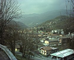
Sant'Omobono Terme
| Sant'Omobono Terme | ||
|---|---|---|

|
|
|
| Country | Italy | |
| region | Lombardy | |
| province | Bergamo (BG) | |
| Local name | Sant Imbù | |
| Coordinates | 45 ° 49 ' N , 9 ° 32' E | |
| height | 427 m slm | |
| surface | 15.8 km² | |
| Residents | 3,892 (Dec 31, 2019) | |
| Population density | 246 inhabitants / km² | |
| Post Code | 24038 | |
| prefix | 035 | |
| ISTAT number | 016252 | |
| Popular name | Santomobonesi | |
| Patron saint | Omobono Tucenghi (November 13th) | |
| Website | Sant'Omobono Terme | |
Sant'Omobono Terme is a northern Italian municipality ( comune ) with 3892 inhabitants (as of December 31, 2019) in the province of Bergamo in Lombardy . Until 2004 the municipality was still called Sant'Omobono Imagna . It is located in the Imagna Valley, about 17 kilometers northwest of Bergamo . The municipality is an amalgamation of the localities of Cepino, Mazzoleni, Selino Alto and Selino Basso. On January 21, 2014, Valsecca was incorporated into Sant'Omobono Terme.
Web links
Commons : Sant'Omobono Terme - collection of images, videos and audio files
- Sant'Omobono Terme on the ETHorama platform
Individual evidence
- ↑ Statistiche demografiche ISTAT. Monthly population statistics of the Istituto Nazionale di Statistica , as of December 31 of 2019.


