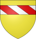
Vitrac (Dordogne)
| Vitrac | ||
|---|---|---|

|
|
|
| region | Nouvelle-Aquitaine | |
| Department | Dordogne | |
| Arrondissement | Sarlat-la-Canéda | |
| Canton | Sarlat-la-Canéda | |
| Community association | Sarlat-Black Perigord | |
| Coordinates | 44 ° 50 ′ N , 1 ° 14 ′ E | |
| height | 60–243 m | |
| surface | 14.38 km 2 | |
| Residents | 800 (January 1, 2017) | |
| Population density | 56 inhabitants / km 2 | |
| Post Code | 24200 | |
| INSEE code | 24587 | |
 The church of Vitrac |
||
Vitrac is a French commune of 800 inhabitants (at January 1, 2017), located in the department of Dordogne in the region Nouvelle-Aquitaine . The residents call themselves Vitracois.
geography
The municipality of Vitrac is located on the Dordogne in the Black Périgord , about seven kilometers south of Sarlat-la-Canéda and about 70 kilometers southeast of Périgueux and 60 kilometers southwest of Brive-la-Gaillarde . The municipality consists of two districts: Vitrac Bourg , spread over smaller hills, and Vitrac Port , located directly on the Dordogne.
Neighboring communities
| Sarlat-la-Canéda | ||
| Vezac |

|
Carsac-Aillac |
| Domme | La Roque-Gageac |
history
From 1998 to 2010 Vitrac was the seat of the Périgord Noir municipal association . After their merger with the Communauté de communes du Sarladais , the seat moved to Sarlat-La-Canéda.
Population development
| year | 1962 | 1968 | 1975 | 1982 | 1990 | 1999 | 2006 | 2016 |
| Residents | 570 | 550 | 622 | 631 | 743 | 768 | 831 | 803 |
Attractions
Individual evidence
- ↑ a b VITRAC en périgord. mairie-vitrac.pagesperso-orange.fr. Retrieved March 25, 2016.
- ↑ Où? Comment? mairie-vitrac.pagesperso-orange.fr. Retrieved March 25, 2016.
Web links
Commons : Vitrac - collection of images, videos and audio files
- Vitrac municipality on the Internet (French)
- Administration of the municipality (French)

