
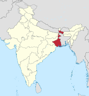
West Bengal
 |
|
| status | State |
| Capital | Calcutta |
| surface | 88,752 km² |
| Residents | 91,347,736 (2011) |
| Population density | 1,029 inhabitants per km² |
| languages | Bengali |
| governor | Jagdeep Dhankar |
| Chief Minister | Mamata Banerjee ( AITC ) |
| Website | http://westbengal.gov.in |
| ISO code | IN-WB |
 .svg) |
|
West Bengal ( Bengali : পশ্চিমবঙ্গ , Paścimbaṅga , Pashchimbanga ; English : West Bengal ) is an Indian state with an area of 88,752 km² and 91 million inhabitants (2011 census). The capital of West Bengal is Kolkata (Calcutta) in the south of the state. The predominant language in the state is Bengali .
In 2011, a consensus resolution of various political parties was passed to officially rename the state in Paschimbanga , also in English , according to the transcription from Bengali. The resolution has not yet been implemented consistently. In August 2016, the government of West Bengal decided that the state should simply be called Bengal (in Bengali: Bangla ) in future . A corresponding decision by Parliament is still pending (as of August 2016).
With a value of 0.620, West Bengal reached 21st place among the 29 states of India in the Human Development Index in 2015 .
geography
West Bengal borders the states of Odisha (southwest), Jharkhand (west), Bihar (northwest), Sikkim (north) and Assam (northeast), as well as Nepal to the northwest , Bhutan to the northeast, Bangladesh to the east and the to the south Bay of Bengal .
relief
The surface shape in West Bengal is dominated by the Indo-Ganges plain , with heights between 0 and 150 m . In the southwest are the peripheral areas of the Peninsular Plateaus with heights between 150 and 300 m. To the north of the plain, on the other hand, is the mountain range of the front Himalayas, which extends over 3000 m on the border with Sikkim . To the south there is a major marginal fault , followed by the foremost mountain range of the Himalayas, the Siwaliks . At the foot of this mountain range lies the Bharbar , formed by the erosion of the Siwaliks and the Terai , special swamps that carry water all year round.

climate


Due to the monsoons, West Bengal is largely subject to a warm tropical summer rain climate , partly semi-humid , partly semi-arid , with the exception of the northernmost districts, which are influenced by a subtropical , continental climate . The annual precipitation is below 2000 mm.
Average temperatures:
- January: 17–21 ° C depending on the region
- April: 27-30 ° C
Possible effects of global warming : Global warming is likely to have serious consequences for the flat-lying West Bengal. The country is already struggling with floods during the summer monsoon; a rise in sea level of only a few meters would result in catastrophic loss of land in the extremely flat relief.
Flora and fauna
The potential tree vegetation consists largely of deciduous, moist forests with dense vegetation . In the Front Himalayas you can find tall chestnuts and oaks , subtropical mountain and pine forests as well as damp mixed forests, but also conifers that are actually native to Siberia . Near the coast there are mangrove forests , which act as important breeding grounds for fish. The mangroves are also the retreat of the critically endangered King Tiger .
population
Demographics

According to the 2011 Indian census, the population of West Bengal is 91,347,736. This means that the state has more inhabitants than Germany. In terms of population, West Bengal is the fourth largest state in India after Uttar Pradesh , Maharashtra and Bihar . The population of West Bengal is steadily increasing. Between 2001 and 2011 the population grew by 13.9%. However, this value is somewhat below the overall Indian average of 17.6%. West Bengal is extremely densely populated: an average of 1,029 people live in one square kilometer. This is around two and a half times as much as the national average for India. Of the Indian states, only Bihar has a higher population density. 31.9% of the population of West Bengal live in cities. The urbanization rate thus corresponds to the average for India.
The literacy rate in West Bengal is 77.1% (men 82.7%, women 71.2%) and is therefore only slightly above the average of 74.0% for all of India (as of the 2011 census). In the period from 2010 to 2014, the average life expectancy was 70.2 years (the Indian average was 67.9 years). The fertility rate was 1.81 children per woman (as of 2016) while the Indian average was 2.23 children in the same year.
Most of the inhabitants of West Bengal belong to the Bengal people . In addition, Gurkha of Nepalese origin live in the state of Biharis in the Darjeeling district (required Gorkhaland autonomous region ) as well as various indigenous Adivasi tribes. The 2001 census classified 5.5 percent of the population as members of the tribes population ( scheduled tribes ). The largest tribal people in West Bengal are the Santal , with around 2.28 million members, followed by the Oraon (617,000), Munda (342,000), Bhumji (336,000) and another (as each census 2001).
Population development
West Bengal census population since the first Indian census in 1951.
| Census year | population |
|---|---|
| 1951 | 26,300,670 |
| 1961 | 34,926,000 |
| 1971 | 44.312.017 |
| 1981 | 54,580,650 |
| 1991 | 68,077,970 |
| 2001 | 80.221.300 |
| 2011 | 91,347,736 |
languages
| Languages in West Bengal | ||||
|---|---|---|---|---|
| language | percent | |||
| Bengali | 85.3% | |||
| Hindi | 7.2% | |||
| Santali | 2.8% | |||
| Urdu | 2.1% | |||
| Nepali | 1.3% | |||
| Other | 1.3% | |||
| Distribution of languages (2001 census) | ||||
The official language of West Bengal is Bengali . With around 200 million speakers in Bangladesh , West Bengal and neighboring areas, it is one of the ten largest languages in the world. According to the 2001 census, Bengali is spoken as the mother tongue of 85.3 percent of West Bengal's residents.
The largest linguistic minority are the Hindi speakers , who make up 7.2 percent of the population. For the most part, they are speakers of regional languages from the Bihari group, which is closely related to Hindi , and who are subsumed under the term Hindi in official statistics. Some Muslims also speak Urdu (2.1 percent), the Muslim variant of Hindi. Various languages are spoken among the tribal population, the largest of which is Santali (2.8 percent), which belongs to the group of Munda languages in the Austro-Asian language family . Nepali (1.3 percent) is also spoken in the Darjeeling district .
Religions
| Religions in West Bengal | ||||
|---|---|---|---|---|
| religion | percent | |||
| Hinduism | 70.5% | |||
| Islam | 27.0% | |||
| Other | 2.5% | |||
| Distribution of religions (2011 census) | ||||
The majority of West Bengal's population are Hindus . According to the 2011 census, they make up 70.5 percent of the state's population. There is also a large Muslim minority of 27 percent. After Assam , West Bengal has the second highest Muslim population of all Indian states, including the union territories of Jammu and Kashmir and Ladakh the fourth highest. In absolute numbers, West Bengal is home to almost 25 million Muslims, the second largest Muslim population in India after Uttar Pradesh. Other religions only play a subordinate role, but there are small minorities of Christians (0.7 percent) and Buddhists (0.3 percent).
Biggest cities
Status: 2011 census.
| city | Residents | city | Residents | ||
|---|---|---|---|---|---|
| 1 | Kolkata (Calcutta) | 4,486,679 | 8th | South Dum Dum | 410,524 |
| 2 | Haora (Howrah) | 1,072,161 | 9 | Rajarhat Gopalpur | 404.991 |
| 3 | Siliguri | 647,804 | 10 | Bhatpara | 390,467 |
| 4th | Durgapur | 566.937 | 11 | Panihati | 383,522 |
| 5 | Asansol | 564.491 | 12 | Kamarhati | 336,579 |
| 6th | Maheshtala | 449.423 | 13 | Bardhaman | 314,638 |
| 7th | Rajpur Sonarpur | 423,806 | 14th | Kulti | 313,977 |
history
In 1905, Bengal was divided in two by the English along the Hindu-Muslim religious line . The western part consisted roughly of today's Indian states West Bengal, Jharkhand , Orissa and Bihar . After popular protests, the English revised the division in 1912. Bihar - which at that time still included Jharkhand - and Orissa, however, remained independent provinces. When British India was granted independence in 1947, two states emerged, the predominantly Hindu India and the Muslim state Pakistan . Bengal was essentially divided along religious lines, the predominantly Muslim part came to Pakistan ("East Pakistan") and the part inhabited by Hindus became a federal state of India under the name "West Bengal". East Pakistan gained independence in 1971 under the name of Bangladesh . The second division of Bengal in 1947 roughly corresponded to the demarcation of 1905. In 1956, a boundary correction took place under the States Reorganization Act , in which Bengali-speaking neighboring districts in Bihar were annexed to West Bengal. The Bengal Provincial Railway operated here from 1890 to 1956.
Relations between India and Bangladesh were strained for many years, which was due to political differences. For many years, Bangladesh was under a military dictatorship and showed Islamist tendencies. India accused Bangladesh of providing shelter to terrorists and sealed off the border with a border fence several thousand kilometers long, also to protect itself against uncontrolled immigration from Bangladesh. There were several border battles between Indian and Bangladeshi police units at the border. Since around 2006, however, the relationship between the two countries has improved significantly and numerous bilateral agreements have been concluded. A high point was the Indian-Bangladeshi border treaty , which came into force on July 31, 2015 and which included an extensive exchange of areas to regulate the long-smoldering problem of the Indian-Bangladeshi enclaves in the area of the Koch Bihar district in West Bengal . The relaxation and cooperation with the neighboring country offers West Bengal new economic prospects.
Radical Marxist-Leninist rebels, the Naxalites , have been fighting in West Bengal since the 1960s .
politics
Political system

The parliament of West Bengal, the Vidhan Sabha , is a one-chamber parliament with 294 directly elected members. Another MP is appointed by the governor to represent the Anglo-Indian minority. A legislative period lasts 5 years. The Chief Minister , West Bengal's head of government, is elected by the MPs. But appointed by the President of India Governor (is formally at the head of the State Governor ). Its main tasks are to appoint the Chief Minister and to entrust him with the formation of the government. The ministers are also appointed by the governor on the recommendation of the chief minister . In addition, the governor is responsible for dissolving parliament at the end of the legislative period or in the event of a government crisis. In this case he can put the state under the direct administration of the Indian President (" President's rule ").
The Calcutta High Court in Calcutta is the highest legal instance for the state of West Bengal and the union territory of the Andaman and Nicobar Islands .
Parties
| Distribution of seats after the 2016 general election |
|
|---|---|
| Trinamool | 211 |
| congress | 44 |
| CPI (M) | 26th |
| BJP | 3 |
| RSP | 3 |
| GJM | 3 |
| AIFB | 2 |
| CPI | 1 |
| Independent | 1 |
| Anglo-Indians | 1 |
| total | 295 |
West Bengal was a communist stronghold for a long time . The Communist Party of India (Marxist) (CPI (M)) ruled uninterruptedly from 1977 to 2011. This gave the state the longest running democratically elected communist government in the world. Jyoti Basu (Chief Minister from 1977 to 2000) has been in office for 23 years and is still the longest serving Chief Minister of an Indian state. The political landscape of the state has changed since about 2000 and is shaped by the continuous rise of the All India Trinamool Congress (AITC), a regional party that was formed in 1997 under the leadership of politician Mamata Banerjee as a split from the Indian National Congress . In the 2011 state election, the AITC won an absolute majority of the seats and ended the three-decade rule of the CPI (M). In the subsequent election to the West Bengal parliament in 2016, the AITC was able to increase its share of votes and mandates and achieved a two-thirds majority in parliament. The communists fell to an all-time low and only came third behind the Congress party.
economy
With a per capita gross domestic product of 70,059 rupees (1,532 US dollars ) in 2015, West Bengal was ranked 17th out of 29 Indian states. The state's development indicators are thus slightly below the Indian average.
An industrial economy exists mainly in the regional economic center of Calcutta. The rest of West Bengal is still heavily agricultural. The state is, among other things, a center for the cultivation of tea and jute .
Administrative division


West Bengal is divided into the three divisions Bardhaman , Jalpaiguri and Presidency as well as the following districts (population and population density according to the 2011 census):
| District | Administrative headquarters | Area (km²) |
Residents | Population density ( inhabitants / km² ) |
|
|---|---|---|---|---|---|
| 01 | Darjeeling | Darjeeling | 3.149 | 1,842,034 | 595 |
| 02 | Jalpaiguri ** | Jalpaiguri | 3,386 | 2,381,596 | 703 |
| 03 | Chef Bihar | Chef Bihar | 3,387 | 2,822,780 | 833 |
| 04 | Uttar Dinajpur | Raiganj | 3,140 | 3,000,849 | 956 |
| 05 | Dakshin Dinajpur | Balurghat | 2,219 | 1,670,931 | 753 |
| 06 | Malda | English Bazaar | 3,733 | 3,997,970 | 1,071 |
| 07 | Birbhum | Suri | 4,545 | 3,502,387 | 771 |
| 08 | Murshidabad | Baharampur | 5,324 | 7.102.430 | 1,334 |
| 09 | Bardhaman | Bardhaman | 7,024 | 7,723,663 | 1,100 |
| 10 | Nadia | Krishnanagar | 3,927 | 5,168,488 | 1,361 |
| 11 | Purulia | Purulia | 6,259 | 2,927,965 | 468 |
| 12 | Bankura | Bankura | 6,882 | 3,596,292 | 523 |
| 13 | Hugli | Hugli-Chunchura | 3.149 | 5,520,389 | 1,753 |
| 14th | Uttar 24 Pargana | Barasat | 4,094 | 10,082,852 | 2,463 |
| 15th | Pashchim Medinipur | Medinipur | 9,345 | 5,943,300 | 636 |
| 16 | Haora | Haora | 1,467 | 4,841,638 | 3,300 |
| 17th | Calcutta | Calcutta | 185 | 4,486,679 | 24,252 |
| 18th | Dakshin 24 Pargana | Alipur | 9,960 | 8,153,176 | 819 |
| 19th | Purba Medinipur | Tamluk | 4,736 | 5,094,238 | 1,076 |
| 20th | Kalimpong * | Kalimpong | 2,567 | ||
| 21st | Alipurduar * | Alipurduar | |||
| 22nd | Pashchim Bardhaman * | ||||
| 23 | Jhargram * | Jhargram |
*) Newly founded after the 2011 census.
**) Downsized after the 2011 census due to the separation of new districts, figures refer to the district within the boundaries of 2016.
Web links
Individual evidence
- ↑ a b Census of India 2011: Distribution of population, sex ratio, density and decadal growth rate of population: 2011 ( Memento of April 9, 2011 in the Internet Archive )
- ↑ West Bengal to be renamed Paschimbanga. The Times of India, August 19, 2011, accessed May 19, 2016 .
- ↑ Bangla or Banga? Mamata holds impromptu referendum at public rally. The Hindu, August 26, 2016, accessed August 26, 2016 .
- ^ Sub-national HDI - Area Database - Global Data Lab. Retrieved August 12, 2018 .
- ^ Census of India 2011: Provisional Population Totals - India - Rural-Urban Distribution. (PDF file; 7.74 MB)
- ↑ Census of India 2011: Literates and literacy rates by sex: 2011. ( Memento of April 9, 2011 in the Internet Archive )
- ^ Indian States by Life Expectancy 2010-2014. Retrieved March 19, 2018 .
- ^ Fertility Rates. Retrieved March 19, 2018 .
- ^ Census of India 2001: West Bengal. Data highlights: The Scheduled Tribes. (PDF file; 32 kB)
- ^ Population of Indian States | Indian states population 1901-2011 - StatisticsTimes.com. Retrieved March 19, 2018 .
- ↑ Indian census 2001
- ↑ Census of India 2011: Population by religious community.
- ^ Census of India 2011: Provisional Population Totals. Cities having population 1 lakh and above. (PDF file; 151 kB)
- ^ West Bengal Results Status. Indian Election Commission, accessed May 19, 2016 .
- ^ The Times of India : Assembly elections: Historic win for Trinamool Congress in Bengal , May 13, 2011.
- ^ Comparing Indian States and Countries by GDP per capita - StatisticsTimes.com. Retrieved March 20, 2018 .
- ^ Census of India: Provisional Population Totals - Census 2011: West Bengal. Area, Population, Decennial Growth Rate and Density for 2001 and 2011 at a glance for West Bengal and the Districts. ( MS Excel ; 25 kB)
| Today's states |
Andhra Pradesh • Arunachal Pradesh • Assam • Bihar • Chhattisgarh • Goa • Gujarat • Haryana • Himachal Pradesh • Jharkhand • Karnataka • Kerala • Madhya Pradesh • Maharashtra • Manipur • Meghalaya • Mizoram • Nagaland • Odisha • Punjab • Rajasthan • Sikkim • Tamil Nadu • Telangana • Tripura • Uttarakhand • Uttar Pradesh • West Bengal |
|
| Union Territories |
Andaman and Nicobar Islands • Chandigarh • Dadra and Nagar Haveli and Daman and Diu • Delhi • Jammu and Kashmir • Ladakh • Lakshadweep • Puducherry |
|
| Former states |
Ajmer • Andhra • Bhopal • Bilaspur • Bombay • Coorg • Hyderabad • Jammu and Kashmir • Kachchh • Madhya Bharat • Mysore • Patiala and East Punjab States Union • Saurashtra • Travancore-Cochin • Vindhya Pradesh |
Coordinates: 24 ° 0 ' N , 88 ° 0' E