
Ramberg (Palatinate)
| coat of arms | Germany map | |
|---|---|---|
_COA.svg)
|
Coordinates: 49 ° 16 ' N , 8 ° 1' E |
|
| Basic data | ||
| State : | Rhineland-Palatinate | |
| County : | Southern Wine Route | |
| Association municipality : | Annweiler am Trifels | |
| Height : | 237 m above sea level NHN | |
| Area : | 7.75 km 2 | |
| Residents: | 930 (Dec. 31, 2019) | |
| Population density : | 120 inhabitants per km 2 | |
| Postcodes : | 76857, 76829 (Modenbacherhof) |
|
| Area code : | 06345 | |
| License plate : | SOUTH | |
| Community key : | 07 3 37 064 | |
| Association administration address: | Meßplatz 1 76855 Annweiler am Trifels |
|
| Website : | ||
| Local Mayor : | Jürgen Munz | |
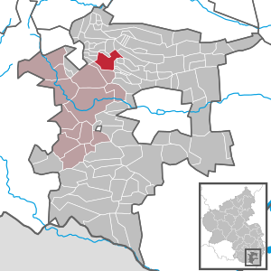
| Location of the local community Ramberg in the district of Südliche Weinstrasse | ||
  |
||


Ramberg is a municipality in the Südliche Weinstrasse district in Rhineland-Palatinate . It belongs to the Verbandsgemeinde Annweiler am Trifels , within which it is the fifth largest local community in terms of population. Ramberg is a state-approved resort .
geography
location
The local community Ramberg is located in the Palatinate Forest around seven kilometers as the crow flies north-northeast of Annweiler am Trifels in the Ramberger Valley named after it . The Holpertal begins a few hundred meters north of the town's residential area ; further west of this is the nuns valley . The northeast of the district extends to the Modenbach valley . The Drei Buchen pass forms the transition between the Ramberger Valley and the Modenbach Valley. The Modenbacherhof also belongs to the community . Neighboring communities are - clockwise - Roschbach , Edesheim , Rhodt unter Rietburg , Weyher in the Palatinate , Hainfeld , Burrweiler , Flemlingen , Dernbach , Böchingen and Walsheim .
Surveys
The village is framed by wooded mountains. Above the village, the 442.4 m above sea level extends . NN high Schlossberg. Other prominent elevations on the municipality include the Drenselberg ( 523.8 m above sea level ) and the Eichbühl in the northeast, the Harzofenberg ( 556.4 m above sea level ), the Langentalkopf ( 536 m above sea level ), the Schindl Kopf ( 510 m above sea level ) and the Hühnerberg ( 476.9 m above sea level ) in the north-west as well as the Hermeskopf in the south-west and the Mühlberg in the south-east.
Waters
Ramberg is traversed by the Dernbach , a tributary of the Eisbach , in a north-south direction . Within the municipality, it takes on several tributaries such as the Drenselberg brook , the Hermersbach , the Holpertalbach , the Ohlsbach , the Ramberger Bach , the Talbach and the Waltersbach . The Talbach also takes on the Kleiner Wiesenbach and the Wiesenbächle from the left . The Modenbach also flows through the northeast of the district .
history
Until the end of the 18th century Ramberg belonged to Löwenstein-Wertheim and was under the rule of Scharfeneck .
From 1798 to 1814, when the Palatinate was part of the French Republic (until 1804) and then part of the Napoleonic Empire , Ramberg was incorporated into the canton of Annweiler and was the seat of a mairie that also included Eusserthal. In 1815 the community had a total of 800 inhabitants. In the same year, Austria was struck. Just one year later, the place, like the entire Palatinate, changed to the Kingdom of Bavaria . From 1818 to 1862 Ramberg belonged to the Land Commissioner Bergzabern ; from this the district office Bergzabern emerged.
From 1939 the place was part of the Bergzabern district . After the Second World War , Ramberg became part of the then newly formed state of Rhineland-Palatinate within the French occupation zone . During the first Rhineland-Palatinate administrative reform changed the place on 7 June 1969 in the newly created district Landau-Bad Bergzabern, in 1978 in South County Wine Trail is renamed . In 1972 Ramberg was assigned to the newly formed community of Annweiler am Trifels .
politics
Municipal council
The local council in Ramberg consists of twelve council members, who were elected in a personalized proportional representation in the local elections on May 26, 2019 , and the honorary local mayor as chairman.
The distribution of seats in the municipal council:
| choice | Green | LFW | RBL | WGK | total |
|---|---|---|---|---|---|
| 2019 | 1 | - | 8th | 3 | 12 seats |
| 2014 | - | 5 | 7th | - | 12 seats |
| 2009 | by majority vote | 12 seats | |||
- LFW = List of Free Voters
- RBL = Ramberger Citizens List
- WGK = voter group Klos
mayor
Jürgen Munz (RBL) became the local mayor of Ramberg in 2014. In the direct election on May 26, 2019, he was confirmed in his office for another five years with a share of the vote of 73.10%. His predecessor Dieter Schwarzmann (LFW) had held the office for 30 years.
coat of arms
|
|
Blazon : "A black bar in silver, topped with a left-facing blue armored and tongued red lion." |
Culture and sights
Cultural monuments


The ruins of Meistersel Castle and the Ramburg are designated as monument zones. The first was a rock castle, the remains of which are on a hilltop near Ramberg. It has been owned by the State of Rhineland-Palatinate since 2006 . The Ramburg represents the ruins of a hilltop castle and is located on the Schlossberg above the village. In addition, there are a total of six individual monuments: In the town center, the local history and museum association of the brush- making trade has set up a brush- making museum on the history, manufacture and trade of brooms and brushes. The Modenbacherhof is also a listed building.
nature

The only natural monument is a sweet chestnut to the northwest of the buildings. In the northeast of the district is also the Ritterstein 234 ; it is called Drei Buchen and points to the pass of the same name and is therefore an orientation point for hikers.
Events
On September 6, 2015, the German mountain championships of the cycling Bundesliga took place on site.
Infrastructure
Economy and media
In the course of the Haingeraide , Ramberg was involved in the so-called second Haardtgeraide - alternatively called Mittel-Haingeraide - which was dissolved in the early modern period and which was partially subordinated to the community. At times there was a location for chord radio . In addition, the community belongs to the distribution area of the Open Canal Weinstrasse .
traffic

The state road 506 runs through Ramberg, which leads from Albersweiler via Dernbach, Weyher and Rhodt unter Rietburg to Edesheim. The county road 6 runs through the north-east of the district and passes the Modenbacherhof.
The community is also connected to the local public transport network via bus line 521 of the Rhein-Neckar transport association , which connects the town with Landau in the Palatinate , Frankweiler , Albersweiler , Eusserthal and Dernbach. In addition, there is bus line 522, which is exclusively responsible for school traffic and leads to Annweiler.
tourism
A hiking trail marked with a red dot leads through Ramberg . In addition, the community is located on a branch line of the Palatinate Keschdeweg . In the north-east of the district there is also a hut belonging to the Palatinate Forest Association, the Drei Buchen forest house . Another hiking trail begins in this area , which is marked with a blue bar and which leads to Burrweiler .
Personalities
Sons and daughters of the church
- Guido Benedikt Beck (1885–1958), Capuchin Father, Mission Bishop, Apostolic Vicar in Chile. Also called himself Guido Beck de Ramberga after his hometown .
People who worked on site
- Heinrich Georg Rung (1854–1931), priest, lived in Ramberg from 1926 until his death, where he also died and was buried
Web links
- Internet presence of the local community Ramberg
- Literature about Ramberg in the Rhineland-Palatinate State Bibliography
Individual evidence
- ↑ State Statistical Office of Rhineland-Palatinate - population status 2019, districts, communities, association communities ( help on this ).
- ↑ State Statistical Office Rhineland-Palatinate - regional data
- ^ The Regional Returning Officer Rhineland-Palatinate: Local elections 2019, city and municipal council elections
- ^ The Regional Returning Officer for Rhineland-Palatinate: 2014 Ramberg municipal council election. Retrieved April 16, 2020 .
- ^ The Regional Returning Officer Rhineland-Palatinate: Local council election 2009 Ramberg. Retrieved April 16, 2020 .
- ↑ Gerhard Sommer: On Case II: Which local chiefs in Trifelsland are running again. Die Rheinpfalz, September 14, 2018, accessed on April 16, 2020 .
- ^ The Regional Returning Officer Rhineland-Palatinate: direct elections 2019. see Annweiler am Trifels, Verbandsgemeinde, seventh line of results. Retrieved April 16, 2020 .
- ↑ Thanks and appreciation. Honoring resigned local mayors. Verbandsgemeinde Annweiler am Trifels, December 2, 2014, accessed on April 18, 2020 .

Cities: Annweiler am Trifels | Bad Bergzabern | Edenkoben
Municipalities: Albersweiler | Altdorf (Palatinate) | Barbelroth | Cheapheim-Ingenheim | Birkenhördt | Birkweiler | Böbingen (Palatinate) | Böchingen | Böllenborn | Bornheim (Palatinate) | Burrweiler | Dernbach (Palatinate) | Dierbach | Dörrenbach | Edesheim | Eschbach (Palatinate) | Essingen (Palatinate) | Eusserthal | Flemlingen | Frankweiler | Freimersheim (Palatinate) | Gleisweiler | Gleiszellen-Gleishorbach | Goecklingen | Gommersheim | Gossersweiler-Stein | Großfischlingen | Hainfeld (Palatinate) | Hergersweiler | Herxheim near Landau / Pfalz | Herxheimweyher | Heuchelheim Blades | Hochstadt (Palatinate) | Ilbesheim near Landau in the Palatinate | Vaccinees | Insheim | Kapellen-Drusweiler | Kapsweyer | Kirrweiler (Palatinate) | Small fish | Klingenmünster | Knöringen | Leinsweiler | May Chamber | Münchweiler am Klingbach | Niederhorbach | Niederotterbach | Oberhausen (near Bad Bergzabern) | Oberotterbach | Oberschlettenbach | Offenbach an der Queich | Pleisweiler-Oberhofen | Ramberg (Palatinate) | Ranschbach | Rhodt under Rietburg | Rinnthal | Rohrbach (Palatinate) | Roschbach | Saint Martin (Palatinate) | Schweigen-Rechtenbach | Schweighofen | Siebeldingen | Silz | Steinfeld (Palatinate) | Venningen | Völkersweiler | Vorderweidenthal | Waldhambach | Waldrohrbach | Walsheim | Wernersberg | Weyher in the Palatinate