
Saint-Martin-du-Mont (Saône-et-Loire)
| Saint-Martin-du-Mont | ||
|---|---|---|
|
||
| region | Bourgogne-Franche-Comté | |
| Department | Saône-et-Loire | |
| Arrondissement | Louhans | |
| Canton | Louhans | |
| Community association | Bresse Louhannaise Intercom ' | |
| Coordinates | 46 ° 37 ' N , 5 ° 18' E | |
| height | 181-204 m | |
| surface | 5.26 km 2 | |
| Residents | 202 (January 1, 2017) | |
| Population density | 38 inhabitants / km 2 | |
| Post Code | 71580 | |
| INSEE code | 71454 | |

Saint-Martin-du-Mont is a French commune in the department of Saone-et-Loire in the region of Bourgogne Franche-Comté . It belongs to the Arrondissement of Louhans and the Canton of Louhans . The place has 202 inhabitants (as of January 1, 2017).
geography
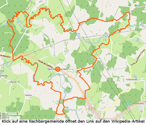

Saint-Martin-du-Mont is in the Bresse countryside , 5.5 kilometers east-southeast of Louhans on the D21 departmental road from Louhans to Flacey-en-Bresse . The northern municipal boundary forms the Ruisseau de Blaine , which is still called Blanette here , and the Ruisseau de l'Étang du Villard . In the southwest, the Vallière forms the border with the neighboring town of Bruailles . The community only has larger wooded areas in the west and east. The municipality includes the following hamlets and corridors: Bois-Jannin, Carruge-Garnier, Chambards, Champ-Diot, Charrière, Courbes, Culets, Curtil, Montagne, Moulin-des-Chalires, Poiriers, Prosts, Ronceau, Saint-Martin, Sapins, Tournelle
climate
The climate in Saint-Martin-du-Mont is warm and temperate. There is significant rainfall throughout the year in Saint-Martin-du-Mont. Even the driest month still shows high rainfall. The effective climate classification according to Köppen and Geiger is Cfb . The average annual temperature in Saint-Martin-du-Mont is 11.1 ° C. Over the year, the average rainfall is 827 mm.
| Saint-Martin-du-Mont | ||||||||||||||||||||||||||||||||||||||||||||||||
|---|---|---|---|---|---|---|---|---|---|---|---|---|---|---|---|---|---|---|---|---|---|---|---|---|---|---|---|---|---|---|---|---|---|---|---|---|---|---|---|---|---|---|---|---|---|---|---|---|
| Climate diagram | ||||||||||||||||||||||||||||||||||||||||||||||||
| ||||||||||||||||||||||||||||||||||||||||||||||||
Toponymy
The place appears for the first time in 930 as In pago Scodingensi… foresta de Montis , so a mountain forest is mentioned. The church was consecrated to Saint Martin, from which the name of the present-day community was formed. Today's hamlet Tournelle was probably more important, it was in any case a separate fiefdom, there was a castle and a family named themselves after this place.
history
Guillaume de la Tournelle was Maréchal de France in 1220 and in the 14th century Jean Bouton married a Caterin de la Tournelle . In the 16th century Theode Bouton was lord of La Tournelle , his granddaughter Marie Bouton married Joseph-Guillaume de Rovorée in 1643 , so the rule passed to this family. The church of Saint-Martin-du-Mont was rebuilt in 1659 , so it must have existed earlier. It is dedicated to Saint Martin .
population
| year | 1793 | 1800 | 1821 | 1831 | 1841 | 1851 | 1861 | 1872 | 1881 | 1891 | 1901 | 1911 | 1921 | 1931 | 1946 | 1962 | 1975 | 1982 | 1990 | 1999 | 2006 | 2011 |
|---|---|---|---|---|---|---|---|---|---|---|---|---|---|---|---|---|---|---|---|---|---|---|
| Residents | 214 | 206 | 264 | 304 | 258 | 240 | 240 | 247 | 242 | 235 | 238 | 212 | 199 | 195 | 166 | 179 | 137 | 167 | 155 | 146 | 163 | 224 |


Economy and Infrastructure
In addition to the Mairie and the church, there are five farms, a restaurant and a building trade in the community. As AOC products are in Saint-Martin-du-Mont de Bresse Volaille and Dinde de Bresse , further Crème et beurre de Bresse admitted.
Educational institutions
There is an École élémentaire in the municipality , which is subordinate to the Académie de Dijon and attended by 22 children. The vacation schedule for zone A applies to the school.
literature
- Claude Courtépée (1721–1781): Description historique et topographique du Duché de Bourgogne . tape 5 . Chez Causse, Dijon 1780 (French, Google Books ).
- Lucien Guillemaut (1842-1917): Histoire de la Bresse Louhannaise. Vol. 1, Louhans 1897.
- Lucien Guillemaut (1842–1917): Armoiries et familles nobles de la Bresse louhannaise: armoiries ouvrières, armoiries particulières et de familles . Vve L. Romand, Louhans 1909 (French, gallica ).
Web links
- Saint-Martin-du-Mont. on INSEE. Institut national de la statistique et des études économiques , accessed on January 18, 2015 (French).
- Saint-Martin-du-Mont. in the register of communes in France. Retrieved January 18, 2015 (French).
- Saint-Martin-du-Mont. in the Base Mérimée . Ministère de la Culture, accessed January 18, 2015 (French).
- Saint-Martin-du-Mont. in Archives départementales. Saône-et-Loire department, accessed on January 21, 2016 (French).
Individual evidence
- ↑ Ruisseau de Blaine , length 25.9 km, tributary to the Vallière , source at 46 ° 40 ′ 8.4 ″ N , 5 ° 27 ′ 20.2 ″ E in Courlaoux at approx. 221 m, mouth at 46 ° 37 ′ 11.3 ″ N , 5 ° 14 ′ 30.8 ″ E in Louhans at approx. 177 m, Ruisseau de Blaine on sandre.eaufrance.fr
- ↑ Ruisseau de l'Étang du Villard , length 6.8 km, tributary to Ruisseau de Blaine, source at 46 ° 40 ′ 38.3 ″ N , 5 ° 18 ′ 22.7 ″ E in Le Fay at approx. 198 m , Mouth at 46 ° 37 ′ 44 ″ N , 5 ° 16 ′ 35 ″ E in Louhans at approx. 184 m, Ruisseau de l'Étang du Villard on sandre.eaufrance.fr
- ↑ La Vallière , length 50.8 km, tributary to Solnan , source at 46 ° 37 ′ 25.3 ″ N , 5 ° 36 ′ 27.7 ″ E in Revigny at approx. 419 m, mouth at 46 ° 37 ′ 10 , 2 ″ N , 5 ° 13 ′ 19.6 ″ E in Louhans at approx. 178 m, La Vallière on sandre.eaufrance.fr
- ↑ Dictionnaire Topographique de Saône-et-Loire. (PDF) Comité des Travaux Historiques et Scientifiques, accessed on April 16, 2015 (French, search term: Ctrl+ FSaint-Martin-du-Mont).
- ↑ Brief description of the church. (PDF) from Saint-Martin-du-Mont. La Pastorale du Tourisme en Saône et Loire, accessed on May 30, 2015 (French).
- ↑ Population statistics on cassini.ehess.fr. Retrieved December 6, 2014 (French).
- ^ Chicken de Bresse. to INAO, L'Institut national de l'origine et de la qualité. Retrieved June 26, 2015 (French).
- ↑ Dinde de Bresse. to INAO, L'Institut national de l'origine et de la qualité. Retrieved June 26, 2015 (French).
- ↑ Crème de Bresse. to INAO L'Institut national de l'origine et de la qualité. Retrieved July 3, 2015 (French).
- ↑ Beurre de Bresse. to INAO L'Institut national de l'origine et de la qualité. Retrieved July 3, 2015 (French).
- ^ Homepage of the Académie de Dijon. Retrieved January 10, 2016 (French).
- ↑ Holiday and bank holiday schedule for Zone A. Saint-Martin-du-Mont. Retrieved January 10, 2016 (French).