
Park Avenue: Difference between revisions
Epicgenius (talk | contribs) |
Epicgenius (talk | contribs) |
||
| (46 intermediate revisions by 31 users not shown) | |||
| Line 2: | Line 2: | ||
{{About|the avenue in Manhattan and the Bronx}} |
{{About|the avenue in Manhattan and the Bronx}} |
||
{{Attached KML|display=title}} |
{{Attached KML|display=title}} |
||
{{Use mdy dates|date= |
{{Use mdy dates|date=December 2023}} |
||
{{Infobox street |
{{Infobox street |
||
| name = Park Avenue |
| name = Park Avenue |
||
| Line 12: | Line 12: | ||
| other_name = Fourth Avenue, Union Square East, Park Avenue South |
| other_name = Fourth Avenue, Union Square East, Park Avenue South |
||
| former_names = Fourth Avenue |
| former_names = Fourth Avenue |
||
| namesake = tracks between 34th and 40th Streets which were covered in grass<ref>{{Cite web|url=https://www.nycgo.com/articles/nyc-street-name-meanings|title=Mean Streets: The Stories Behind NYC Street Names|first=Adam|last=Kuban|date=February 13, 2013|website=NYCgo.com}}</ref> |
|||
| postal_code = |
| postal_code = |
||
| addresses = |
| addresses = |
||
| length_mi = 10.9 |
| length_mi = 10.9 |
||
| Line 24: | Line 25: | ||
| direction_a = South |
| direction_a = South |
||
| terminus_a = [[Astor Place]] in [[Cooper Square]] |
| terminus_a = [[Astor Place]] in [[Cooper Square]] |
||
| junction = [[Park Avenue Tunnel (roadway)|Park Avenue Tunnel]] and [[Park Avenue Viaduct|Viaduct]] in [[East Midtown]]<br>{{jct|state=NY|Parkway|Harlem River}} in [[East Harlem]] |
| junction = [[Park Avenue Tunnel (roadway)|Park Avenue Tunnel]] and [[Park Avenue Viaduct|Viaduct]] in [[East Midtown]]<br />{{jct|state=NY|Parkway|Harlem River}} in [[East Harlem]] |
||
| direction_b = North |
| direction_b = North |
||
| terminus_b = [[Third Avenue]] in [[Fordham, Bronx|Fordham]] |
| terminus_b = [[Third Avenue]] in [[Fordham, Bronx|Fordham]] |
||
| commissioning_date = [[Commissioners' Plan of 1811|March 1811]] |
| commissioning_date = [[Commissioners' Plan of 1811|March 1811]] |
||
| construction_start_date = |
| construction_start_date = |
||
| completion_date = |
| completion_date = |
||
| inauguration_date = |
| inauguration_date = |
||
| demolition_date = |
| demolition_date = |
||
| north = |
| north = |
||
| south = |
| south = |
||
| east = [[Lexington Avenue]] |
| east = [[Lexington Avenue]] |
||
| Line 38: | Line 39: | ||
}} |
}} |
||
'''Park Avenue''' is a |
'''Park Avenue''' is a [[boulevard]] in [[New York City]]<ref>{{cite news |last=Gray |first=Christopher |author-link=Christopher Gray (architectural historian) |date=May 12, 2002 |title=Streetscapes:903 Park Avenue, at 79th Street |url=https://www.nytimes.com/2002/05/12/realestate/streetscapes-903-park-avenue-79th-street-1914-apartment-house-once-called-world.html |newspaper=[[The New York Times]]}}</ref> that carries north and southbound traffic in the [[borough (New York City)|boroughs]] of [[Manhattan]] and [[the Bronx]]. For most of the road's length in Manhattan, it runs parallel to [[Madison Avenue]] to the west and [[Lexington Avenue (Manhattan)|Lexington Avenue]] to the east. Park Avenue's entire length was formerly called '''Fourth Avenue'''; the title still applies to the section between [[Cooper Square]] and [[14th Street (Manhattan)|14th Street]].<ref>{{Cite web|url=http://maps.nyc.gov/|title=NYCityMap|website=NYC.gov}}</ref> The avenue is called '''Union Square East''' between 14th and [[17th Street (Manhattan)|17th Streets]], and '''Park Avenue South''' between 17th and [[32nd Street (Manhattan)|32nd Streets]]. |
||
==History== |
== History == |
||
[[File:ParkAvenueAug2004.JPG|thumb|left|225px|Park Avenue on the [[Upper East Side]]]] |
[[File:ParkAvenueAug2004.JPG|thumb|left|225px|Park Avenue on the [[Upper East Side]]]] |
||
[[File:Park Avenue tunnel.jpg|thumb|left|225px|The railroad tunnel in 1941]] |
[[File:Park Avenue tunnel.jpg|thumb|left|225px|The railroad tunnel in 1941]] |
||
===Early years and railroad construction=== |
=== Early years and railroad construction === |
||
Because of its designation as the widest avenue on Manhattan's East Side, Park Avenue originally carried the tracks of the [[New York and Harlem Railroad]] built in the 1830s, just a few years after the adoption of the [[Commissioners' Plan of 1811|Manhattan street grid]].<ref>{{cite news|last=Gray|first=Christopher|title=Before There Was a 'Grand' in Central|url=https://www.nytimes.com/2013/03/03/realestate/before-there-was-a-grand-in-central.html|date=March 3, 2013|newspaper=[[The New York Times]]|access-date=October 15, 2015|author-link=Christopher Gray (architectural historian)}}</ref> The railroad's [[Right-of-way (property access)|right-of-way]] at ground level forced foot and carriage traffic onto either side of the tracks. Later on, the railroad was run through an [[Park Avenue Tunnel (roadway)|open cut tunnel]] under [[Murray Hill, Manhattan|Murray Hill]], which was then covered with grates and grass between 34th and 40th Street in the early 1850s. A section of this "park" was later renamed Park Avenue in 1860.<ref>{{cite news|last=Gray|first=Christopher|title=Putting the Park in Park Avenue|url=https://www.nytimes.com/2011/07/24/realestate/putting-the-park-in-park-avenue-streetscapesmidtown.html|date=July 24, 2011|newspaper=[[The New York Times]]|access-date=October 15, 2015|author-link=Christopher Gray (architectural historian)}}</ref> Park Avenue's original southern terminus was at 34th Street, and the newly renamed Park Avenue was given its own house-numbering system separate from that of Fourth Avenue. The address 1 Park Avenue was assigned to a house at 101 East 34th Street, at the northeast corner of Park Avenue and 34th Street.<ref name=nyt20081107>{{Cite news|last=Gray|first=Christopher|date=November 7, 2008|title=History Lessons by the Numbers|language=en-US|work=The New York Times|url=https://www.nytimes.com/2008/11/09/realestate/09scape.html|access-date=July 20, 2021|issn=0362-4331}}</ref> |
|||
The Harlem Railroad was later incorporated into the [[New York Central Railroad]], and a terminal for the New York Central at 42nd Street, the [[Grand Central Depot]], opened in 1871.<ref name=" |
The Harlem Railroad was later incorporated into the [[New York Central Railroad]], and a terminal for the New York Central at 42nd Street, the [[Grand Central Depot]], opened in 1871.<ref name="Fitch 1974">{{Cite book|url=https://archive.org/stream/grandcentralterm00fitc|title=Grand Central Terminal and Rockefeller Center: A Historic-critical Estimate of Their Significance|last1=Fitch|first1=James Marston|last2=Waite|first2=Diana S.|date=1974|publisher=The Division|location=Albany, New York|language=en}}</ref>{{rp|3}} But the tracks laid to the new terminal proved problematic. There were originally no grade-separated crossings of the railroads between 42nd and 59th Streets.<ref>{{cite web|url=https://www.nytimes.com/1871/11/18/archives/the-railroad-trap-another-days-scenes-at-the-grand-central-depot.html|title=THE RAILROAD TRAP.; Another Day's Scenes at the Grand Central Depot|date=November 18, 1871|website=The New York Times|access-date=December 4, 2018}}</ref> As such, they required railroad crossings along Fourth Avenue, which resulted in frequent accidents; seven people died within 12 days of the Hudson River Railroad's move to Grand Central.<ref>{{cite web|url=https://www.nytimes.com/1871/11/17/archives/railroad-abuses-official-investigation-into-the-grand-central-depot.html|title=RAILROAD ABUSES.; Official Investigation into the Grand Central Depot Nuisance. Scenes and Incidents at the Crossings Yesterday.Search for the Missing Dead Only One Out of the Seven Said to be Killed Yet Found The Coroners and the PoliceUtterly in the Dark. The Dangers that Centre Around the New Vanderbilt Depot What the Officials Say Minor Inconveniences.|date=October 1, 2018|website=The New York Times|access-date=December 4, 2018}}</ref> |
||
In 1872, shortly after the opening of Grand Central Depot, New York Central owner [[Cornelius Vanderbilt]] proposed the Fourth Avenue Improvement Project.<ref name=" |
In 1872, shortly after the opening of Grand Central Depot, New York Central owner [[Cornelius Vanderbilt]] proposed the Fourth Avenue Improvement Project.<ref name="Fitch 1974" /> The tracks between 48th and 56th Streets were to be moved into a shallow [[Cut (earthmoving)|open cut]],<ref>{{cite news|url=https://www.newspapers.com/clip/26003776/the_state_capital_rapid_transit_of/|title=The State Capital; Rapid Transit of Railroad Bills in the Assembly|date=April 24, 1872|work=New York Herald|access-date=December 6, 2018|page=13|via=newspapers.com}} {{open access}}</ref> while the segment between 56th and 97th Streets, which was in a rock cut, would be covered over.<ref name="Fitch 1974" />{{efn|The line entered fully enclosed brick tunnels between 67th and 71st Streets, and between 80th and 96th Streets. The remainder of this segment was located in a "beam tunnel" structure, which were mostly open-air, except where cross-streets traversed the cut on steel-beam bridges.<ref>{{cite book | last1=Robins | first1=A.W. | last2=New York Transit Museum | title=Grand Central Terminal: 100 Years of a New York Landmark | publisher=ABRAMS | year=2013 | isbn=978-1-61312-387-4 | url=https://books.google.com/books?id=GnKxDQAAQBAJ&pg=PT98 | access-date=December 6, 2018 |page=85}}</ref>}} After the improvements were completed in 1874, the railroads, approaching Grand Central Depot from the north, descended into the [[Park Avenue Tunnel (railroad)|Park Avenue Tunnel]] at 96th Street and continued underground into the new depot.<ref name="Fitch 1974" /> As part of the project, Fourth Avenue was transformed into a boulevard with a median strip that covered the railroad's ventilation grates.<ref>{{cite book|url=https://books.google.com/books?id=mmJODwAAQBAJ&pg=PT278|title=The Restless City: A Short History of New York from Colonial Times to the Present|last=Reitano|first=J.|publisher=Taylor & Francis|year=2018|isbn=978-1-134-81048-2|page=278|access-date=December 4, 2018}}</ref><ref name="MTA-ESA-EIS-2001">{{cite book|url=https://books.google.com/books?id=USs3AQAAMAAJ&pg=SA3-PA3|title=East Side Access in New York, Queens, and Bronx Counties, New York, and Nassau and Suffolk Counties, New York: Environmental Impact Statement|year=2001|page=3|section=Grand Central Terminal|access-date=December 4, 2018}}</ref><ref name="Fitch 1974" />{{rp|4}} Eight footbridges crossed the tracks between 45th and 56th Streets, and there were also vehicular overpasses at 45th and 48th Streets.<ref name="Fitch 1974" />{{rp|4}} The boulevard north of Grand Central was renamed Park Avenue in 1888.<ref>{{cite news|last=Gray|first=Christopher|title=Streetscapes: 709 and 711 Park Avenue, Between 69th and 70th Streets; When Park Ave. Was 4th, and Not Socially Correct|url=https://www.nytimes.com/2002/03/17/realestate/streetscapes-709-711-park-avenue-between-69th-70th-streets-when-park-ave-was-4th.html|date=March 17, 2002|newspaper=[[The New York Times]]|access-date=October 15, 2015|author-link=Christopher Gray (architectural historian)}}</ref> |
||
===Grand Central and Terminal City=== |
=== Grand Central and Terminal City === |
||
A fatal collision between two trains occurred under Park Avenue in 1902, in part because the smoke coming from the steam trains obscured the signals.<ref>{{cite web|url=https://www.nytimes.com/1902/01/09/archives/fifteen-killed-in-rear-end-collision-trains-crash-in-darkness-of.html|title=FIFTEEN KILLED IN REAR END COLLISION; Trains Crash in Darkness of Park Avenue Tunnel. TWO SCORE ARE INJURED Engineer Disregards or Fails to See Signals. LOCOMOTIVE BURIED IN CAR Firemen Cut Their Way Into the Wreck and Climb Over the Hot Boiler to the Aid of the Wounded |
A fatal collision between two trains occurred under Park Avenue in 1902, in part because the smoke coming from the steam trains obscured the signals.<ref>{{cite web|url=https://www.nytimes.com/1902/01/09/archives/fifteen-killed-in-rear-end-collision-trains-crash-in-darkness-of.html|title=FIFTEEN KILLED IN REAR END COLLISION; Trains Crash in Darkness of Park Avenue Tunnel. TWO SCORE ARE INJURED Engineer Disregards or Fails to See Signals. LOCOMOTIVE BURIED IN CAR Firemen Cut Their Way Into the Wreck and Climb Over the Hot Boiler to the Aid of the Wounded – Heroic Acts of Rescuers and Rescued – Survivors and Others Tell Thrilling Stories of Their Experiences.|date=January 9, 1902|website=The New York Times|access-date=December 10, 2018}}</ref><ref>{{cite news|url=https://www.newspapers.com/clip/26110515/fifteen_killed_thirtysix_hurt/|title=Fifteen Killed, Thirty-Six Hurt|date=January 9, 1902|work=New-York Tribune|access-date=December 10, 2018|page=1|via=newspapers.com}} {{open access}}</ref> The New York state legislature subsequently passed a law to ban all steam trains in Manhattan.<ref name="Sprague Cunningham 2013 pp. 58–76">{{cite journal|last1=Sprague|first1=J. L.|last2=Cunningham|first2=J. J.|year=2013|title=A Frank Sprague Triumph: The Electrification of Grand Central Terminal [History]|journal=IEEE Power and Energy Magazine|publisher=Institute of Electrical and Electronics Engineers (IEEE)|volume=11|issue=1|pages=58–76|doi=10.1109/mpe.2012.2222293|s2cid=6729668 |issn=1540-7977}}</ref> By December 1902, as part of an agreement with the city, New York Central agreed to put the approach to Grand Central Station from 46th to 59th Streets in an open cut under Park Avenue, and to upgrade the tracks to accommodate electric trains. Overpasses would be built across the open cut at most of the cross-streets.<ref>{{cite web|url=https://www.nytimes.com/1902/12/27/archives/new-york-central-to-accept-citys-plans-station-tunnel-and-other.html|title=NEW YORK CENTRAL TO ACCEPT CITY'S PLANS; Station, Tunnel, and Other Improvements to Cost $25,000,000. Park Avenue to be Opened, Bridges Built at Cross Streets, Electricity Introduced, and Grade Crossings Abolished.|date=December 27, 1902|website=The New York Times|access-date=December 10, 2018}}</ref> The new electric-train terminal, [[Grand Central Terminal]], was opened in 1913.<ref>{{cite web|last1=Maranzani|first1=Barbara|title=Grand Central Terminal: An American Icon|url=http://www.history.com/news/grand-central-terminal-an-american-icon-turns-100|website=History.com|access-date=February 2, 2018}}</ref> |
||
After the electric trains were buried underground, the area around Park Avenue in the vicinity of Grand Central was developed into several blocks worth of prime real estate called [[Terminal City (Manhattan)|Terminal City]]. Stretching from 42nd to 51st Streets between Madison and Lexington Avenues, it came to include the [[Chrysler Building]] and other prestigious office buildings; luxury apartment houses along Park Avenue; and an array of high-end hotels that included the [[Marguery Hotel|Marguery]], Park Lane, and [[Waldorf Astoria New York|Waldorf Astoria]].<ref name="Gray 2010">{{cite web|url=https://www.nytimes.com/2010/08/22/realestate/22scapes.html|title=Covering Its Tracks Paid Off Handsomely|last=Gray|first=Christopher|date=August 19, 2010|website=The New York Times|access-date=December 10, 2018}}</ref> In 1929, New York Central built its headquarters in a 34-story building (now called the [[Helmsley Building]]), straddling Park Avenue north of the terminal.<ref>{{cite web | title=Park Avenue, Interrupted | website=The New York Times | date=December 21, 2014 | url=https://www.nytimes.com/2014/12/21/realestate/park-avenue-interrupted.html | access-date=December 8, 2018}}</ref> |
After the electric trains were buried underground, the area around Park Avenue in the vicinity of Grand Central was developed into several blocks worth of prime real estate called [[Terminal City (Manhattan)|Terminal City]]. Stretching from 42nd to 51st Streets between Madison and Lexington Avenues, it came to include the [[Chrysler Building]] and other prestigious office buildings; luxury apartment houses along Park Avenue; and an array of high-end hotels that included the [[Marguery Hotel|Marguery]], Park Lane, and [[Waldorf Astoria New York|Waldorf Astoria]].<ref name="Gray 2010">{{cite web|url=https://www.nytimes.com/2010/08/22/realestate/22scapes.html|title=Covering Its Tracks Paid Off Handsomely|last=Gray|first=Christopher|date=August 19, 2010|website=The New York Times|access-date=December 10, 2018}}</ref> In 1929, New York Central built its headquarters in a 34-story building (now called the [[Helmsley Building]]), straddling Park Avenue north of the terminal.<ref>{{cite web | title=Park Avenue, Interrupted | website=The New York Times | date=December 21, 2014 | url=https://www.nytimes.com/2014/12/21/realestate/park-avenue-interrupted.html | access-date=December 8, 2018}}</ref> |
||
The [[Park Avenue Viaduct]] reroutes Park Avenue around Grand Central Terminal between 40th and 46th Streets, allowing Park Avenue traffic to traverse around the building and over 42nd Street without encumbering nearby streets.<ref name=" |
The [[Park Avenue Viaduct]] reroutes Park Avenue around Grand Central Terminal between 40th and 46th Streets, allowing Park Avenue traffic to traverse around the building and over 42nd Street without encumbering nearby streets.<ref name="The New York Times 1928">{{cite news|url=http://timesmachine.nytimes.com/timesmachine/1928/09/02/105202500.pdf|title=New Viaduct Thoroughfare Relieves Park Avenue Traffic Congestion; Result of Many Years' Work.|date=September 2, 1928|newspaper=The New York Times|access-date=December 7, 2018|page=Real Estate, Page 123}}</ref> The western (now southbound) leg of the viaduct was completed in 1919,<ref>{{cite news|url=https://www.nytimes.com/1919/04/17/archives/link-up-park-av-to-ease-congestion-civic-bodies-celebrate-opening.html|title=Link Up Park Av. to Ease Congestion|date=April 17, 1919|newspaper=The New York Times|access-date=December 7, 2018}}</ref> but congestion developed soon after the viaduct's opening, so an eastern leg for northbound traffic was added in 1928.<ref name="The New York Times 1928" /> |
||
===Later years=== |
=== Later years === |
||
The developer Henry Mandel acquired the lots on the eastern side of Fourth Avenue between 32nd and 33rd Street in 1923 under the name "One Park Avenue Corporation". To ensure his corporate name was accurate, Mandel asked the [[New York City Board of Aldermen]] to move Park Avenue's southern terminus to 32nd Street.<ref name=nyt20081107/> The change went into effect on December 1, 1924, and address numbers along Park Avenue were changed accordingly.<ref name=n81853595>{{Cite news|date=1927 |
The developer Henry Mandel acquired the lots on the eastern side of Fourth Avenue between 32nd and 33rd Street in 1923 under the name "One Park Avenue Corporation". To ensure his corporate name was accurate, Mandel asked the [[New York City Board of Aldermen]] to move Park Avenue's southern terminus to 32nd Street.<ref name=nyt20081107 /> The change went into effect on December 1, 1924, and address numbers along Park Avenue were changed accordingly.<ref name=n81853595>{{Cite news|date=November 4, 1927|title=Appellate Court Scores Officials in Park Ave. Suit|pages=24|work=The Brooklyn Daily Eagle|url=https://www.newspapers.com/clip/81853595/appellate-court-scores-officials-in/|access-date=July 20, 2021}}</ref> The previous house numbered 1 Park Avenue was occupied by Martha Bacon, widow of diplomat [[Robert Bacon]], who led the opposition to the renumbering.<ref>{{Cite news|date=February 10, 1925|title=Number One Park Avenue|language=en-US|work=The New York Times|url=https://www.nytimes.com/1925/02/10/archives/number-one-park-avenue.html|access-date=July 20, 2021|issn=0362-4331}}</ref> The Board of Aldermen summarily overturned the name change,<ref name=nyt20081107 /> but Mayor [[John Hylan]] vetoed the move in April 1925.<ref>{{Cite news|date=April 23, 1925|title=Hylan Veto Halts Park Ave. Change|pages=8|work=The Yonkers Herald|url=https://www.newspapers.com/clip/81853960/hylan-veto-halts-park-ave-change/|access-date=July 20, 2021}}</ref> This prompted Bacon to appeal the decision to the [[New York Supreme Court, Appellate Division]], which overturned Hylan's veto in November 1927, on the basis that the extension of Park Avenue to 32nd Street had been made for the benefit of a developer.<ref name=n81853595 /><ref>{{Cite news|date=November 5, 1927|title=Bacon's Widow Blocks Trade on Park Avenue|pages=16|work=Press and Sun-Bulletin|url=https://www.newspapers.com/clip/81854213/bacons-widow-blocks-trade-on-park/|access-date=July 20, 2021}}</ref> Mandel's development at 32nd Street was thus known as 461–477 Fourth Avenue, and the developers of that building sued to reverse the appellate ruling.<ref name=nyt20081107 /> The [[New York Court of Appeals]], the state's highest court, reversed the appellate ruling in February 1928.<ref>{{Cite news|date=February 19, 1928|title=Mrs. Bacon's Long Fight to Retain '1 Park Ave.' as Address Is Finally Lost|pages=7|work=The Brooklyn Daily Eagle|url=https://www.newspapers.com/clip/81854497/mrs-bacons-long-fight-to-retain-1/|access-date=July 20, 2021}}</ref><ref>{{Cite news|date=February 15, 1928|title=Mrs. Bacon Loses Fight for No. 1 Park Avenue; Appeals Court Upholds Renumbering by City|language=en-US|work=The New York Times|url=https://www.nytimes.com/1928/02/15/archives/mrs-bacon-loses-fight-for-no-1-park-avenue-appeals-court-upholds.html|access-date=July 20, 2021|issn=0362-4331}}</ref> Bacon contemplated bringing up the matter with the [[United States Supreme Court]],<ref>{{Cite news|date=February 16, 1928|title=Mrs. Bacon May Fight On; Reported Ready to Take No. 1 Park Avenue Battle to Supreme Court.|language=en-US|work=The New York Times|url=https://www.nytimes.com/1928/02/16/archives/mrs-bacon-may-fight-on-reported-ready-to-take-no-1-park-avenue.html|access-date=July 20, 2021|issn=0362-4331}}</ref> but she ultimately relented, changing her address to "Park Avenue at 34th" by 1930.<ref name=nyt20081107 /> |
||
In 1927, the medians on Park Avenue north of Grand Central were trimmed to add one lane of traffic in each direction. This project eliminated the pedestrian path on the medians, as they became much narrower. The median was extended by one block from [[96th Street (Manhattan)|96th Street]] to 97th Street in 1941, creating the only remaining median on Park Avenue with a pedestrian path and seating.<ref>{{cite news|author=Kadinsky, Sergey|title=Park Avenue's Hidden History|url=http://forgotten-ny.com/2017/10/park-avenues-hidden-history/|date=October 24, 2017|newspaper=Forgotten-NY|access-date=October 25, 2017}}</ref> In the 1920s the portion of Park Avenue from Grand Central to 96th Street saw extensive apartment building construction. This long stretch of the avenue contains some of the most expensive real estate in the world. Real estate at [[740 Park Avenue]], for example, sells for several thousand dollars per square foot.<ref>{{cite news |title=Peeking Behind the Gilded Walls of 740 Park Ave. |first=Teri Karush |last=Rogers |url=https://www.nytimes.com/2005/10/09/realestate/09parkave.html |newspaper=[[The New York Times]] |date=October 9, 2005 |access-date=August 15, 2007}}</ref> |
In 1927, the medians on Park Avenue north of Grand Central were trimmed to add one lane of traffic in each direction. This project eliminated the pedestrian path on the medians, as they became much narrower. The median was extended by one block from [[96th Street (Manhattan)|96th Street]] to 97th Street in 1941, creating the only remaining median on Park Avenue with a pedestrian path and seating.<ref>{{cite news|author=Kadinsky, Sergey|title=Park Avenue's Hidden History|url=http://forgotten-ny.com/2017/10/park-avenues-hidden-history/|date=October 24, 2017|newspaper=Forgotten-NY|access-date=October 25, 2017}}</ref> In the 1920s the portion of Park Avenue from Grand Central to 96th Street saw extensive apartment building construction. This long stretch of the avenue contains some of the most expensive real estate in the world. Real estate at [[740 Park Avenue]], for example, sells for several thousand dollars per square foot.<ref>{{cite news |title=Peeking Behind the Gilded Walls of 740 Park Ave. |first=Teri Karush |last=Rogers |url=https://www.nytimes.com/2005/10/09/realestate/09parkave.html |newspaper=[[The New York Times]] |date=October 9, 2005 |access-date=August 15, 2007}}</ref> |
||
| Line 65: | Line 66: | ||
In October 1937, a part of the [[Park Avenue Tunnel (roadway)|Murray Hill Tunnel]] was reopened for road traffic. Efforts to promote a Grand Park Avenue Expressway to Grand Concourse in the Bronx were unsuccessful.<ref>{{cite web |url=http://www.nycroads.com/roads/park-avenue/ |title=Park Avenue Express Highway (NY 22, unbuilt) |publisher=Nycroads.com |date=February 14, 1935 |access-date=October 8, 2012}}</ref> |
In October 1937, a part of the [[Park Avenue Tunnel (roadway)|Murray Hill Tunnel]] was reopened for road traffic. Efforts to promote a Grand Park Avenue Expressway to Grand Concourse in the Bronx were unsuccessful.<ref>{{cite web |url=http://www.nycroads.com/roads/park-avenue/ |title=Park Avenue Express Highway (NY 22, unbuilt) |publisher=Nycroads.com |date=February 14, 1935 |access-date=October 8, 2012}}</ref> |
||
A tradition was introduced in 1945 as a memorial to American soldiers killed in action, whereby [[Christmas tree]]s are placed in the median and lit up on the first Sunday in December at [[Brick Presbyterian Church (New York City)|Brick Presbyterian Church]].<ref>{{cite news |url=https://www.nytimes.com/2010/12/05/nyregion/05open.html |work=The New York Times |first=Corey |last=Kilgannon |title=Park Ave. Christmas Lights Go Up, and Xiao Ye Closes |date=December 3, 2010}}</ref> On May 5, 1959, the [[New York City Council]] voted 20–1 to change the name of Fourth Avenue between 17th and 32nd Streets to Park Avenue South. The renaming, along with a ban on overhanging signs along the newly renamed Park Avenue South, was intended to improve the character of the avenue.<ref>{{cite news |title=Sign Ban Is Voted on Two Avenues |last=Bennett |first=Charles G. |url=https://select.nytimes.com/gst/abstract.html?res=FB0C1EFD345C1A7B93C4A9178ED85F4D8585F9 |newspaper=[[The New York Times]] |date=May 6, 1959 |page=41 |access-date=July 31, 2010}}</ref> Unlike with the earlier renamings of Park Avenue, the address numbers of Park Avenue South continued from those on the remaining section of Fourth Avenue.<ref name=nyt20081107/> The [[Pan Am Building]] (now MetLife Building), in between the Park Avenue Viaduct's legs north of Grand Central Terminal, was opened in 1963.<ref>{{cite news |last=Gray |first=Christopher |date=October 7, 2001 |title=Streetscapes/The MetLife Building, Originally the Pan Am Building; Critics Once Called It Ugly; Now They're Not Sure |url=https://www.nytimes.com/2001/10/07/realestate/streetscapes-metlife-building-originally-pan-am-building-critics-once-called-it.html?pagewanted=all |work=[[The New York Times]] |access-date=September 30, 2015}}</ref> |
A tradition was introduced in 1945 as a memorial to American soldiers killed in action, whereby [[Christmas tree]]s are placed in the median and lit up on the first Sunday in December at [[Brick Presbyterian Church (New York City)|Brick Presbyterian Church]].<ref>{{cite news |url=https://www.nytimes.com/2010/12/05/nyregion/05open.html |work=The New York Times |first=Corey |last=Kilgannon |title=Park Ave. Christmas Lights Go Up, and Xiao Ye Closes |date=December 3, 2010}}</ref> On May 5, 1959, the [[New York City Council]] voted 20–1 to change the name of Fourth Avenue between 17th and 32nd Streets to Park Avenue South. The renaming, along with a ban on overhanging signs along the newly renamed Park Avenue South, was intended to improve the character of the avenue.<ref>{{cite news |title=Sign Ban Is Voted on Two Avenues |last=Bennett |first=Charles G. |url=https://select.nytimes.com/gst/abstract.html?res=FB0C1EFD345C1A7B93C4A9178ED85F4D8585F9 |newspaper=[[The New York Times]] |date=May 6, 1959 |page=41 |access-date=July 31, 2010}}</ref> Unlike with the earlier renamings of Park Avenue, the address numbers of Park Avenue South continued from those on the remaining section of Fourth Avenue.<ref name=nyt20081107 /> The [[Pan Am Building]] (now MetLife Building), in between the Park Avenue Viaduct's legs north of Grand Central Terminal, was opened in 1963.<ref>{{cite news |last=Gray |first=Christopher |date=October 7, 2001 |title=Streetscapes/The MetLife Building, Originally the Pan Am Building; Critics Once Called It Ugly; Now They're Not Sure |url=https://www.nytimes.com/2001/10/07/realestate/streetscapes-metlife-building-originally-pan-am-building-critics-once-called-it.html?pagewanted=all |work=[[The New York Times]] |access-date=September 30, 2015}}</ref> |
||
In September 2007, the [[Metro-North Railroad]] reached an agreement with the [[New York City Department of Transportation]] (NYCDOT) to install [[Pedestrian crossing#Signalized intersections|pedestrian traffic signals]] along Park Avenue between 46th Street and 56th Street. The two sides had feuded over the issue since 1982, when [[Penn Central Transportation Company|Penn Central]] controlled the Park Avenue Tunnel. In 1997, the NYCDOT commissioner stated that signals would be installed during an upcoming phase of reconstruction in the Grand Central area.<ref>{{Cite news |last=Stamler |first=Bernard |date=November 16, 1997 |title=Neighborhood Report: East Side; The Mystery of Missing Park Ave. Lights |language=en-US |work=The New York Times |url=https://www.nytimes.com/1997/11/16/nyregion/neighborhood-report-east-side-the-mystery-of-missing-park-ave-lights.html |url-status=live |access-date=October 3, 2019 |archive-url=https://web.archive.org/web/20220719164239/https://www.nytimes.com/1997/11/16/nyregion/neighborhood-report-east-side-the-mystery-of-missing-park-ave-lights.html |archive-date=July 19, 2022 |issn=0362-4331}}</ref> The $35 million project, whose cost was split between Metro-North and the city, was approved by the MTA Board later that month. It called for the installation of 12 pedestrian signals and 8 traffic signals at the eleven intersections and the renovation of the sidewalks and streets around Grand Central to prevent rainwater from seeping into the tunnel.<ref name="Neuman 2007">{{Cite news |last=Neuman |first=William |date=September 22, 2007 |title=It's a Deal: Help for Park Ave. Pedestrians |language=en-US |work=The New York Times |url=https://www.nytimes.com/2007/09/22/nyregion/22walkdontwalk.html |url-status=live |access-date=October 3, 2019 |archive-url=https://web.archive.org/web/20220719164239/https://www.nytimes.com/2007/09/22/nyregion/22walkdontwalk.html |archive-date=July 19, 2022 |issn=0362-4331}}</ref> Car traffic in this area had been controlled by traffic lights on a pole at each intersection in the middle of the median, instead of the usual four from each direction, resulting in a relatively high rate of pedestrian injuries. Additional traffic lights and pedestrian signals had not been added because this area of Park Avenue was located directly atop the roof of the Park Avenue Tunnel, with the street being {{Convert|8|in|cm|abbr=}} above the roof in some locations. Because the roof was {{Convert|18 to 24|in|cm|abbr=}} thick, there was not enough room to provide a foundation for the traffic poles without puncturing the structure. Due to the high cost of making these upgrades, and the lack of cooperation between the [[New York City Department of Transportation]] and Metro-North, which had opposed any solution that would modify the tunnel roof, the project was delayed for several years.<ref name="Neuman 2007" /><ref>{{Cite news |last=Upham |first=Ben |date=December 17, 2000 |title=Neighborhood Report: Midtown; For Jaywalkers Who Dare, A Scary Stretch of Park Avenue |language=en-US |work=The New York Times |url=https://www.nytimes.com/2000/12/17/nyregion/neighborhood-report-midtown-for-jaywalkers-who-dare-scary-stretch-park-avenue.html |url-status=live |access-date=October 3, 2019 |archive-url=https://web.archive.org/web/20150527135215/http://www.nytimes.com/2000/12/17/nyregion/neighborhood-report-midtown-for-jaywalkers-who-dare-scary-stretch-park-avenue.html |archive-date=May 27, 2015 |issn=0362-4331}}</ref> The project had been estimated to cost $200,000 per intersection in 1994.<ref>{{Cite news |last=Lambert |first=Bruce |date=September 11, 1994 |title=Neighborhood Report: Midtown; Pushing to Make Park Avenue Safer |language=en-US |work=The New York Times |url=https://www.nytimes.com/1994/09/11/nyregion/neighborhood-report-midtown-pushing-to-make-park-avenue-safer.html |url-status=live |access-date=October 3, 2019 |archive-url=https://web.archive.org/web/20150526102945/http://www.nytimes.com/1994/09/11/nyregion/neighborhood-report-midtown-pushing-to-make-park-avenue-safer.html |archive-date=May 26, 2015 |issn=0362-4331}}</ref> As part of the new agreement, Metro-North designed a way to anchor the traffic signals in the deck and tunnel roof.<ref name="nyt-2006-09-24">{{Cite news |last=Pollak |first=Michael |date=September 24, 2006 |title=Unwelcome and Uncounted |language=en-US |work=The New York Times |url=https://www.nytimes.com/2006/09/24/nyregion/thecity/unwelcome-and-uncounted.html |url-status=live |access-date=October 3, 2019 |archive-url=https://web.archive.org/web/20220719164239/https://www.nytimes.com/2006/09/24/nyregion/thecity/unwelcome-and-uncounted.html |archive-date=July 19, 2022 |issn=0362-4331}}</ref> Pedestrian signals and gantry-mounted traffic signals were installed at these intersections in July 2010.<ref>{{Citation |last1=Goodman |first1=Jillian |title=City Finally Installs Crossing Signals on Park Avenue Above Grand Central |date=July 7, 2010 |url=http://nymag.com/daily/intel/2010/07/city_finally_installs_crossing.html |newspaper=[[New York (magazine)|New York]] |access-date=February 24, 2012 |last2=Rovzar |first2=Chris}}</ref> |
|||
| ⚫ | On March 12, 2014, two apartment buildings near [[116th Street (Manhattan)|116th Street]], 1644 and 1646 Park Avenue, were destroyed in [[2014 East Harlem gas explosion|a gas explosion]]. Eight people were killed and many others were injured.<ref>{{cite news |title=Rescue Effort in East Harlem Yields Only More Victims |url=https://www.nytimes.com/2014/03/14/nyregion/east-harlem-building-collapse.html?hp&_r=0 |access-date=March 13, 2014 |newspaper=New York Times |author1=Santora, Marc |author2=Rashbaum, William K. |name-list-style=amp }}</ref> |
||
| ⚫ | On March 12, 2014, two apartment buildings near [[116th Street (Manhattan)|116th Street]], 1644 and 1646 Park Avenue, were destroyed in [[2014 East Harlem gas explosion|a gas explosion]]. Eight people were killed and many others were injured.<ref>{{cite news |title=Rescue Effort in East Harlem Yields Only More Victims |url=https://www.nytimes.com/2014/03/14/nyregion/east-harlem-building-collapse.html?hp&_r=0 |access-date=March 13, 2014 |newspaper=New York Times |author1=Santora, Marc |author2=Rashbaum, William K. | date=March 13, 2014 |name-list-style=amp }}</ref> |
||
==Route== |
|||
| ⚫ | |||
== |
== Route == |
||
| ⚫ | |||
=== Manhattan === |
|||
{{redirect|Park Avenue South|the street of the same name in Buffalo, New York|South Park Avenue}} |
{{redirect|Park Avenue South|the street of the same name in Buffalo, New York|South Park Avenue}} |
||
The road that becomes Park Avenue originates at the [[Bowery]]. From [[Cooper Square]] at [[8th Street (Manhattan)|8th Street]] to [[Union Square, Manhattan|Union Square]] at [[14th Street (Manhattan)|14th Street]], it is known as '''Fourth Avenue''', a {{convert|70|foot|m|adj=mid|-wide}} road carrying northbound traffic. At 14th Street, it turns slightly northeast to align with other avenues drawn up in the [[Commissioners' Plan of 1811]]. From 14th Street to [[17th Street (Manhattan)|17th Street]], it forms the eastern boundary of Union Square and is known as '''Union Square East'''; its southbound lanes merge with [[Broadway (Manhattan)|Broadway]] south of 15th Street, and the thoroughfare divides into two distinct portions in the one-block section between 14th and 15th Streets. From 17th Street to [[32nd Street (Manhattan)|32nd Street]], it is known as '''Park Avenue South'''.<ref name="gmaps manhattan"/> Address numbers on Park Avenue South are a continuation of those on Fourth Avenue;<ref name="NYC.gov">{{Cite web|title=NYCityMap|url=http://maps.nyc.gov/|access-date=March 20, 2020|website=NYC.gov|publisher=[[New York City Department of Information Technology and Telecommunications]]}}</ref> for example, [[225 Park Avenue South]] was originally known as 225 Fourth Avenue.<ref>{{cite book | title=Records & Briefs New York State Appellate Division | url=https://books.google.com/books?id=tpMOJoFwemsC&pg=RA3-PA19 | access-date=July 20, 2021 | page=7}}</ref> |
The road that becomes Park Avenue originates at the [[Bowery]]. From [[Cooper Square]] at [[8th Street (Manhattan)|8th Street]] to [[Union Square, Manhattan|Union Square]] at [[14th Street (Manhattan)|14th Street]], it is known as '''Fourth Avenue''', a {{convert|70|foot|m|adj=mid|-wide}} road carrying northbound traffic. At 14th Street, it turns slightly northeast to align with other avenues drawn up in the [[Commissioners' Plan of 1811]]. From 14th Street to [[17th Street (Manhattan)|17th Street]], it forms the eastern boundary of Union Square and is known as '''Union Square East'''; its southbound lanes merge with [[Broadway (Manhattan)|Broadway]] south of 15th Street, and the thoroughfare divides into two distinct portions in the one-block section between 14th and 15th Streets. From 17th Street to [[32nd Street (Manhattan)|32nd Street]], it is known as '''Park Avenue South'''.<ref name="gmaps manhattan" /> Address numbers on Park Avenue South are a continuation of those on Fourth Avenue;<ref name="NYC.gov">{{Cite web|title=NYCityMap|url=http://maps.nyc.gov/|access-date=March 20, 2020|website=NYC.gov|publisher=[[New York City Department of Information Technology and Telecommunications]]}}</ref> for example, [[225 Park Avenue South]] was originally known as 225 Fourth Avenue.<ref>{{cite book | title=Records & Briefs New York State Appellate Division | url=https://books.google.com/books?id=tpMOJoFwemsC&pg=RA3-PA19 | access-date=July 20, 2021 | page=7}}</ref> |
||
Above 32nd Street, for the remainder of its distance, it is known as Park Avenue, a {{convert|140|ft|m|adj=mid|-wide}} boulevard.<ref name="gmaps manhattan"/> The address numbers for Park Avenue are reset above 32nd Street;<ref name="NYC.gov"/> for example, the address 1 Park Avenue would ordinarily have been numbered 461 Fourth Avenue.<ref name=nyt20081107/> Between [[33rd Street (Manhattan)|33rd Street]] and [[40th Street (Manhattan)|40th Street]], the leftmost northbound lane descends into the [[Murray Hill Tunnel]]. North of 40th Street, the center lanes of Park Avenue rise onto an elevated structure that goes around [[Grand Central Terminal]] and the [[MetLife Building]] (formerly the Pan Am Building), carrying each direction of traffic on opposite sides of the buildings. The bridge, one of two structures in Manhattan known as the [[Park Avenue Viaduct]], returns to ground level at 46th Street after going through the [[Helmsley Building]] (also referred to as the New York Central Building or 230 Park Avenue).<ref name="gmaps manhattan"/> The [[IRT Lexington Avenue Line]] runs under this portion of the street. Once the line reaches [[Grand Central–42nd Street (IRT Lexington Avenue Line)|Grand Central–42nd Street]], it shifts east to [[Lexington Avenue (Manhattan)|Lexington Avenue]]. |
Above 32nd Street, for the remainder of its distance, it is known as Park Avenue, a {{convert|140|ft|m|adj=mid|-wide}} boulevard.<ref name="gmaps manhattan" /> The address numbers for Park Avenue are reset above 32nd Street;<ref name="NYC.gov" /> for example, the address 1 Park Avenue would ordinarily have been numbered 461 Fourth Avenue.<ref name=nyt20081107 /> Between [[33rd Street (Manhattan)|33rd Street]] and [[40th Street (Manhattan)|40th Street]], the leftmost northbound lane descends into the [[Murray Hill Tunnel]]. North of 40th Street, the center lanes of Park Avenue rise onto an elevated structure that goes around [[Grand Central Terminal]] and the [[MetLife Building]] (formerly the Pan Am Building), carrying each direction of traffic on opposite sides of the buildings. The bridge, one of two structures in Manhattan known as the [[Park Avenue Viaduct]], returns to ground level at 46th Street after going through the [[Helmsley Building]] (also referred to as the New York Central Building or 230 Park Avenue).<ref name="gmaps manhattan" /> The [[IRT Lexington Avenue Line]] runs under this portion of the street. Once the line reaches [[Grand Central–42nd Street (IRT Lexington Avenue Line)|Grand Central–42nd Street]], it shifts east to [[Lexington Avenue (Manhattan)|Lexington Avenue]]. |
||
[[File:Park Avenue NB past 51st Street Manhattan.jpeg|thumb|right|Park Avenue northbound past 51st Street in Midtown Manhattan]] |
[[File:Park Avenue NB past 51st Street Manhattan.jpeg|thumb|right|Park Avenue northbound past 51st Street in Midtown Manhattan]] |
||
As Park Avenue enters [[Midtown Manhattan|Midtown]] north of Grand Central Terminal, it is distinguished by many glass-box skyscrapers that serve as headquarters for corporations and investment banks such as [[Société Générale]], [[JPMorgan Chase]] at [[270 Park Avenue (2021–present)|270 Park Avenue]] and [[277 Park Avenue]], [[UBS]] at [[299 Park Avenue]], [[Citigroup]] at [[399 Park Avenue]], [[Colgate-Palmolive]], and [[MetLife]] at the MetLife Building.<ref name="gmaps manhattan"/> |
As Park Avenue enters [[Midtown Manhattan|Midtown]] north of Grand Central Terminal, it is distinguished by many glass-box skyscrapers that serve as headquarters for corporations and investment banks such as [[Société Générale]], [[JPMorgan Chase]] at [[270 Park Avenue (2021–present)|270 Park Avenue]] and [[277 Park Avenue]], [[UBS]] at [[299 Park Avenue]], [[Citigroup]] at [[399 Park Avenue]], [[Colgate-Palmolive]], and [[MetLife]] at the MetLife Building.<ref name="gmaps manhattan" /> From 47th to 97th Streets, the tracks for [[Metro-North Railroad]]'s [[Park Avenue main line]] run in the Park Avenue Tunnel underneath Park Avenue. At 97th Street, the tracks come above ground, rising onto the other Manhattan structure known as the Park Avenue Viaduct. The first street to pass under the viaduct is 102nd Street; from there to the [[Harlem River]] the railroad viaduct runs down the middle of Park Avenue. Park Avenue in Manhattan ends north of 132nd Street, with connections to the [[Harlem River Drive]].<ref name="gmaps manhattan" /> |
||
From 47th to 97th Streets, the tracks for [[Metro-North Railroad]]'s [[Park Avenue main line]] run in the Park Avenue Tunnel underneath Park Avenue. At 97th Street, the tracks come above ground, rising onto the other Manhattan structure known as the Park Avenue Viaduct. The first street to pass under the viaduct is 102nd Street; from there to the [[Harlem River]] the railroad viaduct runs down the middle of Park Avenue. Park Avenue in Manhattan ends north of 132nd Street, with connections to the [[Harlem River Drive]].<ref name="gmaps manhattan"/> |
|||
The flowers and greenery in the median of Manhattan's Park Avenue are privately maintained, by the Fund for Park Avenue. The [[begonia]] was specifically chosen by the Fund's gardeners because there is no automatic watering system and the floral variety is resilient under hot sun rays.<ref>{{cite news |title=Why Yellow Takes the Wheel |first=Michael |last=Pollak |url=https://www.nytimes.com/2006/07/16/nyregion/thecity/16fyi.html |newspaper=[[The New York Times]] |date=July 16, 2006 |access-date=July 31, 2010}}</ref> |
The flowers and greenery in the median of Manhattan's Park Avenue are privately maintained, by the Fund for Park Avenue. The [[begonia]] was specifically chosen by the Fund's gardeners because there is no automatic watering system and the floral variety is resilient under hot sun rays.<ref>{{cite news |title=Why Yellow Takes the Wheel |first=Michael |last=Pollak |url=https://www.nytimes.com/2006/07/16/nyregion/thecity/16fyi.html |newspaper=[[The New York Times]] |date=July 16, 2006 |access-date=July 31, 2010}}</ref> |
||
===The Bronx=== |
=== The Bronx === |
||
The avenue is continued on the other side of the river in [[the Bronx]]. In the Bronx, Park Avenue begins at East 135th Street in the [[Mott Haven]] neighborhood. The entire avenue is divided by Metro-North's own right of way in the borough. Between East 135th Street to East 173rd Street, Park Avenue is one way only in either direction in most sections. North of East 173rd Street it is a two way avenue continuing to [[Fordham Plaza]] where it ends.<ref name="gmaps bronx"/> |
The avenue is continued on the other side of the river in [[the Bronx]]. In the Bronx, Park Avenue begins at East 135th Street in the [[Mott Haven]] neighborhood. The entire avenue is divided by Metro-North's own right of way in the borough. Between East 135th Street to East 173rd Street, Park Avenue is one way only in either direction in most sections. North of East 173rd Street it is a two way avenue continuing to [[Fordham Plaza]] where it ends.<ref name="gmaps bronx" /> |
||
==Businesses== |
== Businesses == |
||
[[File:Park Av high west jeh.JPG|thumb|right|287px|[[Park Avenue Viaduct]], 2008]] |
[[File:Park Av high west jeh.JPG|thumb|right|287px|[[Park Avenue Viaduct]], during the 2008 [[Summer Streets]] event.]] |
||
The following institutions are either headquartered or have significant business presences on Park Avenue: |
The following institutions are either headquartered or have significant business presences on Park Avenue: |
||
*[[Arconic]] |
* [[Arconic]] |
||
*[[American Airlines]] at 2 Park Ave. |
* [[American Airlines]] at 2 Park Ave. |
||
*[[Americas Society]] |
* [[Americas Society]] |
||
*[[Asia Society]] |
* [[Asia Society]] |
||
*[[Bankers Trust]] |
* [[Bankers Trust]] |
||
*[[The Blackstone Group]] at [[345 Park Avenue|345 Park Ave.]] |
* [[The Blackstone Group]] at [[345 Park Avenue|345 Park Ave.]] |
||
*[[Bristol Myers Squibb]] |
* [[Bristol Myers Squibb]] |
||
*[[British Airways]] at 2 Park Ave. |
* [[British Airways]] at 2 Park Ave. |
||
*[[Cantor Fitzgerald]] at 499 Park Ave. |
* [[Cantor Fitzgerald]] at 499 Park Ave. |
||
*[[Citigroup]] at [[399 Park Avenue|399 Park Ave.]] |
* [[Citigroup]] at [[399 Park Avenue|399 Park Ave.]] |
||
*[[Colgate-Palmolive]] at 300 Park Ave. |
* [[Colgate-Palmolive]] at 300 Park Ave. |
||
*[[Council on Foreign Relations]] |
* [[Council on Foreign Relations]] |
||
*[[Credit Suisse]] at 324 Park Ave. |
* [[Credit Suisse]] at 324 Park Ave. |
||
*[[C. V. Starr]] at 90 Park Ave. |
* [[C. V. Starr]] at 90 Park Ave. |
||
*[[Deutsche Bank]] |
* [[Deutsche Bank]] |
||
*[[Digitas]] |
* [[Digitas]] |
||
*[[Environmental Defense Fund]] |
* [[Environmental Defense Fund]] |
||
*[[EXL Service]] |
* [[EXL Service]] |
||
*[[FactSet]] at 90 Park Ave. |
* [[FactSet]] at 90 Park Ave. |
||
*[[Ferrari]] |
* [[Ferrari]] |
||
*[[Heineken International]] |
* [[Heineken International]] |
||
*[[Hilb, Rogal & Hobbs Co.]] |
* [[Hilb, Rogal & Hobbs Co.]] |
||
*[[Hachette Book Group USA]] at 237 Park Ave. |
* [[Hachette Book Group USA]] at 237 Park Ave. |
||
*[[Houlihan Lokey]] at [[245 Park Avenue|245 Park Ave.]] |
* [[Houlihan Lokey]] at [[245 Park Avenue|245 Park Ave.]] |
||
*[[Hunter College]] |
* [[Hunter College]] |
||
*[[JPMorgan Chase & Co.]] at [[270 Park Avenue (2021–present)|270 Park Ave.]] |
* [[JPMorgan Chase & Co.]] at [[270 Park Avenue (2021–present)|270 Park Ave.]] |
||
*[[KPMG]] |
* [[KPMG]] |
||
*[[Leucadia National]] |
* [[Leucadia National]] |
||
*[[ |
* [[Lenox Hill Hospital]] |
||
* [[Major League Baseball]] |
|||
*[[Maserati]] |
|||
*[[ |
* [[Maserati]] |
||
*[[MetLife]] at [[MetLife Building|200 Park Ave.]] |
* [[Mercedes-Benz]] |
||
* [[MetLife]] at [[MetLife Building|200 Park Ave.]] |
|||
*[[M&T Bank]] |
* [[M&T Bank]] |
||
*[[Mutual of America]] at 320 Park Ave. |
* [[Mutual of America]] at 320 Park Ave. |
||
*The [[National Football League]] |
* The [[National Football League]] |
||
*[[Needham & Company]] |
* [[Needham & Company]] |
||
*[[New York Life]] |
* [[New York Life]] |
||
*[[Oneworld]] at 2 Park Ave. |
* [[Oneworld]] at 2 Park Ave. |
||
*[[Piper Jaffray]] at 345 Park Ave. |
* [[Piper Jaffray]] at 345 Park Ave. |
||
* [[Raymond James]] at 320 Park Ave. |
|||
*[[Reed Elsevier]] |
|||
*[[ |
* [[Reed Elsevier]] |
||
*[[J. & W. Seligman & Co.|Seligman]] |
* [[Sanofi-Aventis]] |
||
* [[J. & W. Seligman & Co.|Seligman]] |
|||
*[[Société Générale]] |
* [[Sefaria]] |
||
* [[Société Générale]] |
|||
*[[Tata Consultancy Services]] |
* [[Tata Consultancy Services]] |
||
* [[Twitch (service)|Twitch Interactive, Inc.]] |
|||
*[[Vivendi SA]] |
|||
*[[UBS]] at [[299 Park Avenue|299 Park Ave.]] |
* [[Vivendi SA]] |
||
* [[UBS]] at [[299 Park Avenue|299 Park Ave.]] |
|||
*[[The Waldorf-Astoria Hotel]] at 301 Park Ave. |
* [[The Waldorf-Astoria Hotel]] at 301 Park Ave. |
||
* [[Warner Bros. Discovery]] at 230 Park Ave. |
|||
==Notable structures== |
== Notable structures == |
||
In north-south order:<ref name="gmaps manhattan"/> |
In north-south order:<ref name="gmaps manhattan" /> |
||
{{div col|colwidth=22em}} |
{{div col|colwidth=22em}} |
||
* [[Daryl Roth Theatre]] |
* [[Daryl Roth Theatre]] |
||
| Line 152: | Line 158: | ||
* [[Metropolitan Life North Building]], 324 Park Avenue South |
* [[Metropolitan Life North Building]], 324 Park Avenue South |
||
* [[New York Life Building]], 364–378 Park Avenue South |
* [[New York Life Building]], 364–378 Park Avenue South |
||
* 2 Park Avenue –designed by [[Ely Jacques Kahn]] |
* [[2 Park Avenue]] –designed by [[Ely Jacques Kahn]] |
||
* [[3 Park Avenue]] |
* [[3 Park Avenue]] |
||
* [[4 Park Avenue]], formerly the Vanderbilt Hotel |
|||
* [[Robb House (New York City)|Robb House]], 41 Park Avenue |
* [[Robb House (New York City)|Robb House]], 41 Park Avenue |
||
* [[Adelaide L. T. Douglas House]], 57 Park Avenue |
|||
* [[Scandinavia House – The Nordic Center in America]], 58 Park Avenue |
* [[Scandinavia House – The Nordic Center in America]], 58 Park Avenue |
||
* [[Our Saviour Roman Catholic Church (Manhattan)|Our Saviour Roman Catholic Church]], 59 Park Avenue |
* [[Our Saviour Roman Catholic Church (Manhattan)|Our Saviour Roman Catholic Church]], 59 Park Avenue |
||
| Line 164: | Line 172: | ||
* [[Helmsley Building]], 230 Park Avenue |
* [[Helmsley Building]], 230 Park Avenue |
||
* [[245 Park Avenue]] |
* [[245 Park Avenue]] |
||
* [[270 Park Avenue (2021–present)|270 Park Avenue]] |
* [[270 Park Avenue (2021–present)|270 Park Avenue]] – replaced the [[Union Carbide Building]] |
||
* [[277 Park Avenue]] |
* [[277 Park Avenue]] |
||
* [[299 Park Avenue]] |
* [[299 Park Avenue]] |
||
| Line 176: | Line 184: | ||
* [[399 Park Avenue]] |
* [[399 Park Avenue]] |
||
* [[425 Park Avenue]] |
* [[425 Park Avenue]] |
||
* [[432 Park Avenue]] – At completion in 2015, was the [[List of tallest residential buildings in the world|tallest residential building in the world]] |
|||
| ⚫ | |||
* [[Ritz Tower]], 465 Park Avenue |
* [[Ritz Tower]], 465 Park Avenue |
||
* [[Halstead Property]], 499 Park Avenue |
* [[Halstead Property]], 499 Park Avenue |
||
| Line 191: | Line 199: | ||
** [[William Sloane House]], 686 Park Avenue (now the Italian Cultural Institute of New York) |
** [[William Sloane House]], 686 Park Avenue (now the Italian Cultural Institute of New York) |
||
** [[Henry P. Davison House]], 690 Park Avenue (now the Italian Consulate General) |
** [[Henry P. Davison House]], 690 Park Avenue (now the Italian Consulate General) |
||
| ⚫ | |||
* [[Asia Society]], 725 Park Avenue |
* [[Asia Society]], 725 Park Avenue |
||
* [[740 Park Avenue]] |
* [[740 Park Avenue]] |
||
| Line 198: | Line 207: | ||
* [[1000 Park Avenue]] |
* [[1000 Park Avenue]] |
||
* [[Park Avenue Christian Church]], 1010 Park Avenue |
* [[Park Avenue Christian Church]], 1010 Park Avenue |
||
*[[Brick Presbyterian Church (New York City)|Brick Presbyterian Church]], 1140 Park Avenue |
* [[Brick Presbyterian Church (New York City)|Brick Presbyterian Church]], 1140 Park Avenue |
||
{{div col end}} |
{{div col end}} |
||
==Transportation== |
== Transportation == |
||
===Rail transit=== |
=== Rail transit === |
||
[[Metro-North Railroad]]'s [[Grand Central Terminal]], serving the [[Harlem Line]], [[Hudson Line (Metro-North)|Hudson Line]], and [[New Haven Line]], is at 42nd Street and Park Avenue. The MNR's [[Park Avenue main line]] runs along Park Avenue in both boroughs between [[Grand Central Terminal|Grand Central]] and [[Fordham station]], with stations in between at [[Harlem-125th Street station|125th Street]], [[Melrose station|162nd Street]], and [[Tremont (Metro-North station)|Tremont Avenue]].<ref name="mnrmap">{{cite web|title=MNR Map|publisher=Metropolitan Transportation Authority|url=http://web.mta.info/mnr/html/mnrmap.htm|access-date=February 2, 2019}}</ref> |
[[Metro-North Railroad]]'s [[Grand Central Terminal]], serving the [[Harlem Line]], [[Hudson Line (Metro-North)|Hudson Line]], and [[New Haven Line]], is at 42nd Street and Park Avenue. The MNR's [[Park Avenue main line]] runs along Park Avenue in both boroughs between [[Grand Central Terminal|Grand Central]] and [[Fordham station]], with stations in between at [[Harlem-125th Street station|125th Street]], [[Melrose station|162nd Street]], and [[Tremont (Metro-North station)|Tremont Avenue]].<ref name="mnrmap">{{cite web|title=MNR Map|publisher=Metropolitan Transportation Authority|url=http://web.mta.info/mnr/html/mnrmap.htm|access-date=February 2, 2019}}</ref> |
||
The [[New York City Subway]]'s adjacent [[Grand Central–42nd Street station]] serves the {{NYCS trains|Grand Central}}. The [[IRT Lexington Avenue Line]] additionally runs under Park Avenue and its extensions from 41st to 8th Streets. The [[33rd Street station (IRT Lexington Avenue Line)|33rd Street]], [[28th Street station (IRT Lexington Avenue Line)|28th Street]], [[23rd Street station (IRT Lexington Avenue Line)|23rd Street]], and [[Astor Place station]]s are served by the {{NYCS trains|Lexington local day|time=nolink}}, while the [[14th Street-Union Square station]] is served by the {{NYCS trains|Union Square}}.<ref name="submap">{{NYCS const|map}}</ref> |
The [[New York City Subway]]'s adjacent [[Grand Central–42nd Street station]] serves the {{NYCS trains|Grand Central}}. The [[IRT Lexington Avenue Line]] additionally runs under Park Avenue and its extensions from 41st to 8th Streets. The [[33rd Street station (IRT Lexington Avenue Line)|33rd Street]], [[28th Street station (IRT Lexington Avenue Line)|28th Street]], [[23rd Street station (IRT Lexington Avenue Line)|23rd Street]], and [[Astor Place station]]s are served by the {{NYCS trains|Lexington local day|time=nolink}}, while the [[14th Street-Union Square station]] is served by the {{NYCS trains|Union Square}}.<ref name="submap">{{NYCS const|map}}</ref> |
||
===Bus service=== |
=== Bus service === |
||
The southbound [[Third and Lexington Avenues Line |
The southbound [[Third and Lexington Avenues Line#M98|M98 Limited]] runs on Park Avenue between [[Harlem River Drive]] and 120th Street, stopping at the Harlem-125th Street station. The northbound [[M1 (New York City bus)|M1]], [[M2 (New York City bus)|M2]], and [[M3 (New York City bus)|M3]] serve Park Avenue between 8th Street and 25th Street.<ref>{{Cite NYC bus map|M}}</ref> The southbound [[SIM1C (New York City bus)|SIM1]], [[SIM3C (New York City bus)|SIM3]], [[SIM4C (New York City bus)|SIM4]], [[SIM33C (New York City bus)|SIM33]], [[X27 (New York City bus)|X27]] and [[X28 (New York City bus)|X28]] express bus routes serve Park Avenue during off-peak hours.<ref>{{Cite NYC bus map|S2}}</ref><ref>{{Cite NYC bus map|B2}}</ref> No buses run along Park Avenue in the Bronx, although [[Fordham Plaza Bus Terminal]] is located at the northern end of the road.<ref>{{Cite NYC bus map|Bx}}</ref> |
||
==In popular culture== |
== In popular culture == |
||
| ⚫ | |||
| ⚫ | |||
* |
* The 1961 stage and film musical ''[[How to Succeed in Business Without Really Trying (musical)|How to Succeed in Business Without Really Trying]]'' takes place in the fictional "Park Avenue office building of World Wide Wicket Company, Inc." |
||
| ⚫ | * In the intro to the mid 1960s – early 1970s TV show ''[[Green Acres]]'', [[Eva Gabor]]'s character sings "Darling I love you, but give me Park Avenue!", where she lived before moving to rural [[Hooterville]] with her husband, the lawyer-turned-farmer.<ref>{{Citation|title=Green Acres Intro|url=https://www.youtube.com/watch?v=DrbPAt1_vc4| archive-url=https://ghostarchive.org/varchive/youtube/20211117/DrbPAt1_vc4| archive-date=November 17, 2021 | url-status=live|language=en|access-date=November 27, 2019}}{{cbignore}}</ref> |
||
* In the TV series ''[[The Odd Couple (1970 TV series)|The Odd Couple]]'', Felix Unger and Oscar Madison live at 1049 Park Avenue. |
* In the TV series ''[[The Odd Couple (1970 TV series)|The Odd Couple]]'', Felix Unger and Oscar Madison live at 1049 Park Avenue. |
||
* In the 1971 film ''[[Carnal Knowledge (film)|Carnal Knowledge]]'', the characters of [[Jack Nicholson]] and [[Art Garfunkel]] can be seen walking up Park Avenue, past the crossing with East 52nd Street. |
|||
* In the TV series ''[[Diff'rent Strokes]]'', Phillip Drummond, with his daughter, Kimberly and adopted sons, Willis and Arnold Jackson live at 697 Park Avenue. |
* In the TV series ''[[Diff'rent Strokes]]'', Phillip Drummond, with his daughter, Kimberly and adopted sons, Willis and Arnold Jackson live at 697 Park Avenue. |
||
* In the 1987 novel ''[[The Bonfire of the Vanities]]'', WASP bond trader Sherman McCoy lives in an apartment on Park Avenue, signifying his financial success. |
|||
| ⚫ | |||
* In ''[[The Simpsons]]'' episode "[[E-I-E-I-D'oh]]", Homer is ridiculed by two farmers outside Sneed's Feed & Seed (Formerly Chuck's) for having a "Park Avenue manicure". Homer responds by saying "I'm sorry, I believe in good grooming". |
* In ''[[The Simpsons]]'' episode "[[E-I-E-I-D'oh]]", Homer is ridiculed by two farmers outside Sneed's Feed & Seed (Formerly Chuck's) for having a "Park Avenue manicure". Homer responds by saying "I'm sorry, I believe in good grooming". |
||
* The [[PBS]] documentary ''Park Avenue: Money, Power and the American Dream'' sheds light on the gap between the impoverished people living on Park Avenue in the [[South Bronx]] and the extremely wealthy living at [[740 Park Avenue]] in Manhattan. |
* The [[PBS]] documentary ''Park Avenue: Money, Power and the American Dream'' sheds light on the gap between the impoverished people living on Park Avenue in the [[South Bronx]] and the extremely wealthy living at [[740 Park Avenue]] in Manhattan. |
||
| ⚫ | |||
* The stage and film musical ''[[How to Succeed in Business Without Really Trying (musical)|How to Succeed in Business Without Really Trying]]'' takes place in the fictional "Park Avenue office building of World Wide Wicket Company, Inc." |
|||
* General Motors borrowed the name of the street for the [[Buick Park Avenue]], a large luxury sedan that was produced first as the premium trim line for the Buick Electra from 1977 to 1990, and as a standalone model from 1991 to 2005. |
* General Motors borrowed the name of the street for the [[Buick Park Avenue]], a large luxury sedan that was produced first as the premium trim line for the Buick Electra from 1977 to 1990, and as a standalone model from 1991 to 2005. |
||
| ⚫ | * In the intro to the |
||
| ⚫ | |||
* In the 2017 video game ''[[Sonic Forces]]'', one of the main stage takes place on Park Avenue, the stage re-imagined as a war zone. |
* In the 2017 video game ''[[Sonic Forces]]'', one of the main stage takes place on Park Avenue, the stage re-imagined as a war zone. |
||
* In the second season of ''[[Riverdale (2017 TV series)|Riverdale]]'', one of the main characters from the show, [[Veronica Lodge]] is said to have lived on Park Avenue when she was back in New York City. |
* In the second season of ''[[Riverdale (2017 TV series)|Riverdale]]'', one of the main characters from the show, [[Veronica Lodge]] is said to have lived on Park Avenue when she was back in New York City. |
||
* In an episode in the second season of ''[[Seinfeld]]'', "[[The Chinese Restaurant]]", one character that cuts in front of the main characters Jerry, Elaine, and George at a restaurant in Manhattan is said to live there, implying that he |
* In an episode in the second season of ''[[Seinfeld]]'', "[[The Chinese Restaurant]]", one character that cuts in front of the main characters Jerry, Elaine, and George at a restaurant in Manhattan is said to live there, implying that he is incredibly wealthy and deserving of the special treatment. |
||
* In the sixth season of [[Mad Men]], [[Don Draper]]'s address appears on an envelope as "783 Park Avenue, apt. 17B". |
|||
* In the 2012 film ''[[The Avengers (2012 film)|The Avengers]]'', the climax takes place on the Park Avenue Viaduct. |
|||
| ⚫ | |||
==Gallery== |
== Gallery == |
||
<div align=center><gallery widths="275px" heights="200px"> |
<div align=center><gallery widths="275px" heights="200px"> |
||
File:690park.jpg|[[Henry P. Davison House]], [[Percy Rivington Pyne House]], [[Oliver D. Filley House]] and [[William Sloane House]] is one of the original house ensembles left on Park Avenue |
File:690park.jpg|[[Henry P. Davison House]], [[Percy Rivington Pyne House]], [[Oliver D. Filley House]] and [[William Sloane House]] is one of the original house ensembles left on Park Avenue |
||
| Line 233: | Line 245: | ||
</gallery><gallery widths="175px" heights="200px"> |
</gallery><gallery widths="175px" heights="200px"> |
||
File:10 Park Avenue.jpg|10 Park Avenue, at the corner of East 34th Street |
File:10 Park Avenue.jpg|10 Park Avenue, at the corner of East 34th Street |
||
File:57 Park Avenue.jpg|The Adelaide L. Townsend Douglas House, currently the Guatemalan U.N. Mission at 57 Park Avenue, between East 37th and 38th Streets |
File:57 Park Avenue.jpg|The [[Adelaide L. T. Douglas House|Adelaide L. Townsend Douglas House]], currently the Guatemalan U.N. Mission at 57 Park Avenue, between East 37th and 38th Streets |
||
</gallery></div> |
</gallery></div> |
||
==See also== |
== See also == |
||
{{portal|New York City}} |
{{portal|New York City}} |
||
*[[List of most expensive streets by city]] |
* [[List of most expensive streets by city]] |
||
==References== |
== References == |
||
'''Explanatory notes''' |
'''Explanatory notes''' |
||
{{notelist}} |
{{notelist}} |
||
| Line 246: | Line 258: | ||
'''Citations''' |
'''Citations''' |
||
{{Reflist}}'''Further reading''' |
{{Reflist}}'''Further reading''' |
||
* {{cite web|url=http://s-media.nyc.gov/agencies/lpc/lp/2547.pdf|title=Park Avenue Historic District|date=April 29, 2014|publisher=[[New York City Landmarks Preservation Commission]]}} |
* {{cite web|url=http://s-media.nyc.gov/agencies/lpc/lp/2547.pdf|title=Park Avenue Historic District|date=April 29, 2014|publisher=[[New York City Landmarks Preservation Commission]]}} |
||
==External links== |
== External links == |
||
{{Commons category|Park Avenue}} |
{{Commons category|Park Avenue}} |
||
*[http://www.nysonglines.com/4av.htm New York Songlines: Fourth Avenue with The Bowery and Park Avenue], a virtual walking tour |
* [http://www.nysonglines.com/4av.htm New York Songlines: Fourth Avenue with The Bowery and Park Avenue], a virtual walking tour |
||
*[http://brickandcornice.com/category/park-avenue/ Classic Apartments Buildings and Architecture of Park Avenue Images & History] |
* [http://brickandcornice.com/category/park-avenue/ Classic Apartments Buildings and Architecture of Park Avenue Images & History] |
||
<!--spacing--> |
<!--spacing--> |
||
| Line 259: | Line 270: | ||
{{Midtown South, Manhattan}} |
{{Midtown South, Manhattan}} |
||
{{Midtown North, Manhattan}} |
{{Midtown North, Manhattan}} |
||
{{Upper East Side}} |
|||
{{Park Avenue}} |
{{Park Avenue}} |
||
{{Manhattan streets|state=collapsed}} |
{{Manhattan streets|state=collapsed}} |
||
{{Bronx streets|state=collapsed}} |
{{Bronx streets|state=collapsed}} |
||
{{Authority control}} |
{{Authority control}} |
||
[[Category:Park Avenue| ]] |
[[Category:Park Avenue| ]] |
||
| ⚫ | |||
| ⚫ | |||
[[Category:East Harlem]] |
[[Category:East Harlem]] |
||
[[Category:Gramercy Park]] |
[[Category:Gramercy Park]] |
||
[[Category:Kips Bay, Manhattan]] |
[[Category:Kips Bay, Manhattan]] |
||
| ⚫ | |||
[[Category:Midtown Manhattan]] |
[[Category:Midtown Manhattan]] |
||
[[Category: |
[[Category:Murray Hill, Manhattan]] |
||
| ⚫ | |||
| ⚫ | |||
[[Category:Union Square, Manhattan]] |
[[Category:Union Square, Manhattan]] |
||
| ⚫ | |||
Revision as of 21:48, 20 April 2024
| Fourth Avenue, Union Square East, Park Avenue South | |
 Looking south from 52nd Street, facing the MetLife Building and Helmsley Building in the background with St. Bartholomew's Episcopal Church and Waldorf Astoria New York to the left | |
| Former name(s) | Fourth Avenue |
|---|---|
| Namesake | tracks between 34th and 40th Streets which were covered in grass[1] |
| Owner | City of New York |
| Maintained by | NYCDOT |
| Length | 10.9 mi (17.5 km)[2][3][4] |
| Location | Manhattan and The Bronx, New York City |
| South end | Astor Place in Cooper Square |
| Major junctions | Park Avenue Tunnel and Viaduct in East Midtown |
| North end | Third Avenue in Fordham |
| East | Lexington Avenue |
| West | Madison Avenue |
| Construction | |
| Commissioned | March 1811 |
Park Avenue is a boulevard in New York City[5] that carries north and southbound traffic in the boroughs of Manhattan and the Bronx. For most of the road's length in Manhattan, it runs parallel to Madison Avenue to the west and Lexington Avenue to the east. Park Avenue's entire length was formerly called Fourth Avenue; the title still applies to the section between Cooper Square and 14th Street.[6] The avenue is called Union Square East between 14th and 17th Streets, and Park Avenue South between 17th and 32nd Streets.
History


Early years and railroad construction
Because of its designation as the widest avenue on Manhattan's East Side, Park Avenue originally carried the tracks of the New York and Harlem Railroad built in the 1830s, just a few years after the adoption of the Manhattan street grid.[7] The railroad's right-of-way at ground level forced foot and carriage traffic onto either side of the tracks. Later on, the railroad was run through an open cut tunnel under Murray Hill, which was then covered with grates and grass between 34th and 40th Street in the early 1850s. A section of this "park" was later renamed Park Avenue in 1860.[8] Park Avenue's original southern terminus was at 34th Street, and the newly renamed Park Avenue was given its own house-numbering system separate from that of Fourth Avenue. The address 1 Park Avenue was assigned to a house at 101 East 34th Street, at the northeast corner of Park Avenue and 34th Street.[9]
The Harlem Railroad was later incorporated into the New York Central Railroad, and a terminal for the New York Central at 42nd Street, the Grand Central Depot, opened in 1871.[10]: 3 But the tracks laid to the new terminal proved problematic. There were originally no grade-separated crossings of the railroads between 42nd and 59th Streets.[11] As such, they required railroad crossings along Fourth Avenue, which resulted in frequent accidents; seven people died within 12 days of the Hudson River Railroad's move to Grand Central.[12]
In 1872, shortly after the opening of Grand Central Depot, New York Central owner Cornelius Vanderbilt proposed the Fourth Avenue Improvement Project.[10] The tracks between 48th and 56th Streets were to be moved into a shallow open cut,[13] while the segment between 56th and 97th Streets, which was in a rock cut, would be covered over.[10][a] After the improvements were completed in 1874, the railroads, approaching Grand Central Depot from the north, descended into the Park Avenue Tunnel at 96th Street and continued underground into the new depot.[10] As part of the project, Fourth Avenue was transformed into a boulevard with a median strip that covered the railroad's ventilation grates.[15][16][10]: 4 Eight footbridges crossed the tracks between 45th and 56th Streets, and there were also vehicular overpasses at 45th and 48th Streets.[10]: 4 The boulevard north of Grand Central was renamed Park Avenue in 1888.[17]
Grand Central and Terminal City
A fatal collision between two trains occurred under Park Avenue in 1902, in part because the smoke coming from the steam trains obscured the signals.[18][19] The New York state legislature subsequently passed a law to ban all steam trains in Manhattan.[20] By December 1902, as part of an agreement with the city, New York Central agreed to put the approach to Grand Central Station from 46th to 59th Streets in an open cut under Park Avenue, and to upgrade the tracks to accommodate electric trains. Overpasses would be built across the open cut at most of the cross-streets.[21] The new electric-train terminal, Grand Central Terminal, was opened in 1913.[22]
After the electric trains were buried underground, the area around Park Avenue in the vicinity of Grand Central was developed into several blocks worth of prime real estate called Terminal City. Stretching from 42nd to 51st Streets between Madison and Lexington Avenues, it came to include the Chrysler Building and other prestigious office buildings; luxury apartment houses along Park Avenue; and an array of high-end hotels that included the Marguery, Park Lane, and Waldorf Astoria.[23] In 1929, New York Central built its headquarters in a 34-story building (now called the Helmsley Building), straddling Park Avenue north of the terminal.[24]
The Park Avenue Viaduct reroutes Park Avenue around Grand Central Terminal between 40th and 46th Streets, allowing Park Avenue traffic to traverse around the building and over 42nd Street without encumbering nearby streets.[25] The western (now southbound) leg of the viaduct was completed in 1919,[26] but congestion developed soon after the viaduct's opening, so an eastern leg for northbound traffic was added in 1928.[25]
Later years
The developer Henry Mandel acquired the lots on the eastern side of Fourth Avenue between 32nd and 33rd Street in 1923 under the name "One Park Avenue Corporation". To ensure his corporate name was accurate, Mandel asked the New York City Board of Aldermen to move Park Avenue's southern terminus to 32nd Street.[9] The change went into effect on December 1, 1924, and address numbers along Park Avenue were changed accordingly.[27] The previous house numbered 1 Park Avenue was occupied by Martha Bacon, widow of diplomat Robert Bacon, who led the opposition to the renumbering.[28] The Board of Aldermen summarily overturned the name change,[9] but Mayor John Hylan vetoed the move in April 1925.[29] This prompted Bacon to appeal the decision to the New York Supreme Court, Appellate Division, which overturned Hylan's veto in November 1927, on the basis that the extension of Park Avenue to 32nd Street had been made for the benefit of a developer.[27][30] Mandel's development at 32nd Street was thus known as 461–477 Fourth Avenue, and the developers of that building sued to reverse the appellate ruling.[9] The New York Court of Appeals, the state's highest court, reversed the appellate ruling in February 1928.[31][32] Bacon contemplated bringing up the matter with the United States Supreme Court,[33] but she ultimately relented, changing her address to "Park Avenue at 34th" by 1930.[9]
In 1927, the medians on Park Avenue north of Grand Central were trimmed to add one lane of traffic in each direction. This project eliminated the pedestrian path on the medians, as they became much narrower. The median was extended by one block from 96th Street to 97th Street in 1941, creating the only remaining median on Park Avenue with a pedestrian path and seating.[34] In the 1920s the portion of Park Avenue from Grand Central to 96th Street saw extensive apartment building construction. This long stretch of the avenue contains some of the most expensive real estate in the world. Real estate at 740 Park Avenue, for example, sells for several thousand dollars per square foot.[35]
In October 1937, a part of the Murray Hill Tunnel was reopened for road traffic. Efforts to promote a Grand Park Avenue Expressway to Grand Concourse in the Bronx were unsuccessful.[36]
A tradition was introduced in 1945 as a memorial to American soldiers killed in action, whereby Christmas trees are placed in the median and lit up on the first Sunday in December at Brick Presbyterian Church.[37] On May 5, 1959, the New York City Council voted 20–1 to change the name of Fourth Avenue between 17th and 32nd Streets to Park Avenue South. The renaming, along with a ban on overhanging signs along the newly renamed Park Avenue South, was intended to improve the character of the avenue.[38] Unlike with the earlier renamings of Park Avenue, the address numbers of Park Avenue South continued from those on the remaining section of Fourth Avenue.[9] The Pan Am Building (now MetLife Building), in between the Park Avenue Viaduct's legs north of Grand Central Terminal, was opened in 1963.[39]
In September 2007, the Metro-North Railroad reached an agreement with the New York City Department of Transportation (NYCDOT) to install pedestrian traffic signals along Park Avenue between 46th Street and 56th Street. The two sides had feuded over the issue since 1982, when Penn Central controlled the Park Avenue Tunnel. In 1997, the NYCDOT commissioner stated that signals would be installed during an upcoming phase of reconstruction in the Grand Central area.[40] The $35 million project, whose cost was split between Metro-North and the city, was approved by the MTA Board later that month. It called for the installation of 12 pedestrian signals and 8 traffic signals at the eleven intersections and the renovation of the sidewalks and streets around Grand Central to prevent rainwater from seeping into the tunnel.[41] Car traffic in this area had been controlled by traffic lights on a pole at each intersection in the middle of the median, instead of the usual four from each direction, resulting in a relatively high rate of pedestrian injuries. Additional traffic lights and pedestrian signals had not been added because this area of Park Avenue was located directly atop the roof of the Park Avenue Tunnel, with the street being 8 inches (20 cm) above the roof in some locations. Because the roof was 18 to 24 inches (46 to 61 cm) thick, there was not enough room to provide a foundation for the traffic poles without puncturing the structure. Due to the high cost of making these upgrades, and the lack of cooperation between the New York City Department of Transportation and Metro-North, which had opposed any solution that would modify the tunnel roof, the project was delayed for several years.[41][42] The project had been estimated to cost $200,000 per intersection in 1994.[43] As part of the new agreement, Metro-North designed a way to anchor the traffic signals in the deck and tunnel roof.[44] Pedestrian signals and gantry-mounted traffic signals were installed at these intersections in July 2010.[45]
On March 12, 2014, two apartment buildings near 116th Street, 1644 and 1646 Park Avenue, were destroyed in a gas explosion. Eight people were killed and many others were injured.[46]
Route

Manhattan
The road that becomes Park Avenue originates at the Bowery. From Cooper Square at 8th Street to Union Square at 14th Street, it is known as Fourth Avenue, a 70-foot-wide (21 m) road carrying northbound traffic. At 14th Street, it turns slightly northeast to align with other avenues drawn up in the Commissioners' Plan of 1811. From 14th Street to 17th Street, it forms the eastern boundary of Union Square and is known as Union Square East; its southbound lanes merge with Broadway south of 15th Street, and the thoroughfare divides into two distinct portions in the one-block section between 14th and 15th Streets. From 17th Street to 32nd Street, it is known as Park Avenue South.[3] Address numbers on Park Avenue South are a continuation of those on Fourth Avenue;[47] for example, 225 Park Avenue South was originally known as 225 Fourth Avenue.[48]
Above 32nd Street, for the remainder of its distance, it is known as Park Avenue, a 140-foot-wide (43 m) boulevard.[3] The address numbers for Park Avenue are reset above 32nd Street;[47] for example, the address 1 Park Avenue would ordinarily have been numbered 461 Fourth Avenue.[9] Between 33rd Street and 40th Street, the leftmost northbound lane descends into the Murray Hill Tunnel. North of 40th Street, the center lanes of Park Avenue rise onto an elevated structure that goes around Grand Central Terminal and the MetLife Building (formerly the Pan Am Building), carrying each direction of traffic on opposite sides of the buildings. The bridge, one of two structures in Manhattan known as the Park Avenue Viaduct, returns to ground level at 46th Street after going through the Helmsley Building (also referred to as the New York Central Building or 230 Park Avenue).[3] The IRT Lexington Avenue Line runs under this portion of the street. Once the line reaches Grand Central–42nd Street, it shifts east to Lexington Avenue.

As Park Avenue enters Midtown north of Grand Central Terminal, it is distinguished by many glass-box skyscrapers that serve as headquarters for corporations and investment banks such as Société Générale, JPMorgan Chase at 270 Park Avenue and 277 Park Avenue, UBS at 299 Park Avenue, Citigroup at 399 Park Avenue, Colgate-Palmolive, and MetLife at the MetLife Building.[3] From 47th to 97th Streets, the tracks for Metro-North Railroad's Park Avenue main line run in the Park Avenue Tunnel underneath Park Avenue. At 97th Street, the tracks come above ground, rising onto the other Manhattan structure known as the Park Avenue Viaduct. The first street to pass under the viaduct is 102nd Street; from there to the Harlem River the railroad viaduct runs down the middle of Park Avenue. Park Avenue in Manhattan ends north of 132nd Street, with connections to the Harlem River Drive.[3]
The flowers and greenery in the median of Manhattan's Park Avenue are privately maintained, by the Fund for Park Avenue. The begonia was specifically chosen by the Fund's gardeners because there is no automatic watering system and the floral variety is resilient under hot sun rays.[49]
The Bronx
The avenue is continued on the other side of the river in the Bronx. In the Bronx, Park Avenue begins at East 135th Street in the Mott Haven neighborhood. The entire avenue is divided by Metro-North's own right of way in the borough. Between East 135th Street to East 173rd Street, Park Avenue is one way only in either direction in most sections. North of East 173rd Street it is a two way avenue continuing to Fordham Plaza where it ends.[4]
Businesses

The following institutions are either headquartered or have significant business presences on Park Avenue:
- Arconic
- American Airlines at 2 Park Ave.
- Americas Society
- Asia Society
- Bankers Trust
- The Blackstone Group at 345 Park Ave.
- Bristol Myers Squibb
- British Airways at 2 Park Ave.
- Cantor Fitzgerald at 499 Park Ave.
- Citigroup at 399 Park Ave.
- Colgate-Palmolive at 300 Park Ave.
- Council on Foreign Relations
- Credit Suisse at 324 Park Ave.
- C. V. Starr at 90 Park Ave.
- Deutsche Bank
- Digitas
- Environmental Defense Fund
- EXL Service
- FactSet at 90 Park Ave.
- Ferrari
- Heineken International
- Hilb, Rogal & Hobbs Co.
- Hachette Book Group USA at 237 Park Ave.
- Houlihan Lokey at 245 Park Ave.
- Hunter College
- JPMorgan Chase & Co. at 270 Park Ave.
- KPMG
- Leucadia National
- Lenox Hill Hospital
- Major League Baseball
- Maserati
- Mercedes-Benz
- MetLife at 200 Park Ave.
- M&T Bank
- Mutual of America at 320 Park Ave.
- The National Football League
- Needham & Company
- New York Life
- Oneworld at 2 Park Ave.
- Piper Jaffray at 345 Park Ave.
- Raymond James at 320 Park Ave.
- Reed Elsevier
- Sanofi-Aventis
- Seligman
- Sefaria
- Société Générale
- Tata Consultancy Services
- Twitch Interactive, Inc.
- Vivendi SA
- UBS at 299 Park Ave.
- The Waldorf-Astoria Hotel at 301 Park Ave.
- Warner Bros. Discovery at 230 Park Ave.
Notable structures
In north-south order:[3]
- Daryl Roth Theatre
- 44 Union Square
- Everett Building, 200 Park Avenue South
- W New York Union Square, 201 Park Avenue South
- 225 Park Avenue South
- Church Missions House, 281 Park Avenue South
- United Charities Building, 287 Park Avenue South
- 300 Park Avenue South
- Metropolitan Life North Building, 324 Park Avenue South
- New York Life Building, 364–378 Park Avenue South
- 2 Park Avenue –designed by Ely Jacques Kahn
- 3 Park Avenue
- 4 Park Avenue, formerly the Vanderbilt Hotel
- Robb House, 41 Park Avenue
- Adelaide L. T. Douglas House, 57 Park Avenue
- Scandinavia House – The Nordic Center in America, 58 Park Avenue
- Our Saviour Roman Catholic Church, 59 Park Avenue
- Union League Club
- 101 Park Avenue
- Pershing Square Building, 125 Park Avenue
- Grand Central Terminal (actually in Park Avenue, between the Park Avenue Viaduct's two roadways)
- MetLife Building, 200 Park Avenue
- Helmsley Building, 230 Park Avenue
- 245 Park Avenue
- 270 Park Avenue – replaced the Union Carbide Building
- 277 Park Avenue
- 299 Park Avenue
- Waldorf Astoria New York, 301 Park Avenue
- St. Bartholomew's Episcopal Church
- 345 Park Avenue
- Racquet and Tennis Club, 370 Park Avenue
- Park Avenue Plaza
- Seagram Building, 375 Park Avenue –designed by Mies van der Rohe
- Lever House, 390 Park Avenue –designed by Gordon Bunshaft
- 399 Park Avenue
- 425 Park Avenue
- 432 Park Avenue – At completion in 2015, was the tallest residential building in the world
- Ritz Tower, 465 Park Avenue
- Halstead Property, 499 Park Avenue
- 500 Park Avenue
- Trump Park Avenue, 502 Park Avenue
- Central Presbyterian Church, 593 Park Avenue
- 620 Park Avenue
- Seventh Regiment Armory, 643 Park Avenue
- 655 Park Avenue
- Harold Pratt House, 58 East 68th Street (corner of Park Avenue)
- Park Avenue Houses
- Percy R. Pyne House, 680 Park Avenue (now the Americas Society)
- Oliver D. Filley House, 684 Park Avenue (now the Queen Sofía Spanish Institute)
- William Sloane House, 686 Park Avenue (now the Italian Cultural Institute of New York)
- Henry P. Davison House, 690 Park Avenue (now the Italian Consulate General)
- 720 Park Avenue
- Asia Society, 725 Park Avenue
- 740 Park Avenue
- 778 Park Avenue
- 970 Park Avenue
- Church of St. Ignatius Loyola, 980 Park Avenue
- 1000 Park Avenue
- Park Avenue Christian Church, 1010 Park Avenue
- Brick Presbyterian Church, 1140 Park Avenue
Transportation
Rail transit
Metro-North Railroad's Grand Central Terminal, serving the Harlem Line, Hudson Line, and New Haven Line, is at 42nd Street and Park Avenue. The MNR's Park Avenue main line runs along Park Avenue in both boroughs between Grand Central and Fordham station, with stations in between at 125th Street, 162nd Street, and Tremont Avenue.[50]
The New York City Subway's adjacent Grand Central–42nd Street station serves the 4, 5, 6, <6>, 7, <7>, and S trains. The IRT Lexington Avenue Line additionally runs under Park Avenue and its extensions from 41st to 8th Streets. The 33rd Street, 28th Street, 23rd Street, and Astor Place stations are served by the 6 and <6> trains, while the 14th Street-Union Square station is served by the 4, 5, 6, <6>, L, N, Q, R, and W trains.[51]
Bus service
The southbound M98 Limited runs on Park Avenue between Harlem River Drive and 120th Street, stopping at the Harlem-125th Street station. The northbound M1, M2, and M3 serve Park Avenue between 8th Street and 25th Street.[52] The southbound SIM1, SIM3, SIM4, SIM33, X27 and X28 express bus routes serve Park Avenue during off-peak hours.[53][54] No buses run along Park Avenue in the Bronx, although Fordham Plaza Bus Terminal is located at the northern end of the road.[55]
In popular culture
- The song "Puttin' On the Ritz", from the film Blue Skies (1946), refers to affluent people strutting "up and down Park Avenue".
- The 1961 stage and film musical How to Succeed in Business Without Really Trying takes place in the fictional "Park Avenue office building of World Wide Wicket Company, Inc."
- In the intro to the mid 1960s – early 1970s TV show Green Acres, Eva Gabor's character sings "Darling I love you, but give me Park Avenue!", where she lived before moving to rural Hooterville with her husband, the lawyer-turned-farmer.[56]
- In the TV series The Odd Couple, Felix Unger and Oscar Madison live at 1049 Park Avenue.
- In the 1971 film Carnal Knowledge, the characters of Jack Nicholson and Art Garfunkel can be seen walking up Park Avenue, past the crossing with East 52nd Street.
- In the TV series Diff'rent Strokes, Phillip Drummond, with his daughter, Kimberly and adopted sons, Willis and Arnold Jackson live at 697 Park Avenue.
- In the 1987 novel The Bonfire of the Vanities, WASP bond trader Sherman McCoy lives in an apartment on Park Avenue, signifying his financial success.
- In the multi-platinum 1989 hit single "Youth Gone Wild" by American band Skid Row, Park Avenue is mentioned in the lyrics: "I said 'Hey man, there's something that you oughta know. / I tell ya Park Avenue leads to Skid Row.'"
- In The Simpsons episode "E-I-E-I-D'oh", Homer is ridiculed by two farmers outside Sneed's Feed & Seed (Formerly Chuck's) for having a "Park Avenue manicure". Homer responds by saying "I'm sorry, I believe in good grooming".
- The PBS documentary Park Avenue: Money, Power and the American Dream sheds light on the gap between the impoverished people living on Park Avenue in the South Bronx and the extremely wealthy living at 740 Park Avenue in Manhattan.
- General Motors borrowed the name of the street for the Buick Park Avenue, a large luxury sedan that was produced first as the premium trim line for the Buick Electra from 1977 to 1990, and as a standalone model from 1991 to 2005.
- In the 2017 video game Sonic Forces, one of the main stage takes place on Park Avenue, the stage re-imagined as a war zone.
- In the second season of Riverdale, one of the main characters from the show, Veronica Lodge is said to have lived on Park Avenue when she was back in New York City.
- In an episode in the second season of Seinfeld, "The Chinese Restaurant", one character that cuts in front of the main characters Jerry, Elaine, and George at a restaurant in Manhattan is said to live there, implying that he is incredibly wealthy and deserving of the special treatment.
- In the sixth season of Mad Men, Don Draper's address appears on an envelope as "783 Park Avenue, apt. 17B".
- In the 2012 film The Avengers, the climax takes place on the Park Avenue Viaduct.
- In the 2020 miniseries The Undoing
Gallery
-
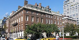 Henry P. Davison House, Percy Rivington Pyne House, Oliver D. Filley House and William Sloane House is one of the original house ensembles left on Park Avenue
 -
 Park Avenue and 47th Street, adjacent to the Helmsley Building


-
 10 Park Avenue, at the corner of East 34th Street
 -
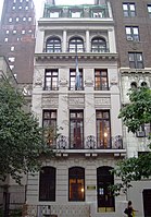 The Adelaide L. Townsend Douglas House, currently the Guatemalan U.N. Mission at 57 Park Avenue, between East 37th and 38th Streets


See also
References
Explanatory notes
Citations
- ^ Kuban, Adam (February 13, 2013). "Mean Streets: The Stories Behind NYC Street Names". NYCgo.com.
- ^ Google (September 10, 2015). "Fourth Avenue and Union Square East" (Map). Google Maps. Google. Retrieved September 10, 2015.
- ^ a b c d e f g Google (September 10, 2015). "Park Avenue (Manhattan)" (Map). Google Maps. Google. Retrieved September 10, 2015.
- ^ a b Google (September 10, 2015). "Park Avenue (The Bronx)" (Map). Google Maps. Google. Retrieved September 10, 2015.
- ^ Gray, Christopher (May 12, 2002). "Streetscapes:903 Park Avenue, at 79th Street". The New York Times.
- ^ "NYCityMap". NYC.gov.
- ^ Gray, Christopher (March 3, 2013). "Before There Was a 'Grand' in Central". The New York Times. Retrieved October 15, 2015.
- ^ Gray, Christopher (July 24, 2011). "Putting the Park in Park Avenue". The New York Times. Retrieved October 15, 2015.
- ^ a b c d e f g Gray, Christopher (November 7, 2008). "History Lessons by the Numbers". The New York Times. ISSN 0362-4331. Retrieved July 20, 2021.
- ^ a b c d e f Fitch, James Marston; Waite, Diana S. (1974). Grand Central Terminal and Rockefeller Center: A Historic-critical Estimate of Their Significance. Albany, New York: The Division.
- ^ "THE RAILROAD TRAP.; Another Day's Scenes at the Grand Central Depot". The New York Times. November 18, 1871. Retrieved December 4, 2018.
- ^ "RAILROAD ABUSES.; Official Investigation into the Grand Central Depot Nuisance. Scenes and Incidents at the Crossings Yesterday.Search for the Missing Dead Only One Out of the Seven Said to be Killed Yet Found The Coroners and the PoliceUtterly in the Dark. The Dangers that Centre Around the New Vanderbilt Depot What the Officials Say Minor Inconveniences". The New York Times. October 1, 2018. Retrieved December 4, 2018.
- ^ "The State Capital; Rapid Transit of Railroad Bills in the Assembly". New York Herald. April 24, 1872. p. 13. Retrieved December 6, 2018 – via newspapers.com.

- ^ Robins, A.W.; New York Transit Museum (2013). Grand Central Terminal: 100 Years of a New York Landmark. ABRAMS. p. 85. ISBN 978-1-61312-387-4. Retrieved December 6, 2018.
- ^ Reitano, J. (2018). The Restless City: A Short History of New York from Colonial Times to the Present. Taylor & Francis. p. 278. ISBN 978-1-134-81048-2. Retrieved December 4, 2018.
- ^ "Grand Central Terminal". East Side Access in New York, Queens, and Bronx Counties, New York, and Nassau and Suffolk Counties, New York: Environmental Impact Statement. 2001. p. 3. Retrieved December 4, 2018.
- ^ Gray, Christopher (March 17, 2002). "Streetscapes: 709 and 711 Park Avenue, Between 69th and 70th Streets; When Park Ave. Was 4th, and Not Socially Correct". The New York Times. Retrieved October 15, 2015.
- ^ "FIFTEEN KILLED IN REAR END COLLISION; Trains Crash in Darkness of Park Avenue Tunnel. TWO SCORE ARE INJURED Engineer Disregards or Fails to See Signals. LOCOMOTIVE BURIED IN CAR Firemen Cut Their Way Into the Wreck and Climb Over the Hot Boiler to the Aid of the Wounded – Heroic Acts of Rescuers and Rescued – Survivors and Others Tell Thrilling Stories of Their Experiences". The New York Times. January 9, 1902. Retrieved December 10, 2018.
- ^ "Fifteen Killed, Thirty-Six Hurt". New-York Tribune. January 9, 1902. p. 1. Retrieved December 10, 2018 – via newspapers.com.
- ^ Sprague, J. L.; Cunningham, J. J. (2013). "A Frank Sprague Triumph: The Electrification of Grand Central Terminal [History]". IEEE Power and Energy Magazine. 11 (1). Institute of Electrical and Electronics Engineers (IEEE): 58–76. doi:10.1109/mpe.2012.2222293. ISSN 1540-7977. S2CID 6729668.
- ^ "NEW YORK CENTRAL TO ACCEPT CITY'S PLANS; Station, Tunnel, and Other Improvements to Cost $25,000,000. Park Avenue to be Opened, Bridges Built at Cross Streets, Electricity Introduced, and Grade Crossings Abolished". The New York Times. December 27, 1902. Retrieved December 10, 2018.
- ^ Maranzani, Barbara. "Grand Central Terminal: An American Icon". History.com. Retrieved February 2, 2018.
- ^ Gray, Christopher (August 19, 2010). "Covering Its Tracks Paid Off Handsomely". The New York Times. Retrieved December 10, 2018.
- ^ "Park Avenue, Interrupted". The New York Times. December 21, 2014. Retrieved December 8, 2018.
- ^ a b "New Viaduct Thoroughfare Relieves Park Avenue Traffic Congestion; Result of Many Years' Work" (PDF). The New York Times. September 2, 1928. p. Real Estate, Page 123. Retrieved December 7, 2018.
- ^ "Link Up Park Av. to Ease Congestion". The New York Times. April 17, 1919. Retrieved December 7, 2018.
- ^ a b "Appellate Court Scores Officials in Park Ave. Suit". The Brooklyn Daily Eagle. November 4, 1927. p. 24. Retrieved July 20, 2021.
- ^ "Number One Park Avenue". The New York Times. February 10, 1925. ISSN 0362-4331. Retrieved July 20, 2021.
- ^ "Hylan Veto Halts Park Ave. Change". The Yonkers Herald. April 23, 1925. p. 8. Retrieved July 20, 2021.
- ^ "Bacon's Widow Blocks Trade on Park Avenue". Press and Sun-Bulletin. November 5, 1927. p. 16. Retrieved July 20, 2021.
- ^ "Mrs. Bacon's Long Fight to Retain '1 Park Ave.' as Address Is Finally Lost". The Brooklyn Daily Eagle. February 19, 1928. p. 7. Retrieved July 20, 2021.
- ^ "Mrs. Bacon Loses Fight for No. 1 Park Avenue; Appeals Court Upholds Renumbering by City". The New York Times. February 15, 1928. ISSN 0362-4331. Retrieved July 20, 2021.
- ^ "Mrs. Bacon May Fight On; Reported Ready to Take No. 1 Park Avenue Battle to Supreme Court". The New York Times. February 16, 1928. ISSN 0362-4331. Retrieved July 20, 2021.
- ^ Kadinsky, Sergey (October 24, 2017). "Park Avenue's Hidden History". Forgotten-NY. Retrieved October 25, 2017.
- ^ Rogers, Teri Karush (October 9, 2005). "Peeking Behind the Gilded Walls of 740 Park Ave". The New York Times. Retrieved August 15, 2007.
- ^ "Park Avenue Express Highway (NY 22, unbuilt)". Nycroads.com. February 14, 1935. Retrieved October 8, 2012.
- ^ Kilgannon, Corey (December 3, 2010). "Park Ave. Christmas Lights Go Up, and Xiao Ye Closes". The New York Times.
- ^ Bennett, Charles G. (May 6, 1959). "Sign Ban Is Voted on Two Avenues". The New York Times. p. 41. Retrieved July 31, 2010.
- ^ Gray, Christopher (October 7, 2001). "Streetscapes/The MetLife Building, Originally the Pan Am Building; Critics Once Called It Ugly; Now They're Not Sure". The New York Times. Retrieved September 30, 2015.
- ^ Stamler, Bernard (November 16, 1997). "Neighborhood Report: East Side; The Mystery of Missing Park Ave. Lights". The New York Times. ISSN 0362-4331. Archived from the original on July 19, 2022. Retrieved October 3, 2019.
- ^ a b Neuman, William (September 22, 2007). "It's a Deal: Help for Park Ave. Pedestrians". The New York Times. ISSN 0362-4331. Archived from the original on July 19, 2022. Retrieved October 3, 2019.
- ^ Upham, Ben (December 17, 2000). "Neighborhood Report: Midtown; For Jaywalkers Who Dare, A Scary Stretch of Park Avenue". The New York Times. ISSN 0362-4331. Archived from the original on May 27, 2015. Retrieved October 3, 2019.
- ^ Lambert, Bruce (September 11, 1994). "Neighborhood Report: Midtown; Pushing to Make Park Avenue Safer". The New York Times. ISSN 0362-4331. Archived from the original on May 26, 2015. Retrieved October 3, 2019.
- ^ Pollak, Michael (September 24, 2006). "Unwelcome and Uncounted". The New York Times. ISSN 0362-4331. Archived from the original on July 19, 2022. Retrieved October 3, 2019.
- ^ Goodman, Jillian; Rovzar, Chris (July 7, 2010), "City Finally Installs Crossing Signals on Park Avenue Above Grand Central", New York, retrieved February 24, 2012
- ^ Santora, Marc & Rashbaum, William K. (March 13, 2014). "Rescue Effort in East Harlem Yields Only More Victims". New York Times. Retrieved March 13, 2014.
- ^ a b "NYCityMap". NYC.gov. New York City Department of Information Technology and Telecommunications. Retrieved March 20, 2020.
- ^ Records & Briefs New York State Appellate Division. p. 7. Retrieved July 20, 2021.
- ^ Pollak, Michael (July 16, 2006). "Why Yellow Takes the Wheel". The New York Times. Retrieved July 31, 2010.
- ^ "MNR Map". Metropolitan Transportation Authority. Retrieved February 2, 2019.
- ^ "Subway Map" (PDF). Metropolitan Transportation Authority. September 2021. Retrieved September 17, 2021.
- ^ "Manhattan Bus Map" (PDF). Metropolitan Transportation Authority. July 2019. Retrieved December 1, 2020.
- ^ "Staten Island Bus Service" (PDF). Metropolitan Transportation Authority. January 2020. Retrieved December 1, 2020.
- ^ "Brooklyn Bus Service" (PDF). Metropolitan Transportation Authority. October 2020. Retrieved December 1, 2020.
- ^ "Bronx Bus Map" (PDF). Metropolitan Transportation Authority. October 2018. Retrieved December 1, 2020.
- ^ Green Acres Intro, archived from the original on November 17, 2021, retrieved November 27, 2019
Further reading
- "Park Avenue Historic District" (PDF). New York City Landmarks Preservation Commission. April 29, 2014.
External links
- New York Songlines: Fourth Avenue with The Bowery and Park Avenue, a virtual walking tour
- Classic Apartments Buildings and Architecture of Park Avenue Images & History