
Castello-Molina di Fiemme
| Castello-Molina di Fiemme | ||
|---|---|---|

|
|
|
| Country | Italy | |
| region | Trentino-South Tyrol | |
| province | Trento (TN) | |
| Coordinates | 46 ° 17 ' N , 11 ° 26' E | |
| height | 950 m slm | |
| surface | 54.5 km² | |
| Residents | 2,319 (Dec. 31, 2019) | |
| Population density | 43 inhabitants / km² | |
| Post Code | 38030 | |
| prefix | 0462 | |
| ISTAT number | 022047 | |
| Website | www.comune.castellomolina.tn.it | |

Castello-Molina di Fiemme is an Italian commune ( comune ) with 2319 inhabitants (as of December 31, 2019) in the province of Trento , region of Trentino-South Tyrol .
geography
The municipality is located in the Fiemme Valley about 30 kilometers northwest of Trento at an altitude of 950 m slm on the Avisio . The latter is dammed up in the Stramentizzo district to form the Stramentizzo reservoir . The neighboring communities are Cavalese , Pieve Tesino , Telve , Valfloriana and Ville di Fiemme in Trentino and Altrei in South Tyrol .
Administrative division
The municipality consists of the fractions Castello di Fiemme (German: Kastell im Fleimstal), Molina di Fiemme ( mills in the Fleimstal ), Predaia and Stramentizzo. The municipal seat is in Castello di Fiemme.
traffic
State road 48 and state road 612 from the Cembra Valley run through the municipality . From the latter, the pass road turns off at Molina to the Manghen Pass in Lagorai , which connects the Fiemme Valley with the Valsugana . Between 1918 and 1963 the place also had a station on the Fiemme Valley Railway .

Castello di Fiemme

Parish church of San Giorgio in Castello with pala group

Molina di Fiemme with Avisio

Parish Church of Sant'Antonio in Molina
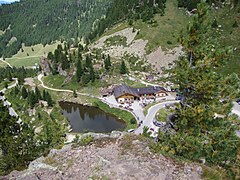
Manghen Pass


Web links
Individual evidence
- ↑ Statistiche demografiche ISTAT. Monthly population statistics of the Istituto Nazionale di Statistica , as of December 31 of 2019.

Ala | Albiano | Aldeno | Altavalle | Altopiano della Vigolana | Amblar-Don | Andalo | Arco | Avio | Baselga di Piné | Bedollo | Besenello | Bieno | Bleggio Superiore | Bocenago | Bondone | Borgo Chiese | Borgo d'Anaunia | Borgo Lares | Borgo Valsugana | Brentonico | Bresimo | Caderzone Terme | Calceranica al Lago | Caldes | Caldonazzo | Calliano | Campitello di Fassa | Campodenno | Canal San Bovo | Canazei | Capriana | Carisolo | Carzano | Castel Condino | Castel Ivano | Castello Tesino | Castello-Molina di Fiemme | Castelnuovo | Cavalese | Cavareno | Cavedago | Cavedine | Cavizzana | Cembra Lisignago | Cimone | Cinte Tesino | Cis | Civezzano | Cles | Comano Terme | Commezzadura | Contà | Dambel | Denno | Dimaro Folgarida | Drena | Dro | Fai della Paganella | Fiavé | Florutz | Folgaria | Fornace | Garniga Terme | Repented | Giovo | Giustino | Grigno | Imer | Isera | Lavarone | Lavis | Ledro | Levico Terme | Livo | Lona-Lases | Lusern | Madruzzo | Malè | Massimeno | Mazzin | Mezzana | Mezzano | Mezzocorona | Mezzolombardo | Moena | Molveno | Mori | Nago-Torbole | Nogaredo | Nomi | Novaledo | Novella | Ospedaletto | Ossana | Palù del Fersina | Panchià | Peio | Pellizzano | Pelugo | Pergine Valsugana | Pieve Tesino | Pieve di Bono-Prezzo | Pinzolo | Pomarolo | Porte di Rendena | Predaia | Predazzo | Primiero San Martino di Castrozza | Rabbi | Riva del Garda | Romeno | Roncegno Terme | Ronchi Valsugana | Ronzo-Chienis | Ronzone | Rovereto | Roverè della Luna | Ruffrè-Mendola | Rumo | Sagron Mis | Samone | San Giovanni di Fassa | San Lorenzo Dorsino | San Michele all'Adige | Sant'Orsola Terme | Sanzeno | Sarnonico | Scurelle | Segonzano | Sella Giudicarie | Sfruz | Soraga di Fassa | Sover | Spiazzo | Spormaggiore | Sporminors | Stenico | Storo | Strembo | Telve | Telve di Sopra | Tenna | Tenno | Terragnolo | Terre d'Adige | Terzolas | Tesero | Tione di Trento | Sound | Torcegno | Trambileno | Tre Ville | Trento | Valdaone | Valfloriana | Vallarsa | Vallelaghi | Vermiglio | Vignola-Falesina | Villa Lagarina | Ville d'Anaunia | Ville di Fiemme | Volano | Ziano di Fiemme