
Hohenfelde (Mecklenburg)
| coat of arms | Germany map | |
|---|---|---|

|
Coordinates: 54 ° 5 ' N , 11 ° 55' E |
|
| Basic data | ||
| State : | Mecklenburg-Western Pomerania | |
| County : | Rostock | |
| Office : | Bad Doberan Country | |
| Height : | 49 m above sea level NHN | |
| Area : | 9.45 km 2 | |
| Residents: | 779 (Dec. 31, 2019) | |
| Population density : | 82 inhabitants per km 2 | |
| Postcodes : | 18209, 18211 (Forsthaus Ivendorf, Ivendorf) |
|
| Area code : | 038203 | |
| License plate : | LRO, BÜZ, DBR, GÜ, ROS, TET | |
| Community key : | 13 0 72 047 | |
| Office administration address: | Kammerhof 3 18209 Bad Doberan |
|
| Website : | ||
| Mayor : | Stefan Bruhn | |
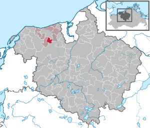
| Location of the community of Hohenfelde in the Rostock district | ||
  |
||

Hohenfelde is a municipality in the Rostock district in Mecklenburg-Western Pomerania (Germany). The municipality is administered by the Bad Doberan-Land office , based in Bad Doberan . Hohenfelde is located 4 km south of the city of Bad Doberan. It is approx. 15 km as the crow flies to the Hanseatic city of Rostock . Due to the higher location of the village, a view over the Hanseatic city to the Baltic Sea is possible. The districts of Neu Hohenfelde, Ivendorf and Forsthof belong to Hohenfelde.
history
Hohenfelde was first mentioned in a document around 1177 as "Putechowe" in a list of the founding property of the Doberan Cistercian Abbey . Hohenfelde is one of the oldest communities in Mecklenburg. The original name for Hohenfelde Putechowe, Putecha or Putekowe, as it was called from 1192, is of Slavic origin and is likely to be derived from the place of Potech , where tech means something like consolation or joy . Hohenfelde was first mentioned with its German name in 1312.
On July 1, 1950, the previously independent municipality of Ivendorf was incorporated.
politics
Municipal council and mayor
The municipal council (including the mayor) consists of six members. The election to the municipal council on May 26, 2019 had the following results:
| Party / applicant | percent | Seats |
|---|---|---|
| Single applicant Neumann | 28.1 | 1 |
| Single applicant Preuss | 27.3 | 1 |
| Single applicant Rosenthal-Hinrich | 18.6 | 1 |
| Single applicant Becker | 15.7 | 1 |
| Single applicant Prachtel | 10.3 | 1 |
On May 26, 2019, Stefan Bruhn was elected mayor with 92.0%.
coat of arms
|
|
Blazon : "In gold over a green hill a green chestnut leaf."
The coat of arms was designed by the Schwerin heraldist Karl-Heinz Steinbruch . It was approved by the Ministry of the Interior on January 28, 2002 and registered under the number 256 of the coat of arms of the state of Mecklenburg-Western Pomerania. |
| Justification of the coat of arms: In the coat of arms, the chestnut leaf, chosen as the main symbol of the coat of arms, is intended to remind of the earlier form of settlement in Hohenfelde, a Rundling. Only one access road led into the interior of this typical defense and protection system of the German-Slavic border area - a central square around which the farmsteads with the gable front are grouped in a fan shape. At the same time, the leaf stands for the numerous chestnut trees in Dorfstrasse. The hill should refer to the community name as a speaking sign. |
flag
The flag was designed by Jens Preuss from Hohenfeld and approved on December 3, 2012 by the Ministry of the Interior.
The flag is striped of green, yellow, and green. The green stripes each take up one sixth, the yellow stripe two thirds of the height of the flag cloth. In the middle of the yellow stripe, five sixths of the height of the stripe, lies a figure of the municipal coat of arms: a green chestnut leaf. The relation of the height of the flag cloth to the length is like 3: 5.
Official seal
The official seal shows the municipal coat of arms with the inscription "• GEMEINDE HOHENFELDE • LANDKREIS ROSTOCK •".
Attractions


- Ice Age natural monument and local recreation area "Quellenental", source of the Glashäger mineral water
Web links
Individual evidence
- ↑ Statistisches Amt MV - population status of the districts, offices and municipalities 2019 (XLS file) (official population figures in the update of the 2011 census) ( help ).
- ↑ Election results on the website of the Bad Doberan Land Office (PDF)
- ^ Election results of the mayoral elections on the pages of the Bad Doberan Land office
- ↑ Hans-Heinz Schütt: On shield and flag - the coats of arms and flags of the state of Mecklenburg-Western Pomerania and its municipalities . Ed .: production office TINUS; Schwerin. 2011, ISBN 978-3-9814380-0-0 , pp. 231 .
- ↑ a b main statute § 1 (PDF).

Admannshagen-Bargeshagen | Old Bukow | Alt Sührkow | Altkalen | Am Salzhaff | Bad Doberan | Bartenshagen-Parkentin | Bastorf | Baumgarten | Behren-Lübchin | Benitz | Bentwisch | Bernitt | Biendorf | Blankenhagen | Börgerende-Rethwisch | Bröbberow | Broderstorf | Bützow | Cammin | Carinerland | Dahmen | Dalkendorf | Dobbin-Linstow | Dolgen am See | Dreetz | Dummerstorf | Elmenhorst / Lichtenhagen | Finkenthal | Gelbensande | Glasewitz | Gnewitz | Gnoien | Graal-Müritz | Grammow | Great Roge | Groß Schwiesow | Big wokers | Groß Wüstenfelde | Gülzow-Prüzen | Guestrow | Gutow | High demzin | Hohen Sprenz | Hohenfelde | Hoppenrade | Jördenstorf | Juergenshagen | Kassow | Klein Belitz | Klein Upahl | Krakow am See | Kritzmow | Kröpelin | Kuchel miss | Kühlungsborn | Cow | Laage | Lalendorf | Lambrechtshagen | Lelkendorf | Wages | Lüssow | Mistorf | Mönchhagen | Mühl Rosin | Neubukow | Nienhagen | Nustrow | Papendorf | Penzin | Plaaz | Pölchow | Poppendorf | Prebberede | Reddelich | Reimershagen | Rerik | Retschow | Rye | Rövershagen | Rühn | Rukieten | Sanitz | Sarmstorf | Satow | Schorssow | Swaan | Schwasdorf | Selpin | Stäbelow | Steffenshagen | Steinhagen | Stubbendorf | Sukow-Levitzow | Tarnow | Ticino | Teterow | Thelkow | Thulendorf | Thürkow | Vorbeck | Walkendorf | Wardow | Warnkenhagen | Warnow | Wiendorf | Wittenbeck | Zarnewanz | Zehna | Zepelin | Ziesendorf