
Schwasdorf
| coat of arms | Germany map | |
|---|---|---|

|
Coordinates: 53 ° 53 ' N , 12 ° 38' E |
|
| Basic data | ||
| State : | Mecklenburg-Western Pomerania | |
| County : | Rostock | |
| Office : | Mecklenburg Switzerland | |
| Height : | 40 m above sea level NHN | |
| Area : | 24.33 km 2 | |
| Residents: | 440 (December 31, 2019) | |
| Population density : | 18 inhabitants per km 2 | |
| Postal code : | 17168 | |
| Area code : | 039977 | |
| License plate : | LRO, BÜZ, DBR, GÜ, ROS, TET | |
| Community key : | 13 0 72 096 | |
| Office administration address: | von-Pentz-Allee 7 17166 Teterow |
|
| Website : | ||
| Mayor : | Herbert Zingler | |
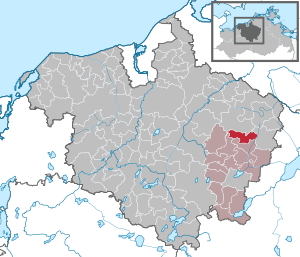
| Location of the community of Schwasdorf in the Rostock district | ||
  |
||

Schwasdorf is a municipality in the Rostock district in Mecklenburg-Western Pomerania (Germany). The municipality is administered by the Mecklenburg Switzerland Office with its seat in the non-official city of Teterow . The community was formed on June 13, 2004 from the formerly independent communities Poggelow and Remlin . In contrast to many other municipal mergers, no double name was chosen here, but the name of the former Remlin district of Schwasdorf.
geography
The municipality of Schwasdorf north of Mecklenburg Switzerland lies between the upper Peene and the Recknitz valley in a gently hilly area. The elevations reach up to 57 m above sea level. NN. The city of Teterow is 15 kilometers away, Gnoien about ten kilometers.
Schwasdorf is surrounded by the neighboring communities of Walkendorf in the north, Altkalen in the east, Jördenstorf in the south and Groß Wüstenfelde in the west.
history
The community consists of the districts Poggelow, Remlin, Schwasdorf and Stierow.
Schwasdorf: The area was already settled during the Neolithic Age. When a place is passage grave from this period, between Schwasdorf and Peenetal are five burial mounds from the Bronze Age . The property was u. a. owned by the Schröder (1814–1845) and Kortüm (1855–1945) families. The manor house was built in the middle of the 19th century. On July 1, 1950 Schwasdorf was incorporated into Poggelow.
Poggelow , a manor village, was first mentioned in a document in 1314. The estate was owned by the Graf von Bassewitz families (14th century – 1891) and the veterinarian's wife Clara Henriette Wilhelmine Schröder (until 1933). The 670 hectare estate was settled in 1933. The renovated manor house dates from 1848. After 1945 it was refugee accommodation, kindergarten, restaurant, seat of the community and LPG seat and since 1997 a holiday home. The stables, a barn and a forge have been preserved.
Remlin was first mentioned in documents as Remmelyn in 1361 . The estate was u. a. owned by a knight Schlicht and the families von Kardorff (1704–1860) and Wilhelm and Adolf von Oertzen (from 1866). In 1935 the estate was relocated. The manor house was demolished because it was in disrepair. The renovated, beautiful thatched half-timbered barn from 1870 was converted into a residential building in 1935.
Attractions

- Poggelow manor from 1848 based on plans by Friedrich Hitzig ; Landscape park with lake and old trees; today holiday apartments
- Half-timbered manor house Remlin from the 19th century.
- Half-timbered barn as a hall house in Remlin
- Schwasdorf manor from around 1850
Transport links
The community is located on the road connecting Teterow to Gnoien . From Teterow, 16 km away, there are federal highways connections in all directions. The former train station in the Poggelow district is on the Teterow – Gnoien railway line, which was closed in 1997 . The railway line was replaced by bus services.
Web links
Individual evidence
- ↑ Statistisches Amt MV - population status of the districts, offices and municipalities 2019 (XLS file) (official population figures in the update of the 2011 census) ( help ).
- ^ StBA: Changes in the municipalities in Germany, see 2004

Admannshagen-Bargeshagen | Old Bukow | Alt Sührkow | Altkalen | Am Salzhaff | Bad Doberan | Bartenshagen-Parkentin | Bastorf | Baumgarten | Behren-Lübchin | Benitz | Bentwisch | Bernitt | Biendorf | Blankenhagen | Börgerende-Rethwisch | Bröbberow | Broderstorf | Bützow | Cammin | Carinerland | Dahmen | Dalkendorf | Dobbin-Linstow | Dolgen am See | Dreetz | Dummerstorf | Elmenhorst / Lichtenhagen | Finkenthal | Gelbensande | Glasewitz | Gnewitz | Gnoien | Graal-Müritz | Grammow | Great Roge | Groß Schwiesow | Big wokers | Groß Wüstenfelde | Gülzow-Prüzen | Guestrow | Gutow | High demzin | Hohen Sprenz | Hohenfelde | Hoppenrade | Jördenstorf | Juergenshagen | Kassow | Klein Belitz | Klein Upahl | Krakow am See | Kritzmow | Kröpelin | Kuchel miss | Kühlungsborn | Cow | Laage | Lalendorf | Lambrechtshagen | Lelkendorf | Wages | Lüssow | Mistorf | Mönchhagen | Mühl Rosin | Neubukow | Nienhagen | Nustrow | Papendorf | Penzin | Plaaz | Pölchow | Poppendorf | Prebberede | Reddelich | Reimershagen | Rerik | Retschow | Rye | Rövershagen | Rühn | Rukieten | Sanitz | Sarmstorf | Satow | Schorssow | Swaan | Schwasdorf | Selpin | Stäbelow | Steffenshagen | Steinhagen | Stubbendorf | Sukow-Levitzow | Tarnow | Ticino | Teterow | Thelkow | Thulendorf | Thürkow | Vorbeck | Walkendorf | Wardow | Warnkenhagen | Warnow | Wiendorf | Wittenbeck | Zarnewanz | Zehna | Zepelin | Ziesendorf