
Roggentin (near Rostock)
| coat of arms | Germany map | |
|---|---|---|

|
Coordinates: 54 ° 4 ′ N , 12 ° 12 ′ E |
|
| Basic data | ||
| State : | Mecklenburg-Western Pomerania | |
| County : | Rostock | |
| Office : | Carbak | |
| Height : | 34 m above sea level NHN | |
| Area : | 9.59 km 2 | |
| Residents: | 2683 (Dec. 31, 2019) | |
| Population density : | 280 inhabitants per km 2 | |
| Postal code : | 18184 | |
| Area code : | 038204 | |
| License plate : | LRO, BÜZ, DBR, GÜ, ROS, TET | |
| Community key : | 13 0 72 087 | |
| LOCODE : | DE M7V | |
| Office administration address: | Moorweg 5 18184 Broderstorf |
|
| Website : | ||
| Mayor : | Henrik Holtz | |
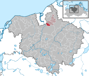
| Location of the community of Roggentin in the Rostock district | ||
  |
||

Roggentin is a municipality in the Rostock district in Mecklenburg-Western Pomerania, Germany. The municipality is administered by the Carbäk office with its seat in the municipality of Broderstorf .
Geographical location
The municipality is located on a moraine, to the south of Roggentin toward Warnow aligned Kösterbeck -Tal the area by nearly 40 m from falls. The community of Roggentin is only about 5 km away from Rostock's old town and borders - only separated by the A 19 - on the Rostock district of Brinckmansdorf .
The Kösterbeck nature reserve is located southeast of Roggentin .
Roggentin is surrounded by the neighboring communities Broderstorf , Dummerstorf and Rostock .
The community of Roggentin consists of the three districts Fresendorf, Kösterbeck (formerly Ober- and Unterkösterbeck) and Roggentin.
politics
Municipal council and mayor
The municipal council (including the mayor) consists of twelve members. The last election for municipal council took place on May 26, 2019, the runoff election for mayor on June 16, 2019.
Mayor of the municipality is Henrik Holtz.
coat of arms
The coat of arms was approved by the Ministry of the Interior on October 11, 2002 and registered under the number 267 of the coat of arms of Mecklenburg-Western Pomerania.
Blazon : "In red over a silver wavy strip a golden lily."
The coat of arms was designed by the Schwerin heraldist Heinz Kippnick .
flag
The municipality's flag is striped in red, gold (yellow) and red across the longitudinal axis of the flag cloth. The outer red stripes each take up a quarter, the golden (yellow) central stripe takes up half the length of the flag cloth. In the middle of the flag, two thirds of the height of the flag, is the coat of arms of the municipality. The length of the flag is related to the height as 5: 3.
Economy and Infrastructure
The Roggentin Computer Science Center (ICR), founded in November 2005, is a competence center for software development and IT services in the commercial area of the municipality of Roggentin. Under the roof of the two-storey, four-wing office building, small and medium-sized companies in the industry with around 250 employees have the opportunity to settle on approx. 3200 m². The ICR is Mecklenburg-Western Pomerania's start-up and technology center for companies in the IT sector. The Roggentin municipality is an ICR partner. The most important partner is SIV.AG, the largest IT company in Mecklenburg-Western Pomerania.

The German Post AG operates in Roggentin one of its 82 mail centers in Germany.
The Rostock – Ticino railway line , the federal motorway 20 and the federal highway 110 run through the municipality of Roggentin .
Web links
Individual evidence
- ↑ Statistisches Amt MV - population status of the districts, offices and municipalities 2019 (XLS file) (official population figures in the update of the 2011 census) ( help ).

Admannshagen-Bargeshagen | Old Bukow | Alt Sührkow | Altkalen | Am Salzhaff | Bad Doberan | Bartenshagen-Parkentin | Bastorf | Baumgarten | Behren-Lübchin | Benitz | Bentwisch | Bernitt | Biendorf | Blankenhagen | Börgerende-Rethwisch | Bröbberow | Broderstorf | Bützow | Cammin | Carinerland | Dahmen | Dalkendorf | Dobbin-Linstow | Dolgen am See | Dreetz | Dummerstorf | Elmenhorst / Lichtenhagen | Finkenthal | Gelbensande | Glasewitz | Gnewitz | Gnoien | Graal-Müritz | Grammow | Great Roge | Groß Schwiesow | Big wokers | Groß Wüstenfelde | Gülzow-Prüzen | Guestrow | Gutow | High demzin | Hohen Sprenz | Hohenfelde | Hoppenrade | Jördenstorf | Juergenshagen | Kassow | Klein Belitz | Klein Upahl | Krakow am See | Kritzmow | Kröpelin | Kuchel miss | Kühlungsborn | Cow | Laage | Lalendorf | Lambrechtshagen | Lelkendorf | Wages | Lüssow | Mistorf | Mönchhagen | Mühl Rosin | Neubukow | Nienhagen | Nustrow | Papendorf | Penzin | Plaaz | Pölchow | Poppendorf | Prebberede | Reddelich | Reimershagen | Rerik | Retschow | Rye | Rövershagen | Rühn | Rukieten | Sanitz | Sarmstorf | Satow | Schorssow | Swaan | Schwasdorf | Selpin | Stäbelow | Steffenshagen | Steinhagen | Stubbendorf | Sukow-Levitzow | Tarnow | Ticino | Teterow | Thelkow | Thulendorf | Thürkow | Vorbeck | Walkendorf | Wardow | Warnkenhagen | Warnow | Wiendorf | Wittenbeck | Zarnewanz | Zehna | Zepelin | Ziesendorf